CSIR NET Earth Science Mock Test - 3 Free Online Test 2026
Full Mock Test & Solutions: CSIR NET Earth Science Mock Test - 3 (150 Questions)
You can boost your CSIR NET Earth Science 2026 exam preparation with this CSIR NET Earth Science Mock Test - 3 (available with detailed solutions).. This mock test has been designed with the analysis of important topics, recent trends of the exam, and previous year questions of the last 3-years. All the questions have been designed to mirror the official pattern of CSIR NET Earth Science 2026 exam, helping you build speed, accuracy as per the actual exam.
Mock Test Highlights:
- - Format: Multiple Choice Questions (MCQ)
- - Duration: 180 minutes
- - Total Questions: 150
- - Analysis: Detailed Solutions & Performance Insights
- - Sections covered: Part A, Part B, Part C
Sign up on EduRev for free and get access to these mock tests, get your All India Rank, and identify your weak areas to improve your marks & rank in the actual exam.

Which among the following mineral group is abundantly found in the earth’s crust?
Detailed Solution: Question 1
Detailed Solution: Question 2

During which condition, permeability of rocks have to be given more importance?
Detailed Solution: Question 3
Detailed Solution: Question 4
The property of a mineral by virtue of which it can be cut with a knife is
Detailed Solution: Question 5
Detailed Solution: Question 6
Which of the following sediment types has the lowest permeability?
Detailed Solution: Question 7
Detailed Solution: Question 8
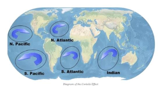
Gulf Stream, Kuroshio Current, Brazil Current and Agulhas Current
Detailed Solution: Question 9
Andean mountains-Atlantic Ocean – San Andreas fault represent one of the following sequences of plate boundaries.
Detailed Solution: Question 10
Which one of the following is not a plate boundary?
Detailed Solution: Question 11
Detailed Solution: Question 12
Which one of the following statements about high tides is INCORRECT?
Detailed Solution: Question 13
Chemical composition of Earth’s core is similar to that of
Detailed Solution: Question 14
In ocean remote sensing infrared sensor gives information about
Detailed Solution: Question 15
Which one of the following chemical present on the landscape is the most effective agent of chemical weathering of rocks?
Detailed Solution: Question 16
Detailed Solution: Question 17
Which of the following major soil orders covers the largest areal extent globally?
Detailed Solution: Question 18
Detailed Solution: Question 19
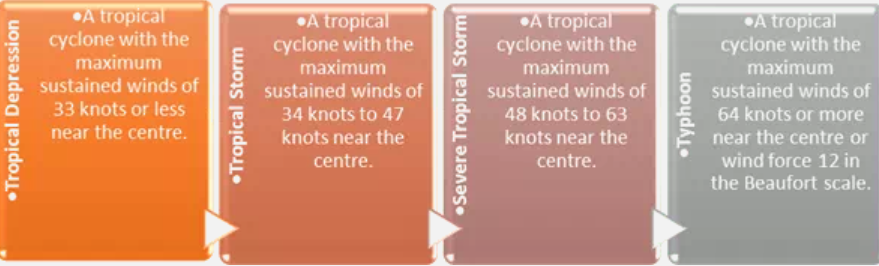
According to the classification of tropical storms by the World Meteorological Organization, the maximum sustained wind speed in knots for severe tropical storm is
Detailed Solution: Question 20
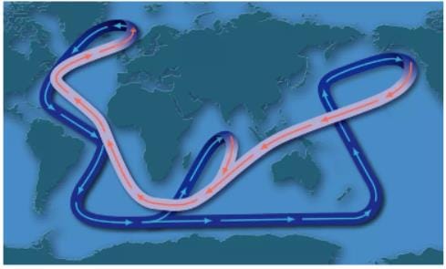
Which one of the following does not form a part of the oceanic conveyer belt circulation?
Detailed Solution: Question 21
The beginning of the Quaternary period broadly coincides with the
Detailed Solution: Question 22
Which of the following are the features of the tropical wet evergreen forest?
Detailed Solution: Question 23
Which one of the essential elements is the most critical for the growth and production of diatoms in the Antarctic waters?
Detailed Solution: Question 24
Which one of the following does not form a part of the oceanic conveyer belt circulation?
Detailed Solution: Question 25
On an upper-level chart, normally we find warm air associated with ________ pressure and cold air associated with ________ pressure
Detailed Solution: Question 26
Which one of the following types of mass movement indicates movement enmasse along a structural surface, such as a bedding or foliation plane?
Detailed Solution: Question 27
Granite domes are domical hills composed of _______.
Detailed Solution: Question 28
When a number of mountain ranges and ridges continue for extensive distances for thousands of kilometres maintaining their characteristic features throughout, the term used is
Detailed Solution: Question 29
Which of the following is an example of high clouds?
Detailed Solution: Question 30