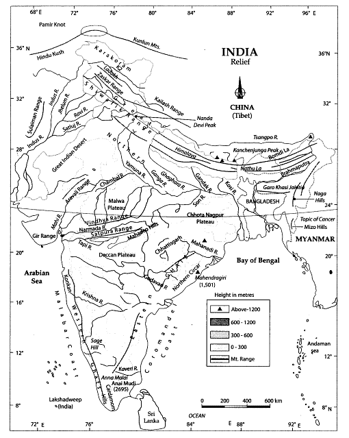
Map Based Questions: Physical Features of India

INDIA: Physical Features
This is a physical map of India showing all the physiographic regions of the nation. In terms of physiography, the nation can be split into the following areas:
- The Islands
- Coastal plains
- The Peninsular plateau
- The Great Indian Desert
- Northern plains
- The Himalayan mountains
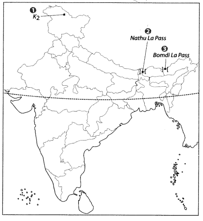
Q1: Features are marked by numbers in the given political map of India. Identify these features with the help of the following information and write their correct names on the lines marked in the map.
1. The highest mountain peak of Himalaya in India
2. A mountain pass in Sikkim
3. A mountain pass in Arunachal Pradesh
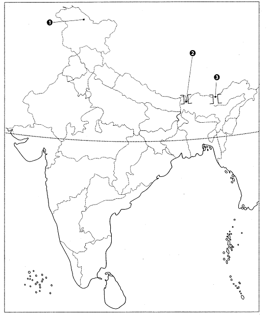
Ans:
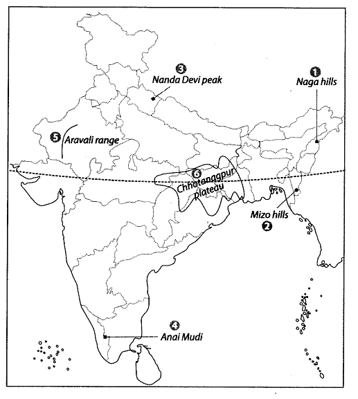
Q2: Locate and label the following items on the given map
1.Naga hills
2. Mizo hills
3. Nanda Devi peak
4. Anai Mudi
5. Aravali range or A mountain range in Rajasthan or The hill range forming the Western boundary of the Malwa plateau
6. Chhotanagpur plateau or An important plateau
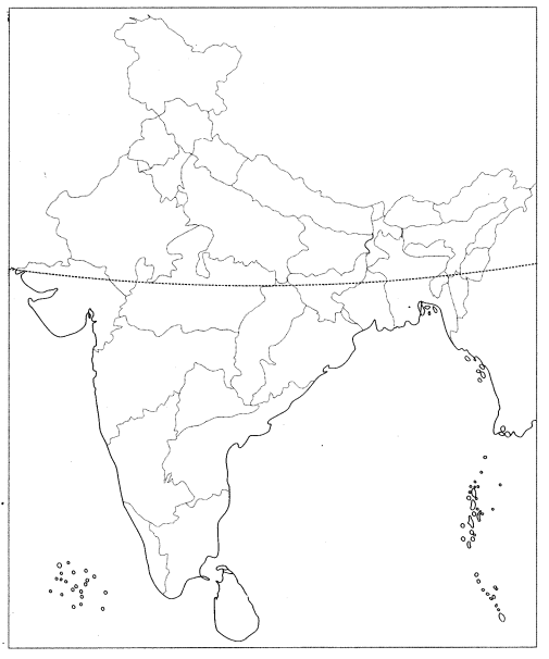
Ans:
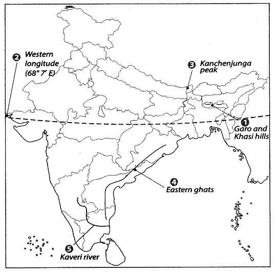
Q3: Locate and label the following items on the given map with appropriate symbols.
1. Garo and Khasi hills
2. Western Longitude
3. Kanchenjunga peak
4. Eastern ghats
5. Kaveri river
Ans:
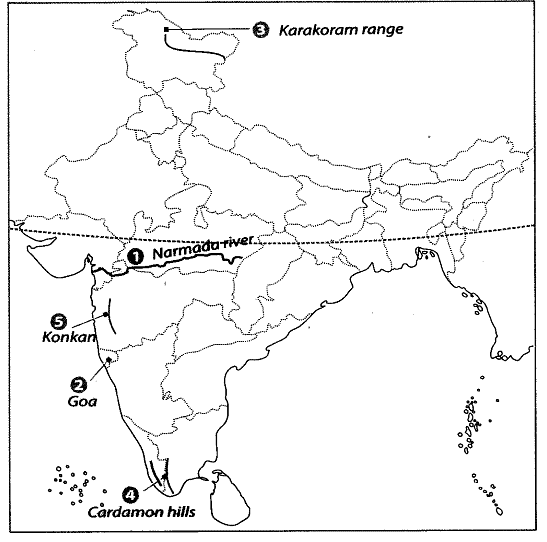
Q4: Features are marked by numbers in the given political map of India. Identify these features with the help of the following information and write their correct names on the lines marked in the map.
1. River of Peninsular India that forms an estuary
2. A mountain range
3. A South India hill range
4. A South Indian hill range
5. Western Coastal strip in the North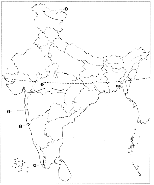
Ans:
1. Narmada River - A major west-flowing peninsular river which opens into the Arabian Sea and forms an estuary near its mouth.
2. Goa - The location marked corresponds to the State of Goa on the west coast; this area lies close to the Western Ghats, a prominent mountain range along India's western edge.
3. Karakoram Range - A major mountain range in northern India and part of the greater Himalayan system, noted for very high peaks and glaciers.
4. Cardamom Hills - A hill range in southern India, forming part of the southern Western Ghats, situated mainly in Kerala and Tamil Nadu.
5. Konkan - The northern section of the western coastal strip along the Arabian Sea, forming the western coastal plain in the north of the peninsula.
FAQs on Map Based Questions: Physical Features of India
| 1. What are the major physical features of India? |  |
| 2. How do the Himalayas influence the climate of India? | |
| 3. What is the significance of the Indo-Gangetic Plain in India? | |
| 4. Describe the characteristics of the Thar Desert. | |
| 5. What role do the Western and Eastern Ghats play in India's ecology? | |


