Rapid Revision: Locating Places On The Earth


1. Maps - Meaning and Importance
A map is a drawing or representation of the Earth's surface or a part of it, viewed from above. It helps us understand the location of places, distances between them, and directions for movement.
- Maps are essential tools for travel, planning, administration, and education.
- Maps can represent very small areas, such as a school campus, or very large areas, such as a country or the entire world. An atlas is a collection of maps compiled into a book.
2. Types of Maps
Different maps serve different purposes depending on the information they present.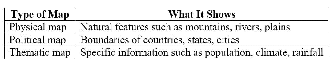
3. Components of a Map
Every map contains three essential components that make it useful and readable.
Distance (Scale)
- Because a large area cannot fit on paper at actual size, maps use a scale to reduce distances proportionally. The scale shows the relationship between distance on the map and actual distance on the ground.
Direction
Maps indicate directions using cardinal points:
- North
- South
- East
- West
Intermediate directions include northeast, southeast, southwest, and northwest. Most maps include a north arrow to orient the user.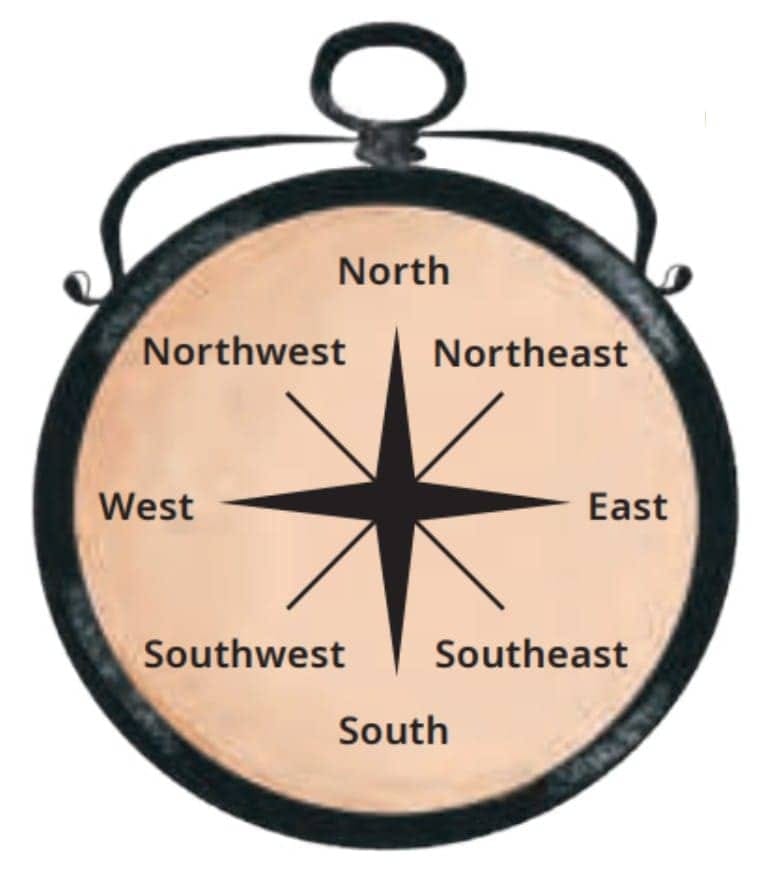
Symbols
- Since real objects cannot be drawn to scale on maps, symbols are used to represent features such as roads, buildings, rivers, and boundaries. Standard symbols ensure that maps can be understood universally.
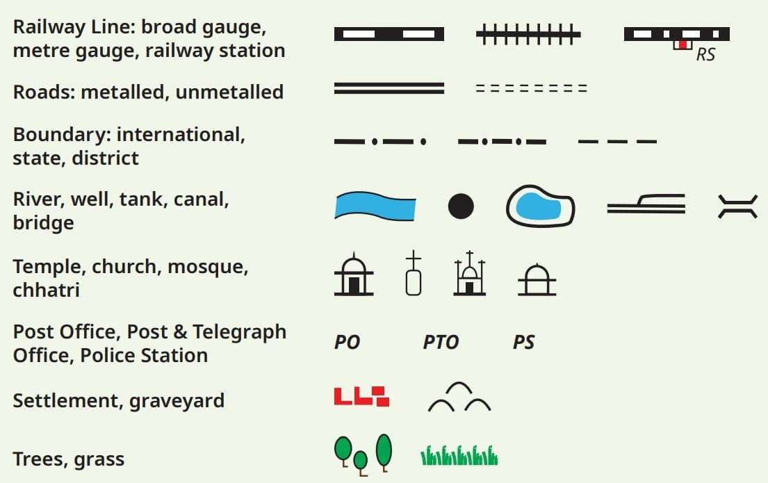 A selection of symbols commonly used in maps
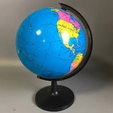
4. Globe - A Model of the Earth
- The Earth is nearly spherical, so representing it accurately on a flat map is difficult. A globe is a three-dimensional model of the Earth that shows continents, oceans, and other features in correct proportions.
- A globe provides a more accurate representation of the Earth's shape and spatial relationships than a flat map.
5. Coordinates - Locating Places Precisely
To identify an exact location on Earth, a system of coordinates is used. This system is similar to locating a position on a grid, such as squares on a chessboard.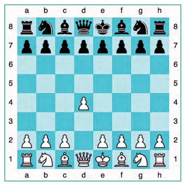
Coordinates consist of two values:
- Latitude
- Longitude
Together, they allow any place on Earth to be located precisely.
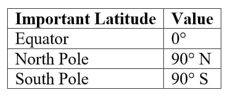
6. Latitudes
Latitudes are imaginary lines running east-west around the Earth, parallel to the Equator. They measure the distance of a place north or south of the Equator.
The Equator is the largest latitude and divides the Earth into two halves:
- Northern Hemisphere
- Southern Hemisphere
Latitudes are measured in degrees (°).
Climate varies with latitude: regions near the Equator are generally hot, while areas near the poles are cold.
 This globe shows both parallels of latitude and meridians of longitudes
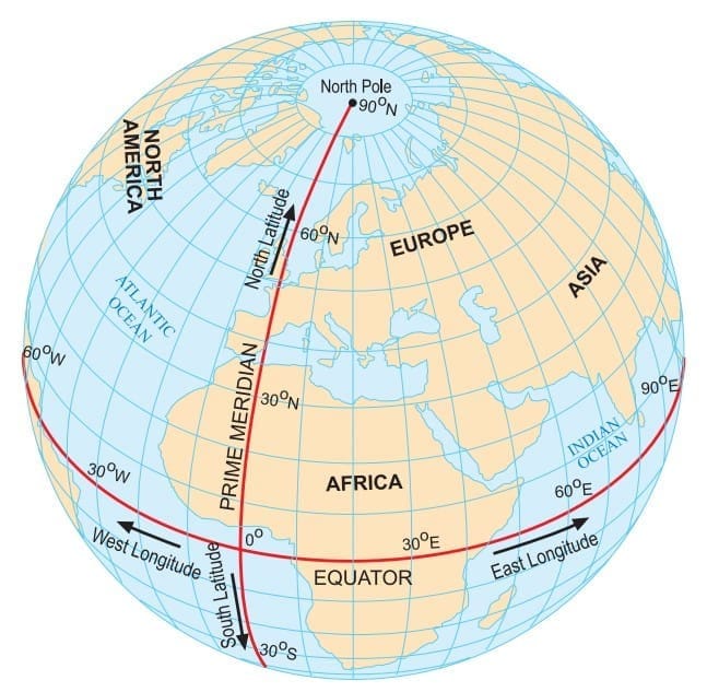
7. Longitudes
Longitudes are imaginary lines running from the North Pole to the South Pole. They measure the distance east or west of the Prime Meridian.
The Prime Meridian passes through Greenwich in London and is assigned 0° longitude. It divides the Earth into:
- Eastern Hemisphere
- Western Hemisphere
Longitudes are also measured in degrees, from 0° to 180° east or west.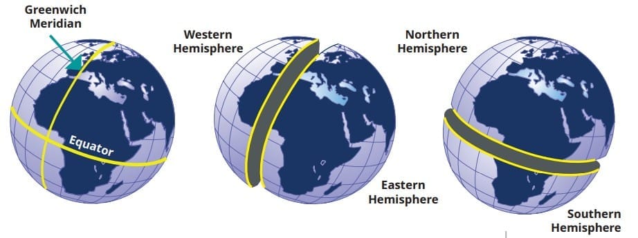
8. Grid System of the Earth
- Latitudes and longitudes intersect to form a network of lines called a grid. This grid makes it possible to determine the exact coordinates of any place on Earth.
- For example, a location may be described by stating both its latitude and longitude values.
9. Relation Between Longitude and Time
The Earth rotates from west to east, completing one full rotation in 24 hours. Since the Earth has 360° of longitude, every 15° of longitude corresponds to a time difference of one hour.
As a result, places to the east experience sunrise earlier than places to the west.
10. Local Time and Standard Time
Local time depends on the position of the Sun at a particular longitude. However, using a different time for every location would be inconvenient.
Therefore, countries adopt a single standard time based on a selected central meridian.
Indian Standard Time (IST)
India follows a single standard time based on a central longitude, which is ahead of Greenwich Mean Time (GMT).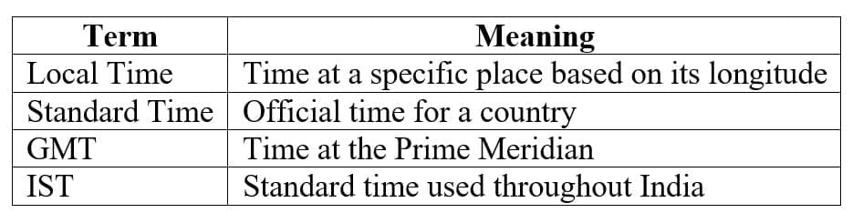
11. Time Zones
- The world is divided into time zones, each roughly covering 15° of longitude. Countries may have one or more time zones depending on their size.
- Large countries such as Russia or the United States have multiple time zones, while smaller countries usually follow one.
12. International Date Line
The International Date Line lies roughly along 180° longitude, opposite the Prime Meridian. Crossing this line results in a change of date by one day.
- Crossing westward → add one day
- Crossing eastward → subtract one day
The line bends in places to avoid splitting countries into different dates.
FAQs on Rapid Revision: Locating Places On The Earth
| 1. What are the main types of maps used in mapping the Earth? |  |
| 2. How do time zones affect global communication? | |
| 3. What is the significance of the Prime Meridian in mapping? | |
| 4. How does the scale of a map influence its use? | |
| 5. What tools are commonly used for creating and reading maps? | |


