UPSC Exam > UPSC Notes > Current Affairs & Hindu Analysis: Daily, Weekly & Monthly > Geography – Current Affairs (December 2025)
Geography – Current Affairs (December 2025)

GS1/Geography
Pamir-Karakoram Anomaly
Why in News?
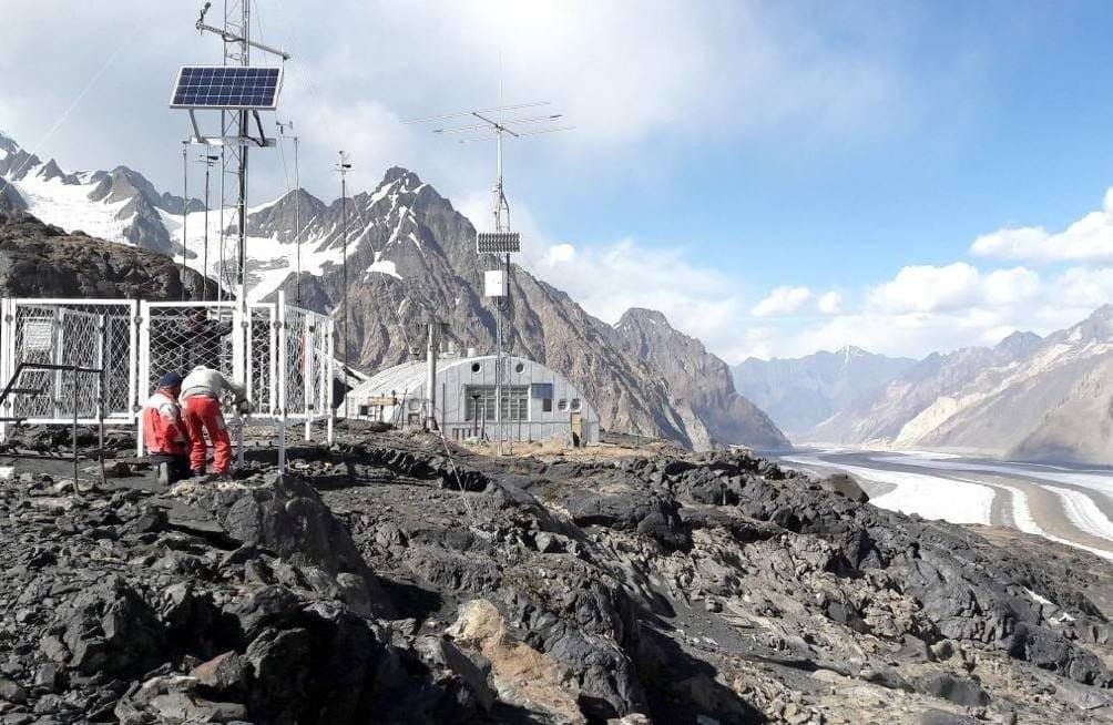
Scientists are studying deep ice cores from the Kon-Chukurbashi ice cap in Tajikistan to understand the Pamir-Karakoram anomaly. This anomaly is observed where glaciers have either remained stable or have even grown, despite the ongoing global warming.
Pamir-Karakoram Anomaly
- Definition: The Pamir-Karakoram anomaly describes the surprising stability or slight growth of glaciers in the Karakoram and parts of the Pamir mountain ranges since the late 1900s. In contrast, glaciers in regions like the Himalayas, Alps, Andes, and Rocky Mountains have been shrinking due to global warming.
- Proposed Causes:
- Increased Winter Precipitation: Heavier snowfall during winter helps to replenish glaciers, counteracting the melting that occurs in summer.
- High, Steep Topography: The steep and high terrain of these mountains provides shade for the ice and creates high-altitude zones where snow and ice can accumulate.
- Climate Patterns: The moisture that contributes to glacier growth primarily comes from Western Disturbances, rather than the Indian Monsoon.
- Summer Cloud Cover: Increased cloud cover during the summer months may help reduce the amount of solar radiation that reaches the glaciers, thereby decreasing the rate of melting.
- Protective Debris Cover: A layer of debris on the surface of glaciers can insulate the ice below, slowing down the melting process.
- Geographic Scope: The anomaly is mainly observed in the Karakoram Range, particularly in regions such as Gilgit-Baltistan and parts of Ladakh. It also extends into the western Pamir Mountains, which are located in Tajikistan and Afghanistan.
- Recent Findings: Recent scientific studies using advanced methods like satellite altimetry (for example, ICESat-2) and gravity data from the GRACE mission have shown that the Pamir-Karakoram anomaly is weakening. However, evidence from field-based ice-core studies is still being analyzed.
- Significance for India: The glaciers in the Karakoram Range are crucial because they feed the Indus River and its tributaries. The relative stability of these glaciers is important for maintaining more reliable river flows into regions like Ladakh and Jammu & Kashmir.
Karakoram Ranges
- Overview: The Karakoram Range is situated in the heart of Asia and is part of a complex system of mountains. This system includes the Hindu Kush to the west, the Pamirs to the northwest, the Kunlun Mountains to the northeast, and the Himalayas to the southeast.
- Geographic Spread: The Karakoram Range spans across several countries, including Afghanistan, China, India, Pakistan, and Tajikistan.
- Highest Peak: The tallest peak in the Karakoram Range is K2, which stands at 8,611 meters (28,251 feet) above sea level. K2 is also known as Mount Godwin-Austen and is the second-highest mountain on Earth, following Mount Everest, which is 8,849 meters (29,032 feet) tall.
GS1/Geography
Tsunami Ready Recognition Programme

Why in News?
India is set to enhance its preparedness for tsunamis by designating over 100 villages in the Indian Ocean region as tsunami-ready under the Tsunami Ready Recognition Programme.
Key Takeaways
- This initiative aims to foster resilient communities through awareness and preparedness strategies.
- The programme is developed by the Intergovernmental Oceanographic Commission (IOC) of UNESCO.
- Communities must meet 12 established indicators to earn the 'Tsunami Ready' certification.
- Recognition is renewable every four years, emphasizing ongoing preparedness and community involvement.
Additional Details
- Tsunami Ready Recognition Programme: An international initiative aimed at enhancing coastal community preparedness by implementing strategies that protect lives, livelihoods, and property from tsunamis.
- Aim: The primary goal is to improve preparedness for tsunamis through community awareness and the establishment of effective response mechanisms.
- Methodology: Communities aspiring to achieve this recognition must fulfill 12 indicators related to assessment, preparedness, and response efforts.
- Tsunami-ready villages: These are communities that demonstrate high levels of awareness regarding tsunami hazards, effective mapping, public evacuation displays, 24-hour warning systems, and regular participation in mock drills.
The Tsunami Ready Recognition Programme represents a significant step towards safeguarding coastal communities from the threats posed by tsunamis, ensuring that they are well-prepared and resilient in the face of natural disasters.
The document Geography – Current Affairs (December 2025) is a part of the UPSC Course Current Affairs & Hindu Analysis: Daily, Weekly & Monthly.
All you need of UPSC at this link: UPSC
FAQs on Geography – Current Affairs (December 2025)
| 1. What is the Pamir-Karakoram Anomaly? |  |
Ans. The Pamir-Karakoram Anomaly refers to the unusual geological and climatic patterns observed in the Pamir and Karakoram mountain ranges, specifically relating to the elevated rates of glacial retreat and the distinct climatic conditions that differ from surrounding areas. This anomaly is significant in understanding the impacts of climate change and geological processes in high-altitude regions.
| 2. How does the Pamir-Karakoram Anomaly relate to climate change? | |
Ans. The Pamir-Karakoram Anomaly is linked to climate change as it showcases a unique response of glaciers in this region compared to other parts of the Himalayas. While many glaciers globally are retreating due to rising temperatures, some glaciers in the Pamir and Karakoram are either stable or advancing, suggesting complex interactions between temperature, precipitation, and local climatic conditions that warrant further study.
| 3. What is the Tsunami Ready Recognition Programme? | |
Ans. The Tsunami Ready Recognition Programme is an initiative aimed at enhancing community preparedness for tsunami events. It involves a series of criteria that communities must meet to be recognised as 'Tsunami Ready', including the establishment of an effective tsunami warning system, public education on tsunami risks, and the development of evacuation plans to ensure safety during tsunami threats.
| 4. Why is community preparedness important in the context of tsunamis? | |
Ans. Community preparedness is critical in the context of tsunamis because it directly influences the effectiveness of response measures during an actual tsunami event. Educated and well-prepared communities can reduce loss of life and property by following established evacuation routes and protocols, understanding warning signals, and having access to necessary information and resources to respond effectively.
| 5. What are the benefits of being recognised as 'Tsunami Ready'? | |
Ans. Being recognised as 'Tsunami Ready' offers several benefits, including increased awareness and education about tsunami risks in the community, improved preparedness and response capabilities, and enhanced collaboration among local agencies, which can lead to better resource allocation and emergency services. This recognition also fosters a culture of safety and resilience among residents, thereby reducing vulnerability to tsunami impacts.
About this Document

4.90/5 Rating

Apr 19, 2026 Last updated
Related Exams
Document Description: Geography – Current Affairs (December 2025) for UPSC 2026 is part of Current Affairs & Hindu Analysis: Daily, Weekly & Monthly preparation. The notes and questions for Geography – Current Affairs (December 2025) have been prepared according to the UPSC exam syllabus. Information about Geography – Current Affairs (December 2025) covers topics like and Geography – Current Affairs (December 2025) Example, for UPSC 2026 Exam. Find important definitions, questions, notes, meanings, examples, exercises and tests below for Geography – Current Affairs (December 2025).
Introduction of Geography – Current Affairs (December 2025) in English is available as part of our Current Affairs & Hindu Analysis: Daily, Weekly & Monthly for UPSC & Geography – Current Affairs (December 2025) in Hindi for Current Affairs & Hindu Analysis: Daily, Weekly & Monthly course. Download more important topics related with notes, lectures and mock test series for UPSC Exam by signing up for free. UPSC: Geography – Current Affairs (December 2025)
Description
Geography – Current Affairs (December 2025) provides information related to important recent events for the UPSC exam. You can download free PDF as well.
Information about Geography – Current Affairs (December 2025)
In this doc you can find the meaning of Geography – Current Affairs (December 2025) defined & explained in the simplest way possible. Besides explaining types of Geography – Current Affairs (December 2025) theory, EduRev gives you an ample number of questions to practice Geography – Current Affairs (December 2025) tests, examples and also practice UPSC tests


Related Searches
MCQs, Summary, Extra Questions, shortcuts and tricks, pdf , Geography – Current Affairs (December 2025), Geography – Current Affairs (December 2025), ppt, Viva Questions, Important questions, Sample Paper, practice quizzes, Geography – Current Affairs (December 2025), Semester Notes, study material, Exam, Objective type Questions, video lectures, Free, Previous Year Questions with Solutions, mock tests for examination, past year papers;