Q1: What does the word 'Himalaya' mean? (a) Land of rivers (b) Home of snow (c) Mountain of gods (d) Valley of flowers
Solution:
Ans: (b) Explanation: The word Himalaya means 'home of snow' in Sanskrit. The Himalayas are tall mountains in the northern part of India covered with snow all year.
Q2: Which is the highest peak in the world? (a) Kanchenjunga (b) Nanda Devi (c) Mount Everest (d) Mount K-2
Solution:
Ans: (c) Explanation: Mount Everest is the highest peak in the world and is found in the Himadri range. It is 8848 meters tall.
Q3: What is a glacier? (a) A hot spring (b) A big moving block of snow (c) A deep valley (d) A sandy hill
Solution:
Ans: (b) Explanation: A glacier is a big moving block of snow. Glaciers like Gangotri and Siachen melt and flow down as rivers, giving water to northern rivers.
Q4: Which plains are known as the 'Food bowl of India'? (a) Coastal Plains (b) Desert Plains (c) Northern Plains (d) Deccan Plains
Solution:
Ans: (c) Explanation: The Northern Plains are known as the 'Food bowl of India' because the soil is fertile and good for agriculture with enough rainfall and rivers.
Q5: Which desert is also known as the Thar Desert? (a) The Indian Desert (b) The Great Indian Desert (c) The Rajasthan Desert (d) The Sandy Desert
Solution:
Ans: (b) Explanation: The Great Indian Desert is also known as the Thar Desert. It is located in the northwest part of Rajasthan and is hot and dry.
Fill in the Blanks
Q1: India is divided into _____ physical divisions.
Solution:
Ans: six
Q2: The Himalayas are divided into _____ parallel ranges.
Solution:
Ans: three
Q3: A _____ is a small river that joins the main river.
Solution:
Ans: tributary
Q4: The Sundarbans is the largest _____ in the world.
Solution:
Ans: delta
Q5: Hills of sand in the desert are called sand _____.
Solution:
Ans: dunes
True or False
Q1: The Himadri is the lowest range in the Himalayas.
Solution:
Ans: False Explanation: The Himadri is the highest range in the Himalayas with many peaks more than 6000 meters tall.
Q2: The Shiwalik range has large flat valleys called Duns.
Solution:
Ans: True Explanation: The Shiwalik range has large flat valleys called Duns. Dehra Dun, Kotli Dun, and Patli Dun are famous Duns.
Q3: The Eastern Coastal Plains are narrower than the Western Coastal Plains.
Solution:
Ans: False Explanation: The Eastern Coastal Plains are broader than the Western Coastal Plains. They stretch along the Bay of Bengal coast.
Q4: Perennial rivers have water all year round.
Solution:
Ans: True Explanation: Perennial rivers have water all year. They get water from melted ice from mountains and do not dry even in summers.
Q5: The Peninsular Plateau is circular in shape.
Solution:
Ans: False Explanation: The Peninsular Plateau is triangular in shape. It is mainly rocky and uneven and tilts towards the east.
Match the Following
Column A
Column B
1. Himachal range
A. Only active volcano in India
2. River Ganga
B. Home of snow
3. Himalaya
C. Enters plains at Haridwar
4. Barren Island
D. Between 3700 to 4600 meters
5. Yamuna
E. Main tributary of Ganga
Solution:
Ans:
1 - D: The Himachal range is lower than the Himadri with height between 3700 to 4600 meters.
2 - C: River Ganga enters the plains at Haridwar and flows eastward through the Northern Plains.
3 - B: The word Himalaya means 'home of snow' in Sanskrit. These are tall mountains in northern India.
4 - A: The only active volcano in India is found on Barren Island in the Andaman and Nicobar group.
5 - E: Yamuna is the main tributary of River Ganga and meets it at Prayagraj, known as Sangam.
Short Answer Questions
Q1: What is the importance of the Himalayas?
Solution:
Ans: The Himalayas protect us from cold winds coming from the north. They stop monsoon winds and help bring rainfall to India. The Himalayas act like a natural wall and protect us from foreign invaders. Many rivers like Ganga and Yamuna start from the Himalayas and give us water all year. The Himalayan forests give us wood, medicinal plants, and herbs.
Q2: Describe the Northern Plains and their importance.
Solution:
Ans: The Northern Plains are south of the Himalayas and stretch from Punjab to Assam. They were made by soil brought by Himalayan rivers. The Northern Plains get enough rainfall and have many rivers, streams, and lakes. The soil is fertile and good for agriculture. It is known as the 'Food bowl of India'. The flat land helps in laying roads and railway lines easily.
Q3: What are the three parts of the Peninsular Plateau?
Solution:
Ans: The Peninsular Plateau has three parts: the Malwa Plateau, the Chota Nagpur Plateau, and the Deccan Plateau. The Malwa Plateau lies between the Vindhya and Aravalli hills. The Chota Nagpur Plateau is in the eastern part. The Deccan Plateau is a triangular landmass south of the Vindhya and Satpura ranges. The Western Ghats and Eastern Ghats lie on its edges.
Q4: What is the difference between perennial and non-perennial rivers?
Solution:
Ans: Perennial rivers have water all year. They get water from melted ice from mountains, so they do not dry even in summers. River Ganga and Yamuna are examples of perennial rivers. Non-perennial rivers do not have water all year. They get water from rains only and dry up during summers. These are also known as seasonal rivers and are found in peninsular India.
Q5: Why are the Coastal Plains important?
Solution:
Ans: The Eastern Coastal Plains have very fertile soil which is good for agriculture. Fishing is an important occupation of people living on the west coast. The beaches of the Coastal Plains are places of tourist attraction. The seaports like Mumbai, Kandla, and Vishakhapatnam help in the development of trade with other countries.
FAQs on Worksheet with Solutions: The Physical Divisions of India
1. What are the physical divisions of India?
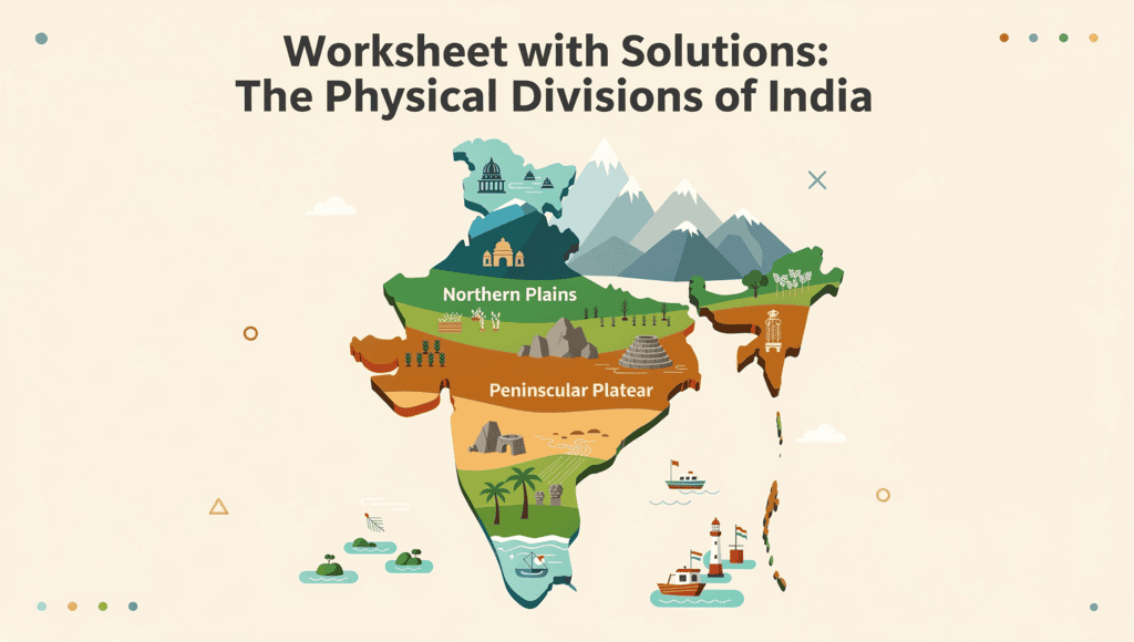
Ans. The physical divisions of India include the Himalayan region, the Northern Plains, the Peninsular Plateau, the Coastal Plains, and the Islands. Each division has distinct geographical features and ecological characteristics.
2. What is the significance of the Himalayas in India?
Ans. The Himalayas serve as a natural barrier to cold winds from Central Asia, influencing the climate of the Indian subcontinent. They also play a crucial role in the monsoon weather patterns and are home to diverse flora and fauna.
3. Describe the Northern Plains of India.
Ans. The Northern Plains are characterized by fertile alluvial soil, making them suitable for agriculture. This region is densely populated and is known for major rivers such as the Ganges, Yamuna, and Brahmaputra, which contribute to its agricultural productivity.
4. What features distinguish the Peninsular Plateau?
Ans. The Peninsular Plateau is marked by a rocky terrain and is surrounded by hills and mountains. It is rich in mineral resources and is known for its unique topography, including plateaus like the Deccan Plateau and the Chotanagpur Plateau.
5. How do the Coastal Plains of India differ from the Islands?
Ans. The Coastal Plains are low-lying areas adjacent to the seas, featuring beaches and lagoons, while the Islands, such as the Andaman and Nicobar Islands, are landmasses surrounded by water and are often characterized by tropical climates and rich biodiversity.
Objective type Questions, Worksheet with Solutions: The Physical Divisions of India, Worksheet with Solutions: The Physical Divisions of India, shortcuts and tricks, Sample Paper, Semester Notes, Free, Extra Questions, Exam, MCQs, mock tests for examination, Previous Year Questions with Solutions, Worksheet with Solutions: The Physical Divisions of India, Summary, study material, pdf , past year papers, practice quizzes, ppt, Important questions, video lectures, Viva Questions;