Veena Bhargava Textbook Solutions: Interpretation of Topographical Maps - II (Part - I)

Multiple Choice Question
Q1: What does the black line in 4812 indicate?
a. Seasonal stream
b. Contour
c. Cart track
d. Dry land
Ans: (a) Seasonal stream
Q2: What does the brown line in grid square 4927 indicate?
a. Cart track
b. Contour
c. Pack track
d. Stream
Ans: (b) Contour
Q3: The direction of Amarapura from Dantrai is
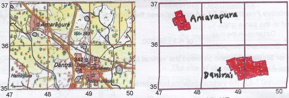
a. SE
b. NW
c. SW
d. NE
Ans: (b) NW
Q4: What is the feature in broken black lines in grid square 4932?

a. River
b. Stream
c. Disappearing stream
d. Broken ground
Ans: (d) Broken ground
Q5: What is the distance in km between Awara and Marol as the crow flies, the scale being 2cm = 1km?
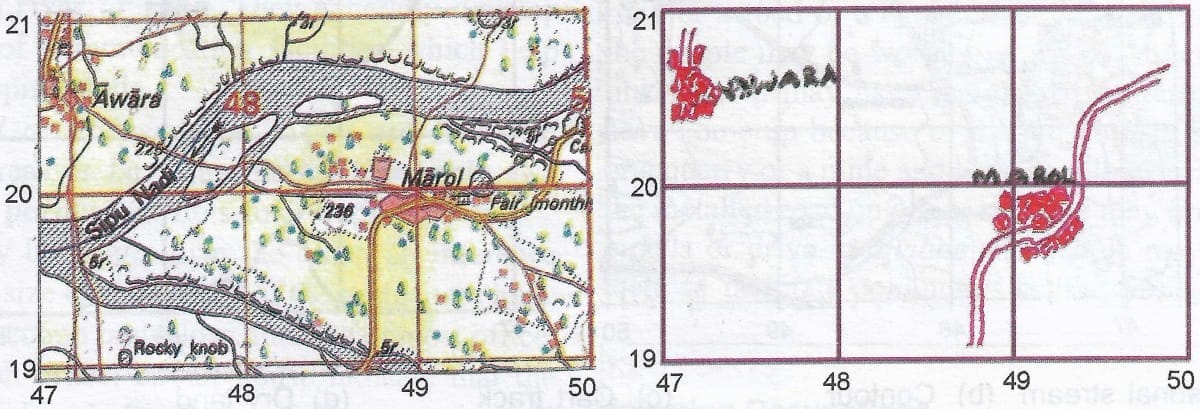
a. 4 cm
b. 4.5 cm
c. 2.25 km
d. 2 m
Ans: (c) 2.25 km
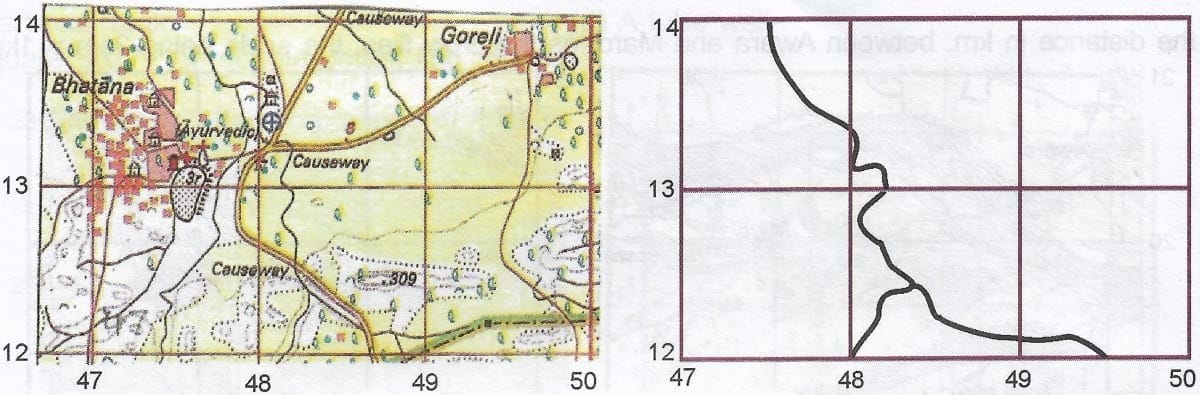
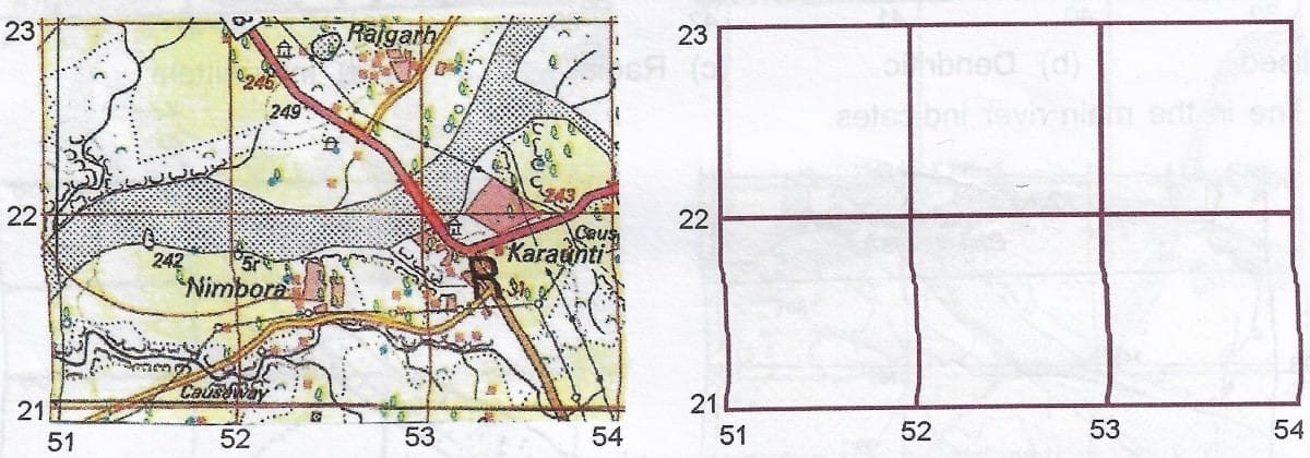
Q6: What does the term Causeway mean in grid square 4723?
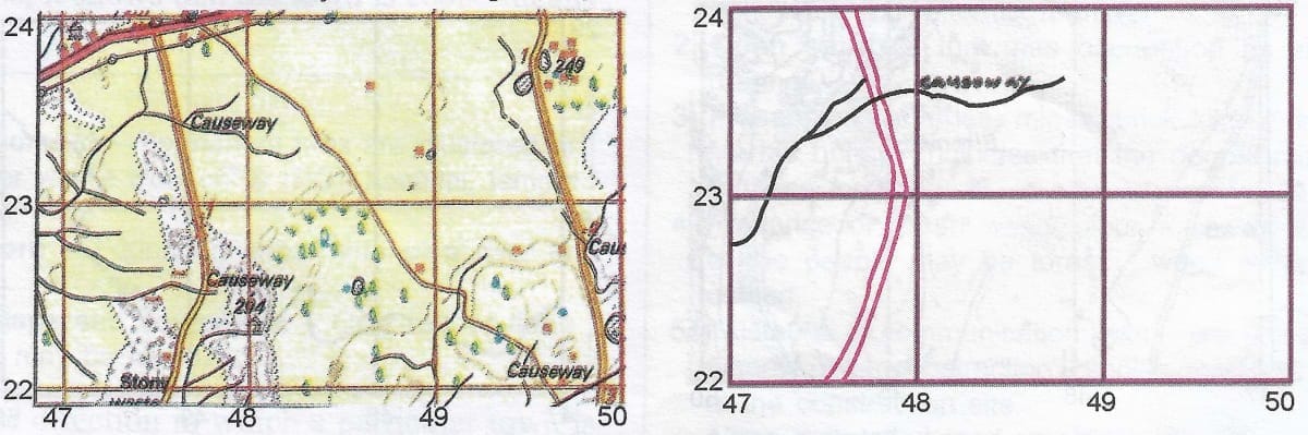
a. It is a Road across a river
b. A Raised platform across a stream
c. It is a Cart
d. It is a Stream
Ans: (b) A raised platform across a stream
Q7: The broken line in red in grid square 6812 and 6913 indicates
a. A cart track
b. A footpath
c. A pack track
d. A road
Ans: (a) A pack track
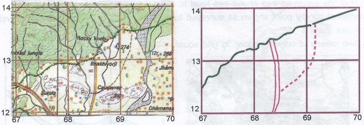
Q8: The term Diggi in grid square 6226 means
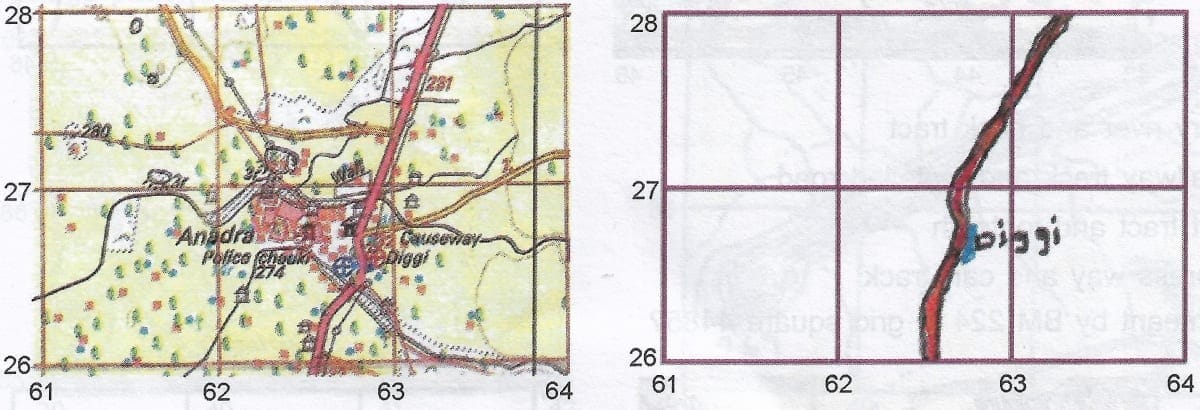
a. A well
b. A tank which is used for collection of water
c. A artificial tank
d. A tube well
Ans: (b) A tank which is used for collection of water
Q9: In grid square 6827, the double dotted line means
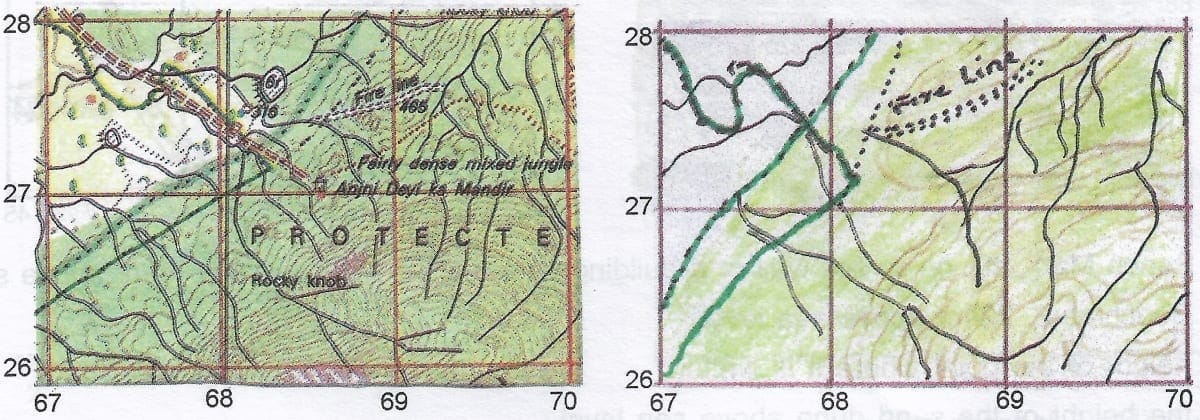
a. A road in the forest
b. A clearing made in the forest to prevent spread of fire called fire line.
c. An unmetalled road to cross the forest
d. Clearing the forest for farming purpose
Ans: (b) A clearing made in the forest to prevent spread of fire called fire line.
Q10: What does the number 158 in the grid square 2189 indicate?
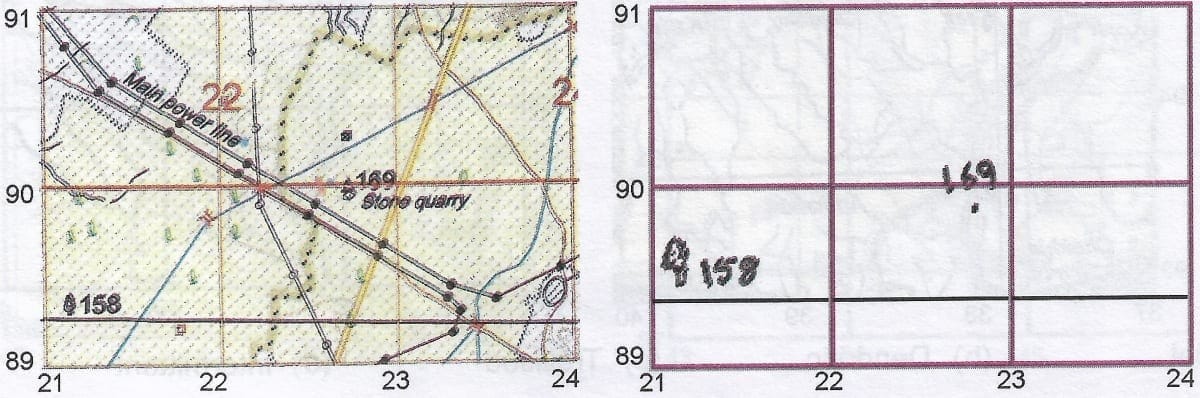
a. A spot height of 158 m
b. Height of the surveyed tree above sea level is 158 m
c. A prominent survey point shown as surveyed tree at the height of 158 m above sea level
d. Surveyors mark is 158
Ans: (c) A prominent survey point shown as surveyed tree at the height of 158 m above sea level
Q11: State any two means of communication in grid square 4485
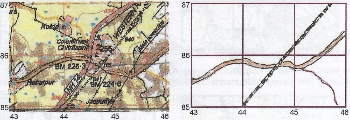
a. A dry river and pack tract
b. A railway track and metalled road
c. Cart tract and footpath
d. Express way and cart track
Ans: (b) A railway track and metalled road
Q12: What is meant by BM 224 in grid square 4485?
a. It is Bench Mark, cut on a rock wall or a building showing the height of that mark above sea level is 224 m
b. It is Benchmark, 224 m above sea level
c. The height of the point where it is written
d. It is the height of the sand dune above sea level
Ans: (a) It is Bench Mark, cut on a rock wall or a building showing the height of that mark above sea level is 224 m
Q13: Which drainage pattern is seen in grid square 3893?
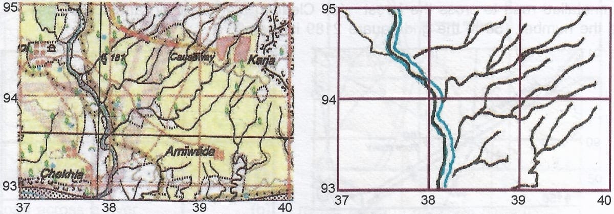
a. Radial
b. Dendritic
c. Trellised
d. Intermittent
Ans: (c) Trellised
Q14: Which drainage pattern is seen in grid square 4196?
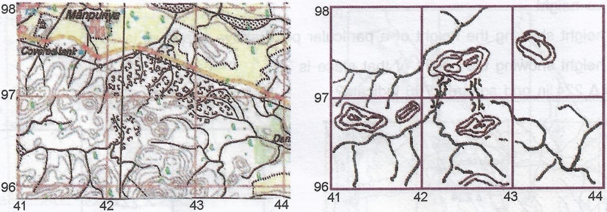
a. Dendritic
b. Trellised
c. Radial
d. Intermittent
Ans: (b) Trellised
Q15: Which drainage pattern is seen in grid square 4085 and 4086?
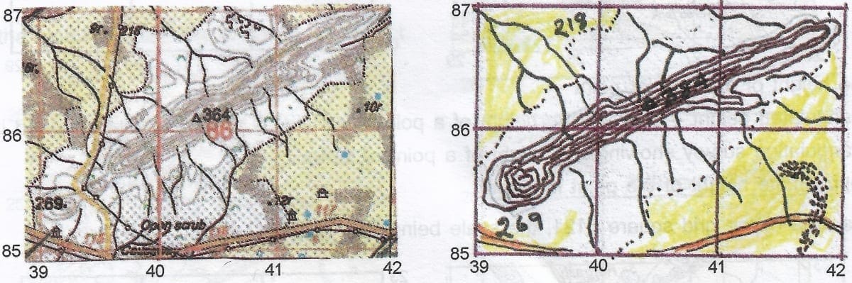
a. Trellised
b. Dendritic
c. Radial
d. Intermittent
Ans: (c) Radial
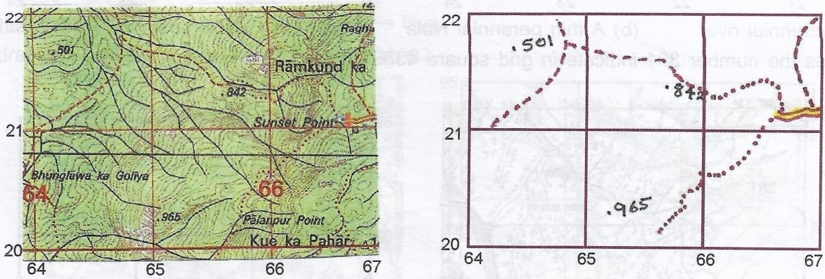
Q16: The blue line in the main river indicates

a. A perennial
b. A thin perennial Nala
c. A thin water channel
d. A stream
Ans: (c) A thin water channel
Q17: What does the number 381 indicate in grid square 4388?

a. Approximate height is 381
b. Relative height
c. Spot height showing the height of a particular point above sea level is 381 m
d. Spot height showing the height of that place is 381
Ans: (c) Spot height showing the height of a particular point above sea level is 381 m
Q18: What does ▲ 224 in grid square 2706 indicate?

a. The height of a particular point
b. Triangulated height - showing the height of a point surveyed by the triangulated method is 224m
c. Triangulation survey showing the height of a point of 224m
d. Approximate height of the point is 224 m
Ans: (b) Triangulated height - showing the height of a point surveyed by the triangulated method is 224m
Q19: State the area of the grid square 5121, the scale being 2cm = 1km.
a. 4 sq km
b. 2 sq km
c. 1 sq km
d. 1 km
Ans: (c) 1 sq km
Q20: Name the three types of communication shown in the grid square 6621.
a. Metalled road, cart track, pack tract
b. Cart track, footpath, road
c. Footpath, pack track and metalled road
d. Cart track, road and footpath
Ans: (c) Footpath, pack track and metalled road
FAQs on Veena Bhargava Textbook Solutions: Interpretation of Topographical Maps - II (Part - I)
| 1. What are topographical maps and what information do they provide? |  |
| 2. How do contour lines help in understanding the terrain on a topographical map? | |
| 3. What symbols are commonly used on topographical maps, and what do they represent? | |
| 4. How can one determine the direction of water flow using a topographical map? | |
| 5. Why is it important to read and interpret topographical maps in geography? | |


