Veena Bhargava Textbook Solutions: Interpretation of Topographical Maps - II (Part - II)

Q21: Give four figure grid reference of the temporary huts
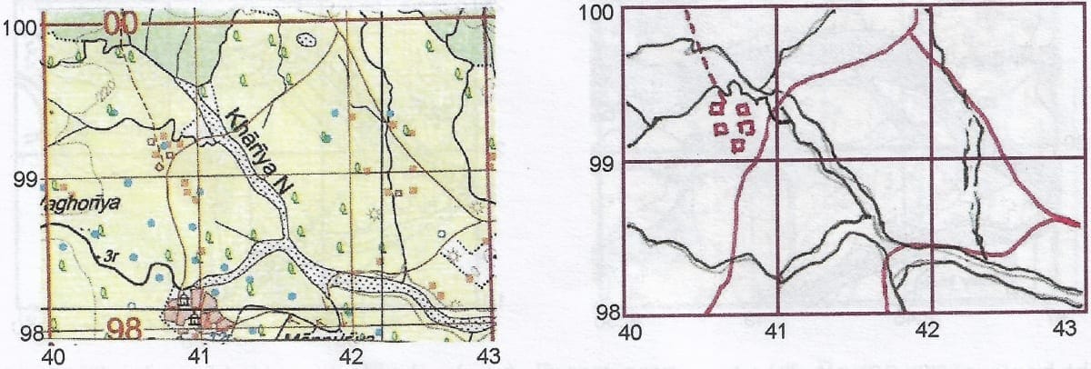
- 4199
- 4099
- 9940
- 0041
Ans: 4099
Q22: Identify the type of settlement in the given extract.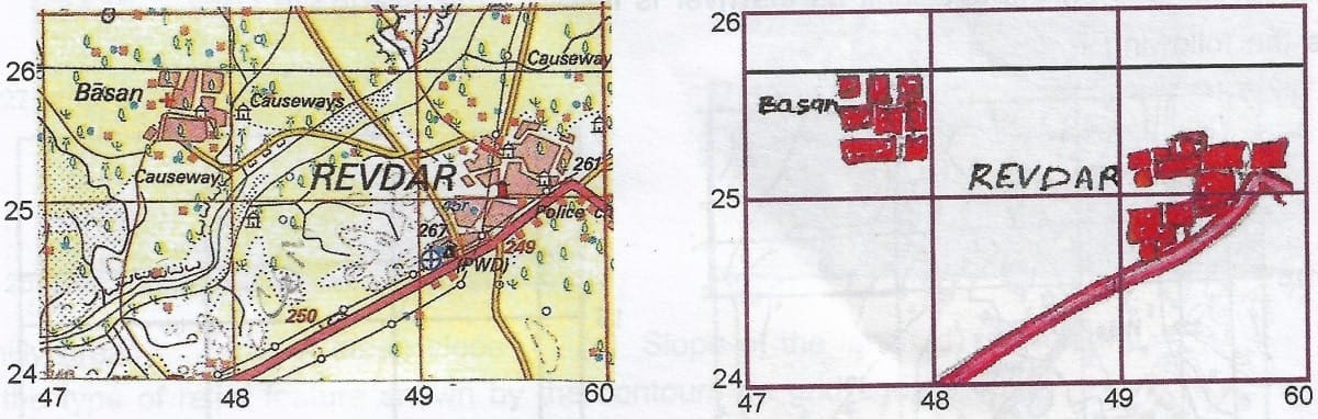
- Compact settlement or Nucleated settlement
- Linear settlement
- Scattered settlements
- None of the above
Ans: Compact settlement or Nucleated settlement
Q23: Identify the type of settlement in grid square 6223
- Compact settlement or Nucleated settlement
- Scattered or dispersed settlement
- Linear settlement
- Temporary huts
Ans: Scattered or dispersed settlements
Q24: On which bank of the river Sipu is Marol situated? Give a reason for your Ans:.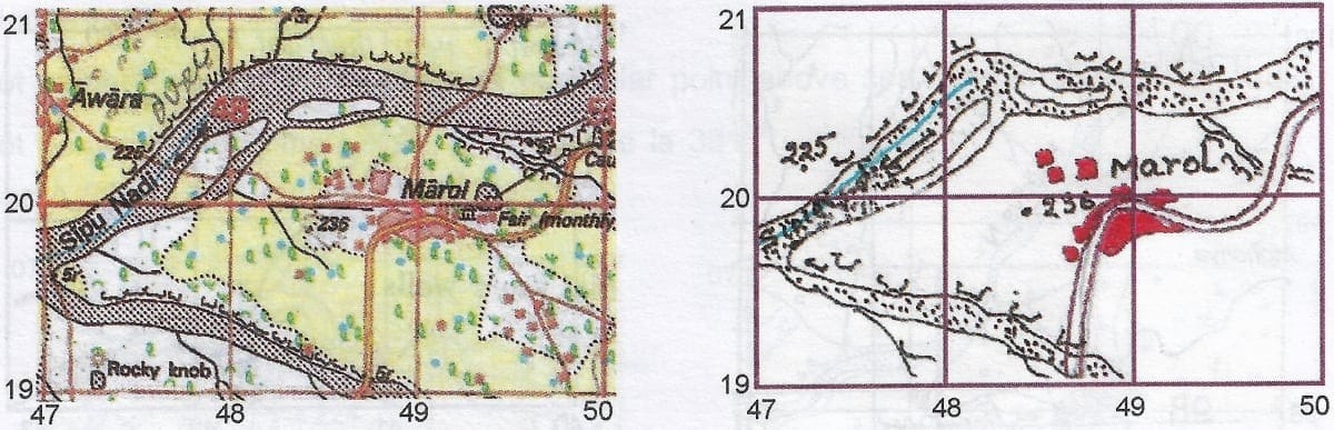
- Right bank, as the spot height is on the right bank
- Left bank as the arrow shows river is flowing from east towards SW. If we stand at the source in the east facing the river, Marol is on the left bank
- Marol is on the right bank as slope of the land is towards SW
- Marol is situated on the left bank as the river is flowing from SW to NE
Ans: Left bank as the arrow shows river is flowing from east towards SW. If we stand at the source in the east facing the river, Marol is on the left bank
Q25: What are the following -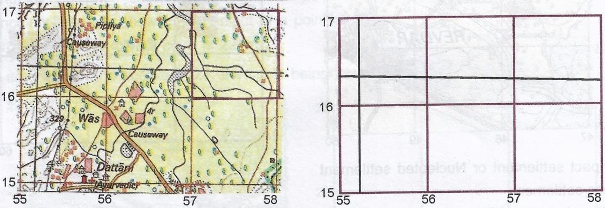
(a) The black vertical line between Easting 55 and 56
- Northing of 55 in the given extract
- Line of Longitude, 37'30"
- Line of Longitude 37
- None of the above
(b) The black horizontal line between Northing 16 and 17
- Northing of 55 in the given extract
- Line of Latitude, 32'30"
- Line of Longitude 37
- None of the above
Ans:
(a) Line of Longitude, 37'30"
(b) Line of Latitude, 32'30"
Q26: What is the conventional sign given in grid square 5824?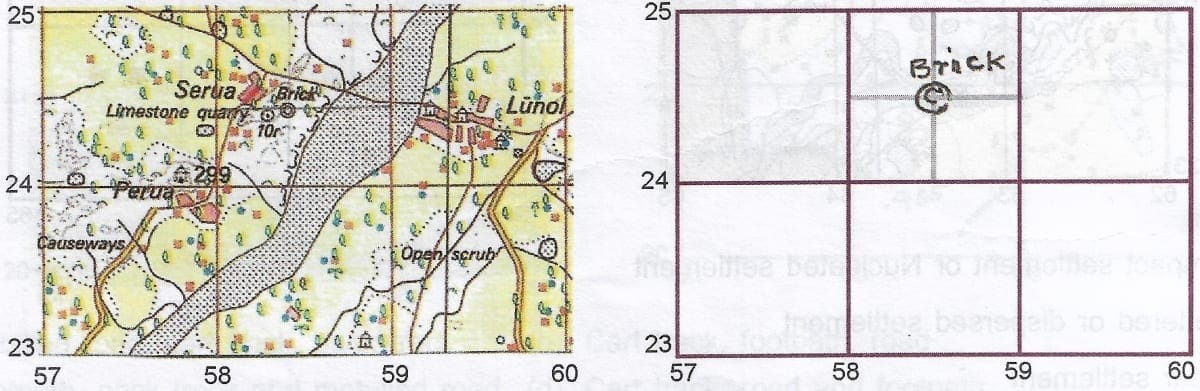
- Brick kiln
- A Well
- A Quarry
- A Brick Mine
Ans: Brick kiln
Q27: What does the area shown in green wash represent?
- Cultivable lan
- Uncultivable land
- Forest area
- Barren area
Ans: Forest area
Q28: Name the relief feature shown by contours in grid square 7127
- A hilly area
- A steep slope
- Slope of the land
- A highland
Ans: A steep slope
Q29: What is the type of relief feature shown by the contours on grid square 4097?

- A steep slope
- A gentle slope
- Slope of the land
- Higher elevation
Ans: A gentle slope
Q30: What are the following in the given extract?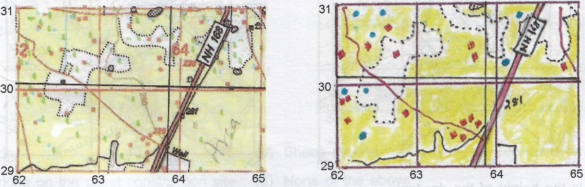
(a) Yellow wash
- Flat land
- Cultivable land
- Barren land
- None of the above
(b) Blue dots
- The perennial tanks
- Perennial lined wells
- Unlined wells
- Perennial ponds
Ans:
(a) Cultivable land
(b) Perennial lined wells
Q31: What does 10 r indicate grid square 6832?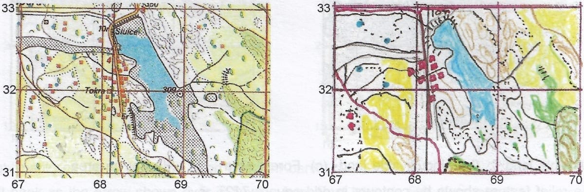
- 10 r stands for the height of the artificial perennial tank as 10m
- 10 r means that the relative height of the embankment of the perennial artificial tank is 10m
- 10 r is the relative depth of the artificial tank
- The height of the embankment of the artificial tank is 10 m
Ans: 10 r means that the relative height of the embankment of the perennial artificial tank is 10m
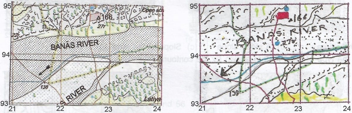
Q32: What is the direction of Banas River? Give a reason for your Ans: other than it being shown by the arrow?
- West to east as it is a flat land
- Shown by the arrow
- NE to SW as the spot heights are receding from NE to SW eg., △ 166, 138 ...
- It is a dry river flowing from west to east
Ans: NE to SW as the spot heights are receding from NE to SW eg., △ 166, 138 ...
Reason: Receding spot heights can be seen from NE to SW which means that the slope of the land is towards SW and hence the direction of the flow of river.
Q33: What does 3 r indicate in grid square 5618?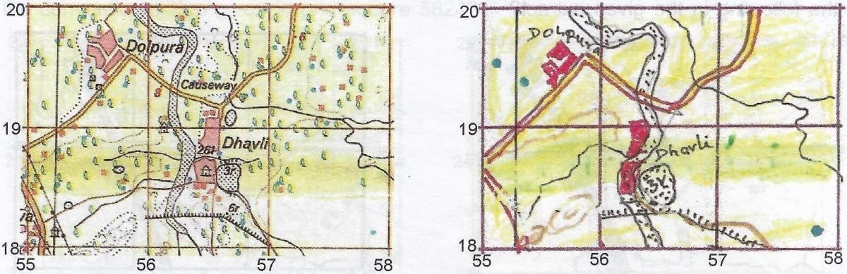
- 3 r is the height of the dry tank
- 3 r is the relative depth of the tank
- 3 r means relative height of the dry tank is 3m
- It means the height of the tank is 3m
Ans: 3 r means relative height of the dry tank is 3m
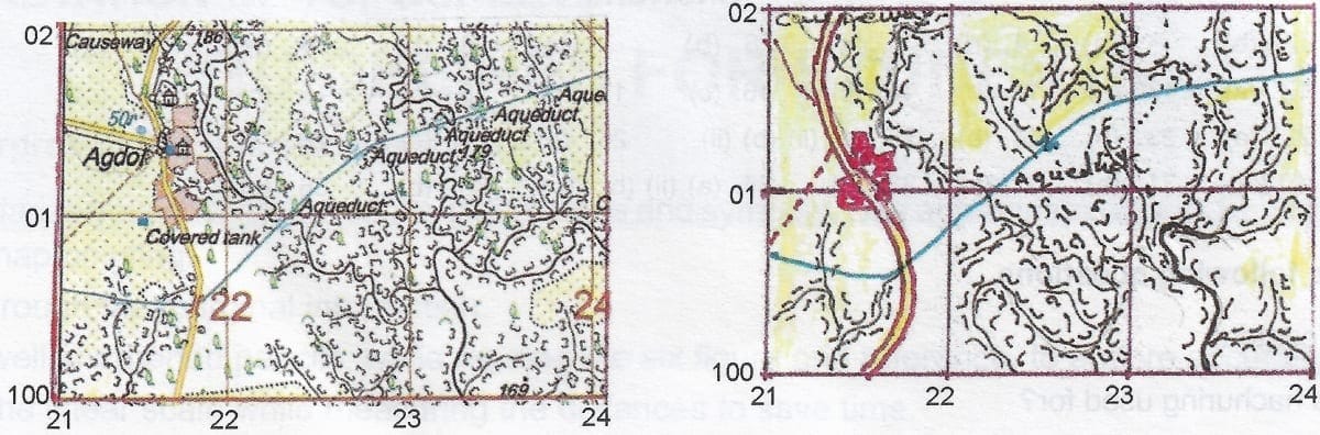
Q34: (a) What does Aqueduct in grid square 2201?
- An artificial canal
- An artificial channel for conveying water typically in the form of a bridge across a valley
- A perennial canal
- A water channel supplying water through an artificial canal
(b) The given map extract receives seasonal rainfall because of
- Flat land
- Broken ground
- Uncultivable land
- White patch of land
Ans: (a) An artificial channel for conveying water typically in the form of a bridge across a valley
(b) Broken ground
Q35: Give four figure grid reference of a causeway in the given extract.
- 3467
- 6733
- 6834
- 3368
Ans:6733
Q36: What is the occupation of the people other than farming in grid square 5723 and 5724?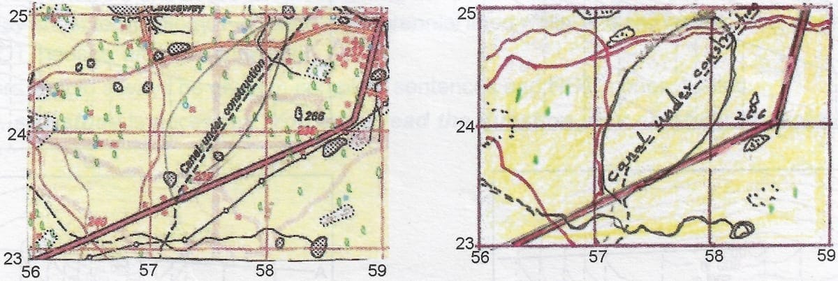
- Trade
- Sheep rearing
- Working on the canal construction site
- None of the above
Ans: Working on the canal construction site
Ans: the following questions
Q1: Define Contour.
Ans: Contours are lines drawn in brown colour, joining places having the same elevation above mean sea level. The contour lines on a map provide a useful insight into the topography of an area.
Q2: What is hachuring used for?
Ans: Hachures are short lines representing directions of a slope. For steep slopes they are drawn closer together than for the gentle slopes. They cannot be used for flat ground.
Q3: What is a gradient? How is it determined?
Ans: The term gradient refers to the slope of the concerned feature. It is determined by calculating the Horizontal Equivalent. Horizontal Equivalent is the distance between the two contour lines. If it is less, the slope is steep and if it is more, the slope is gentle.
Q4: What are form lines?
Ans: Form lines are the contour lines drawn as broken lines which are used to indicate the approximate heights above sea level. They are used to indicate the elevations of the area which are not accessible for proper survey.
Q5: What are spot heights? How are they represented on the map?
Ans: Spot heights are points which show the height of that point from the mean sea level. They are represented by a dot with a number beside it. If the spot height is shown as .220, it means that the height of that point is 220 m from the mean sea level.
Q6: What is meant by Bench marks? How are they represented on the map?
Ans: Bench marks are the permanent survey points shown by a stone or a building. They show the height of that point above sea level through accurate survey. The Bench mark is represented on the map as 'BM' with a number beside it. For example, 'BM 230 m' shows a bench mark with 230 m height.
Q7: What is meant by index contours? In what way are they useful?
Ans:In a contour map, every fifth line in multiple of 20 m is accentuated and is called the Index Contour.
Index contours make the contour map distinct. They also indicate whether the height of the terrain is increasing or decreasing.
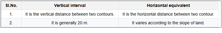
Q8: Differentiate between vertical interval and horizontal equivalent.
Ans:
Q9: What is a grid?
Ans: The network of horizontal and vertical lines, or the Eastings and Northings on a topo sheet is called the grid.
Q10: What points should be kept in mind while reading a grid reference?
Ans:
The Following point should be kept in mind while reading a grid reference:
- Origin is the south-west corner of the map. The reading on the map is always taken with reference to this origin.
- Eastings are always read to the East of the origin.
- Northings are always read to the North of the origin.
- While giving a grid reference, Eastings are always stated first, followed by the Northings.
- The readings are always taken to the right of the Eastings and to the North of the Northings
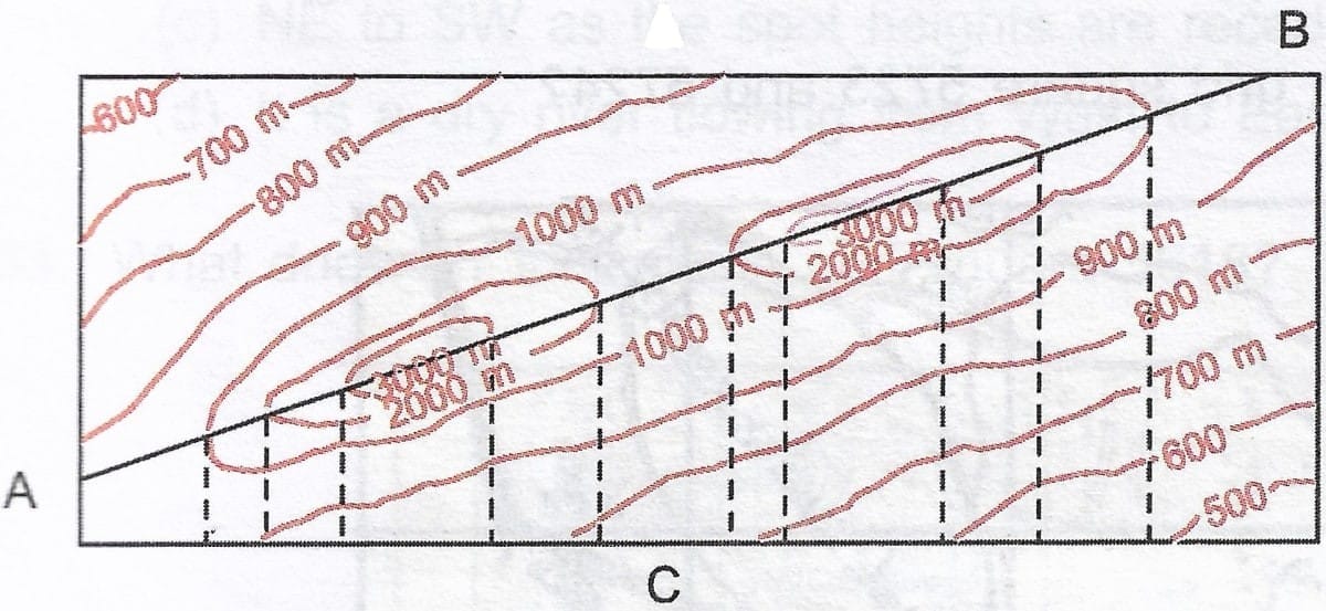
Q11: (a) Identify and name the relief features represented in the given diagram.

Ans: A Hill flat top gentle slope
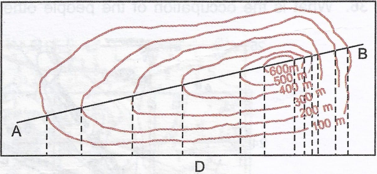
Q11: (b) Identify and name the relief features represented in the given diagram.

Ans:A v-shaped Valley
Q11: (c)Identify and name the relief features represented in the given diagram.
Ans: A Ridge
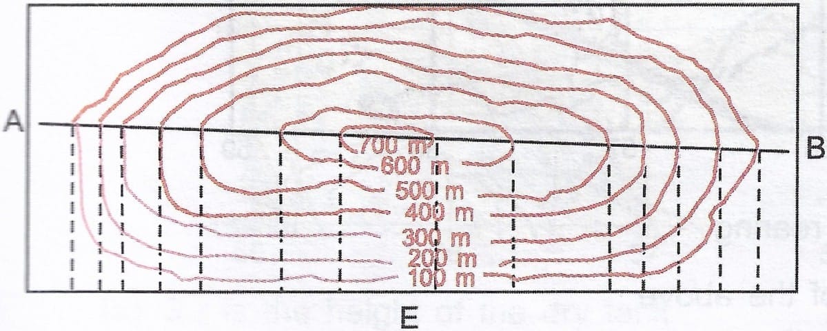
Q11: (d)Identify and name the relief features represented in the given diagram.
Ans: A hill with gentle and steep slope
Q11: (e)Identify and name the relief features represented in the given diagram.
Ans: A conical hill with steep slope
Q11: (f) Identify and name the relief features represented in the given diagram.
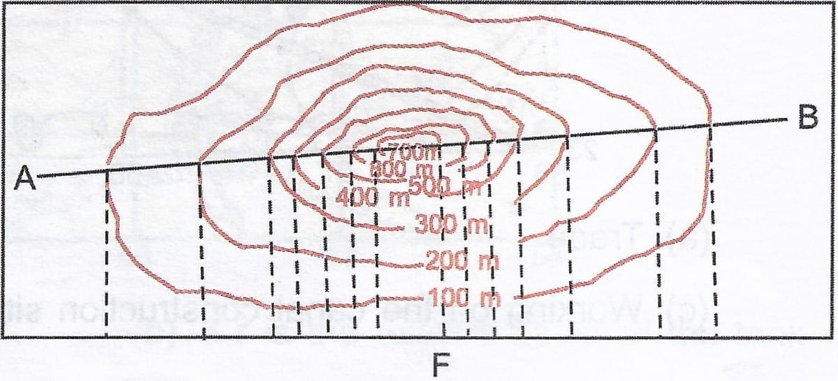
Ans: A conical hill
FAQs on Veena Bhargava Textbook Solutions: Interpretation of Topographical Maps - II (Part - II)
| 1. What are topographical maps? |  |
| 2. How do contour lines work on a topographical map? | |
| 3. What is the significance of scale in topographical maps? | |
| 4. How can one interpret symbols on a topographical map? | |
| 5. Why is understanding topographical maps important for outdoor activities? | |


