NCERT Solutions: India - Size And Location

Q1. Choose the right answer from the four alternatives given below.
(i) The Tropic of Cancer does not pass through
(a) Rajasthan
(b) Odisha
(c) Chhattisgarh
(d) Tripura
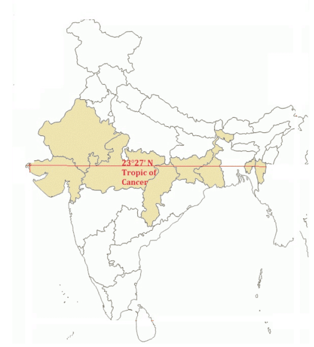
Ans: (b) Odisha
The Tropic of Cancer is an imaginary line that is located at approximately 23.5° North of the Equator. In India, the Tropic of Cancer passes through 8 states, which are Gujarat, Rajasthan, Madhya Pradesh, Chhattisgarh, Jharkhand, West Bengal, Tripura and Mizoram.
 The Tropic of Cancer through India
(ii) The easternmost longitude of India is
(a) 97025' E
(b) 6807' E
(c) 7706' E
(d) 82032' E
Ans: (a) 97°25' E
The easternmost longitude of India is located at 97°25' E in the state of Arunachal Pradesh, near the eastern border with Myanmar. This longitude marks the eastern boundary of India.
(iii) Uttarakhand, Uttar Pradesh, Bihar, West Bengal, and Sikkim have common frontiers with
(a) China
(b) Bhutan
(c) Nepal
(d) Myanmar
Ans: (c) Nepal
Uttarakhand, Uttar Pradesh, Bihar, West Bengal, and Sikkim all share their borders with Nepal. These Indian states have common frontiers with Nepal along its southern border.
(iv) If you intend to visit Kavaratti during your summer vacations, which one of the following Union Territories of India you will be going to
(a) Puducherry
(b) Lakshadweep
(c) Andaman and Nicobar
(d) Daman and Diu
Ans: (b) Lakshadweep
Kavaratti is the capital of the Union Territory of Lakshadweep, a group of islands located in the Arabian Sea. If you are visiting Kavaratti, you will be going to Lakshadweep.
(v) My friend hails from a country which does not share a land boundary with India. Identify the country.
(a) Bhutan
(b) Tajikistan
(c) Bangladesh
(d) Nepal
Ans: (b) Tajikistan
Tajikistan does not share a land boundary with India. While Bhutan, Bangladesh, and Nepal all share borders with India, Tajikistan is separated from India by other countries like Afghanistan and China.
Q2. Answer the following questions briefly.
(i) Name the group of islands lying in the Arabian Sea.
(ii) Name the countries which are larger than India.
(iii) Which island group of India lies to its south-east?
(iv) Which island countries are our southern neighbours?
Ans:
(i) Lakshadweep Islands lie in the Arabian Sea.
(ii) Russia, Canada, the USA, China, Brazil, and Australia are countries larger than India.
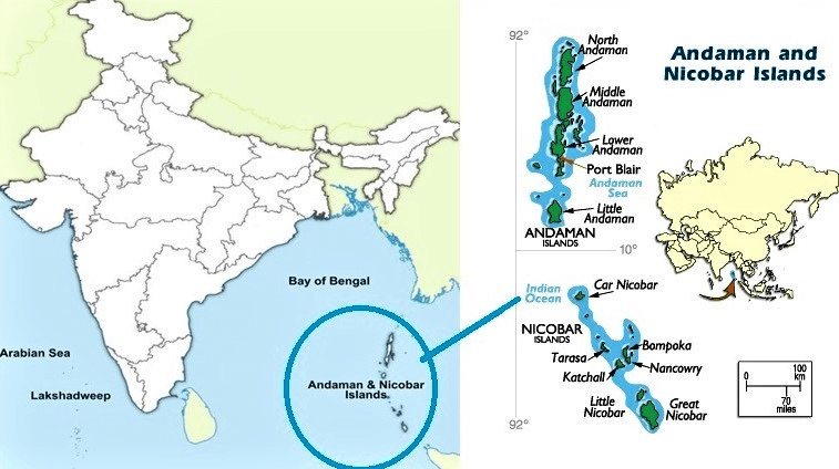
(iii) Andaman and Nicobar Islands lie to the southeast of India.
 Location of Andaman and Nicobar Islands
(iv) Sri Lanka and the Maldives are the two island countries that are the southern neighbours of India.
Q3. The sun rises two hours earlier in Arunachal Pradesh as compared to Gujarat in the west, but the watches show the same time. How does this happen?
Ans: India uses a single time zone, Indian Standard Time, which is based on the 82°30' E longitude. This longitude passes near Mirzapur in Uttar Pradesh and is used as the reference meridian for the entire country. The time difference across the width of India happens because India stretches across a vast longitudinal range from Gujarat to Arunachal Pradesh. The entire country follows the same official time, IST, to maintain uniformity in schedules.
Q4. The central location of India at the head of the Indian Ocean is considered of great significance. Why?
Ans: India's central location at the head of the Indian Ocean is of great significance because it provides strategic connections through the trans-Indian Ocean routes linking Europe in the West with East Asia. The Deccan Peninsula projects into the ocean, helping India maintain close contact with West Asia, Africa, and Europe from the western coast, and with Southeast and East Asia from the eastern coast. This advantageous position has promoted trade and cultural contacts with many parts of the world.
FAQs on NCERT Solutions: India - Size And Location
| 1. What are the exact geographical boundaries and coordinates of India's location? |  |
| 2. How does India's size compare with other countries, and why does it matter for CBSE exams? | |
| 3. What are the major states and union territories that form India's political boundaries? | |
| 4. Why does India's location between two oceans make it geographically and economically significant? | |
| 5. How do latitudinal and longitudinal lines help determine India's time zones and climate patterns? | |


