


All Exams > UPSC > Geography (Prelims) by Valor Academy > All Questions
All questions of India - Physical Environment for UPSC CSE Exam
Cultivation should never be done on the slope gradient of- a)5-7 per cent.
- b)8-10 per cent.
- c)10-12 per cent.
- d)15-25 per cent.
Correct answer is option 'C'. Can you explain this answer?
Cultivation should never be done on the slope gradient of
a)
5-7 per cent.
b)
8-10 per cent.
c)
10-12 per cent.
d)
15-25 per cent.
| | Arun Yadav answered |
Land with slope gradient 15-25% is not suitable for cultivation

Which place in India receives lowest rainfall?- a)Leh
- b)Jaisalmer
- c)Bikaner
- d)Jodhpur
Correct answer is option 'A'. Can you explain this answer?
Which place in India receives lowest rainfall?
a)
Leh
b)
Jaisalmer
c)
Bikaner
d)
Jodhpur
| | Athul Ghosh answered |
Leh is a cold area. Only snowfall occurs here.
What is the cause of climatic difference in Agra and Darjeeling?- a)Latitude
- b)Altitude
- c)Distance from the sea
- d)The Himalayan Mountains
Correct answer is option 'B'. Can you explain this answer?
What is the cause of climatic difference in Agra and Darjeeling?
a)
Latitude
b)
Altitude
c)
Distance from the sea
d)
The Himalayan Mountains
| | Aniket Banerjee answered |
Agra and Darjeeling are located on the same latitude, but temperature of January in Agra is 16°C whereas it is only 4°C in Darjeeling. It is due to the altitude difference. Temperature decreases with height. Due to thin air, places in the mountains are cooler than places on the plains.
Deccan plateau comes under area of- a)inadequate rainfall.
- b)high rainfall.
- c)medium rainfall.
- d)low rainfall.
Correct answer is option 'D'. Can you explain this answer?
Deccan plateau comes under area of
a)
inadequate rainfall.
b)
high rainfall.
c)
medium rainfall.
d)
low rainfall.
| | Meera Singh answered |
There is heavy rainfall on the western coast of India but very little in the Deccan because the Deccan plateau is situated in the rain shadow of the Western Ghats. The Deccan Plateau to the east of the Western Ghats receives significantly less rainfall than the coasts. As the summer (wet) monsoons approach the West Coast of India, they rise up the western Ghats (mountains) and the air cools. This cool air is less able to hold moisture and it is released as rainfall.
Khadar soils are found in:- a)In flood plains
- b)In piedmont plains
- c)In the foot hills
- d)Over plateaus
Correct answer is option 'A'. Can you explain this answer?
Khadar soils are found in:
a)
In flood plains
b)
In piedmont plains
c)
In the foot hills
d)
Over plateaus
| | Sarthak Banerjee answered |
Khadar soils are coarse grained soils deposited by the rivers.
Which is the north flowing tributary of Ganga?- a)Kosi
- b)Ghaghra
- c) Sone
- d)Chambal
Correct answer is option 'C'. Can you explain this answer?
Which is the north flowing tributary of Ganga?
a)
Kosi
b)
Ghaghra
c)
Sone
d)
Chambal
| | Rashi Rahul answered |
The Ganges flows throughout the country from the North to the south, the different tributaries of the ganges in the north are Gomti, Ghaghara, the Gandak, Kosi river , the Mahananda and the tributaries of Ganga in the south are Chambal, son, betwa.
(Son is it's major right bank tributary).
So, in my opinion answer should be ghaghara.
Source:-Given in NCERT too.
(Son is it's major right bank tributary).
So, in my opinion answer should be ghaghara.
Source:-Given in NCERT too.
October is hot due to- a)the absence of rain.
- b)combination of high temperature and high humidity.
- c)dry hot weather.
- d)low pressure.
Correct answer is option 'B'. Can you explain this answer?
October is hot due to
a)
the absence of rain.
b)
combination of high temperature and high humidity.
c)
dry hot weather.
d)
low pressure.
| | Harsh Roy answered |
October is hot due to combination of high temperature and high humidity.
Bamboos are important raw material for making- a)a match stick.
- b)books.
- c)musical instrument.
- d)boxes.
Correct answer is option 'C'. Can you explain this answer?
Bamboos are important raw material for making
a)
a match stick.
b)
books.
c)
musical instrument.
d)
boxes.
| | Athul Chawla answered |
Bamboo's natural hollow form makes it an obvious choice for many instruments, particularly wind and percussion. There are numerous types of bamboo flute made all over the world, such as the dizi, xiao, shakuhachi, palendag, jinghu and angklung.
Ravines are widespread in the- a)Kashmir valley.
- b)Chambal basin.
- c)Gangetic plains.
- d)Western ghats.
Correct answer is option 'B'. Can you explain this answer?
Ravines are widespread in the
a)
Kashmir valley.
b)
Chambal basin.
c)
Gangetic plains.
d)
Western ghats.
| | Sparsh Malik answered |
A region with a large number of deep gullies or ravines is called a badland topography. Ravines are widespread in the Chambal basin. Besides this, they are also found in Tamil Nadu and West Bengal. The country is losing about 8,000 hectares of land to ravines every year.
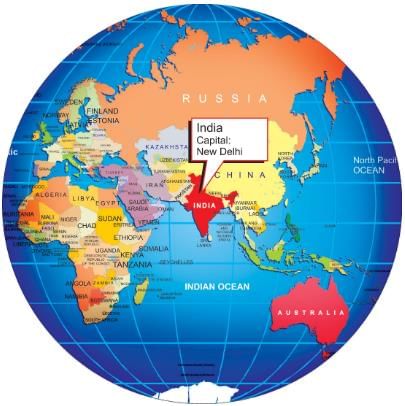
In the Asian continent, India is located at the
- a)central part.
- b)Northern Part
- c)Western Part
- d)Southern Part
Correct answer is option 'D'. Can you explain this answer?
In the Asian continent, India is located at the
a)
central part.
b)
Northern Part
c)
Western Part
d)
Southern Part
| | Anagha Pillai answered |
India is located in the southern part of the Asian continent. It shares its land borders with seven countries on three sides - Pakistan, Afghanistan, China, Nepal, Bhutan, Myanmar, and Bangladesh.
The most important geographical advantage of the Himalayas is- a)prevention of invasions.
- b)valuable source of timber.
- c)They prevent the monsoons from crossing to the north and also serve as a reservoir of water from which our perennial rivers flow
- d)They protect India from the icy cold north winds
Correct answer is option 'C'. Can you explain this answer?
The most important geographical advantage of the Himalayas is
a)
prevention of invasions.
b)
valuable source of timber.
c)
They prevent the monsoons from crossing to the north and also serve as a reservoir of water from which our perennial rivers flow
d)
They protect India from the icy cold north winds
| | Shruti Joshi answered |
The most important geographical advantage of the Himalayas is option 3: They prevent the monsoons from crossing to the north and also serve as a reservoir of water from which our perennial rivers flow. The Himalayas act as a barrier to the southward movement of cold, dry winds from Central Asia and Siberia, which helps to maintain a relatively warm and humid climate in the Indian subcontinent. Moreover, the Himalayas receive heavy rainfall during the monsoon season, which results in the formation of numerous rivers and streams that provide water for irrigation, hydroelectric power generation, and other human needs.
The dreaded evening thunderstorms in West Bengal are locally known as- a)Loo.
- b)Kalbaisakhi.
- c)Chheerha.
- d)Mango Shower.
Correct answer is option 'B'. Can you explain this answer?
The dreaded evening thunderstorms in West Bengal are locally known as
a)
Loo.
b)
Kalbaisakhi.
c)
Chheerha.
d)
Mango Shower.
| | Arjun Chaudhary answered |
The dreaded evening thunderstorms in Bengal are known as ‘Kalbaisakhi’, a calamity of the month of Baisakh.
Bamboos are grown most commonly at- a)great height from sea level.
- b)medium height from sea level.
- c)a very low height from sea level.
- d)at any condition.
Correct answer is option 'C'. Can you explain this answer?
Bamboos are grown most commonly at
a)
great height from sea level.
b)
medium height from sea level.
c)
a very low height from sea level.
d)
at any condition.
| | Siddharth Nair answered |
Height of Bamboo Growth
Bamboos are one of the fastest-growing plants in the world, and they have a wide range of uses. They are grown mainly in tropical and subtropical regions. The height of bamboo growth depends on various factors like species, climate, soil, and sunlight.
Low Height from Sea Level
The correct answer to the given question is option 'C,' i.e., a very low height from sea level. Bamboos are mostly found in lowland areas, and they grow best in warm and humid conditions. Most of the bamboo species grow well at an elevation of 500 meters or less from sea level, and they prefer well-drained soils with a high content of organic matter.
Tropical and Subtropical Regions
Bamboos are commonly grown in tropical and subtropical regions, including Asia, Africa, South America, and Australia. In these areas, the climate is suitable for bamboo growth, and there is an ample supply of water.
Uses of Bamboo
Bamboos have numerous uses, including:
1. Construction material: Bamboo is used extensively for construction purposes, including building houses, bridges, and other structures.
2. Furniture: Bamboo is also used to make furniture like chairs, tables, and beds.
3. Paper production: Bamboo is a good source of pulp for paper production.
4. Food: Certain species of bamboo are used as food, and they are a rich source of nutrients.
5. Ornamental purposes: Bamboos are used for ornamental purposes, and they add beauty to gardens and landscapes.
Conclusion
In conclusion, bamboos are grown mostly at a very low height from sea level. They are commonly found in tropical and subtropical regions, and they have numerous uses, including construction material, furniture, paper production, food, and ornamental purposes.
Plants remain leafless for most of the year in- a)moist deciduous forest.
- b)littoral and swamp forest.
- c)montane forest.
- d)tropical thorn forest.
Correct answer is option 'D'. Can you explain this answer?
Plants remain leafless for most of the year in
a)
moist deciduous forest.
b)
littoral and swamp forest.
c)
montane forest.
d)
tropical thorn forest.
| | Mira Gupta answered |
These forests receive rainfall less than 50 cm and temperatures can exceed a scorching 45 degree Celsius during the hotter months of the year.
The state having very little alluvial soil area is- a)Uttar Pradesh.
- b)Uttaranchal.
- c)Arunachal Pradesh.
- d)Gujarat.
Correct answer is option 'C'. Can you explain this answer?
The state having very little alluvial soil area is
a)
Uttar Pradesh.
b)
Uttaranchal.
c)
Arunachal Pradesh.
d)
Gujarat.
| | Prasenjit Rane answered |
Arunachal Pradesh has a high concentration of red and yellow soil.
The Great plain has been subjected to ________ throughout its period of existence.- a)The denudation processes
- b)The degradational processes
- c)The aggradational processes
- d)The weathering processes
Correct answer is option 'C'. Can you explain this answer?
The Great plain has been subjected to ________ throughout its period of existence.
a)
The denudation processes
b)
The degradational processes
c)
The aggradational processes
d)
The weathering processes
| | Harsh Chawla answered |
The northern plains are formed by the alluvial deposits brought by the rivers – the Indus, the Ganga and the Brahmaputra.
Black soils are best for growing- a)wheat.
- b)rice.
- c)cotton.
- d)tea.
Correct answer is option 'C'. Can you explain this answer?
Black soils are best for growing
a)
wheat.
b)
rice.
c)
cotton.
d)
tea.
| | Varun Datta answered |
Black soils are best for growing cotton. These soils are also known as the ‘Regur Soil’ or the ‘Black Cotton Soil’. The black soils are generally clayey, deep and impermeable.
In the plains of Arunachal Pradesh, River Brahmaputra is known as ________. - a)Dibang.
- b)Lohit.
- c)Dihang.
- d)Kenula.
Correct answer is option 'C'. Can you explain this answer?
In the plains of Arunachal Pradesh, River Brahmaputra is known as ________.
a)
Dibang.
b)
Lohit.
c)
Dihang.
d)
Kenula.
| | Deepa Iyer answered |
In the plains of Arunachal Pradesh, River Brahmaputra is known as Dihang. The Brahmaputra is one of the major rivers of Asia, it is the ninth largest river in the world by discharge, and the 15th longest. The Brahmaputra enters India in the state of Arunachal Pradesh, where it is called Siang. It appears in the plains, where it is called Dihang.
In mountainous course, the Himalayan rivers form- a)meander.
- b)gorges.
- c)braided channels.
- d)delta.
Correct answer is option 'B'. Can you explain this answer?
In mountainous course, the Himalayan rivers form
a)
meander.
b)
gorges.
c)
braided channels.
d)
delta.
| | Rajdeep Choudhury answered |
When a waterfall retreats upstream, it erodes the rock at the base of a river valley creating a gorge.
Length of the peninsular part of India is :- a)1,700 km.
- b)1,600 km.
- c)1,500 km.
- d)2,000 km.
Correct answer is option 'B'. Can you explain this answer?
Length of the peninsular part of India is :
a)
1,700 km.
b)
1,600 km.
c)
1,500 km.
d)
2,000 km.
| | Bharti Singh answered |
The Length of the Peninsular Part of India: 1,600 km
The correct answer to the question is option 'B' - 1,600 km. Let's explore why this is the correct answer.
Introduction to the Peninsular Part of India
India is a vast country located in South Asia, bordered by the Indian Ocean on the south, the Arabian Sea on the southwest, and the Bay of Bengal on the southeast. The peninsular part of India refers to the southern region of the country, which is surrounded by water on three sides. It is also known as the Deccan Plateau.
Length of the Peninsular Part of India
The peninsular part of India extends southward from the northern plains and covers a significant portion of the country. The correct length of the peninsular part of India is 1,600 km.
Geographical Features of the Peninsular Part of India
The peninsular part of India is characterized by various geographical features that contribute to its unique landscape. Some of these features include:
1. Western Ghats: Running parallel to the western coast of India, the Western Ghats are a mountain range that stretches for about 1,600 km. These mountains act as a natural barrier, separating the Deccan Plateau from the Arabian Sea.
2. Eastern Ghats: Similar to the Western Ghats, the Eastern Ghats are a range of mountains located along the eastern coast of India. They span approximately 1,700 km and provide a natural boundary between the Deccan Plateau and the Bay of Bengal.
3. Deccan Plateau: The Deccan Plateau is a large, elevated region that covers most of the peninsular part of India. It is characterized by its flat-topped hills, plateaus, and rugged terrain. The plateau has an average elevation of about 600 meters above sea level.
4. Rivers: The peninsular part of India is home to several major rivers, including the Godavari, Krishna, Kaveri, and Tungabhadra. These rivers play a crucial role in the region's agriculture and provide water for irrigation and hydropower generation.
Conclusion
In conclusion, the correct length of the peninsular part of India is 1,600 km. This region is characterized by its unique geographical features, including the Western Ghats, Eastern Ghats, Deccan Plateau, and major rivers. Understanding the length and geography of the peninsular part of India helps in comprehending the country's diverse landscapes and natural features.
The northernmost part of the Himachal is an extension of the- a)Kashmir valley
- b)Ladakh cold desert.
- c)Siwaliks.
- d)Punjab plains.
Correct answer is option 'B'. Can you explain this answer?
The northernmost part of the Himachal is an extension of the
a)
Kashmir valley
b)
Ladakh cold desert.
c)
Siwaliks.
d)
Punjab plains.
| | Anjana Bose answered |
Ladakh cold desert lies in the Lahaul and Spiti subdivision.
Khar, Neem, Khejri, Palas are:- a)Tropical Thorn forests
- b)Tropical forests
- c)Evergreen forests
- d)Mangroves
Correct answer is option 'A'. Can you explain this answer?
Khar, Neem, Khejri, Palas are:
a)
Tropical Thorn forests
b)
Tropical forests
c)
Evergreen forests
d)
Mangroves
| | Naina Sharma answered |
The correct option is Option A.
Tropical Thorn Forests :
- These occur in the areas which receive rainfall less than 50 cm. It includes semi-arid areas of south west Punjab, Haryana, Rajasthan, Gujarat, Madhya Pradesh and Uttar Pradesh.
- These consist of a variety of grasses and shrubs. In these forests, plants remain leafless for most part of the year and give an expression of scrub vegetation.
- Important species found are babool, ber and wild date palm, khair, neem, khejri, palas, etc. Tussocky grass upto a height of 2m as the under growth.
Which one of the following states suffers from loo?- a)Tamil Nadu
- b)Assam
- c)Gujarat
- d)None of these
Correct answer is option 'C'. Can you explain this answer?
Which one of the following states suffers from loo?
a)
Tamil Nadu
b)
Assam
c)
Gujarat
d)
None of these
| | Abhigyan Gupta answered |
Gujrat, winds blow in summers with sand in Thar desert are called loo.
Which region has the youngest rivers in India?- a)Eastern Ghats
- b)Western Ghats
- c)Himalayas
- d)Deccan plateau
Correct answer is option 'C'. Can you explain this answer?
Which region has the youngest rivers in India?
a)
Eastern Ghats
b)
Western Ghats
c)
Himalayas
d)
Deccan plateau
| | Mansi Banerjee answered |
Himalayas are the youngest mountains of India. Therefore, the rivers of this region are also the youngest rivers of India.
Which of the following soils contain a large proportion of sodium, potassium and magnesium?- a)Forest soil
- b)Usara soil
- c)Yellow soil
- d)Laterite soil
Correct answer is option 'B'. Can you explain this answer?
Which of the following soils contain a large proportion of sodium, potassium and magnesium?
a)
Forest soil
b)
Usara soil
c)
Yellow soil
d)
Laterite soil
| | Athul Choudhary answered |
Usara soil is also known as saline soil. It contains a large proportion of sodium, potassium and magnesium. It has salts largely because of the dry climate and poor drainage.
Most fertile soils are found in the- a)flood plains.
- b)delta region.
- c)river terraces.
- d)estuaries.
Correct answer is option 'B'. Can you explain this answer?
Most fertile soils are found in the
a)
flood plains.
b)
delta region.
c)
river terraces.
d)
estuaries.
| | Subhankar Rane answered |
Because in delta region fine silt is deposited by the rivers,it has most fertile soils.
In arid and semi-arid areas, lands unsuitable for cultivation should be converted into- a)fallow lands.
- b)wastelands.
- c)pastures.
- d)residential areas.
Correct answer is option 'C'. Can you explain this answer?
In arid and semi-arid areas, lands unsuitable for cultivation should be converted into
a)
fallow lands.
b)
wastelands.
c)
pastures.
d)
residential areas.
| | Aditya Choudhary answered |
In arid and semi-arid areas, efforts should be made to protect cultivable lands from encroachment by sand dunes through developing shelter belts of trees and agro-forestry. Lands not suitable for cultivation should be converted into pastures for grazing.
Vegetation cover is very scanty in parts of Rajasthan due to- a)over population.
- b)over irrigation.
- c)deforestation.
- d)overgrazing.
Correct answer is option 'D'. Can you explain this answer?
Vegetation cover is very scanty in parts of Rajasthan due to
a)
over population.
b)
over irrigation.
c)
deforestation.
d)
overgrazing.
| | Anjali Pillai answered |
In the western and southern part of Rajasthan, vegetation cover is very scanty due to low rainfall and overgrazing.
The meeting place of Alaknanda and Bhagirathi is- a)Vishnu Prayag.
- b)Karan Prayag.
- c)Dev Prayag.
- d)Rudra Prayag.
Correct answer is option 'C'. Can you explain this answer?
The meeting place of Alaknanda and Bhagirathi is
a)
Vishnu Prayag.
b)
Karan Prayag.
c)
Dev Prayag.
d)
Rudra Prayag.
| | Aravind Chawla answered |
It rises in the Gangotri glacier near Gaumukh (3,900 m) in the Uttarkashi district of Uttaranchal and is known as the Bhagirathi. At Devprayag, the Bhagirathi meets the Alaknanda; hereafter, it is known as the Ganga.
Which of the following statement(s) is/are correct?i. The standard meridian of India is 82°30' E longitude.ii. India’s coastline is the longest in the world.iii. The southernmost point of India is Kanniyakumari.iv. India extends from 6°45' N latitude to 37°6' N latitude.- a)i and iv
- b)ii and iii
- c) iii and iv
- d)None of the above
Correct answer is option 'A'. Can you explain this answer?
Which of the following statement(s) is/are correct?
i. The standard meridian of India is 82°30' E longitude.
ii. India’s coastline is the longest in the world.
iii. The southernmost point of India is Kanniyakumari.
iv. India extends from 6°45' N latitude to 37°6' N latitude.
a)
i and iv
b)
ii and iii
c)
iii and iv
d)
None of the above
 | Divey Sethi answered |
- The standard meridian of India is 82°30' E longitude.
This statement is correct. 82°30' E is the standard meridian of India, passing through Mirzapur in Uttar Pradesh. - India’s coastline is the longest in the world.
This statement is incorrect. India has a coastline of about 7,516.6 km, but it is not the longest in the world. The longest coastline belongs to Canada. - The southernmost point of India is Kanniyakumari.
This statement is incorrect. The southernmost point of mainland India is Kanniyakumari, but the actual southernmost point of the entire territory of India is Indira Point, located in the Nicobar Islands. - India extends from 6°45' N latitude to 37°6' N latitude.
This statement is correct. India’s latitudinal extent is indeed from 6°45' N (southernmost point: Indira Point) to 37°6' N (northernmost point in Jammu and Kashmir).
Which of the following statements are true?- The Tropic of Cancer passes through the southernmost point of India.
- Indian Standard Time (IST) is based on the 82°30' E longitude.
- India has only one standard time zone.
- The Himalayas act as a barrier to cold winds from Central Asia.
- a)1 and 2 are true
- b)2, 3, and 4 are true
- c)1, 3, and 4 are true
- d)All statements are true
Correct answer is option 'B'. Can you explain this answer?
Which of the following statements are true?
- The Tropic of Cancer passes through the southernmost point of India.
- Indian Standard Time (IST) is based on the 82°30' E longitude.
- India has only one standard time zone.
- The Himalayas act as a barrier to cold winds from Central Asia.
a)
1 and 2 are true
b)
2, 3, and 4 are true
c)
1, 3, and 4 are true
d)
All statements are true
| | Pj Commerce Academy answered |
- The Tropic of Cancer does not pass through the southernmost point of India; it passes through the middle of the country.
- Indian Standard Time (IST) is indeed based on the 82°30' E longitude.
- India has only one standard time zone, unlike countries with vast longitudinal extents.
- The Himalayas act as a natural barrier, protecting India from cold winds originating in Central Asia.
Tsunamis are caused when- a)an earthqauke under the seawater
- b)wind is strong.
- c)ocean currents become warm.
- d)sea level rises.
Correct answer is option 'A'. Can you explain this answer?
Tsunamis are caused when
a)
an earthqauke under the seawater
b)
wind is strong.
c)
ocean currents become warm.
d)
sea level rises.
| | Mayank Goyal answered |
Earthquakes and volcanic eruptions that cause the sea-floor to move abruptly resulting in sudden displacement of ocean water in the form of high vertical waves are called tsunamis (harbour waves) or seismic sea waves. A tsunami is generated when an earthquake comes or a volcano erupts.
According to Koppen's scheme of climatic regions the monsoon with short dry season is represented by- a)As.
- b)Cwg.
- c)Amw.
- d)Aw.
Correct answer is option 'C'. Can you explain this answer?
According to Koppen's scheme of climatic regions the monsoon with short dry season is represented by
a)
As.
b)
Cwg.
c)
Amw.
d)
Aw.
| | Avi Kapoor answered |
According to Koppen's scheme of climatic regions the monsoon with short dry season is represented by Amw.
The Peninsular Plateau of India extends up to:- a)Mizo hills
- b)Himachal Himalayas
- c)Assam valley
- d)Meghalaya hills
Correct answer is option 'D'. Can you explain this answer?
The Peninsular Plateau of India extends up to:
a)
Mizo hills
b)
Himachal Himalayas
c)
Assam valley
d)
Meghalaya hills
| | Prashanth Das answered |
The northeastern plateau is an extension of the main Peninsular plateau. It is believed that due to the force exerted by the northeastward movement of the Indian plate at the time of the Himalayan origin, a huge fault was created between the Rajmahal hills and the Meghalaya hills. Today, the Meghalaya and Karbi Anglong plateau stand detached from the main peninsular block.
Which of the mountain system is the oldest according to geological history?- a)Nilgiris
- b)Satpuras
- c)Vindhyas
- d)Aravalli
Correct answer is option 'D'. Can you explain this answer?
Which of the mountain system is the oldest according to geological history?
a)
Nilgiris
b)
Satpuras
c)
Vindhyas
d)
Aravalli
| | Malavika Patel answered |
According to age, the Indian mountains can be arranged from the oldest; Aravalli,the Western Ghats, Vindhya and Satpura, the Nilgris and the Himalayas.
The Nilgiris are part of the- a)Eastern Ghats.
- b)Western Ghats.
- c)Vindhyachal.
- d)Tamil Nadu Hills.
Correct answer is option 'B'. Can you explain this answer?
The Nilgiris are part of the
a)
Eastern Ghats.
b)
Western Ghats.
c)
Vindhyachal.
d)
Tamil Nadu Hills.
| | Arjun Ghoshal answered |
These hills are called Ghats because they have reduced to very low heights.
What is the range of the intensity scale used in measuring earthquakes?- a)1 to 12
- b)1 to 7
- c)1 to 15
- d)1 to 5
Correct answer is option 'A'. Can you explain this answer?
What is the range of the intensity scale used in measuring earthquakes?
a)
1 to 12
b)
1 to 7
c)
1 to 15
d)
1 to 5
 | EduRev Humanities answered |
The intensity of earthquakes is measured on a scale known as the Modified Mercalli Intensity (MMI) scale, which describes the effects of an earthquake on the Earth's surface, humans, objects of nature, and man-made structures on a scale of I to XII. Each increasing number indicates a greater level of damage to structures and a more noticeable impact on people.
Statement I: India’s latitudinal extent results in diverse climatic conditions across the country.
Statement II: The distance between two longitudes decreases as one moves towards the poles.
Statement III: India’s easternmost point experiences sunrise before its westernmost point.
Statement IV: The Indian Standard Time is based on the 68°7' E longitude.- a)Statements I, II, and III are correct
- b)Statements II and III are correct
- c)Statements I, II, and IV are correct
- d)All statements are correct
Correct answer is option 'A'. Can you explain this answer?
Statement I: India’s latitudinal extent results in diverse climatic conditions across the country.
Statement II: The distance between two longitudes decreases as one moves towards the poles.
Statement III: India’s easternmost point experiences sunrise before its westernmost point.
Statement IV: The Indian Standard Time is based on the 68°7' E longitude.
Statement II: The distance between two longitudes decreases as one moves towards the poles.
Statement III: India’s easternmost point experiences sunrise before its westernmost point.
Statement IV: The Indian Standard Time is based on the 68°7' E longitude.
a)
Statements I, II, and III are correct
b)
Statements II and III are correct
c)
Statements I, II, and IV are correct
d)
All statements are correct
 | Crafty Classes answered |
- Statement I is correct as India’s vast latitudinal extent does lead to diverse climatic conditions.
- Statement II is correct because the distance between longitudes indeed decreases towards the poles.
- Statement III is correct since the easternmost point of India experiences sunrise earlier than the westernmost point.
- Statement IV is incorrect as the Indian Standard Time (IST) is based on the 82°30' E longitude, not 68°7' E.
Assertion (A): Tsunamis primarily cause more devastation near coastal areas than in the open ocean.
Reason (R): The speed of tsunami waves increases in deeper waters, minimizing their impact at sea.- a)If both Assertion and Reason are true and Reason is the correct explanation of Assertion
- b)If both Assertion and Reason are true but Reason is not the correct explanation of Assertion
- c)If Assertion is true but Reason is false
- d)If both Assertion and Reason are false
Correct answer is option 'B'. Can you explain this answer?
Assertion (A): Tsunamis primarily cause more devastation near coastal areas than in the open ocean.
Reason (R): The speed of tsunami waves increases in deeper waters, minimizing their impact at sea.
Reason (R): The speed of tsunami waves increases in deeper waters, minimizing their impact at sea.
a)
If both Assertion and Reason are true and Reason is the correct explanation of Assertion
b)
If both Assertion and Reason are true but Reason is not the correct explanation of Assertion
c)
If Assertion is true but Reason is false
d)
If both Assertion and Reason are false
| | Crafty Classes answered |
- Assertion (A) is true. Tsunamis, due to their wave characteristics and behavior, do indeed cause more significant damage when they reach shallow coastal waters rather than in the deep ocean.
- Reason (R) is also true. The speed of tsunami waves is affected by water depth; they travel faster in deeper water. However, this does not explain why they cause more destruction near the coast. Instead, the wave height increases as they approach shallower waters, which is the primary cause of coastal devastation.
- Therefore, while both statements are true, the reason provided does not correctly explain the assertion.
In which year largest cyclone-hit Andhra Pradesh displaced 63,40,000 people?- a)1992
- b)1989
- c)1990
- d)1991
Correct answer is option 'C'. Can you explain this answer?
In which year largest cyclone-hit Andhra Pradesh displaced 63,40,000 people?
a)
1992
b)
1989
c)
1990
d)
1991
| | Sudhir Singh answered |
Major Cyclone in Andhra Pradesh in 1990
The largest cyclone to hit Andhra Pradesh, which displaced 63,40,000 people, occurred in the year 1990.
Impact of the Cyclone
- The cyclone caused widespread destruction, affecting millions of lives in Andhra Pradesh.
- It led to massive displacement of people, with over 63 lakh individuals being forced to leave their homes.
Response to the Cyclone
- The state government, along with various relief organizations, immediately swung into action to provide aid and assistance to the affected population.
- Relief camps were set up to provide shelter, food, and medical aid to those displaced by the cyclone.
- Rehabilitation efforts were initiated to help the affected communities rebuild their lives and homes.
Long-Term Consequences
- The cyclone of 1990 left a lasting impact on the people of Andhra Pradesh, highlighting the importance of disaster preparedness and resilience.
- It also brought to the forefront the need for better infrastructure and early warning systems to mitigate the impact of such natural disasters in the future.
Overall, the cyclone that hit Andhra Pradesh in 1990 stands as a stark reminder of the devastating power of nature and the importance of timely response and support in times of crisis.
The area of India is- a)32, 87,263 sq.km.
- b)30,87,263 sq.km.
- c)32,80,263 sq.km.
- d)32,87,283 sq.km.
Correct answer is option 'A'. Can you explain this answer?
The area of India is
a)
32, 87,263 sq.km.
b)
30,87,263 sq.km.
c)
32,80,263 sq.km.
d)
32,87,283 sq.km.
| | Arnab Gupta answered |
Correct Answer Explanation:
Area of India:
- The correct area of India is 32,87,263 sq.km.
- This information is important for geographical studies and understanding the size of the country.
- It is crucial to have accurate data when conducting research or analysis related to India's land area.
Importance of Knowing the Correct Area:
- Knowing the correct area of India helps in various planning and development projects.
- It is essential for demarcating boundaries, calculating population density, and managing natural resources.
- Having accurate geographical data is fundamental for effective governance and decision-making.
Significance for Students:
- For students studying geography or related subjects, knowing the correct area of India is crucial.
- It forms the basis for understanding the country's physical features, climate patterns, and biodiversity.
- Students can use this information to compare India's size with other countries and analyze its geopolitical significance.
Conclusion:
In conclusion, the correct area of India is 32,87,263 sq.km, and it is essential to have accurate geographical data for various academic, research, and developmental purposes.
Which one of the following states receive floods in the winter?- a)Assam
- b)West Bengal
- c)Kerala
- d)Tamil Nadu
Correct answer is option 'D'. Can you explain this answer?
Which one of the following states receive floods in the winter?
a)
Assam
b)
West Bengal
c)
Kerala
d)
Tamil Nadu
| | Anand Das answered |
During winter, the North-east dry Monsoon winds blow over the Bay of Bengal. Tamil Nadu receives rainfall in the winter season due to northeast trade winds. which causes a flood.
Structure of arid soils are generally- a)loamy.
- b)clayey.
- c)silty.
- d)sandy.
Correct answer is option 'D'. Can you explain this answer?
Structure of arid soils are generally
a)
loamy.
b)
clayey.
c)
silty.
d)
sandy.
| | Ruchi Joshi answered |
Arid soils range from red to brown in colour. They are generally sandy in structure and saline in nature.
Which of the following states have very little alluvial soil area?- a)Uttar Pradesh
- b)Uttaranchal
- c)Arunachal Pradesh
- d)Madhya Pradesh
Correct answer is option 'C'. Can you explain this answer?
Which of the following states have very little alluvial soil area?
a)
Uttar Pradesh
b)
Uttaranchal
c)
Arunachal Pradesh
d)
Madhya Pradesh
| | Varun Chauhan answered |
Alluvial soils are widespread in the northern plains and the river valleys. These soils coverabout 40 per cent of the total area of the country. Arunachal Pradesh has very little alluvial soil area.
Arrange the following geographical features of India in the correct chronological order based on their formation or significance:1. Formation of the Himalayas2. Establishment of the Indian Standard Time3. Development of the Ganga River system4. Recognition of India's varied ecosystems- a)1, 3, 4, 2
- b)1, 4, 3, 2
- c)4, 1, 3, 2
- d)1, 3, 2, 4
Correct answer is option 'A'. Can you explain this answer?
Arrange the following geographical features of India in the correct chronological order based on their formation or significance:
1. Formation of the Himalayas
2. Establishment of the Indian Standard Time
3. Development of the Ganga River system
4. Recognition of India's varied ecosystems
a)
1, 3, 4, 2
b)
1, 4, 3, 2
c)
4, 1, 3, 2
d)
1, 3, 2, 4
| | Arnab Gupta answered |
Chronological Order of Geographical Features in India
To understand the correct chronological order of the given geographical features of India, we can analyze each one based on its formation or significance in history.
1. Formation of the Himalayas
- The Himalayas began forming approximately 50 million years ago due to the collision of the Indian tectonic plate with the Eurasian plate.
- This geological event is significant as it shaped not only the physical landscape of northern India but also influenced climate patterns and the biodiversity of the region.
2. Development of the Ganga River System
- The Ganga River system developed over millions of years, with its origins traced back to the melting glaciers of the Himalayas.
- The river has been central to Indian civilization, providing water resources, supporting agriculture, and serving as a cultural and spiritual symbol for millions.
3. Recognition of India's Varied Ecosystems
- The varied ecosystems of India, including forests, grasslands, deserts, and coastal areas, have been recognized more prominently in the 20th century.
- This recognition has been vital for conservation efforts and understanding the ecological diversity of India.
4. Establishment of the Indian Standard Time
- Indian Standard Time (IST) was officially adopted in 1906.
- This was a significant milestone for coordinating time across the vast geographical expanse of India, reflecting the modernization of the country during British colonial rule.
Conclusion
Based on the above analysis, the correct chronological order is:
1. Formation of the Himalayas
2. Development of the Ganga River system
3. Recognition of India's varied ecosystems
4. Establishment of the Indian Standard Time
Thus, the correct option is a) 1, 3, 4, 2.
Match the following geographical features of India with their descriptions:a. Himalayas - 1. Rich in biodiversityb. Thar Desert - 2. Extends along the coastlinec. Ganga - 3. Formidable barriersd. Indian Ocean - 4. Major river system- a)(a)- 3, (b)- 1, (c)- 4, (d)- 2
- b)(a)- 2, (b)- 4, (c)- 3, (d)- 1
- c)(a)- 4, (b)- 3, (c)- 1, (d)- 2
- d)(a)- 2, (b)- 1, (c)- 4, (d)- 3
Correct answer is option 'D'. Can you explain this answer?
Match the following geographical features of India with their descriptions:
a. Himalayas - 1. Rich in biodiversity
b. Thar Desert - 2. Extends along the coastline
c. Ganga - 3. Formidable barriers
d. Indian Ocean - 4. Major river system
a)
(a)- 3, (b)- 1, (c)- 4, (d)- 2
b)
(a)- 2, (b)- 4, (c)- 3, (d)- 1
c)
(a)- 4, (b)- 3, (c)- 1, (d)- 2
d)
(a)- 2, (b)- 1, (c)- 4, (d)- 3
 | Learning Educators answered |
- The Himalayas serve as natural barriers to the north of India.
- The Thar Desert is known for its unique ecosystem and biodiversity, though it is a harsh environment.
- The Ganga River is one of India's most significant and extensive river systems.
- The Indian Ocean borders the southern part of India, contributing to its extensive coastline.
Suez canal was open in- a)1969
- b)1869
- c)1850
- d)1849
Correct answer is option 'B'. Can you explain this answer?
Suez canal was open in
a)
1969
b)
1869
c)
1850
d)
1849
| | Pankaj Singh answered |
Opening of the Suez Canal in 1869
The Suez Canal was officially opened on November 17, 1869. It is an artificial waterway in Egypt that connects the Mediterranean Sea to the Red Sea. Here's why the opening of the Suez Canal in 1869 is significant:
Historical Context
- The idea of constructing a canal in Egypt to connect the Mediterranean and Red Seas dates back to ancient times, but it was not until the 19th century that the project became a reality.
- The Suez Canal was constructed by the French engineer Ferdinand de Lesseps, with funding from French and Egyptian investors.
Impact on Trade
- The opening of the Suez Canal revolutionized global trade by providing a shortcut between Europe and Asia, significantly reducing the travel time for ships.
- It allowed ships to avoid the long and treacherous journey around the southern tip of Africa, known as the Cape of Good Hope.
Geopolitical Significance
- The Suez Canal became a strategic waterway for the British Empire, as it provided a crucial link to their colonies in Asia and allowed for faster communication and transportation.
- Control over the Suez Canal was a major point of contention during the 20th century, leading to conflicts such as the Suez Crisis in 1956.
In conclusion, the opening of the Suez Canal in 1869 had a profound impact on global trade and geopolitics, shaping the course of history in the region and beyond.
Which of the following statement(s) about India's geography is/are correct?i. India extends approximately 3,214 km from north to south and 2,933 km from east to west.ii. The southernmost point of India lies at 6°45' N latitude in the Arabian Sea.iii. The standard meridian of India is 82°30' E, which is ahead of GMT by 5 hours and 30 minutes.iv. The geographical area of India includes regions in the tropics and sub-tropical zones.- a)i, iii, and iv
- b)ii and iv
- c)i and iii
- d)i, ii, and iii
Correct answer is option 'A'. Can you explain this answer?
Which of the following statement(s) about India's geography is/are correct?
i. India extends approximately 3,214 km from north to south and 2,933 km from east to west.
ii. The southernmost point of India lies at 6°45' N latitude in the Arabian Sea.
iii. The standard meridian of India is 82°30' E, which is ahead of GMT by 5 hours and 30 minutes.
iv. The geographical area of India includes regions in the tropics and sub-tropical zones.
a)
i, iii, and iv
b)
ii and iv
c)
i and iii
d)
i, ii, and iii
| | Crafty Classes answered |
- Statement i is correct as it accurately describes the distance from north to south (3,214 km) and east to west (2,933 km).
- Statement ii is incorrect because the southernmost point of India, Kanniyakumari, is located at approximately 8°04' N latitude, not 6°45' N.
- Statement iii is correct since the standard meridian of India is indeed 82°30' E, which is 5 hours and 30 minutes ahead of GMT.
- Statement iv is correct as India spans both tropical and sub-tropical regions.
Thus, the correct statements are i, iii, and iv, making Option A the correct answer.
Dry winter is experienced in the- a)Ganga plain.
- b)Eastern Ghats.
- c)Western Ghats.
- d)Deccan Plateau.
Correct answer is option 'A'. Can you explain this answer?
Dry winter is experienced in the
a)
Ganga plain.
b)
Eastern Ghats.
c)
Western Ghats.
d)
Deccan Plateau.
| | Rishabh Sengupta answered |
In winters, the northwestern parts of the subcontinent attracts wind from the Meditteranean region in the form of westerly disturbances. After September, retreating monsoons move out of the Ganga plains towards the low pressure zone of Bay of Bengal. They gather moisture from the bay and are drawn towards another low-pressure zone in the southern peninsula.
Chapter doubts & questions for India - Physical Environment - Geography (Prelims) by Valor Academy 2026 is part of UPSC CSE exam preparation. The chapters have been prepared according to the UPSC CSE exam syllabus. The Chapter doubts & questions, notes, tests & MCQs are made for UPSC CSE 2026 Exam. Find important definitions, questions, notes, meanings, examples, exercises, MCQs and online tests here.
Chapter doubts & questions of India - Physical Environment - Geography (Prelims) by Valor Academy in English & Hindi are available as part of UPSC CSE exam. Download more important topics, notes, lectures and mock test series for UPSC CSE Exam by signing up for free.
Geography (Prelims) by Valor Academy12 videos|182 docs|155 tests |