MAHA TET Exam  >  MAHA TET Tests  >  MH SET Mock Test Series 2025  >  MH SET Paper 2 Mock Test - 8 (Geography) - MAHA TET MCQ

MH SET Paper 2 Mock Test - 8 (Geography) - MAHA TET MCQ


Test Description

30 Questions MCQ Test MH SET Mock Test Series 2025 - MH SET Paper 2 Mock Test - 8 (Geography)

MH SET Paper 2 Mock Test - 8 (Geography) for MAHA TET 2025 is part of MH SET Mock Test Series 2025 preparation. The MH SET Paper 2 Mock Test - 8 (Geography) questions and answers have been prepared according to the MAHA TET exam syllabus.The MH SET Paper 2 Mock Test - 8 (Geography) MCQs are made for MAHA TET 2025 Exam. Find important definitions, questions, notes, meanings, examples, exercises, MCQs and online tests for MH SET Paper 2 Mock Test - 8 (Geography) below.
Solutions of MH SET Paper 2 Mock Test - 8 (Geography) questions in English are available as part of our MH SET Mock Test Series 2025 for MAHA TET & MH SET Paper 2 Mock Test - 8 (Geography) solutions in Hindi for MH SET Mock Test Series 2025 course. Download more important topics, notes, lectures and mock test series for MAHA TET Exam by signing up for free. Attempt MH SET Paper 2 Mock Test - 8 (Geography) | 100 questions in 120 minutes | Mock test for MAHA TET preparation | Free important questions MCQ to study MH SET Mock Test Series 2025 for MAHA TET Exam | Download free PDF with solutions
MH SET Paper 2 Mock Test - 8 (Geography) - Question 1

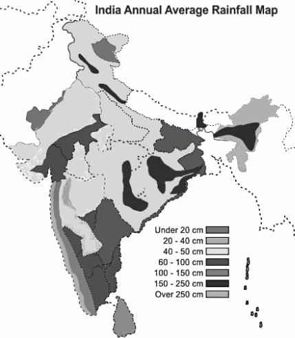
Which of the following part of India receives the first monsoon in summer?

Detailed Solution for MH SET Paper 2 Mock Test - 8 (Geography) - Question 1

The correct answer is the Western Ghats.

  • India receives rainfall from two monsoons:
    • South-West Monsoon
    • North-East Monsoon

  Key Points

  • South West Monsoon is a major one that occurs from July -to September.
    • The majority of Indian states receive rainfall from this Monsoon.
    • Rain hits first the state of Kerala and along with the coastal areas of Karnataka/Maharastra ( Konken coastal area).
    • After it gains momentum it crosses the Western ghats and causes downpours in all other states of India.


  • North-East Monsoon mostly starts at end of September.
    • This monsoon wind gets obstructed by Eastern ghats and downpours at the eastern coastal area (Coramendal Cost) along with Andhra Pradesh and Tamil Nadu.
    • The coastal area of Andhra Pradesh and the majority of Tamil Nadu receives most of the rainfall from this Monsoon.

Additional Information 

  • In- between the area of Western and Eastern ghats called Deccan Plateau (dry area) receives very little rainfall from both Monsoons. 
MH SET Paper 2 Mock Test - 8 (Geography) - Question 2

Consider the following statements about Demangeon:

i. Demangeon was the pupil of Vidal de la Blache

ii. “La Picardie et les regions veisines” is his monograph

ii. He wrote L’Lomme el la Terre

iv. He was of the view that man destroyed natural flora and fauna.

Choose the correct option from below.

Detailed Solution for MH SET Paper 2 Mock Test - 8 (Geography) - Question 2

Albert Damengean was a pupil of Vidal de la Blache. He produced a monograph “La Picardie et les regions veisines”. He concentrated mainly on human geography. He wrote on transport geography, population and international economics. He prepared land use maps.

Thus, the Correct answer is C.

MH SET Paper 2 Mock Test - 8 (Geography) - Question 3

Which of the following is NOT a reason for a glacial lake outburst flood?

Detailed Solution for MH SET Paper 2 Mock Test - 8 (Geography) - Question 3

The Glacial Lake outburst flow (GLOF) occurs when the dam that contains the glacial lake falls. It can occur due to an avalanche of heavy snow and rock, an earthquake or volcanic eruption under the ice, erosion, pressure due to buildup of water, etc.

MH SET Paper 2 Mock Test - 8 (Geography) - Question 4
Select the example of Active sensor in Remote sensing, from the following sensors.
Detailed Solution for MH SET Paper 2 Mock Test - 8 (Geography) - Question 4

Concepts:

Remote sensing is the art and science of obtaining information about an object without physical contact with that object.

The passive sensor responds to physical stimuli. Light, heat, vibrations are detected from passive sensors as they occur in the environment. Examples are Electro-optical sensors, the Television cameras. Return Beam Vidicon.

Active sensors work along with transducers that create the stimuli to be detected and measured that interaction of those stimuli with the environment. Examples are Sonar or LIDAR systems, Laser scanners, etc. 

MH SET Paper 2 Mock Test - 8 (Geography) - Question 5
Which one of the following crops is generally benefitted by the rain caused by western disturbances in India?
Detailed Solution for MH SET Paper 2 Mock Test - 8 (Geography) - Question 5

The correct answer is Wheat.

Key Points

  • Winter rainfall and agriculture:
    • Western disturbances originate from the Mediterranean Sea and come to India.
    • It causes rainfall in states like Haryana, Punjab, Jammu and Kashmir, Himachal Pradesh, Uttarakhand during winter.
    • Precipitation during the winter season is of great importance in agriculture, especially for Rabi crops including wheat, which is one of the most important Indian crops.
    • The major Rabi crop in India is wheat, followed by barley, mustard, sesame and peas.
    • The rains caused by western disturbances have a direct impact on the economy of wheat-producing states like Haryana and Punjab.

Additional Information

  • The Indian crop season is classified into two major seasons:
    • Kharif crops:
      • Dependent on monsoon and their crop season runs from July to October.
      • Examples include rice, maize, millet, ragi, pulses, soybean, groundnut etc.
    • Rabi crops:
      • Sown in winter after the monsoon rains end and harvested in summer, their crop season runs from October to April.
      • Examples include wheat, barley, rapeseed, oats, gram, flax, etc.
MH SET Paper 2 Mock Test - 8 (Geography) - Question 6

Which among the following is / are common features of the drainage pattern of Ganges river system?

  1. Parallel Courses of rivers
  2. Tributaries meeting their master streams at acute angles
  3. Most rivers are of perennial nature
  4. Lower reaches of rivers with steep gradient suitable for hydropower generation

Choose the correct option from the codes given below:

Detailed Solution for MH SET Paper 2 Mock Test - 8 (Geography) - Question 6

The drainage of the Gangetic region is dendritic with parallel courses and acute angle functions of tributaries with their master stream s. Most of the rivers are perennial streams with well-defined courses and gentle gradient. While the upper reaches of the rivers are suitable for generating hydel power. the mainstreams in the plains provide water for canal irrigation and are also used for navigation purposes.

MH SET Paper 2 Mock Test - 8 (Geography) - Question 7
The number of satellites used in global positioning system operated by the US department of defence is
Detailed Solution for MH SET Paper 2 Mock Test - 8 (Geography) - Question 7

Concept:

Global positioning system (GPS):

  • The global positioning system is a space-based satellite navigation system that provides location and time information in all weather, anywhere or near the earth.
  • It is maintained by the United States Government and is freely accessible to anyone.
  • The baseline satellite constellation consists of 24 satellites positioned in six earth-centered orbital planes with four operation satellites and a spare satellite slot in each orbital plane. 
  • The system can support a constellation of up to thirty satellites in orbit.
  • For stationary objects minimum of 3 satellites are required and for moving objects minimum of 4 satellites are required.
  • The orbital period of a GPS satellite is one-half of a sidereal day or 11 hours 58 minutes.
  • The orbital radius (i.e. distance from the center of mass of the earth to the satellite) is approximately 26,600 km.
  • The GPS program has critical capabilities for military, civil, and commercial users around the world. In addition, GPS is the backbone for modernizing the global air traffic system.
MH SET Paper 2 Mock Test - 8 (Geography) - Question 8
Conglomerate is an example of:
Detailed Solution for MH SET Paper 2 Mock Test - 8 (Geography) - Question 8

Important Points

  • The conglomerate and Breccia both are two sedimentary structures.
  • They commonly form as rock-fall and debris flow deposits along cliffs, and underground along faults or where caves collapse.
  • They are both clastic sedimentary rocks composed of particles larger than two millimeters in diameter.
  • The main difference between them are as follows,

Key Points

Conglomerate:

  • A conglomerate has rounded clasts
  • The water transport rapidly rounds large clasts
  • The particle shape reveals a difference in how far the particles were transported.
  • Near the outcrop where the fragments were produced by mechanical weathering, the shape is angular.

Thus, Conglomerate is an example of a Mechanically formed sedimentary rock.

MH SET Paper 2 Mock Test - 8 (Geography) - Question 9
Consider the following statements:-

a) Culture has no precise standard of measurement.

b) Brock and Webb has divided the world into 5 major and 3 minor cultural realms.

c) According to H. Robinson, the European cultural region is the most favourable continent.

d) Cultural regions and areas both are the same.

Which of the following options are correct?

Detailed Solution for MH SET Paper 2 Mock Test - 8 (Geography) - Question 9

Culture cannot be measured. The work standard of a person cannot be measured with another person's work. Culture is a social concept and is constantly changing and adapting.

Brock and Webb has divided the world into 4 major and 2 minor cultural realms. Occidental realm, Islamic, Indian and east Indian cultural realm are the major ones while south east Asian, Meso African are the minor cultural realms.

Europe has a large acre of agricultural land than any other continent and there are no deserts. Its mineral wealth is considerable and varied as well as the trade conditions exceed that of Europe. The mixing of European races results in a variety of energetic and inventive people.

Cultural area is a concept of cultural geography, in which a geographic region and time sequence is characterised by substantially uniform environment and culture. The present boundaries of states in India, which have been drawn on the basis of languages, generally represent cultural areas while cultural region is a portion of the Earth's surface that has common cultural elements.

MH SET Paper 2 Mock Test - 8 (Geography) - Question 10

Deutsche mark is the currency of

Detailed Solution for MH SET Paper 2 Mock Test - 8 (Geography) - Question 10

D-Mark (Deutsche Mark) was the official currency of the Federal Republic of Germany until 2002. First issued in 1948, it was the official currency of West Germany, and later, the unified German state until the final adoption of the euro (EUR) in 2002. The official currency code is DEM.

MH SET Paper 2 Mock Test - 8 (Geography) - Question 11
Energy in remote sensing deals with which region of electromagnetic spectrum ?
Detailed Solution for MH SET Paper 2 Mock Test - 8 (Geography) - Question 11

Explanation:

Remote sensing survey:

It is the art and science of obtaining information about an object or feature without physically coming in contact with that object.

Energy in remote sensing deals with the infrared region of the electromagnetic spectrum (EMR)

The entire EMR is divided into seven regions.

  • Gamma rays
  • X-rays
  • UV rays
  • Visible spectrum
  • Infrared 
  • Microwave
  • Radiowave

Additional Information Advantages of remote sensing are:

  1. Remote sensing provides data on large areas.
  2. It can be used to obtain data of very remote and inaccessible regions.
  3. With the help of remote sensing imagery of any area over a continuous period through which any natural changes in the landscape (earthquake) can be analyzed.
  4. It is relatively cheap when compared to employing a team of surveyors.
  5. Easy and rapid collection of data.
  6. Rapid production of maps for interpretation.
MH SET Paper 2 Mock Test - 8 (Geography) - Question 12
The classical theory of Indian Monsoon was explained by
Detailed Solution for MH SET Paper 2 Mock Test - 8 (Geography) - Question 12

 Although there are mentions of Indian Monsoon in the Rig Veda and Al Masudi’s works, the concept of Indian Monsoon was explained in 1686 by Sir Edmund Halley. Halley said that monsoon resulted due to thermal contrast between continents and oceans because of differential heating.

Thus, the correct answer is B.

MH SET Paper 2 Mock Test - 8 (Geography) - Question 13
Which of the following pairs is not correctly matched?
Detailed Solution for MH SET Paper 2 Mock Test - 8 (Geography) - Question 13

The correct answer is Bantu - Sahara.

Key Points

  • Bantu peoples, the approximately 85 million speakers of the more than 500 distinct languages of the Bantu subgroup of the Niger-Congo language family, occupying almost the entire southern projection of the African continent.
    • Bantu the largest African language family, spoken in much of Sub-Saharan Africa.

Additional Information

  • Fulani, a primarily Muslim people scattered throughout many parts of West Africa, from Lake Chad, in the east, to the Atlantic coast.
  • The Maasai are an indigenous ethnic group in East Africa of semi-nomadic people settled in Kenya and northern Tanzania.
  • Nuba, inhabitants of the Nuba Hills in the Kordofan region of central-southern Sudan.
    • Sudan is a country in North Africa.
MH SET Paper 2 Mock Test - 8 (Geography) - Question 14

Who manufactures the largest quantity of jute goods in the world?

Detailed Solution for MH SET Paper 2 Mock Test - 8 (Geography) - Question 14

India manufactures the largest quantity of jute goods in the world. This industry is located mainly in West Bengal, followed by Andhra Pradesh, Bihar, Jharkhand, Uttar Pradesh and Madhya Pradesh.

MH SET Paper 2 Mock Test - 8 (Geography) - Question 15

Given below are two statements:

Statement I: Cultural trait is the smallest unit of culture and single identifiable material or non-material element within a culture.

Statement II: A cultural realm is a geographical region where cultural traits maintain homogeneity.

In the light of the above statements, choose the correct answer from the options given below:

Detailed Solution for MH SET Paper 2 Mock Test - 8 (Geography) - Question 15

Correct Answer: ​(B), (C), (A), (D).

Key Points

Cultural realm:

  • A cultural realm is a geographical region where cultural traits maintain homogeneity.
  • The cultural traits are supposed to be the product of regional geographical circumstances.
  • It is, thus, regional geography that has become the basis of the delineation of cultural realms in the world.
  • Ratzel‘s concept of the cultural landscape provided encouragement to geographers for culture regionalization.
  • It is the largest possible area of cultural influence. It is a wider concept and includes overlaps and transitional areas. It can be discontinuous. E.g. Islam realm.

Cultural trait:

  • A cultural trait is the smallest unit of culture and single identifiable material or non-material element within a culture and is conceivable as an object in itself.
  • Different cultural traits can also be found within the same kind of population.
  • For example, some Christians worship every Sunday, some every day, and others not at all.
  • In some native tribes around the world, piercing one's ears and expanding the piercings slowly over time is a cultural trait.

Therefore, both Statement I and Statement II are true.

MH SET Paper 2 Mock Test - 8 (Geography) - Question 16
The statistical methods for the study of distribution and pattern of settlement is known as:
Detailed Solution for MH SET Paper 2 Mock Test - 8 (Geography) - Question 16

Nearest neighbor analysis is the method used to study the distance between the nearest two points. It helps in studying the pattern of distribution of a settlement that is clustered, random or regular. Nearest neighbor analysis will produce a result between 0 and 2.5.

Thus, the Correct answer is C.

MH SET Paper 2 Mock Test - 8 (Geography) - Question 17

How the Himalayas are formed?

Detailed Solution for MH SET Paper 2 Mock Test - 8 (Geography) - Question 17

The Himalayan mountain range and Tibetan plateau have formed as a result of the collision between the Indian Plate and Eurasian Plate which began 50 million years ago and continues today. 225 million years ago (Ma) India was a large island situated off the Australian coast and separated from Asia by the Tethys Ocean.

MH SET Paper 2 Mock Test - 8 (Geography) - Question 18
Which of the following are cruciform settlements?
Detailed Solution for MH SET Paper 2 Mock Test - 8 (Geography) - Question 18

The correct answer is 1 and 2 Both options.

Key Points

Cruciform settlements

  • T-shaped and Y-shaped both are Cross-shaped or cruciform settlements.
  • T -shaped settlements develop at tri-junctions of the roads.
  • While Y-shaped settlements emerge as the places where two roads converge on the third one and houses are built along these roads.
  • Cruciform settlements develop on the cross-roads and houses extend in

​Y-shaped settlement

All the rural settlements:

MH SET Paper 2 Mock Test - 8 (Geography) - Question 19
The Zenith is/are
Detailed Solution for MH SET Paper 2 Mock Test - 8 (Geography) - Question 19

Explanation:

Zenith:

  • If a plumb line through an observer is extended upward, the imaginary point at which it appears to intersect the celestial sphere is known as Zenith.

Additional Information

Nadir point:

  • The imaginary point at which it appears to intersect downward in the celestial sphere is known as Nadir.
  •  

Pole:

  • If the axis of rotation of the earth is imagined to be extended infinitely in both directions, the points at which it meets the celestial sphere are known as poles.
  • The point of intersection in the northern hemisphere is known as the north celestial pole and that in the southern hemisphere as the south celestial pole.

Celestial point:

  • An imaginary sphere of infinite radius with the earth at its center and other celestial bodies studded on its inside surface is known as the celestial sphere.
MH SET Paper 2 Mock Test - 8 (Geography) - Question 20
Atlas and wall maps fall under which category of maps?
Detailed Solution for MH SET Paper 2 Mock Test - 8 (Geography) - Question 20

Atlas and wall maps are intended for portraying the geography of large areas. These maps are described as small scale, which usually refer to scales smaller than 1:100,000. Small-scale maps show a large area on a single map sheet, but their contents are less detailed and include only major features like highways, railways, lakes, rivers, etc.

Thus, the Correct answer is D

MH SET Paper 2 Mock Test - 8 (Geography) - Question 21
Which of the following correctly describes the shape of the pyramid of numbers in a parasitic food chain?
Detailed Solution for MH SET Paper 2 Mock Test - 8 (Geography) - Question 21

Answer: Option 2) Inverted.

A food chain represents the linear sequence of energy transfer from producers to consumers in an ecosystem. The pyramid of numbers depicts the relative abundance of organisms at each trophic level within a food chain. In the case of a parasitic food chain, the shape of the pyramid of numbers is distinct and differs from that of other types of food chains.
Key Points
Shape of the Pyramid of Numbers in a Parasitic Food Chain: Inverted:
  • The pyramid of numbers in a parasitic food chain is typically inverted. This means that the number of producers (plants) at the base of the pyramid is lower compared to the number of primary consumers (herbivores). This pattern continues with the number of organisms decreasing at each successive trophic level.
  • The inverted shape of the pyramid of numbers in parasitic food chains is due to the fact that parasites often have a high mortality rate and depend on their hosts for survival.
  • Parasitic food chains are common in many ecosystems, including aquatic and terrestrial environments.
Additional Information
  • Upright: An upright pyramid of numbers is typically observed in simple food chains where the number of producers is higher compared to the number of consumers at each trophic level. This is not the case in parasitic food chains.
  • Spindle-shaped: A spindle-shaped pyramid of numbers is characterized by a large number of producers at the base, followed by a decrease in numbers at intermediate trophic levels, and then an increase in numbers at higher trophic levels. This shape is not typically seen in parasitic food chains.
  • Irregular: An irregular pyramid of numbers does not have a consistent pattern and can vary significantly between different ecosystems. This shape is not specific to parasitic food chains.
Therefore, the correct answer is option 2) Inverted. In a parasitic food chain, the pyramid of numbers is typically inverted, reflecting the lower abundance of producers compared to consumers at each trophic level.
MH SET Paper 2 Mock Test - 8 (Geography) - Question 22

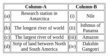
Match the following columns.

Choose the correct option:

Detailed Solution for MH SET Paper 2 Mock Test - 8 (Geography) - Question 22

The correct option is: (a)-(iv), (b)-(iii), (c)-(i), (d)-(ii)
Important Points

(a) Research station in Antarctica:

  • Dakshin Gangotri is a research station in Antarctica
  • . Therefore, (a) matches with (iv).

(b) The longest river of the world:

  • The Nile is the longest river in the world.
  • Therefore, (b) matches with (i).

(c) The largest river of the world:

  • The Amazon is the largest river in the world.
  • Therefore, (c) matches with (iii).

(d) Strip of land between North and South America:

  • The Isthmus of Panama is the strip of land between North and South America.
  • Therefore, (d) matches with (ii).

Based on these matches, the correct option is (3) (a)-(iv), (b)-(i), (c)-(iii), (d)-(ii)

MH SET Paper 2 Mock Test - 8 (Geography) - Question 23

Which of the following statements(s) concerning natural regions of the world is/are correct?

1) Equatorial climatic regions have less urbanization

2) Mediterranean climatic regions have a high level of urbanization

3) Equatorial climatic regions have a high concentration of human population

4) Mediterranean climatic regions practice plantation farming

Select the correct answer using the code given below:

Detailed Solution for MH SET Paper 2 Mock Test - 8 (Geography) - Question 23

The correct answer is 1, ​2 and 4 are correct.

Key Points

  • Equatorial climatic regions have less urbanization because of the lack of favorable weather conditions for growing crops or industrial development. Hence, statement 1 is correct.
  • Mediterranean climatic regions have a high level of urbanization because the climate is more favorable for growing crops and plantations.
  • The Mediterranean lands are also known as the world's orchard lands because a wide range of citrus fruits and grapefruits are grown here. The Olive tree is most probably typical of the Mediterranean cultivated vegetation. Hence, statements 2 and 4 are correct.
  • Mediterranean climate is confined to the Western portions of Continental masses between 30 degrees and 45 degrees north and south of the equator.
  • The basic cause of the Mediterranean climate is the shifting of wind belts.
  • Equatorial climatic regions are mostly comprised of developing nations like the countries in Amazon Basin (South America), the Congo Basin (Africa), Malaysia, Indonesia, etc.
    • The concentration of the human population in these regions is low because of the unpleasant weather conditions. Hence, Statement 3 is NOT correct.
MH SET Paper 2 Mock Test - 8 (Geography) - Question 24
Which of the following best defines the term 'dichotomy'?
Detailed Solution for MH SET Paper 2 Mock Test - 8 (Geography) - Question 24

The correct answer is A division or contrast between two things that are or are represented as being opposed or entirely different.
Key Points

A dichotomy is a division or contrast between two things that are or are represented as being opposed or entirely different.

"Dichotomy" in geographical thought often refers to the perceived binary opposition between two distinct elements or ideas. Here are two classic examples:

Environmental Determinism vs. Possibilism:

  • This is perhaps one of the most well-known dichotomies in geography.
  • Environmental determinism suggests that the physical environment sets hard limits on human activity, essentially determining the course of human history and cultural development.
  • On the other hand, possibilism posits that while the environment sets certain constraints, human agency plays a significant role in determining the paths that societies can take.

Physical vs. Human Geography:

  • Another dichotomy in the field of geography is the division between physical and human geography.
  • Physical geography focuses on understanding the Earth's physical landscape and processes, such as climate, landforms, and ecosystems.
  • In contrast, human geography concentrates on human activities, cultures, societies, and their impacts on the physical landscape. While this dichotomy exists, contemporary geographical thought recognizes the interplay between the two.

It's important to note that dichotomies, while useful for organizing ideas, can oversimplify complex relationships. In reality, concepts often exist along a spectrum rather than in binary opposition. This is especially true in geography, where physical and human elements are deeply intertwined

MH SET Paper 2 Mock Test - 8 (Geography) - Question 25
Which one of the following is the narrow belt parallel to the Shiwalik foothills where streams and rivers coming from the mountains deposit heavy materials of rocks and boulders? 
Detailed Solution for MH SET Paper 2 Mock Test - 8 (Geography) - Question 25

The correct answer is Bhabar.

Key Points

  • At the break of the Bhabar escarpment, there is a narrow belt of 8-10 km parallel to the Shiwalik foothills.
    • As a result, streams and rivers coming from the mountains deposit heavy materials of rocks and stones and sometimes disappear in the region.
  • South of the Bhabar is the Terai belt, approximately 10–20 km wide, where most of the streams and rivers re-emerge without any properly demarcated channel, giving rise to marshy and swampy conditions, known as the Terai.

Additional Information

  • To the south of the Terai is a belt composed of older and younger alluvial deposits known as Bhangar and Khadar respectively.
    • These plains are characterized by mature river erosion and depositional landforms, such as sand ridges, meanders, oxbow lakes, and braided channels.
    • The Brahmaputra plain is known for its river islands and sand bars.
    • Most of these areas are subject to periodic floods and river courses change, creating small streams.
MH SET Paper 2 Mock Test - 8 (Geography) - Question 26
In which book did Thomas Kuhn introduce the concept of "paradigm shift"?
Detailed Solution for MH SET Paper 2 Mock Test - 8 (Geography) - Question 26

The correct answer is The Structure of Scientific Revolutions. Key PointsThomas Kuhn introduced the concept of a "paradigm shift" in his book "The Structure of Scientific Revolutions" published in 1962. The book is considered one of the most influential in the philosophy of science. In it, Kuhn argues that scientific progress is not steady and gradual but occurs via revolutionary shifts in worldview.

  • A paradigm, according to Kuhn, is a constellation of achievements, values, techniques, and so on, shared by a scientific community and used to define legitimate problems and solutions.
  • A paradigm shift happens when the dominant paradigm under which normal science operates is rendered incompatible with new phenomena, facilitating the adoption of a new theory or paradigm.

Paradigms:

  • According to Kuhn, a paradigm is a universally recognized scientific achievement that provides model problems and solutions for a community of practitioners.
  • Paradigms guide the research conducted within a particular scientific discipline. They include laws, theories, applications, and instrumentation that community members share.

Paradigm Shifts:

  • Over time, new discoveries or observations that conflict with the prevailing paradigm accumulate.
  • These anomalies present problems that cannot be solved with the existing paradigm. Continued accumulation of anomalies can lead to a crisis state in the scientific community.
MH SET Paper 2 Mock Test - 8 (Geography) - Question 27
The process in which the outer layers of rocks are peeled off from the main mass of the rock in the form of concentric shells is known as:
Detailed Solution for MH SET Paper 2 Mock Test - 8 (Geography) - Question 27

Exfoliation is one of the processes of Mechanical weathering where the expansion and contraction phases occur more on the outer rock layers than in the inner layers due to which the layers of concentric shells get peeled off from the main rock mass.

MH SET Paper 2 Mock Test - 8 (Geography) - Question 28

When molten rock comes out the surface of earth, it is known as –

Detailed Solution for MH SET Paper 2 Mock Test - 8 (Geography) - Question 28

Magma is extremely hot liquid and semi-liquid rock located under Earth's surface. When magma flows onto Earth's surface, it is called lava.

MH SET Paper 2 Mock Test - 8 (Geography) - Question 29

Which country produces the most fish?

Detailed Solution for MH SET Paper 2 Mock Test - 8 (Geography) - Question 29

The Correct Answer is Peru

Key Points

  • Peru
    • Peru is placed 4th in our list of fish-producing countries.
    • This country produces 5,854,233 metric tons of fish annually.
    • This country has been a leading producer of fish since 1960, although fish production has declined recently due to overfishing even led to the extinction of some species.
    • Peru is blessed with a 3000 km coastline and 12,000 lakes and lagoons that hosts over 50 species of fishes.
    • The fish industry in Peru is one of the major sources of income for a majority of people.
  • Its nutrient-rich environment supports the world's largest fishery.
  • Top 5 countries of fish production:
    • China (58.8 million tonnes)
    • India (9.46 million tonnes)
    • Indonesia (6.10 million tonnes)
    • Peru (5.85 million tonnes)
    • US (5.36 million tonnes)

Additional Information

  • Aquaculture
    • Aquaculture simply means farming in water. It is the breeding, rearing, and harvesting of fish, shellfish, algae, and other sea animals in all types of water environments for human consumption.
  • China
    • China tops our list as the largest fish-producing country in the world, with an annual production of 58.8 million metric tons.
    • This country has been consistent and remained in its position as the global leader in fish production for the past few years with no competition.
    • In fact, China accounts for the 1/3 of world's total fish production.
MH SET Paper 2 Mock Test - 8 (Geography) - Question 30

The Himalayas are generally divided into three ranges which do not include ________

Detailed Solution for MH SET Paper 2 Mock Test - 8 (Geography) - Question 30

The Himalayas are generally divided into three ranges which are Siwalik, Greater Himalayas and Lesser Himalayas. The Karakoram or Karakorum is a large mountain range spanning the borders of Pakistan, India, and China, with the northwest extremity of the range extending to Afghanistan and Tajikistan.

View more questions
60 tests
Information about MH SET Paper 2 Mock Test - 8 (Geography) Page
In this test you can find the Exam questions for MH SET Paper 2 Mock Test - 8 (Geography) solved & explained in the simplest way possible. Besides giving Questions and answers for MH SET Paper 2 Mock Test - 8 (Geography), EduRev gives you an ample number of Online tests for practice
Download as PDF