Civil Engineering (CE) Exam  >  Civil Engineering (CE) Tests  >  Civil Engineering SSC JE (Technical)  >  Test: Surveying- 1 - Civil Engineering (CE) MCQ

Test: Surveying- 1 - Civil Engineering (CE) MCQ


Test Description

25 Questions MCQ Test Civil Engineering SSC JE (Technical) - Test: Surveying- 1

Test: Surveying- 1 for Civil Engineering (CE) 2024 is part of Civil Engineering SSC JE (Technical) preparation. The Test: Surveying- 1 questions and answers have been prepared according to the Civil Engineering (CE) exam syllabus.The Test: Surveying- 1 MCQs are made for Civil Engineering (CE) 2024 Exam. Find important definitions, questions, notes, meanings, examples, exercises, MCQs and online tests for Test: Surveying- 1 below.
Solutions of Test: Surveying- 1 questions in English are available as part of our Civil Engineering SSC JE (Technical) for Civil Engineering (CE) & Test: Surveying- 1 solutions in Hindi for Civil Engineering SSC JE (Technical) course. Download more important topics, notes, lectures and mock test series for Civil Engineering (CE) Exam by signing up for free. Attempt Test: Surveying- 1 | 25 questions in 50 minutes | Mock test for Civil Engineering (CE) preparation | Free important questions MCQ to study Civil Engineering SSC JE (Technical) for Civil Engineering (CE) Exam | Download free PDF with solutions
Test: Surveying- 1 - Question 1

To avoid large centering error with very short legs, observations are generally made

Detailed Solution for Test: Surveying- 1 - Question 1
Explanation:

  • Observations: When making observations with a theodolite, it is important to avoid large centering errors, especially with very short legs.

  • Reason for avoiding centering errors: Centering errors can lead to inaccuracies in measurements and affect the overall precision of the surveying work.

  • Methods to avoid centering errors: To address this issue, the following methods are commonly used:


    • Chain pins: Using chain pins to mark specific points for centering the theodolite can help ensure accurate positioning.

    • Optical system: Utilizing an optical system to center the theodolite can provide a more precise alignment and reduce errors.

    • Target fixed on theodolite tripod: Having a target fixed on the theodolite tripod allows for easy fitting of the theodolite and improves stability during observations.


  • Combining methods: While each method can be effective on its own, using a combination of these techniques can further enhance the accuracy of the measurements taken with the theodolite.

Test: Surveying- 1 - Question 2

Different grades are joined together by a

Detailed Solution for Test: Surveying- 1 - Question 2
Explanation:

  • Vertical Curve: Vertical curves are used to connect different grades on roads or railways. They are gradual upward or downward curves that allow vehicles or trains to transition smoothly between two different grades without causing discomfort to passengers or excessive strain on the vehicle.

  • Types of Vertical Curves: There are two main types of vertical curves - crest curves and sag curves. Crest curves are used to transition from a downhill grade to an uphill grade, while sag curves are used to transition from an uphill grade to a downhill grade.

  • Design Considerations: When designing vertical curves, engineers must consider factors such as sight distance, stopping sight distance, and vehicle speed to ensure safe and efficient transitions between grades.

  • Importance: Vertical curves are essential in road and railway design to ensure the safety and comfort of passengers and vehicles. Without proper vertical curves, abrupt changes in grade can lead to accidents, discomfort, and excessive wear and tear on vehicles.

1 Crore+ students have signed up on EduRev. Have you? Download the App
Test: Surveying- 1 - Question 3

Which of the following methods of theodolite traversing is suitable for locating the details which are far away from transit stations?

Detailed Solution for Test: Surveying- 1 - Question 3
Explanation:

  • Measuring angles to the point from at least two stations: This method is suitable for locating details far away from transit stations because it helps in reducing errors and improving accuracy. By measuring angles from at least two stations, you can triangulate the position of the point and determine its exact location.

  • Reducing Errors: By taking measurements from multiple stations, you can account for any errors or inaccuracies in individual readings, resulting in a more precise location determination.

  • Improving Accuracy: Triangulating the position of a point from multiple stations helps in improving the overall accuracy of the surveying process, especially when dealing with points that are far away.

  • Long-Distance Measurements: When details are located far away from transit stations, measuring angles from multiple stations provides a more reliable way to determine their positions accurately.

Test: Surveying- 1 - Question 4

The line of collimation method of reduction of levels, does not provide a check on

Detailed Solution for Test: Surveying- 1 - Question 4
Line of Collimation Method of Reduction of Levels

  • Fore Sights: The line of collimation method of reduction of levels does provide a check on fore sights. Fore sights are taken on points where the level is to be set up, and the line of collimation method ensures that these sights are accurately recorded and accounted for in the leveling process.


  • Intermediate Sights: The line of collimation method does not provide a check on intermediate sights. Intermediate sights are taken on points between the instrument and the staff, and they are used to determine differences in height. Since the line of collimation method focuses on the main line of sight, it may not account for errors in intermediate sights.


  • Back Sights: The line of collimation method provides a check on back sights. Back sights are taken on points of known elevation, and they are used to reference the starting point for the leveling process. The line of collimation method ensures that back sights are accurately recorded and used in the calculations.


  • Reduced Levels: The line of collimation method provides a check on reduced levels. Reduced levels are the final results of the leveling process, where the heights of different points are calculated relative to a reference point. The line of collimation method ensures that these reduced levels are accurate and consistent with the recorded sights.


By understanding the role of the line of collimation method in the reduction of levels, we can see that it is essential for maintaining accuracy in the leveling process. While it may not provide a check on intermediate sights, it does ensure the reliability of fore sights, back sights, and reduced levels.
Test: Surveying- 1 - Question 5

Which of the following methods of contouring is most suitable for a hilly terrain?

Detailed Solution for Test: Surveying- 1 - Question 5
Tachometric method for contouring hilly terrain:

  • Principle: The tachometric method involves measuring vertical angles and horizontal distances simultaneously to calculate the elevation of points on a hilly terrain.

  • Advantages:


    • It is suitable for rough and undulating terrains like hills and mountains.

    • It provides accurate results even in difficult terrains with steep slopes.

    • It is faster compared to other methods, making it ideal for hilly areas with challenging topography.


  • Procedure:


    • Measure horizontal distances along the terrain.

    • Measure vertical angles to determine the elevation of points.

    • Calculate the contours based on the collected data.


  • Application:


    • The tachometric method is commonly used in geological surveys, road construction, and urban planning in hilly regions.

    • It helps in creating accurate topographic maps for hilly terrain, essential for various infrastructure development projects.


Test: Surveying- 1 - Question 6

The chord of a curve less than peg interval, is known as

Detailed Solution for Test: Surveying- 1 - Question 6
Explanation:

  • Definition of Sub-chord: The chord of a curve less than peg interval is known as a sub-chord.

  • Understanding Chords: In geometry, a chord is a straight line segment that joins two points on a curve. In this case, the sub-chord is a chord that is smaller than the peg interval.

  • Significance: Sub-chords play a crucial role in various mathematical applications, such as calculating distances and angles within curves.

  • Usage: Engineers, architects, and mathematicians often utilize sub-chords in their work to make precise calculations and designs.

  • Identification: When dealing with curves and chords, it is important to differentiate between normal chords and sub-chords to ensure accurate measurements and analysis.

Test: Surveying- 1 - Question 7

The size of a plane table is

Detailed Solution for Test: Surveying- 1 - Question 7
Plane Table Size

  • Given Options:


    • A: 750 mm x 900 mm

    • B: 600 mm x 750 mm

    • C: 450 mm x 600 mm

    • D: 300 mm x 450 mm


  • Correct Answer: B: 600 mm x 750 mm


Detailed Solution

  • The size of a plane table is typically determined by the dimensions of its working surface.

  • When choosing a plane table size, it is important to consider the balance between having enough space to work comfortably and the portability of the table.

  • In this case, the correct size of the plane table is given as 600 mm x 750 mm.

  • This size provides a good balance between workspace and portability, making it suitable for various surveying and mapping tasks.

  • Therefore, option B is the correct answer for the size of a plane table.

Test: Surveying- 1 - Question 8

If the reduced bearing of a line AB is N60°W and length is 100 m,then the latitude and departure respectively of the line AB will be

Detailed Solution for Test: Surveying- 1 - Question 8


  • Reduced Bearing: N60°W

  • Length of line AB: 100 m

  • Latitude and Departure:


    • Latitude: +50 m

    • Departure: -86.6 m


When the reduced bearing is N60°W, it means the angle between the line AB and the north direction is 60° in the west direction. To find the latitude and departure, we use trigonometry:


  • We can find the latitude by using the formula: Latitude = Length * cos(Angle)

  • Latitude = 100 * cos(60°) = 100 * 0.5 = +50 m

  • We can find the departure by using the formula: Departure = Length * sin(Angle)

  • Departure = 100 * sin(60°) = 100 * 0.866 = +86.6 m


Therefore, the latitude and departure of the line AB are +50 m and +86.6 m respectively.


Hence, the correct answer is option B: +50 m, -86.6 m.

Test: Surveying- 1 - Question 9

A lemniscate curve between the tangents will be transitional throughout if the polar deflection angle of its apex, is

Detailed Solution for Test: Surveying- 1 - Question 9
Explanation:

  • Definition of a Lemniscate Curve: A lemniscate curve is a figure-eight shaped curve that is symmetric about both the x-axis and y-axis.

  • Transitional Lemniscate Curve: A lemniscate curve is said to be transitional throughout if its apex has a polar deflection angle that is equal to D/6.

  • Polar Deflection Angle: The polar deflection angle at a point on a curve is the angle between the tangent to the curve at that point and the radial line passing through that point.

  • Calculating the Polar Deflection Angle for a Transitional Lemniscate Curve: To show that a lemniscate curve is transitional throughout, we need to calculate the polar deflection angle at its apex.

  • Using the Given Options: We are given the options of D/2, D/3, D/4, and D/6 for the polar deflection angle. We need to choose the option that satisfies the condition for a transitional lemniscate curve.

  • Correct Answer: The correct answer is D/6, as this value for the polar deflection angle ensures that the lemniscate curve is transitional throughout.

Test: Surveying- 1 - Question 10

Contour interval is

Detailed Solution for Test: Surveying- 1 - Question 10
Contour Interval Explanation:

  • Inversely proportional to the scale of the map: The contour interval is the vertical distance between contour lines on a map. It is important to note that the contour interval is inversely proportional to the scale of the map. This means that on larger scale maps, such as topographic maps, the contour interval will be smaller to represent more detailed elevation changes, while on smaller scale maps, the contour interval will be larger to show broader elevation changes.


  • Directly proportional to the flatness of ground: The contour interval is also directly proportional to the flatness of the ground. In areas where the terrain is relatively flat, the contour interval can be larger because there are fewer elevation changes to represent. On the other hand, in mountainous or hilly areas, the contour interval will be smaller to accurately depict the steep terrain.


  • Larger for accurate works: In accurate mapping and surveying work, a smaller contour interval is necessary to capture precise elevation changes. Larger contour intervals may lead to a loss of detail and accuracy in representing the terrain. Therefore, larger contour intervals are not suitable for accurate works.


  • Larger if the time available is more: The contour interval may be larger if time constraints limit the detail that can be included on a map. In situations where there is limited time available to create a map, a larger contour interval may be used to quickly depict the general topography of an area without needing to show every small elevation change.

Test: Surveying- 1 - Question 11

The smaller horizontal angle between the true meridian and a survey line, is known

Detailed Solution for Test: Surveying- 1 - Question 11

Azimuths are horizontal angles observed clockwise from any reference meridian.

Test: Surveying- 1 - Question 12

Contour interval is

Detailed Solution for Test: Surveying- 1 - Question 12
Explanation:

  • Contour interval: It is the vertical distance between two consecutive contours on a topographic map.

  • Vertical distance: The contour lines on a map represent points of equal elevation, and the contour interval is the difference in elevation between two adjacent contour lines.

  • Importance: Understanding the contour interval is crucial for interpreting the topography of a region, as it helps in determining the steepness of the terrain and identifying features such as valleys, hills, and mountains.

  • Measurement: The contour interval is typically provided in the map's legend, and it allows users to calculate the elevation change between different points on the map.

  • Usage: By knowing the contour interval, hikers, surveyors, and other professionals can estimate the elevation at any point on the map and plan their routes accordingly.

Test: Surveying- 1 - Question 13

Check lines (or proof lines) in Chain Surveying, are essentially required

Detailed Solution for Test: Surveying- 1 - Question 13
Importance of Check Lines in Chain Surveying

  • To plot the chain lines: Check lines help in accurately plotting the chain lines on the survey plan, ensuring that the measurements are correctly represented.


  • To plot the offsets: Check lines also assist in plotting the offsets from the chain lines, which are essential for marking the features or boundaries of the surveyed area.


  • To indicate the accuracy of the survey work: Check lines serve as a quality control measure to indicate the accuracy of the survey work. By checking the alignment and measurements of the chain lines, surveyors can ensure the reliability of the survey data.


  • To increase the out-turn: By using check lines, surveyors can identify any errors or discrepancies in the survey data early on, allowing them to make necessary corrections and improve the overall out-turn of the survey project.

Test: Surveying- 1 - Question 14

After fixing the plane table to the tripod, the main operations which are needed at each plane table station are

(i) Levelling

(ii) Orientation

(iii) Centering

The correct sequence of these operations is

Detailed Solution for Test: Surveying- 1 - Question 14
Levelling, Orientation, and Centering in Plane Table Surveying

  • Levelling: This is the first operation that needs to be performed at each plane table station. Levelling ensures that the plane table is perfectly horizontal, which is essential for accurate measurements and plotting of the survey data.


  • Orientation: Once the plane table is level, the next step is to orient it. Orientation involves aligning the plane table with a known reference direction, such as true north or a previously established survey line. This allows the surveyor to accurately plot the features of the area being surveyed.

  • Centering: After levelling and orientation, the final operation is centering. Centering involves positioning the plane table directly over the survey point, ensuring that the survey data is recorded from the correct location. This step is crucial for accurate mapping and analysis of the survey area.


Correct Sequence of Operations:

The correct sequence of operations in plane table surveying is (i) Levelling, (ii) Centering, and (iii) Orientation. This sequence ensures that the plane table is properly set up and aligned before beginning the actual survey work.


Therefore, the correct answer to the question is option B: (i), (iii), (ii).

Test: Surveying- 1 - Question 15

There are two stations A and B. Which of the following statements is correct?

Detailed Solution for Test: Surveying- 1 - Question 15


Test: Surveying- 1 - Question 16

The Random errors tend to accumulate proportionally to

Detailed Solution for Test: Surveying- 1 - Question 16
Explanation:

  • Random errors: Random errors are errors that occur due to unpredictable factors and tend to be equally likely to be positive or negative.

  • Accumulation of errors: When random errors accumulate, they tend to cancel each other out on average, resulting in a net error that grows proportionally to the square root of the number of operations involved.

  • Numbers of operations involved: The square root relationship arises because the errors from each operation add up in a way that is proportional to the square root of the total number of operations.

  • Effect on accuracy: As the number of operations increases, the accumulated random errors can significantly affect the accuracy of the final result.

  • Dealing with random errors: To minimize the impact of random errors, techniques such as error propagation analysis and error mitigation strategies can be employed.

Test: Surveying- 1 - Question 17

In direct method of contouring, the process of locating or identifying points lying on a contour is called

Detailed Solution for Test: Surveying- 1 - Question 17

Direct Method of Contouring: Locating Points on a Contour


  • Ranging: Ranging is the process of locating or identifying points lying on a contour in the direct method of contouring. It involves visually identifying points along the contour line.


  •  
  • Centring: Centring is the process of accurately determining the midpoint of a line or the position of a point in relation to other points. It is important for ensuring precision in locating points on a contour.


  •  
  • Horizontal Control: Horizontal control refers to the process of establishing known points along the horizontal plane to provide a reference for locating points on a contour accurately.


  •  
  • Vertical Control: Vertical control involves establishing known points along the vertical plane to ensure that the elevation of points on a contour is accurately determined.


  •  


By following these steps and techniques in direct contouring, surveyors can efficiently locate points on a contour with precision and accuracy.


Test: Surveying- 1 - Question 18

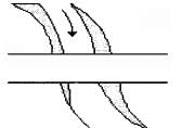
The conventional sign shown in below figure represents a

Detailed Solution for Test: Surveying- 1 - Question 18

Correct Answer :- a

Explanation : The conventional sign shown in below figure represents a road bridge. A  conventional symbol is a symbol that is widely accepted. The various features shown on a map are represented by conventional signs or symbols.

In a map or drawings or plans or in land surveying, the objects or an area is depicted by symbols not by names. As a civil engineer, you must know how to read the drawings, maps and plans. This post will be a key for you to read maps.

In this article,  we are going to show you different types of symbols used in topographic land surveys, road maps, railway maps, surveying maps, building plans, Electrical and telephone lines.

Test: Surveying- 1 - Question 19

Pick up the incorrect statement from the following:

Detailed Solution for Test: Surveying- 1 - Question 19

a) A tape of length 100.005 m will measure longer than the true distance by 0.005 m for each tape length. This is correct - this is called the standardization correction.

b) When temperature increases, the tape expands and measured distances appear larger than they actually are (because the tape unit is longer). This is correct.

c) When a tape is suspended between points, it sags in a catenary curve. The straight-line distance between the ends is indeed less than the length along the curve. Sag correction is added to get the true horizontal distance. This is correct.

d) For a tape with:

  • Length (L) = 100 m
  • Cross-section area (A) = 10 mm × 0.25 mm = 2.5 mm²
  • Pull (P) = 5 kg ≈ 49 N
  • Steel's Young's modulus (E) ≈ 200 GPa

Using the formula for extension: ΔL = (P×L)/(A×E) The extension would be much less than 10 mm.


Therefore, statement (d) is incorrect. The stated extension of 10 mm is too large for the given specifications.

Test: Surveying- 1 - Question 20

For the construction of highway (or railway)

Detailed Solution for Test: Surveying- 1 - Question 20
Why are both longitudinal and cross sections required for the construction of a highway (or railway)?

  • Longitudinal sections: Longitudinal sections provide a detailed view of the terrain along the alignment of the highway or railway. This helps in understanding the natural features of the land, such as slopes, valleys, and ridges.

  • Cross sections: Cross sections provide a perpendicular view of the terrain at regular intervals along the alignment. This helps in determining the earthwork required for the construction, identifying any obstacles, and planning drainage systems.

  • Both sections combined: By combining longitudinal and cross sections, engineers can create a comprehensive profile of the construction site. This allows for accurate planning and design of the highway or railway, ensuring optimal construction and maintenance.

  • Efficient construction: Having both longitudinal and cross sections helps in optimizing the alignment, minimizing earthwork, and ensuring proper drainage, leading to a more efficient and cost-effective construction process.

  • Safety and durability: Proper planning using longitudinal and cross sections ensures that the highway or railway is constructed on stable ground, reducing the risk of landslides, flooding, or other natural disasters that could compromise the safety and durability of the infrastructure.

Test: Surveying- 1 - Question 21

Detailed plotting is generally done by

Detailed Solution for Test: Surveying- 1 - Question 21

- Detailed plotting is generally done by radiation because it involves using a specific point as a reference and measuring the angles and distances to other points from that reference.
- Radiation is a method used in surveying to plot points on a map or plan by using angles and distances measured from a single known point.
- Traversing and resection are also surveying techniques, but they are used for different purposes such as determining boundaries or locating unknown points based on known points.

Test: Surveying- 1 - Question 22

If the smallest division of a vernier is longer than the smallest division of its primary scale, the vernier is known as

Detailed Solution for Test: Surveying- 1 - Question 22
Explanation:

  • Retrograde Vernier: When the smallest division of a vernier scale is longer than the smallest division of its primary scale, it is known as a retrograde vernier.

  • Direct Vernier: In a direct vernier, the smallest division of the vernier scale is shorter than the smallest division of the main scale.

  • Double Vernier: A double vernier has two vernier scales that work in opposite directions.

  • Simple Vernier: A simple vernier is a single vernier scale that is used to measure lengths with high precision.


Comparison:

  • In a retrograde vernier, the smallest division of the vernier scale is longer than the smallest division of the main scale.

  • This type of vernier is used when high precision measurements are needed, and the main scale cannot provide enough accuracy.

  • Retrograde verniers are commonly found in instruments where extreme accuracy is required, such as precision measuring tools and scientific instruments.


Conclusion:

  • Understanding the different types of vernier scales and their uses is essential for accurate measurements in various fields such as engineering, physics, and manufacturing.

  • By knowing the characteristics of a retrograde vernier, one can select the right tool for the job and ensure precise measurements are obtained.

Test: Surveying- 1 - Question 23

The method of reversal

Detailed Solution for Test: Surveying- 1 - Question 23


Explanation of the method of reversal:

  • Definition: The method of reversal is a technique used to examine whether a certain part is truly parallel or perpendicular to another in a given situation.

  • Purpose: The main purpose of using this method is to make the erroneous relationship between parts evident, helping to identify any mistakes or inaccuracies in the initial analysis.

  • Process: The process involves reversing the assumed relationship between parts and examining the implications of this reversal on the overall analysis.

  • Outcome: By applying the method of reversal, one can gain a better understanding of the relationship between different parts and make necessary adjustments to ensure accuracy in the analysis.

  • Conclusion: The method of reversal is a valuable tool in critical thinking and problem-solving, as it helps to uncover hidden assumptions and errors in reasoning.


Test: Surveying- 1 - Question 24

The line normal to the plumb line is known as

Detailed Solution for Test: Surveying- 1 - Question 24
Explanation:

  • Normal to the plumb line: The line normal to the plumb line is known as the level line.

  • Horizontal line: A horizontal line is parallel to the horizon and perpendicular to the vertical direction.

  • Datum line: A datum line is a reference line from which measurements or calculations are taken.

  • Vertical line: A vertical line is perpendicular to the horizontal plane.


Therefore, the correct answer is Option B: Level line.

Test: Surveying- 1 - Question 25

In levelling operation

Detailed Solution for Test: Surveying- 1 - Question 25

Before shifting the instrument the last sight is foresight which is taken on change point. After shifting the instrument the first sight taken is taken on the same change point i.e back sight.

2 videos|122 docs|55 tests
Information about Test: Surveying- 1 Page
In this test you can find the Exam questions for Test: Surveying- 1 solved & explained in the simplest way possible. Besides giving Questions and answers for Test: Surveying- 1, EduRev gives you an ample number of Online tests for practice

Top Courses for Civil Engineering (CE)

Download as PDF

Top Courses for Civil Engineering (CE)