Geography CUET PG Mock Test- 2 - CUET PG MCQ
30 Questions MCQ Test Geography CUET PG Mock Test Series 2025 - Geography CUET PG Mock Test- 2

Who stated "Similar location leads to the similar mode of life"?
Which of the following marine mammals is a herbivore?

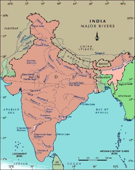
Arrange the following rivers in sequence as per their length.
1. Ganga river
2. Mahanadi river
3. Kaveri river
1. Ganga river
2. Mahanadi river
3. Kaveri river
A relatively fixed point of known elevation above datum is called ___________.
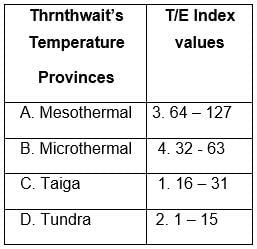
Match the scales with its description:
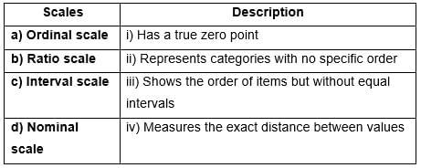
Choose the correct answer from the options given below:
Arrange the following rivers in descending order of their length in India.
(A). Godavari
(B). Sutlej
(C). Krishna
(D). Yamuna
Choose the correct answer from the options given below:
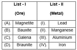
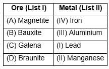
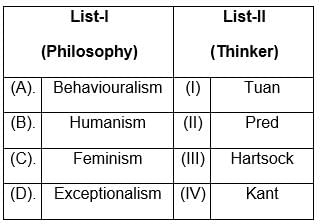
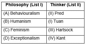
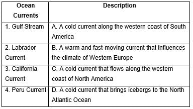
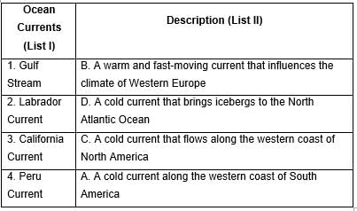
Match List-I with List-II
Choose the correct answer from the options given below:
Identify the correct statements about soils of India.
(A). Khadar represents the older part of Alluvial soil.
(B). Black soil has the higher water retaining capacity among all the soils of India.
(C). Desert soils are rich in mineral salt but poor in organic matter.
(D). Red soils cover the largest area among soils of India.
Choose the correct answer from the options given below:
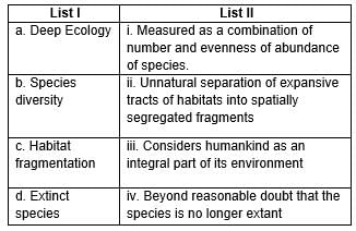
Match List-I with List-II
Choose the correct answer from the options given below:
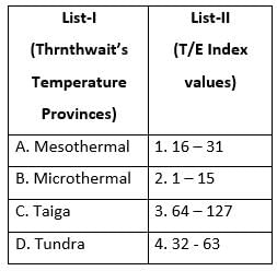
Match the List - I with List - II and select the correct answer from the code given below :
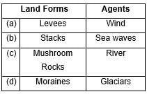
Match the following:
Choose the correct answer from the codes given below.
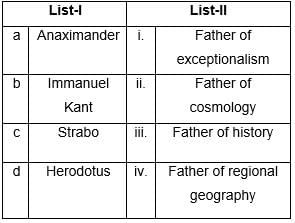
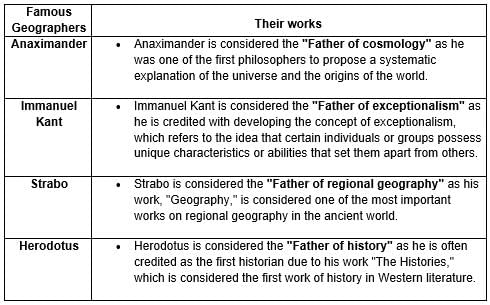
Match List-I of scholars with their respective titles in List-II and select the correct answer from the given alternatives.
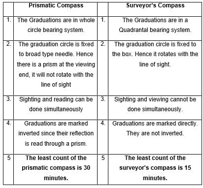
Least count of prismatic compass and surveyor’s compass is
Consider the following pairs:
Which of the following options is correct?
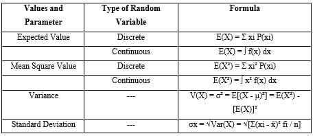
The square of the standard deviation is called __________.
Which of the following is NOT an example of zonal soil ?
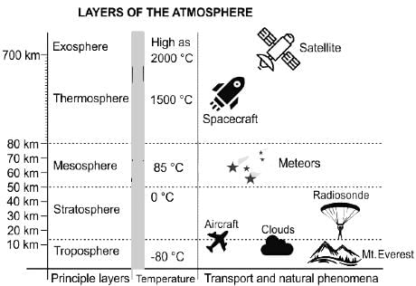
The ionosphere overlaps which two layers of the atmosphere?
Choose the correct one from the given statements.
1. There are four varieties of coal, among which Anthracite is called hard coal
2. Bituminous is the most commonly used type of coal for electricity generation
3. Lignite has a high heating value and a low moisture content


Important Questions for Geography CUET PG Mock Test- 2
Geography CUET PG Mock Test- 2 MCQs with Answers
Online Tests for Geography CUET PG Mock Test- 2 Geography CUET PG Mock Test Series 2025
|
© EduRev
|
Education Revolution
|


|


within 7 days!