Important Questions (1 mark): Size And Location - Class 9 MCQ
20 Questions MCQ Test - Important Questions (1 mark): Size And Location
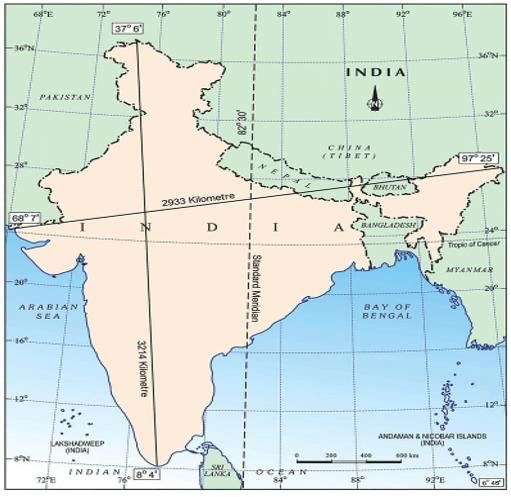
The eastern-most longitude of India is
Which geographical feature forms the boundary between Sri Lanka and India?
Which of the following has reduced India’s distance from Europe by 7000 km?
which option is correct about India's geographical and historical attributes:
(i) India is located entirely in the Northern Hemisphere.
(ii) The Tropic of Cancer divides the country into almost two equal parts.
(iii) The southernmost point of the Indian Union is known as Indira Point.
(iv) India's land mass covers an area of 3.28 million square km.
Both the latitudinal and longitudinal extent of India’s mainland is about 30°. But on looking at the map of India which of the following alternatives do you observe about India’s size?
The Tropic of Cancer does not pass through
Choose the incorrectly matched pair:
Which of the following groups of islands belonging to the Indian territory lies in the Arabian Sea?
Choose the correctly matched pair.
Uttarakhand, Uttar Pradesh, Bihar, West Bengal and Sikkim have common frontiers with
Which state experiences the sun rising two hours earlier compared to Gujarat but showing the same time on watches?
If you intend to visit Kavarati during your summer vacations, which one of the following Union Territories of India you will be going to?
Which of the following is the longitudinal extent of India?
Which latitude passes through the southern-most point of India’s mainland?
My friend hails from a country which does not share land boundary with India. Identify the country.
What ancient trade routes contributed to the exchange of ideas and commodities since ancient times?


