 |  Locating Places on the Earth 32 Flashcards |  Start |
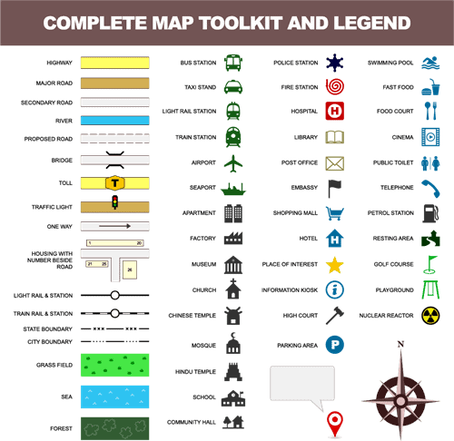
 | Fill in the blank: A map's ___ explains the symbols used to represent different features. |  Card: 1 / 32 |
| Legend
| Card: 2 / 32 |
| True or False: Thematic maps focus on the physical geography of an area. | Card: 3 / 32 |
| False. Thematic maps focus on specific types of information, such as population density or climate zones. 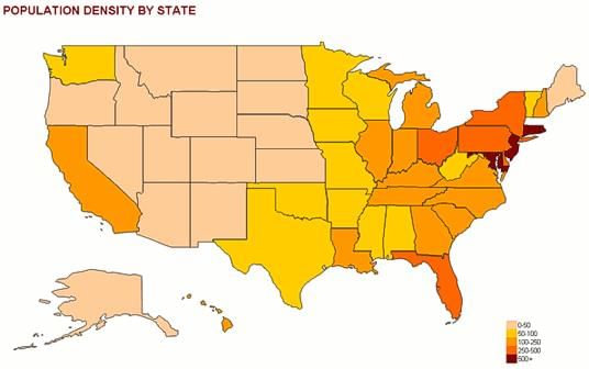 | Card: 4 / 32 |
| What role do cardinal directions play in map reading? | Card: 5 / 32 |
| Cardinal directions (North, South, East, West) and intermediate directions help indicate orientation and navigation on a map. | Card: 6 / 32 |
| Fill in the blank: Physical maps primarily display ___ features like mountains and rivers. | Card: 7 / 32 |
| Natural 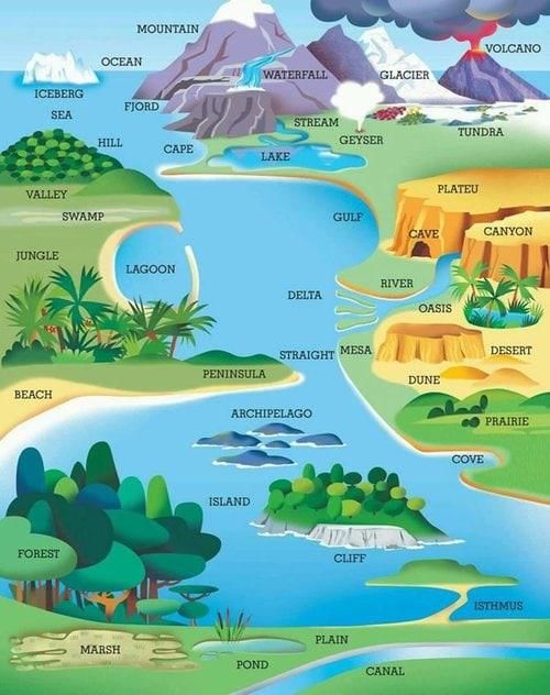 | Card: 8 / 32 |
| What is the significance of symbols on a map? | Card: 9 / 32 |
| Symbols represent different features on a map, such as a tree for a forest or a dotted line for a road, and are explained in the map's legend. | Card: 10 / 32 |
| Multiple Choice: Which type of map would you use to find the boundaries of countries? | Card: 11 / 32 |
| B) Political Map | Card: 12 / 32 |
| The Equator is located at ___ latitude. | Card: 13 / 32 |
| 0° latitude. 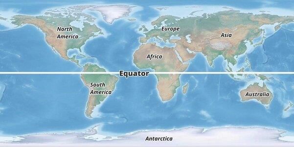 | Card: 14 / 32 |
| Which climate zone is characterized by hot temperatures and is located near the Equator? | Card: 15 / 32 |
| The torrid zone. | Card: 16 / 32 |
|  Unlock all Flashcards with EduRev Infinity Plan Starting from @ ₹99 only | |
| True or False: The poles are located at 90° latitude north and south. | Card: 17 / 32 |
| True. | Card: 18 / 32 |
| Fill in the blank: The areas between the tropics and the polar circles are referred to as ___ zones. | Card: 19 / 32 |
| Temperate zones. | Card: 20 / 32 |
| What is the approximate latitude of the Tropic of Cancer? | Card: 21 / 32 |
| 23.5°N latitude. | Card: 22 / 32 |
| True or False: A globe is less accurate than a flat map in representing the Earth. | Card: 23 / 32 |
| False. A globe is more accurate than a flat map. | Card: 24 / 32 |
| What is the significance of the Prime Meridian in terms of global navigation? | Card: 25 / 32 |
| The Prime Meridian, located at 0° longitude, serves as the reference line from which all other longitudes are measured, facilitating global navigation and timekeeping. | Card: 26 / 32 |
| Fill in the blank: The Earth is divided into ___ time zones, each representing one hour of time. | Card: 27 / 32 |
| 24 | Card: 28 / 32 |
| True or False: When crossing the International Date Line from west to east, the date changes by subtracting a day. | Card: 29 / 32 |
| True | Card: 30 / 32 |
| What standard time does India follow, and how does it relate to Greenwich Mean Time? | Card: 31 / 32 |
| India follows Indian Standard Time (IST), which is 5.5 hours ahead of Greenwich Mean Time (GMT). | Card: 32 / 32 |
| Completed! Keep practicing to master all of them. |  Restart |


