|
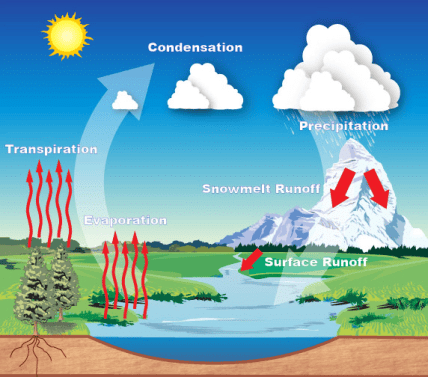
The hydrological cycle involves the continuous exchange of water between the ___, ___, and ___ components of the Earth. |
Card: 1 / 40 |
|
True or False: Approximately 59% of water that falls on land is absorbed by the ground and does not return to the atmosphere. |
Card: 3 / 40 |
|
False. Approximately 59% of water that falls on land returns to the atmosphere through evaporation. |
Card: 4 / 40 |
|
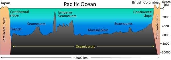
The oceanic deeps are the deepest regions of the ocean floor, comprising trenches and ___ plains. |
Card: 9 / 40 |
|
True or False: The average depth of oceanic trenches is generally shallower than that of the abyssal plains. |
Card: 11 / 40 |
|
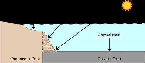
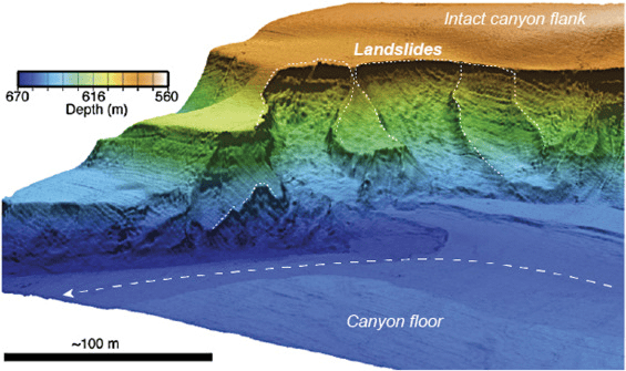
The continental slope marks the boundary between the continental shelf and the deep ocean floor, featuring a steep descent with depths ranging from 200m to 3000m and often containing underwater canyons and channels. 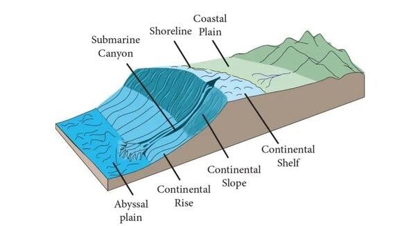 |
Card: 14 / 40 |
|
Fill in the blank: The continental shelf features a gentle gradient of about ___ degrees or less. |
Card: 15 / 40 |
|
True or False: The continental shelf is generally wider in regions like the west coast of Sumatra compared to the Siberian shelf. |
Card: 17 / 40 |
|
False; the Siberian shelf is the world's largest and can span up to 1500 kilometers in width, while the west coast of Sumatra has a narrow shelf.  |
Card: 18 / 40 |
|
The deep-sea plain represents a vast and relatively flat expanse on the ocean floor, characterized by sediment accumulation and minimal surface relief, making it one of the most extensive terrains in oceanic geography. 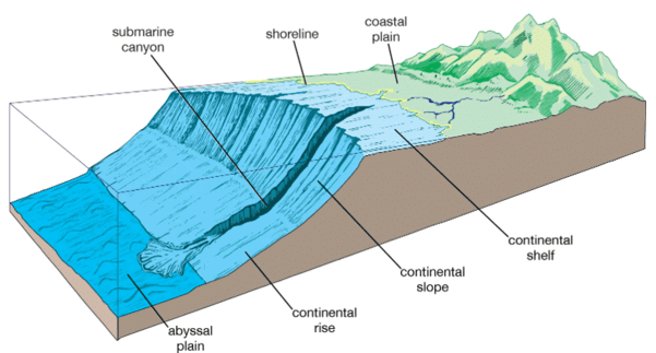 |
Card: 20 / 40 |
 Unlock all Flashcards with EduRev Infinity Plan Starting from @ ₹99 only
|
|
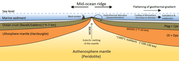
A mid-oceanic ridge consists of two chains of mountains separated by a large depression. True or False? |
Card: 21 / 40 |
|
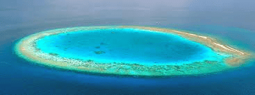
A guyot is a flat-topped seamount that has subsided over time, resulting in a flat top. 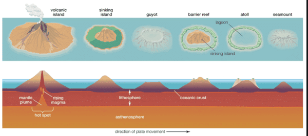 |
Card: 26 / 40 |
|
Surface water temperature in the ocean decreases from the equator towards the poles due to ___ reduction in insolation. |
Card: 29 / 40 |
|
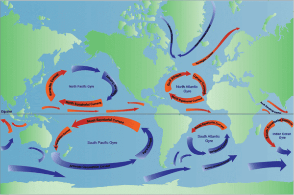
True or False: The Gulf Stream is a cold ocean current that lowers temperatures along the eastern coast of North America. |
Card: 31 / 40 |
|
False; the Gulf Stream is a warm current that raises temperatures along the eastern coast of North America. 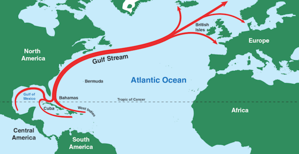 |
Card: 32 / 40 |
|
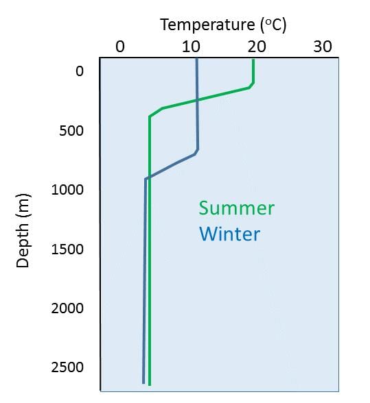
The temperature-depth profile of ocean water shows a rapid decrease in temperature at the ___, which separates warmer surface waters from deeper waters. |
Card: 33 / 40 |
|
Prevailing winds moving from land to oceans push warm surface water away from the coast, resulting in the upwelling of cold water from deeper levels. 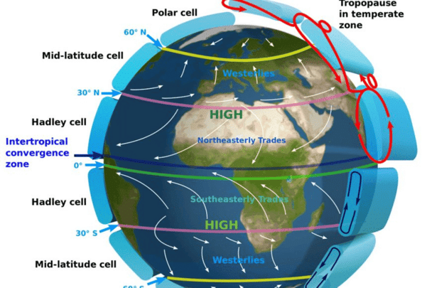 |
Card: 36 / 40 |
|
Longitudinal variation in ocean temperature is primarily influenced by ___ and ___ winds. |
Card: 39 / 40 |


