Class 6 Geography Chapter 5 Notes - Major Domains of the Earth
| Table of contents |

|
| What is a landform? |

|
| How landforms are formed? |

|
| Explanation of the Different Landforms |

|
| Plains |

|
| Landforms and the People. |

|
| Some Important Questions |

|
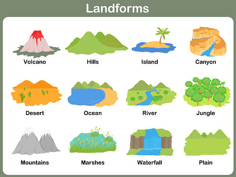
What is a landform?
A landform is a natural feature of the solid surface of the Earth. Examples include:
- Mountains
- Plateaus, and
- Plains.
How landforms are formed?
The earth has an infinite variety of landforms. These landforms are a result of two processes. Within the earth, a continuous movement is taking place.
- Internal Process: The first or the internal process leads to the upliftment and sinking of the earth’s surface at several places.
- External Process: The second, or the external process is the continuous wearing down and rebuilding of the land surface.
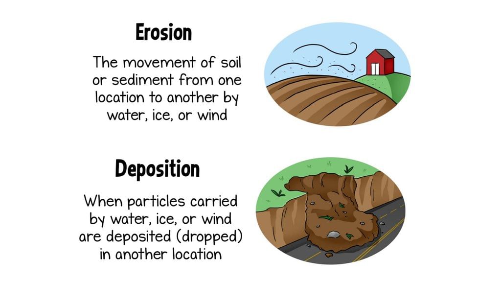
- Erosion & Deposition: The wearing away of the earth’s surface is called erosion. The surface is being lowered by the process of erosion and rebuilt by the process of deposition. These two processes are carried out by running water, ice and wind.
Explanation of the Different Landforms
Here are the details of the different landforms depending on elevation and slope:
Mountains
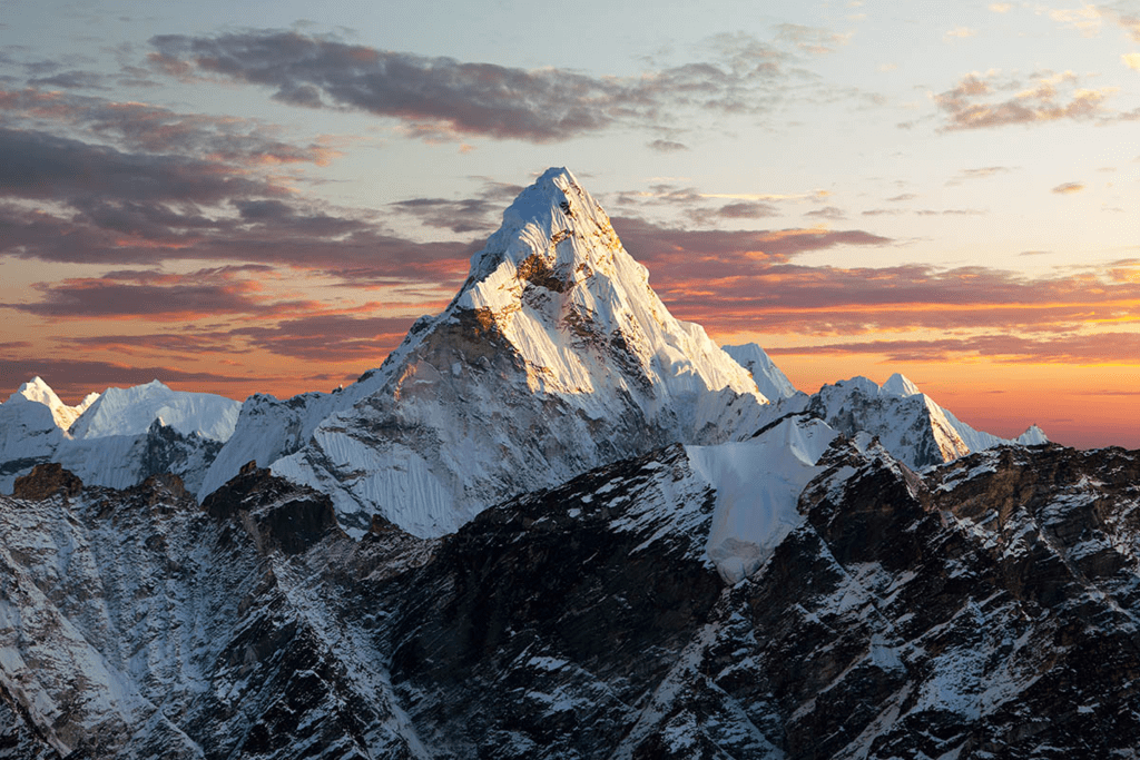
A mountain is any natural elevation of the earth’s surface. It may have a small summit and a broad base. It is considerably higher than the surrounding area. Some mountains are even higher than the clouds. The climate becomes colder when we go higher. There are some mountains deep under the sea
 Mountains
- Glaciers: In some mountains, there are permanently frozen rivers of ice. They are called glaciers.
- Range: A continuous chain of mountains over a large area is called ‘Range’. The Himalayas, The Alps and The Andes in Asia, Europe and South America respectively are mountain ranges of Asia, Europe and South America, respectively. Mountains vary in their heights and shape.
- Harsh Climatic Conditions: There are some mountains deep under the sea. Owing to harsh climate, less people live in the mountain areas. Since the slopes are steep, less land is available for farming.
- Water from mountains: Water from the mountains is also used for irrigation and generation of hydro-electricity. The river valleys and terraces are ideal for cultivation of crops. Mountains have a rich variety of flora and fauna. The forests provide fuel, fodder, shelter and other products like gum, raisins, etc.
- The Three types of Mountains: There are three types of mountains:
Fold Mountains
Block mountains
Volcanic mountains
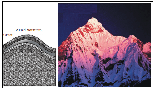
1. Fold Mountains: The Himalayan Mountains and the Alps are young fold mountains with rugged relief and high conical peaks. The Aravali range in India is one of the oldest fold mountain systems in the world. The Appalachians in North America and the Ural mountains in Russia have rounded features and low elevation. They are very old fold mountains.
 Fold Mountains
2. Block Mountains: Block Mountains are created when large areas are broken and displaced vertically. The uplifted blocks are termed as horsts and the lowered blocks are called graben. The Rhine valley and the Vosges mountain in Europe are examples of such mountain systems.
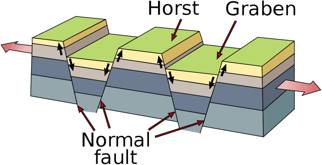 Block Mountains
3. Volcanic mountains: Volcanic Mountains are formed due to volcanic activity. Mt.Kilimanjaro in Africa and Mt.Fujiyama in Japan are examples of such mountains. Mountains are very useful. They are a storehouse of water. Many rivers have their source in the glaciers in the mountains. Reservoirs are made and the water is harnessed for the use of people.
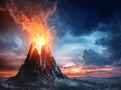 Volcanic Mountains
Plateau
A plateau is a flat-topped tableland. It is an elevated flat land. A plateau may have one or more sides with steep slopes.
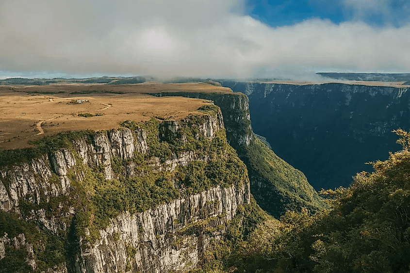 A plateau in Brazil
- The height of plateaus often varies from a few hundred metres to several thousand metres Plateaus, like mountains, may be young or old. The Deccan plateau in India is one of the oldest plateaus.
- The East African Plateau in Kenya, Tanzania and Uganda and the Western plateau of Australia are other examples.
- The Tibet plateau is the highest plateau in the world.Plateaus are useful as they are rich in mineral deposits. Plateaus are very useful because they are rich in mineral deposits. As a result, many of the mining areas in the world are located in the plateau areas.
- The African plateau is famous for gold and diamond mining. In India, huge reserves of iron, coal and manganese are found in the Chhotanagpur plateau.
- In the plateau areas, there may be several waterfalls as the river falls from a great height. In India, the Hundru falls in the Chhotanagpur plateau on the river Subarnarekha and the Jog falls in Karnataka are examples of such waterfalls.
- The lava plateaus are rich in black soil that are fertile and good for cultivation. Many plateaus have scenic spots and are of great attraction to tourists.
Plains
Plains are low-lying and flat stretches of land. Plains may be extremely level, slightly rolling and undulating.
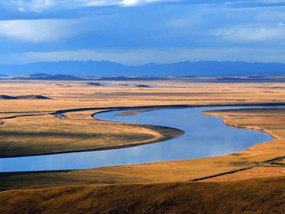 Plains
- Plains are fertile. They are good for cultivation, transport and habitation. Most of the plains are formed by rivers and their tributaries. The rivers flow down the slopes of mountains and erode them. They carry forward the eroded material.
- Then they deposit their load consisting of stones, sand and silt along with their courses and in their valleys. It is from these deposits that plains are formed.
- Some of the largest plains made by the rivers are found in Asia and North America. For example, in Asia, these plains are formed by the Ganga and the Brahmaputra in India and the Yangtze in China.
- Plains are the most useful areas for human habitation. There is a great concentration of people as more flat land is available for building houses, as well as for cultivation.
- Because of fertile soils, the land is highly productive for cultivation. In India too, the Indo-Gangetic plains are the most densely populated regions of the country.
Landforms and the People.
- Humans have been living on different kinds of landforms in different ways.
- Life is difficult in mountainous areas.
- Plains provide much better conditions. It is easier to grow crops, build a house or a road in a plain than a mountain.
- Natural calamities such as earthquakes, volcanic eruptions, storms and floods cause widespread destruction.
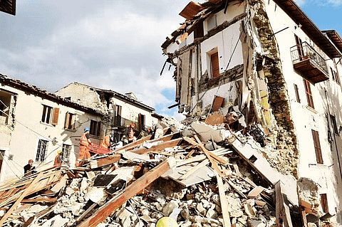 Destruction Caused by Earthquake
- Quite often we use the land for wasteful purposes, for example constructing houses on fertile land.
- Similarly, we throw garbage on land or in water making them dirty.
Some Important Questions
India’s landforms can be classified in five seperate types, respectively these are the Northern mountáin region, the Great Plains of the north, the desert of Rajasthan, the Greát Plateau and the Coastal Strips and Islands.
Q.3. What are the uses of ‘Plains’?The world’s tallest mountain ranges form when pieces of Earth’s crust, called plates-smash against each other in a process called plate tectonics.
Plains in many areas are important for agriculture because where the soils are deposited as sediments they may be deep and fertile, and the flatness facilitates mechanization of crop production.
Q.4. How are mountains useful to man?
Mountains are useful to man in a variety of ways:
- Mountains are storehouses of water which is a basic need of human beings. Reservoirs are made and the water is harnessed for the use of people. Water is used for irrigation and the generation of hydroelectricity.
- Mountains have a rich variety of flora and fauna.
- Mountains provide an idyllic site for tourists. They visit the mountains for their scenic beauty.
Q.5 Why are mountains thinly populated?
Life is very difficult in mountain areas because of harsh climate. It is quite difficult to grow crops, build houses or roads in a mountain. Hence, people do not prefer to live here.
FAQs on Class 6 Geography Chapter 5 Notes - Major Domains of the Earth
| 1. What is a landform? |  |
| 2. How are landforms formed? |  |
| 3. Can you explain the different types of landforms? |  |
| 4. How do landforms affect people? |  |
| 5. Why is it essential to study landforms? |  |


