Eluru District | APPSC State Specific Preparation Course - APPSC (Andhra Pradesh) PDF Download
Overview of Eluru District
- Eluru district was established in 2022, carved out of parts of the old West Godavari District and eight mandals from the old Krishna District, totaling 28 mandals and three revenue divisions. The district's headquarters is located in Eluru.
- Formation of Eluru District: The district came into existence in 2022, with a detailed description of its geographical, topographic, demographic, and socio-economic aspects.
- Geographical Description: Eluru District is surrounded by various features on all sides, bordered by Rajahmundry District to the east, Krishna District to the west, Khammam District to the north, and Krishna District to the south.
- Geographical Coordinates: The district is located in the tropical region between 16°15'00" to 17°30'00" northern latitude and 80°55'00" to 81°35'00" eastern longitude. It can be categorized into three natural regions: Delta, Upland, and Agency areas.
Geography
- The district covers an area of 6413 square kilometers.
- It is bordered by Khammam District to the north and the Bay of Bengal to the south.
- The Tammileru River and Kolleru Lake separate it from Krishna District to the west.
- Sources of irrigation in the district include the Eluru canal, Vijayarai Anicut, Tammileru, Jalleru, and Yerrakaluva reservoirs.
Climate
- In Eluru District, the climate is moderate in both winter and summer seasons in the delta area.
- However, in the non-delta area, particularly in the upland and agency areas, summers can be extremely hot.
- Normal maximum and minimum temperatures range from 36.2°C to 19.9°C, with peak temperatures usually occurring in April and May.
- The district primarily receives rainfall from the South West and North East monsoons, with respective average rainfalls of 791.9 mm and 239.3 mm.
- In 2019-20, the district received 705.02 mm of rainfall from the South West monsoon and 185.9 mm from the North East monsoon.
- Agricultural activities in the district face challenges due to erratic monsoons, unreliable rainfall, and heavy reliance on tanks, wells, and other irrigation sources in upland and agency areas.
Demographics
- The district covers an area of 6411.56 square kilometers with a density of 312 per square kilometer. This area represents 3.9% of the total state area.
- There are 655 revenue villages in the district, out of which 624 are inhabited, and 31 are uninhabited. The district comprises a total of 550 Gram Panchayats.
- The physical characteristics, natural resources, and potentialities of the mandals in the district vary.
- As per the 2011 census, the total population of the district is 2,002,658, accounting for 4.04% of the state's total population.
- The female population in the district is 1,002,389, representing 50.05% of the district's population and 4.05% of the state's female population.
- According to the 2011 census, the rural population of the district is 1,618,288, making up 80.70% of the district's population and 4.63% of the state's rural population.
- The urban population is spread across 4 towns, totaling 384,370 individuals, which is 19.30% of the district's population and 2.63% of the state's urban population.
- The Scheduled Caste (SC) population in the district is 438,087, accounting for 21.87% of the district's population and 5.17% of the state's SC population.
- Similarly, the Scheduled Tribe (ST) population in the district is 121,973, making up 6.09% of the district's population and 4.45% of the state's ST population.
- From the 2001 to 2011 census, the district's population grew by 3.5%.
- The literacy rate in the district is 71.44%, higher than the state's literacy rate of 67.35%.
- The sex ratio in the district is 1002 females per 1,000 males, compared to 997 in the state.
- There are 965,123 workers in the district according to the 2011 census, constituting 48.19% of the total district population and 1.95% of the state's total population.
Question for Eluru DistrictTry yourself: What is the total population of Eluru District according to the 2011 census?View Solution
Religious Tourism in Eluru District
Overview
- Religious tourism, often known as pilgrimage tourism, involves traveling to temples, churches, or masjids for spiritual purposes.
- West Godavari district is renowned for its diverse temples and shrines, showcasing a rich cultural and historical heritage.
Key Pilgrimage Sites
- Sri Venkateswara Swami Temple
- Temples in West Godavari
- Shrines of Historical Importance
Sri Venkateswara Swami Temple
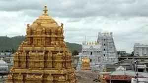
- Sri Venkateswara Swami Temple, also known as Parijathagiri Temple, situated in Jangareddygudem, is a picturesque and sacred place for worship.
- Jangareddygudem is unique for having seven mountains, a rarity in Andhra Pradesh apart from Tirumala Tirupathi.
- The temple underwent recent renovations to accommodate the increasing number of devotees. Many weddings take place in the large Kalyanamandapam within the temple premises.
- The sacred practice of Annadhanam, offering food to the needy, occurs daily.
- The annual Srivari Brahmotsavam, a nine-day festival, is a significant celebration at this temple.
Sri BhuniLa Sameta Sri Janardhana Swamy Kanyakumara Parameshwari Ammanala Temple, Eluru
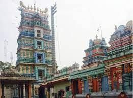
- The temple in Eluru was created by the creator of the Trinity to mature himself.
- Brahma, Sankar, and Vishnu played roles in its creation.
- Lakshmi and Parvati were also significant in the temple's formation.
- Lord Shiva ordered that 101 portions of the temple be distributed among the villages.
- The villages were named Nokkalamma, Polaremma, Sattemma, and Mahavishnu.
- The temple's creation and distribution involved divine intervention and specific instructions from Lord Shiva.
Maddi Anjaneya Swamy (Lord Hanuman) Temple
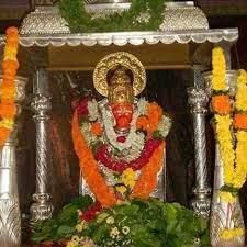
- Maddi Anjaneya Swamy (Lord Hanuman) temple is located 3 km away from Janareddigudem town in the village of Gurvaigudem.
- Devotees often visit this temple on Tuesdays to offer prayers to Lord Anjaneya Swamy.
- Similar to many other South Indian temples, there is a well-organized queue system for Darshan of Lord Hanuman.
- For a quicker Darshan experience, visitors can opt for a special Rs 20 line that bypasses the crowded free Darshan queue.
- It is a tradition to walk around the main temple sanctum 11 times (known as Pradakshina) before seeking Darshan, believed to fulfill wishes within a year.
- Each round of Pradakshina typically takes around one minute 30 seconds to one minute 45 seconds, varying based on walking speed.
- Photography and video recording are allowed inside the temple complex free of charge, with no restrictions.
- Professional photographers are also available to take photos of visitors with the temple in the background.
Syed Baji Hazarat Dargah (ELURU)
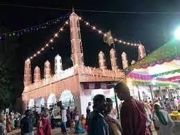
- Hazarat Syed Yaakub Jaan Mahatmulavari Dargah is situated on Eluru's Eastern Street in Paidichintapadu.
Abhaya Buddha Statue, Eluru
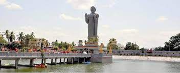
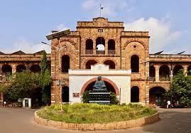
- A remarkable 74-foot Buddha statue stands in the middle of Gajjalavari Cheruvu pond, accompanied by a painting gallery dedicated to spreading Buddha's teachings.
- The statue's pedestal features renowned Amaravathi sculptures along the footbridge railings leading up to the statue.
Question for Eluru DistrictTry yourself: Which temple in Eluru was created with the involvement of Lord Brahma, Lord Sankar, and Lord Vishnu?View Solution
Tourist Places in Eluru District
Papikondalu
Overview of Papikondalu
- Location: Papikondalu, also known as Papi Hills, is a mountain range situated in the Rajahmundry in Eluru District of Andhra Pradesh, India.
- Geographical Significance: The range runs parallel to the River Godavari, offering a picturesque view with its twists and turns.
Exploring Papikondalu
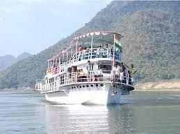
- Boat Journey: To truly experience Papikondalu, visitors can embark on an 8-hour boat journey starting from either Rajahmundry or Bhadachalam.
- Scenic Beauty: The region is known for its stunning landscapes, diverse wildlife, and captivating bird species, making it a popular destination for nature lovers.
- Seasonal Variation: While any season is suitable for visiting Papikondalu, the rainy season (July to September) offers a unique and thrilling experience due to the river's increased water levels.
Local Culture and Activities
- Community: Several tribal communities reside in the hills, primarily engaged in agriculture, fishing, and handicrafts.
- Adventure Camping: For adventurous travelers, camping overnight by the riverside can be an exciting experience, especially for groups of more than five people.
Question for Eluru DistrictTry yourself: What is the geographical significance of Papikondalu?View Solution
The document Eluru District | APPSC State Specific Preparation Course - APPSC (Andhra Pradesh) is a part of the APPSC (Andhra Pradesh) Course APPSC State Specific Preparation Course.
All you need of APPSC (Andhra Pradesh) at this link: APPSC (Andhra Pradesh)
|
128 docs|94 tests
|
FAQs on Eluru District - APPSC State Specific Preparation Course - APPSC (Andhra Pradesh)
| 1. What are some popular tourist places in Eluru District? |  |
Ans. Some popular tourist places in Eluru District include Kolleru Lake, Dwaraka Tirumala, Pattiseema, and the Venugopalaswamy Temple.
| 2. What is the significance of religious tourism in Eluru District? |  |
Ans. Eluru District is known for its religious tourism, with many temples and pilgrimage sites attracting devotees from different parts of the country.
| 3. How can one explore Eluru District for religious tourism purposes? |  |
Ans. One can explore Eluru District for religious tourism by visiting the various temples and pilgrimage sites, participating in religious ceremonies, and learning about the cultural significance of the region.
| 4. What is the overall overview of Eluru District in terms of tourism? |  |
Ans. Eluru District offers a mix of natural beauty, cultural heritage, and religious significance, making it a popular destination for tourists seeking a diverse travel experience.
| 5. How can one make the most of their visit to Eluru District for religious tourism? |  |
Ans. To make the most of a visit to Eluru District for religious tourism, one can plan their itinerary to include visits to multiple temples, attend religious events or festivals, and immerse themselves in the spiritual atmosphere of the region.
Related Searches


