Indian Remote Sensing Satellite System | General Awareness for SSC CGL PDF Download
| Table of contents |

|
| Introduction |

|
| Indian Remote Sensing (IRS) Satellites |

|
| Oceansat Series |

|
| Cartosat Series |

|
| Resourcesat Series |

|
| RISAT Series |

|
| SCATSAT Series |

|
| Satellite Orbits |

|
Introduction
India has developed an advanced array of remote sensing satellites to serve a wide range of applications, from weather forecasting to resource management. These satellites are crucial for gathering data about Earth's surface, oceans, and atmosphere, and they have been designed and launched by the Indian Space Research Organisation (ISRO).
Indian Remote Sensing (IRS) Satellites

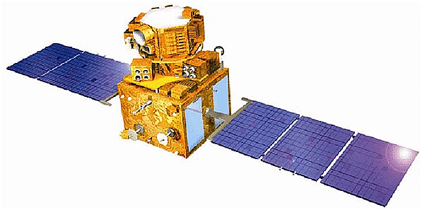
The IRS satellites are a comprehensive group of remote sensing satellites designed and launched by India. The program began with the launch of IRS-1A in 1988. These satellites form the largest civilian remote sensing satellite constellation globally. They are used for a variety of applications such as agricultural monitoring, urban planning, and environmental management.
Oceansat Series
The Oceansat series, initiated in 1999, represents India's first dedicated satellite series for oceanographic studies.
Satellites
- Oceansat-1: Launched in 1999, it featured an Ocean Colour Monitor and a Multi-Frequency Scanning Microwave Radiometer.
- Oceansat-2: Followed in 2009 with enhanced features for better ocean observation.
- Oceansat-2B: Launched in 2010, it continued the mission with improvements in data collection and analysis.
- These satellites are designed to monitor and analyze ocean conditions, including physical and biological aspects, helping in weather forecasting and marine resource management.
Cartosat Series
- The Cartosat satellites are high-resolution Earth observation satellites placed in a Sun-Synchronous orbit.
- Cartosat-3: Launched on November 27, 2019, this satellite is noted for its exceptionally high resolution, making it the world’s highest resolution imaging satellite.
- The Cartosat series is used for detailed cartography, weather mapping, and defense-related applications.
Resourcesat Series
- The Resourcesat satellites provide extensive information on Earth's land and water resources, including agricultural, forestry, and mineral data.
- Resourcesat-2A: Launched on December 7, 2016, it continues the mission of monitoring and managing natural resources.
- These satellites offer valuable insights into land use, crop health, and forest cover, supporting various environmental and resource management activities.
RISAT Series
- The RISAT (Radar Imaging Satellite) series uses synthetic-aperture radar for imaging, which is useful for reconnaissance and observation.
- RISAT-2BR1: Launched on December 11, 2019, it marked the 50th launch of the Polar Satellite Launch Vehicle and the 75th launch from the Satish Dhawan Space Centre.
- These satellites are designed for all-weather, day-and-night imaging, crucial for applications like border security and agricultural monitoring.
SCATSAT Series
- SCATSAT satellites use scatterometer technology to provide essential data for weather forecasting and cyclone tracking.
- SCATSAT-1: Launched on September 26, 2016, it replaced the ISS-Rapidscat from NASA for cyclone prediction and weather services in India.
- This series helps in accurate weather forecasting and monitoring cyclone development, enhancing India's capability in weather management.
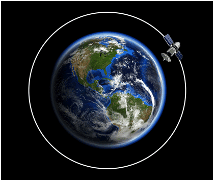
Satellite Orbits

Low Earth Orbit (LEO)
- Satellites in this orbit function at altitudes between 160 and 600 kilometers above Earth.
- Examples: Many Earth observation satellites operate in LEO to capture detailed imagery and data.
Sun-Synchronous Orbit
- Satellites in this orbit pass over the same part of the Earth at the same local solar time each day.
- Examples: Cartosat series satellites often use this orbit to ensure consistent lighting conditions for imaging.
Geosynchronous Orbit (GEO)
- Geosynchronous satellites orbit at an altitude of about 36,000 kilometers, matching Earth’s rotation speed, making them appear stationary from the ground.
- Examples: Communication satellites often use GEO to maintain a constant position relative to Earth.
Highly Elliptical Orbit (HEO)
- These orbits range from altitudes of about 504 kilometers to 39,834 kilometers, providing varying observation times and coverage.
- Examples: Molniya orbits, a type of highly elliptical orbit, are used for satellites that need to focus on high-latitude regions for extended periods.

|
487 videos|1922 docs|396 tests
|
FAQs on Indian Remote Sensing Satellite System - General Awareness for SSC CGL
| 1. What are the different series of Indian Remote Sensing satellites? |  |
| 2. What is the purpose of the Oceansat Series satellites? |  |
| 3. What is the main function of the Cartosat Series satellites? |  |
| 4. How do the Resourcesat Series satellites contribute to resource management? |  |
| 5. What is the significance of the RISAT Series satellites in remote sensing? |  |


