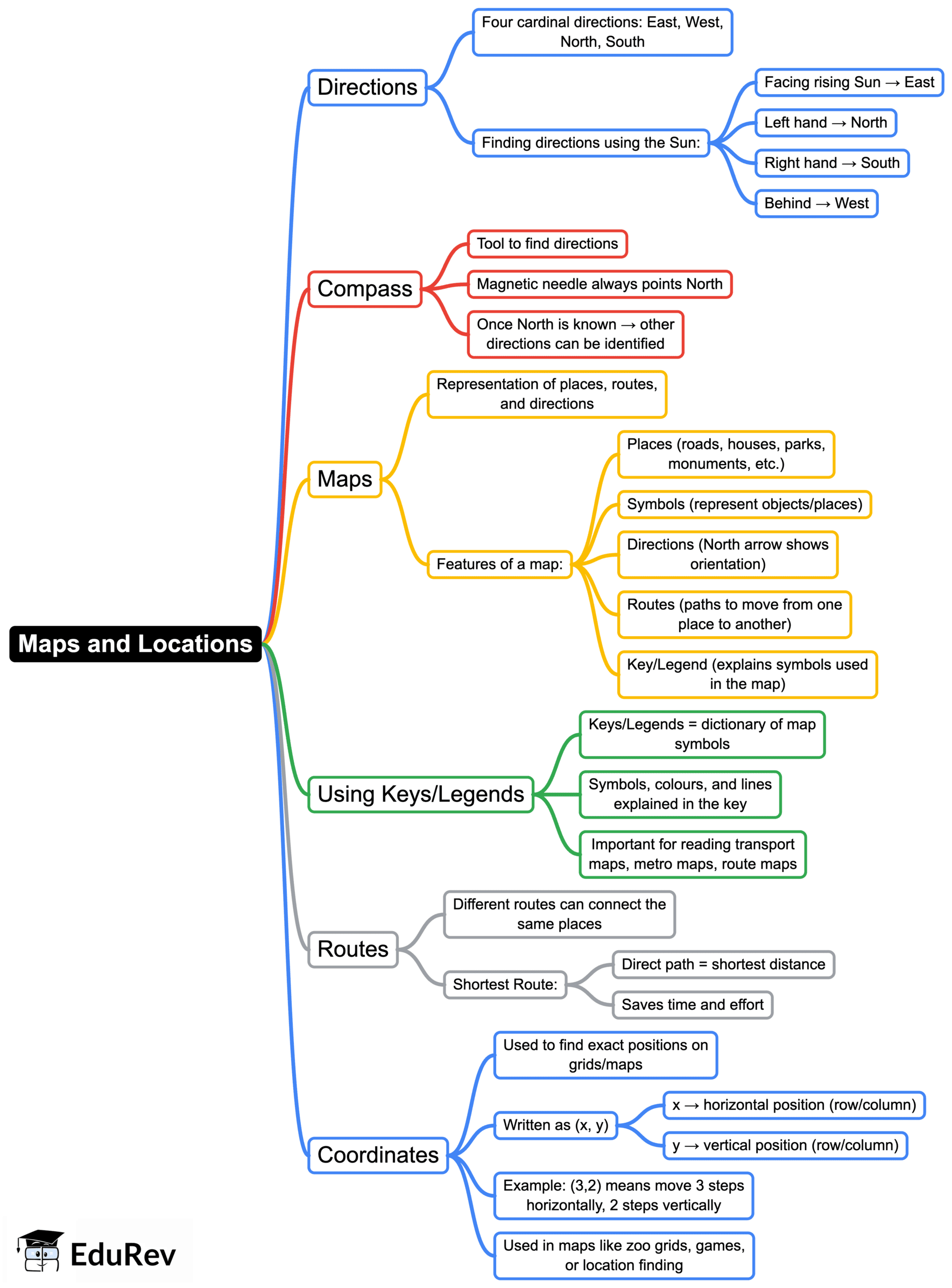
Class 5 Exam > Class 5 Notes > Mathematics (Maths Mela) Class 5 - New NCERT > Mind Map: Maps and Locations
Mind Map: Maps and Locations | Mathematics (Maths Mela) Class 5 - New NCERT PDF Download

The document Mind Map: Maps and Locations | Mathematics (Maths Mela) Class 5 - New NCERT is a part of the Class 5 Course Mathematics (Maths Mela) Class 5 - New NCERT.
All you need of Class 5 at this link: Class 5
|
35 videos|318 docs|7 tests
|
FAQs on Mind Map: Maps and Locations - Mathematics (Maths Mela) Class 5 - New NCERT
| 1. What are the different types of maps used to represent geographical locations? |  |
Ans. There are several types of maps used to represent geographical locations, including physical maps, political maps, topographic maps, thematic maps, and road maps. Physical maps show landforms and bodies of water, political maps depict boundaries and cities, topographic maps illustrate elevation and terrain features, thematic maps focus on specific themes like climate or population, and road maps provide detailed information about roads and highways.
| 2. How do scale and legend on a map help in understanding locations? |  |
Ans. The scale on a map indicates the relationship between distances on the map and actual distances on the ground. It helps users measure real-world distances accurately. The legend, or key, explains the symbols and colors used on the map, allowing users to interpret the different features shown, such as roads, rivers, or land use. Together, the scale and legend enhance the map's usability and clarity.
| 3. What is the importance of using a compass rose on a map? |  |
Ans. A compass rose is essential on a map as it indicates the cardinal directions: north, south, east, and west. Understanding these directions is crucial for navigation and orientation. It helps users determine which way to travel and allows them to correlate the map with the actual landscape. Knowing the orientation helps in understanding the location of places relative to one another.
| 4. Can you explain what coordinates are and how they are used in mapping? |  |
Ans. Coordinates are a set of numbers that define a specific point on the Earth's surface using a grid system. The most common system uses latitude and longitude. Latitude measures how far north or south a point is from the equator, while longitude measures how far east or west a point is from the Prime Meridian. Coordinates help in pinpointing exact locations on a map, making it easier to navigate and find places.
| 5. What role do maps play in history and exploration? |  |
Ans. Maps have played a crucial role in history and exploration by providing a visual representation of territories and helping explorers navigate unknown lands. They have been instrumental in trade, military campaigns, and colonization, allowing people to understand and claim new areas. Maps also reflect historical changes in political boundaries, cultural landscapes, and geographic knowledge over time, making them valuable historical documents.
Related Searches


