Water Resources and Irrigation - 1


Water is an essential natural resource required for irrigation, navigation, hydro-electricity generation, industry and domestic consumption. Irrigation is the major consumer of water resources. Most of India's rainfall and surface water potential occurs in regions receiving about 125 cm or more of rainfall annually, whereas the greatest need for irrigation is in regions with medium to low rainfall. Groundwater in much of western Rajasthan is saline or brackish. Several rivers face pollution risks from urban and industrial effluents. Rapid urban population growth has increased scarcity of drinking water in many large cities. A considerable part of rural India lacks a safe and reliable supply of potable water throughout the year.
 Water irrigation
 In the past, the severity of seasonal water scarcity in cities such as Madras (Chennai) prompted proposals for desalination of seawater despite its high cost. These situations emphasise the requirement for careful planning, conservation and equitable management of the available water resource.
Institutional Framework and Policy
The central agency responsible for coordination of water resource development, conservation and management is the Department of Irrigation, which has been designated the Ministry of Water Resources since 1985. The National Water Policy, 1987 recommends an integrated and multidisciplinary approach for planning, formulating and implementing water-resource projects. The policy assigns highest priority to drinking water, followed by irrigation, hydro-power, navigation, industrial and other uses, and emphasises flood management and water conservation.
Water Potential
If water stands to a depth of one metre over one hectare (10 000 m2), the volume is one hectare-metre, i.e. 10 000 m3. Taking into account normal river flows, India's gross water resources are estimated at about 187 million hectare-metres. Of this, approximately 69 million hectare-metres of surface water and about 43.2 million hectare-metres of groundwater are considered usable.
Utilisation of water has grown from roughly 17 million hectare-metres in 1950-51 to about 90 million hectare-metres (recent historical estimate), and was projected to increase to about 105-110 million hectare-metres by 2010-2020.
By present estimates the ultimate irrigation potential from conventional sources was projected to reach about 150 million hectares (an earlier estimate up to 1992 was 113 million hectares) by 2015 AD. This increase is attributed to higher groundwater availability (from 40 to 64 million hectare-metres). Proven inter-basin transfer technologies offer potential additional irrigation coverage of up to about 35 million hectares.
Need for Irrigation
Irrigation is the artificial application of water to crops to make up for rainfall deficit and to ensure timely and adequate moisture for crop growth. Rainfall is the natural source of irrigation, but in India rainfall is highly seasonal, uneven in distribution and sometimes fails. For these reasons other sources-rivers, springs and groundwater-are tapped to supplement rain for agriculture.
The main reasons for the importance of irrigation in India include:
- Uneven and uncertain rainfall: Rainfall varies widely across India. About 30% of the land receives less than 75 cm annually, about 60% receives between 75 cm and 185 cm, and the remaining 10% receives more than 185 cm. Nearly 75% of annual rainfall occurs in three to four months; the remaining months receive only about 25%. Heavy rains during the wet months mostly run off as surface flow and much less infiltrates; hence irrigation is indispensable for a reliable second crop in the dry season and to mitigate short dry spells during the monsoon.
- Fluctuating river flows: Himalayan rivers are largely snow-fed and have more sustained flow through the year, whereas peninsular rivers are mainly rain-fed and have substantial seasonal variation. Many peninsular rivers practically dry up in the hot season, so river water cannot reliably supply irrigation throughout the year.
- Limited additional cultivable land: Nearly half of India's land area is already under cultivation; only a small fraction remains available for bringing new land under plough. Increasing food production therefore largely depends on increasing yield and cropping intensity on existing land through irrigation.
- Different crop water requirements: A wide variety of crops grown across diverse soils and climates have differing water needs. Rabi (winter) crops, for example, receive only limited rain and generally require irrigation for successful cultivation. Sandy soils need more frequent watering than alluvial or black soils. Irrigation allows crops with higher water demand and multiple cropping on the same land.
Irrigation is central to national food security, employment generation (turning seasonal work into more stable year-round employment for rural populations), poverty reduction and lowering rural-to-urban migration. Given that a large share of India's workforce is engaged in agriculture, reliable irrigation increases cropping intensity and foodgrain production per hectare.
Irrigation support in India is provided through major and medium irrigation projects, command area development, and by utilising both surface and groundwater.
Systems and Methods of Irrigation
The system of irrigation comprises the design, equipment and techniques used to replenish soil moisture deficits by applying water. Choice of system depends on local meteorological, geological and physical conditions; therefore systems vary across the country.
The principal methods of irrigation practised in India are described below.
Surface Irrigation
 Surface irrigation
Surface irrigation applies water directly to the soil surface where it spreads by gravity over the land. Common surface methods include flooding from a ditch, check basins, ring and basin, border-strip and furrow irrigation. Fields are levelled before sowing to increase application efficiency; field layouts are often altered during tillage operations.
- Check-basin method: Widely practised in India; fields are divided into square or rectangular level basins (sizes varying from about 10 m2 to 100 m2 or more). Suitable for many soils and crops. On steep slopes basins are combined with terraces. A drawback is the presence of many ridges which reduce usable area and hinder mechanised interculture and harvesting.
- Ring and basin method: Mainly used for trees; water is applied to the immediate root zone around trees rather than the entire field, conserving water.
- Border-strip irrigation: The field is divided into long narrow strips with small ridges at the sides. It suits closely spaced row crops and pastures; larger flow rates are usually needed compared with other layouts.
- Furrow irrigation: Water is conveyed in furrows between ridges; the ridges' tops remain relatively dry, which is useful for row crops.
Subsoil Irrigation
Subsoil irrigation (or subsurface irrigation) applies water into deep field ditches down to an impervious layer so that water moves laterally and vertically by capillarity and maintains an artificial water table near the crop root zone. The created water table supplies moisture continuously to crop roots.
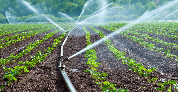
Sprinkler Irrigation
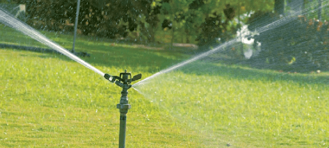 Sprinkler irrigation system
Sprinkler irrigation distributes water in a spray from above so that it falls over the crop and soil surface (similar to rainfall). It permits controlled application rates and uniform distribution.
- Advantages include efficient water use, uniformity, suitability on saline soils (helps leach salts), crop cooling during high temperatures and providing frost protection at near-freezing temperatures.
- Sprinklers can also apply pesticides, weedicides and fertilisers in solution.
- Typical equipment: pumping unit, pipes and sprinkler heads/nozzles.
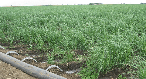
Drip Irrigation (Micro or Trickle Irrigation)
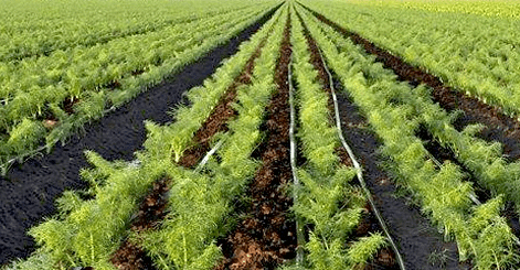 Drip irrigation system
Drip irrigation supplies water slowly and directly to the crop root zone through emitters or drip nozzles. It minimises losses from deep percolation and surface evaporation and reduces weed growth between rows.
- Drip is highly water-efficient, ideal for arid regions, orchards, and widely spaced crops; it also allows fertigation (applying fertiliser in solution).
- Originated and popularised in Israel; India has progressively adopted drip systems, though initial equipment and maintenance costs remain a constraint.
- Drip systems are often cheaper than sprinklers for orchards and perennial crops.
Well and Tube well Irrigation
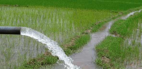 Tube-well irrigation system
Wells and tube wells abstract groundwater and currently account for a large proportion of India's irrigated area (about 40-41% of net irrigated area in historical estimates). Well irrigation enables irrigation even in low-rainfall areas provided groundwater reserves are sufficient.
Wells are common in soft alluvial plains where digging is easy; major well-irrigated regions include parts of Punjab-Haryana (excluding very dry tracts near Rajasthan), plains of Uttar Pradesh, Bihar and Gujarat, parts of the Narmada and Tapti valleys and Tamil Nadu. In contrast, much of the peninsular plateau has limited subsurface water and is unsuitable for wells.
Groundwater problems include salinity (e.g. parts of Rajasthan, Haryana, Punjab, Gujarat and adjacent areas) and deep water tables (depths >50 m in south Haryana and western Rajasthan) which make lifting water costly. Various lifts are used to extract well water: traditional methods such as the mot and reht persist in places, while power-driven pumps are now widespread. A power pump can irrigate up to about 2 hectares per day compared with about 0.2 hectare by a reht and can lift water from greater depths.
Well irrigation percentages vary by state: over three-quarters of net irrigated area in Gujarat is by wells; about 50-55% in Maharashtra, Rajasthan, Uttar Pradesh and Punjab; 30-40% in Haryana, Madhya Pradesh and Tamil Nadu; and below 30% in Bihar, Karnataka, Odisha and Andhra Pradesh.
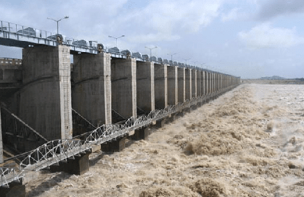
Canal Irrigation
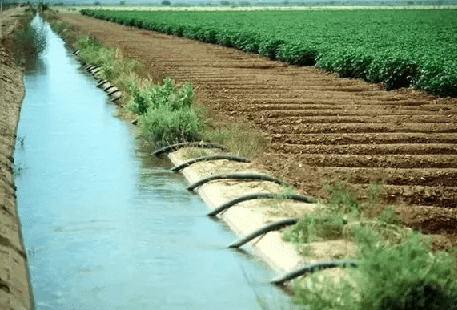 Canal irrigation
Canal irrigation is a principal method due to its relative cheapness and the convenience and reliability of distribution where surface water is adequate. India has one of the world's largest canal networks (stretching over 100 000 km historically), and canals account for a substantial share of net irrigated area.
Requirements for canal irrigation include an adequate perennial source of water (rivers or reservoirs), low relief with deep fertile soft soils and a large contiguous command area. Consequently, canal irrigation is concentrated in the northern plains, coastal lowlands, southern deltas and broad valley plains of the Indian plateau. Canal construction over rocky uneven terrain is expensive and of limited utility, hence other methods dominate the plateau regions.
Canals in India fall into two main types:
- Inundation canals: Taken off directly from rivers without a regulating structure (barrage or dam) at their head. They utilise excess flood water and generally provide irrigation mainly during the monsoon season.
- Perennial canals: Taken from perennial rivers or reservoirs with barrages or regulating structures, providing flow throughout the year. Most canal systems feeding the great northern plains are perennial, while peninsular canal systems require large dams and reservoirs to supply year-round water.
Nearly half of India's canal irrigated area is concentrated in Uttar Pradesh, Punjab, Haryana and Andhra Pradesh, with the rest distributed across West Bengal, Tamil Nadu, Bihar, Rajasthan, Madhya Pradesh, Karnataka, Assam, Maharashtra, Odisha, Jammu & Kashmir and Gujarat in descending order of importance.
Drawbacks of Canal Irrigation
Canal irrigation, especially through unlined channels, can lead to problems such as:
- Seepage and waterlogging: Water soaks into the ground from unlined canals and distributaries, raising the water-table. Where the water-table reaches the surface, cultivable land can become waterlogged and swampy.
- Soil salinisation and alkali development: Capillary action from a raised water-table can bring dissolved salts to the surface, making soils alkaline and unproductive.
- Spread of waterlogging: Initially localised near canals, waterlogging and salinisation can gradually affect neighbouring areas, damaging roads, buildings and groundwater quality for drinking.
- Crop damage: Saturated soils reduce crop yields and standing water after rainfall (in the absence of proper drainage) can remain for long periods and destroy crops and stored produce.
Lining canals with bricks, concrete or other impermeable materials reduces seepage and alleviates some of these problems.
Tank Irrigation
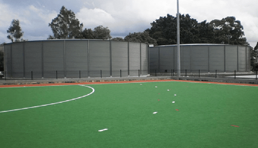 Rhino water tank irrigation
In the rocky, uneven plateau areas of peninsular India-where rivers are seasonal and soils are often less permeable-tank irrigation (small reservoirs or tanks formed by bunding seasonal streams) has been the most feasible and widely practised method. Tank systems historically account for about 12% of India's irrigated area.
Tank irrigation is suitable in peninsular regions for several reasons:
- Rocky land and less porous soils reduce groundwater recharge, so wells are less effective.
- Digging long canals on rocky terrain is expensive and peninsular rivers are seasonal; tanks can store monsoon runoff locally.
- Uneven rocky terrain facilitates construction of tanks and reduces seepage.
- Scattered rural populations benefit from decentralised tanks that serve local needs.
Main drawbacks of tank irrigation include:
- Rapid siltation of tanks, requiring regular desilting for sustained use.
- Tanks often occupy fertile land because shallow tanks spread water over a wide area.
- High evaporation losses from large surface areas of shallow water.
- Irregular and non-perennial supply; tank irrigation is less reliable than well or tube-well irrigation.
Andhra Pradesh (Telangana and Andhra regions) has historically led in tank irrigation, followed by Tamil Nadu, Karnataka, Odisha and Maharashtra.
Irrigation Distribution
Irrigation is concentrated in the great plains and the east coastal lowlands where net sown area and availability of surface and subsurface water are greater than upland and plateau regions. Over one-fifth of India's net irrigated area lies in Uttar Pradesh, followed by Punjab, Haryana, Andhra Pradesh, Tamil Nadu, Bihar and Rajasthan.
Irrigation predominates in the northern plains because:
- Alluvial soils are fertile and provide good returns for canal investments.
- The soft, flat land makes canal and well construction relatively easy and economical.
- Groundwater levels are generally shallow, making well irrigation viable.
- Rivers supplying the plains are often perennial and can feed canals year-round.
Irrigation Projects: Classification
Irrigation projects are commonly classified by the Culturable Command Area (CCA) they serve:
- Major irrigation projects: CCA greater than 10 000 hectares.
- Medium irrigation projects: CCA between 2 000 and 10 000 hectares.
- Minor irrigation projects: CCA less than 2 000 hectares.
Major and medium projects typically harness surface water (rivers, reservoirs), while minor projects mainly exploit groundwater (tube-wells, dug wells, tanks and small lift schemes).
Major versus Minor Irrigation Projects - Comparative Issues
Major irrigation projects, often devised as multi-purpose river-valley schemes, can provide irrigation on a large scale and offer additional services such as flood control, navigation and hydropower generation. However, several practical and economic limitations have been observed:
- Major and medium works have sometimes yielded lower than expected returns-in both agricultural yield and financial terms-relative to their large investments.
- Although hydropower is renewable and comparatively clean, hydro projects often experience long gestation periods (typically 5-12 years) and frequent commissioning delays; thermal units can have shorter gestation (about five years). Historical comparative cost figures showed generation cost disparities (these figures vary with time and context): while thermal costs have been quoted lower, actual costs depend on project specifics, time of construction and financing.
- Flood control benefits have been limited in practice in many cases; reservoir siltation has been higher than estimated, reducing storage capacity and the effective life of reservoirs, and limiting their ability to attenuate floods.
- Large projects require substantial capital, long completion periods (often 15-20 years or more), and extensive administrative structures, which can lead to cost overruns and implementation inefficiencies.
- Seepage losses from unlined distributaries and channels can be substantial-sometimes reported as high as 50% of water released-leading to inefficiency and waterlogging in command areas.
- Environmental and social costs: large dams and river-valley projects can cause significant ecological impacts, displacement of communities, submergence of land, changes in riverine ecology, and deterioration of agricultural lands in command areas due to waterlogging and salinity.
In contrast, minor irrigation schemes generally require smaller investment, have shorter gestation periods, and are often implemented by private farmers using wells, tube-wells and pump sets. Minor schemes tend to avoid creation of large distributary networks, thereby reducing land loss and problems of waterlogging. Farmer control over small systems often incentivises efficient water use. Consequently, many experts advocate emphasis on decentralised minor irrigation and groundwater development alongside carefully planned major projects for balanced water management.
 Major and medium irrigation projects
Command Area Development Programme (CADP)
Command area denotes the total land area intended to be irrigated and served with water (including domestic uses) by a specific irrigation project.
To address under-utilisation of created irrigation potential-particularly in major and medium projects-the Command Area Development Programme was launched at the start of the Fifth Plan (1974-75) as a centrally-sponsored scheme. CADP is an integrated area development programme intended to ensure faster and better utilisation of irrigation potential in project command areas and to increase crop productivity in those areas.
The programme broadly covers the following components:
- On-farm development: Surveying and planning of watercourses, land levelling, adoption of rotational water distribution (warabandi) for equitable water sharing in command areas, shaping and reclamation of degraded land, and construction of field channels linked to distributaries.
- Afforestation and pasture development: Canal-side and road-side plantations, block plantations near new settlements, sand-dune stabilisation and development of pastures on cultivable wasteland to reduce erosion and improve local ecology.
- Communication and civic amenities: Construction and improvement of roads to link settlements and markets, provision of drinking water, market infrastructure, and deployment of communication systems (for example wireless networks historically mentioned) to facilitate timely and equitable irrigation deliveries, particularly to tail-end users.
- Availability of modern agricultural inputs and extension: Ensuring supply of high-yielding variety (HYV) seeds, chemical fertilisers, insecticides and pesticides; and providing farmer training, agricultural extension and technical assistance to improve crop yields and input use efficiency.
At its inception in 1974-75 CADP covered 60 irrigation projects with a cultivable command area of about 15 million hectares. By 1998-99 the programme covered 217 projects with a cultivable command area near 21.95 million hectares across 23 states and two union territories; CADP activities were overseen by multiple Command Area Development Authorities.
Farmer participation in water management and CADP implementation was emphasised from the outset because local involvement is critical to equitable water distribution, maintenance of on-farm works and achievement of CADP objectives.
Additional Concepts and Practical Notes
Hectare-metre: unit of water volume used in irrigation planning; 1 hectare-metre = 10 000 m3.
Cropping intensity (useful concept): the ratio of gross cropped area to net sown area expressed as a percentage. Reliable irrigation raises cropping intensity by enabling multiple crops per year on the same piece of land.
Warabandi: a rotational water distribution schedule used in many canal command areas where each farmer receives water at a fixed time and frequency. Warabandi aims to ensure predictability and equity in surface water distribution.
Water-use efficiency and management: Effective water resource management requires a mix of infrastructure (lining of canals, efficient conveyance), technology (sprinkler and drip systems where appropriate), demand management (crop selection, scheduling, farmer incentives), and institutional measures (water pricing, participatory irrigation management) to reduce losses and improve productivity per unit of water.
Conclusion
India's water resources must be used judiciously to meet competing demands for drinking water, irrigation, power, industry and environment. A balanced strategy combines large multipurpose projects where appropriate, with strong emphasis on minor and decentralised irrigation, groundwater management, command area development, conservation measures and farmer participation. Appropriate selection of irrigation methods (surface, sprinkler, drip, wells, tanks and canals) according to local hydro-meteorological and soil conditions, together with careful management, can enhance agricultural productivity and long-term sustainability of water resources in the country.
FAQs on Water Resources and Irrigation - 1
| 1. What are the different sources of water for irrigation? |  |
| 2. How is water quality important for irrigation purposes? | |
| 3. What are some common irrigation methods used in agriculture? | |
| 4. How can farmers conserve water in irrigation practices? | |
| 5. How does climate change impact water resources and irrigation? | |


