Class 9 Geography Chapter 2 Extra Question Answers - Physical Features of India

Q51. Name the coastal strip of Peninsular plateau lying along Arabian sea. Describe any four features of it.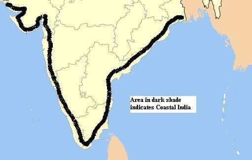 Fig: coastal strip
Ans: The coastal strip along the Arabian Sea is known as the Western coastal strip. Its features include:
- Location: It lies between the Western Ghats and the Arabian Sea.
- Geography: This area is a narrow plain divided into three sections.
- Regions: The northern part is called Konkan, the central section is known as Kannad Plain, and the southern stretch is referred to as the Malabar coast.
Q52. Name the group of Indian islands that is of coral origin. Mention its capital and the island in the group that has a bird sanctuary. Or Which group of island is located in Arabian sea? Write any four features of these islands. What is orographic rainfall? Which part of the Peninsular plateau causes orographic rainfall?
Ans: Indian Islands of Coral Origin
- The Lakshadweep islands in the Arabian Sea are of coral origin, formed from coral deposits on the sea bed.
- Kavaratti Island serves as the capital of Lakshadweep.
- Pitti Island, which is uninhabited, features a bird sanctuary.
- These islands are located near the Malabar coast of Kerala.
- They boast a rich diversity of flora and fauna.
Orographic Rainfall
- Orographic rainfall occurs when moist air is lifted over mountains, cooling and condensing into rain.
- The Western Ghats of the Peninsular plateau are a significant area where orographic rainfall takes place.
Q53. Compare the actions of converging and diverging tectonic plates. 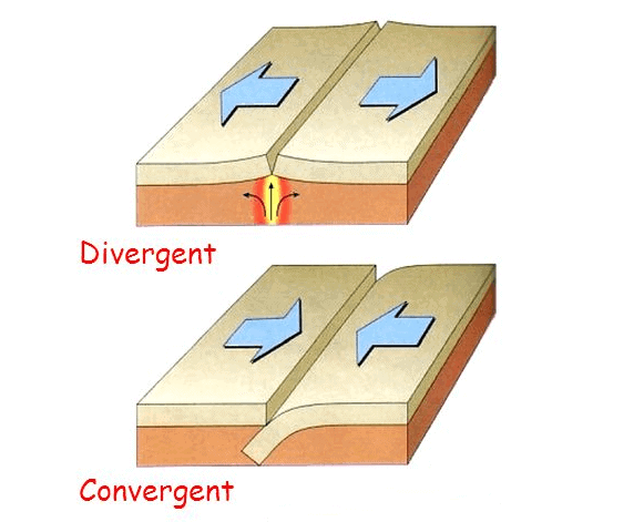 Fig: convergent and divergent plates
Ans: Converging tectonic plates lead to the destruction of the Earth's crust. One plate dives beneath another, recycling material back into the Earth. This process often results in:
- Mountain formation: For example, the Himalayas were created by the collision of the Eurasian and Indo-Australian plates.
- Volcanic activity: Volcanoes frequently form at these boundaries due to the melting of the subducted plate.
Diverging tectonic plates, on the other hand, create new crust as the plates move apart. This process is characterised by:
- Ocean formation: As plates separate, oceans can form and expand.
- Rift valleys: On land, this separation results in rifts, breaking the land into distinct masses.
- Mid-Atlantic Ridge: An example of a divergent boundary is found between the North American and Eurasian plates, creating a ridge in the Atlantic Ocean.
Q54. 'The Indian landmass shows a great physical contrast.' Explain this statement.
Ans: India's landmass exhibits significant physical contrasts due to its diverse geological features:
- The Peninsular Plateau in the south is an ancient landmass, approximately 65 million years old.
- In contrast, the Himalayas in the north are much younger, formed around 25 million years ago.
- Tectonically, the Himalayas and the Northern Plains are considered unstable zones, while the Peninsular Plateau is stable.
- Over millions of years, weathering has accentuated these contrasts:
- The Himalayas consist of sedimentary and metamorphic rocks.
- The Northern Plains are primarily made of alluvial deposits.
- The Peninsular Plateau is composed of igneous and metamorphic rocks.
- Geographically, the Himalayas feature high peaks and steep valleys, whereas the Deccan region has gently rising hills and wide valleys.
These variations illustrate the remarkable physical contrasts within the Indian landmass.
Q55. Describe the river systems of the Northern plains, giving their main features.
Ans: The Northern plains of India are shaped by three major river systems:
- Brahmaputra System:
- Located in Arunachal Pradesh and Assam.
- Tributaries include the Dibang, Lohit, Raidak, and Sankosh.
- Ganga System:
- Extends between the Ghaggar and Teesta rivers.
- Covers Haryana, Delhi, Uttar Pradesh, Bihar, part of Jharkhand, and West Bengal.
- Tributaries include the Yamuna, Gomati, Ghaghara, Son, Gandak, and Kosi.
- Indus System:
- A significant portion lies in Pakistan.
- Includes tributaries such as the Jhelum, Chenab, Ravi, Beas, and Satluj.
- This area is characterised by doabs, regions between two rivers.
The Northern plains are primarily composed of alluvial soil, making them fertile and suitable for agriculture. They span approximately 7 lakh square kilometres and are densely populated due to their rich resources.
Q56. Describe the coastal plains, giving their main features. Or Describe any five features of coastal plains of India.
Ans: The coastal plains of India are narrow strips of land along the country's coastline, bordered by the Arabian Sea to the west and the Bay of Bengal to the east. Here are their main features:
- Geographical Division: The western coastal plain is divided into three regions:
- Konkan in the north
- Kannad in the centre
- Malabar in the south
- Eastern Coastal Plain: This is broader than the western plain, featuring:
- Northern Circar in the north
- Coromandel Coast in the south
- Width: The western plain is approximately 50 km wide, while the eastern plain ranges from 100 to 130 km.
- River Deltas: Major rivers like the Mahanadi, Godavari, Krishna, and Kaveri form extensive deltas on the eastern coast.
- Estuaries: On the western coast, the Narmada and Tapi rivers create significant estuaries.
Q57. Describe the islands of India. Or Give a brief description of two islands of India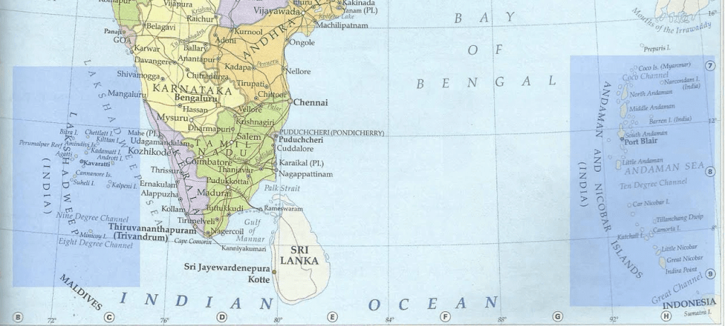
Ans: India is home to two significant groups of islands:
- Lakshadweep:
- Located in the Arabian Sea, near the Malabar coast of Kerala.
- Comprises a small group of coral islands, covering an area of only 32 square kilometres.
- Kavaratti is the administrative headquarters of Lakshadweep.
- Known for its rich diversity of flora and fauna, including the uninhabited Pitti Island, which has a bird sanctuary.
- Andaman and Nicobar Islands:
- Located in the Bay of Bengal, these islands form an elongated chain.
- Cover a larger area of 8,249 square kilometres.
- Home to the only active volcano in India, situated on Barren Island.
- Indira Point, the southernmost point of India, was submerged during the 2004 tsunami.
- These islands feature dense forests and experience an equatorial climate.
58) Distinguish between
(i) Converging and diverging tectonic plates.
(ii) Bhangar and Khadar.
(iii) Western Ghats and Eastern Ghats.
Answer: (i) Difference between converging plates and diverging plates
- Converging Tectonic PlatesDiverging Tectonic PlatesThe plates that come towards each other and form a convergent boundary.The plates that move away from each other and form divergent boundary
- (ii) Differences between Bhangar and KhadarBhangarKhadar(a)Bhangar is old alluvial soil.Khadar is new alluvial soil.(b)Bhangar soil is found away from the river.Khadar is found near the river basin.(c) Bhangar is less fertile.Khadar is very fertile.(d) It contains calcareous deposits locally known as Kankar.This soil is fine grained.(e) The soil is dark in colour.The soil is light in colour.
- (iii) Difference between the Eastern Ghats and the Western Ghats The Eastern ChatsThe Western Ghats(a) The Eastern Ghats mark the Eastern edge of the Deccan plateau.The Western Ghats mark the Western edge of the Deccan plateau.(b) They are discontinuous and irregular and dissected by rivers draining into the Bay of Bengal.They are continuous and can be crossed through passes only.(c) They lie parallel to the Eastern coast along the Bay of Bengal.The Western Ghats lie parallel to the Western coast along the Arabian sea.(d) The highest peak is Mahendragiri with a height of 1501 metres.The highest peak is Anai Mudi with a height of 2695 metres.(e) Their average height is 600 metres.Their average height is 1600 metres.
Q59. Which are the major physiographic divisions of India? Contrast the relief of the Himalayan region with that of the Peninsular plateau.
Ans: The major physiographic divisions of India include:
- The Himalayan Mountains
- The Northern Plains
- The Peninsular Plateau
- The Indian Desert
- The Coastal Plains
- The Islands
Contrast between the Himalayan region and the Peninsular Plateau:The Himalayan Region:
- Formed by the collision of the Indo-Australian plate with the Eurasian plate.
- Composed mainly of sedimentary rocks.
- Considered an unstable zone due to ongoing geological activity.
- Represents the most recent landforms in India.
- Average height is about 6000 metres.
- Rich in water resources and forests.
- Home to many perennial rivers that originate in the mountains.
The Peninsular Plateau:
- Formed from the breaking and drifting of Gondwana land.
- Contains primarily igneous and metamorphic rocks.
- Considered one of the most stable land blocks.
- Includes the ancient Deccan Plateau.
- Average height is around 900 metres.
- A significant storehouse of minerals.
- Rivers in this region are typically seasonal.
Q60. Describe how the Himalayas were formed.
Ans: The Himalayas were formed through a series of geological processes:
- Gondwana Land: The oldest part of India, known as the peninsular region, was once part of a larger landmass called Gondwana, which included India, Australia, Africa, and South America.
- Plate Tectonics: Convectional currents in the Earth's mantle caused the crust to split, leading to the movement of the Indo-Australian plate northwards after separating from Gondwana.
- Collision: This northward drift resulted in a collision with the larger Eurasian plate.
- Mountain Formation: The collision folded the sedimentary rocks accumulated in the Tethys geosyncline, forming the Himalayas and the mountain systems of West Asia.
- Youthful Topography: The Himalayas are characterised by their high peaks, deep valleys, and fast-flowing rivers, representing a relatively young geological structure.
 Fig: Gondwana land
Q61. Give an account of the Northern plains of India. Or Describe how the Northern plains were formed. Also state three characteristics of Northern plain. Or Describe any three features of Northern plains. Or Describe Northern plains of India.
Ans: (a) The Himalayan uplift out of the Tethys sea and subsidence of the Northern flank of the Peninsular plateau resulted in the formation of a large basin. In course of time, this depression gradually got filled with deposition of sediments from rivers flowing from the mountains in the North and led to formation of the fertile Northern plains.
(b) They spread over an area of 7 lakh square km. The plains are about 2400 km long and 240-230 km broad.
(c) It is a densely populated and an intensively cultivated area.
(d) With its adequate water supply and favourable climate, it is agriculturally a very productive part of India.
(e) The Northern plains are broadly divided into 3 sections.
(f) The Western part of the Northern plains is called the Punjab plain, formed by the Indus and its tributaries.
(g) The Ganga Plain extends between the Ghaggar and the Tista rivers, spread over the states of Haryana, Delhi, UP, Bihar and West Bengal.
(h) The Brahmaputra plain lies to the East of the Ganga plains. It covers the areas of Asom and Arunachal Pradesh.
Q62. How are coral reefs formed? Name two examples of coral reefs. Or What are corals ? Name and describe the island which is of coral origin. Or Write a short note on 'corals'.
Ans: Coral polyps are tiny, short-lived organisms that live in colonies. They thrive in shallow, warm, and mud-free waters. These polyps secrete calcium carbonate, which forms their skeletons. Over time, these skeletons accumulate and create coral reefs. There are three main types of coral reefs:
- Barrier reefs
- Fringing reefs
- Atolls
The Great Barrier Reef in Australia is a notable example of a barrier reef. Atolls are typically circular or horseshoe-shaped coral formations. In India, the Lakshadweep Islands are of coral origin, covering an area of just 32 square kilometres. Kavaratti Island serves as the administrative headquarters of Lakshadweep. This island group is rich in biodiversity, featuring a variety of flora and fauna. Additionally, Pitti Island, which is uninhabited, hosts a bird sanctuary. 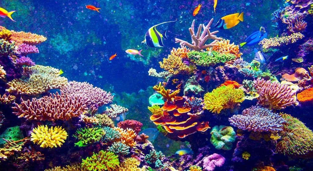 Fig: Coral reef
Q63. Name the two coastal strips that flank the Peninsular plateau. Distinguish the two by giving two characteristics of each.
Ans: The two coastal strips that flank the Peninsular plateau are:
- Western Coastal Strip
- Located between the Western Ghats and the Arabian Sea.
- Narrow plain divided into three sections:
- Konkan Coast (Northern part)
- Kannad Plain (Central part)
- Malabar Coast (Southern part)
- Rivers in this region are short and fast-flowing, with major rivers like Narmada and Tapi.
- Eastern Coastal Strip
- Situated between the Eastern Ghats and the Bay of Bengal.
- Broader than the Western Coastal Strip.
- Divided into two main sections:
- Northern Circar (Northern part)
- Coromandel Coast (Southern part)
- Rivers here are larger and broader, forming deltas, with major rivers including Mahanadi, Godavari, Krishna, and Kaveri.
Q64. Describe about the formation of the peninsular Plateau. Write any four of its distinct features. Or Describe any five features of Central Highlands of India. Or Describe any three distinct features of the Peninsular plateau of India.
Ans: The Peninsular Plateau is a tableland formed from ancient crystalline, igneous, and metamorphic rocks. It originated from the breaking and drifting of the Gondwana land, making it part of the oldest landmass on Earth. This plateau features broad, shallow valleys and rounded hills and is divided into two main sections: the Central Highlands and the Deccan Plateau.
Central Highlands
- The Central Highlands lie north of the Narmada River and cover a significant area of the Malwa Plateau.
- It is bordered by the Vindhyan range to the south and the Aravalis to the northwest, gradually merging with the sandy and rocky desert of Rajasthan.
- Rivers such as the Chambal, Sind, Betwa, and Ken flow from southwest to northeast, indicating the region's slope.
- The Central Highlands are wider in the west and narrower in the east.
- Eastward extensions are known as Bundelkhand and Baghelkhand, while the Chhotanagpur Plateau further east is drained by the Damodar River.
Deccan Plateau
- This triangular plateau lies south of the Narmada River, with the Satpura mountain range marking its northern boundary.
- It is separated from the northeastern hills, such as the Garo, Khasi, and Jaintia, by a geological fault.
- The Western Ghats create orographic rain by forcing moist monsoon winds to rise along their slopes.
- The Deccan Traps, part of this plateau, contain black soil of volcanic origin.
Q65. Give the brief explanation about important features of Ganga plain. Or Write an account on the relief of Ganga plain.
Ans: Important features of the Ganga plain:
- The Ganga plain is located in the middle of the Northern plains of India.
- It stretches between the Ghaggar and Teesta rivers.
- This plain covers parts of several states, including Haryana, Delhi, Uttar Pradesh, Bihar, and parts of Jharkhand and West Bengal.
- The Ganga plain is primarily drained eastward by the Ganga and its major tributaries, such as the Yamuna, Ghaghara, Gandak, Kosi, and Son.
- This area has a gentle eastward slope and is known for its highly fertile soils, making it crucial for agriculture.
- The Ganga plain is densely populated and features several major cities along its riverbanks.
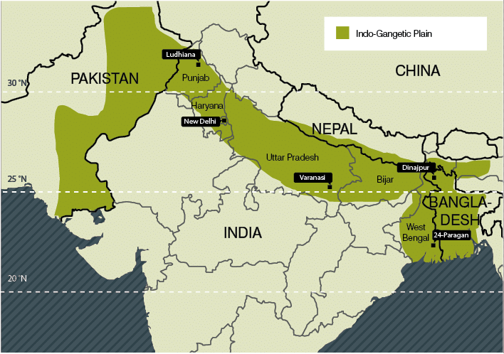 Fig: Ganga plain
|
55 videos|637 docs|79 tests
|
FAQs on Class 9 Geography Chapter 2 Extra Question Answers - Physical Features of India
| 1. What are the major physical features of India? |  |
| 2. How does the Himalayan Mountain Range affect the climate of India? | |
| 3. What are the characteristics of the Indo-Gangetic Plains? | |
| 4. How does the Deccan Plateau differ from the Indo-Gangetic Plains? | |
| 5. What is the significance of the Thar Desert in India? | |


Exam
,shortcuts and tricks
,Class 9 Geography Chapter 2 Extra Question Answers - Physical Features of India
,Previous Year Questions with Solutions
,Viva Questions
,practice quizzes
,Class 9 Geography Chapter 2 Extra Question Answers - Physical Features of India
,Class 9 Geography Chapter 2 Extra Question Answers - Physical Features of India
,Objective type Questions
,Important questions
,video lectures
,MCQs
,past year papers
,mock tests for examination
,Semester Notes
,Summary
,ppt
,Sample Paper
,study material
,Free
,Extra Questions
;


Extra Question & Answers (Part - 2) - Physical Features of India Free PDF Download
Importance of Extra Question & Answers (Part - 2) - Physical Features of India
Extra Question & Answers (Part - 2) - Physical Features of India Notes
Extra Question & Answers (Part - 2) - Physical Features of India Class 9 Questions
Study Extra Question & Answers (Part - 2) - Physical Features of India on the App
|
© EduRev
|
Education Revolution
|


|


