Class 9 Geography Chapter 2 Extra Question Answers - Physical Features of India

66) Name three longitudinal divisions of Himalayas. State one characteristic feature of each. Or Name the three parallel ranges of Himalayas. Write one main feature of each. Or Give two characteristics of each of the following
(1) The Great Himalayas
(2) The middle Himalayas.
Answer: The parallel range of Himalayas are Himadri, Himachal and Shiwaliks.
(i) Himadri
(a)The Northern most range is known as the Great or inner Himalayas.
(b) It is the highest range with an average height of 6000 metres.
(c) It contains all prominent Himalayan peaks.
(d) The folds of Great Himalayas are asymmetrical in nature. The core of this part of Himalayas is composed of granite.
(ii) Himachal
(a) It is known as Himachal or lesser Himalaya.
(b) It lies to the South of Himadri and forms the most ruggged mountain system.
(c) The altitude varies between 3700 and 4500 metres and the average width is 50 km.
(d) This range consist of the famous valley of Kashmir, the Kangra and Kullu valley in Himachal Pradesh.
(iii) Shiwaliks
(a) The outermost range of the Himalayas is called Shiwaliks.
(b) They extend over a width of 10-50 kms and have an altitude varying between 900 and 1100 metres.
(c) These ranges are composed of unconsolidated sediments brought down by rivers from the main Himalayan ranges located further North.
(d) These valleys are covered with thick gravel and alluvium.
67) What geological process formed the present landforms of India?
Answer: The movements of tectonic plates during different geological periods has formed the present landforms of India. Besides this process, other processes like weathering, erosion and deposition have been continuously modifying the relief.
68) What types of actions can happen when two tectonic plates collide with each other?
Answer: When two tectonic plates collide with each other, this can lead to folding, faulting and volcanic activity.
69) Which plateaus lies between the Aravali and the Vindhyan ranges?
Answer: Malwa plateau lies between the Aravali and the Vindhyan ranges.
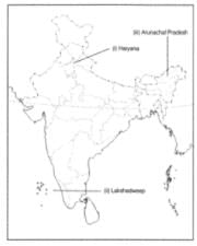
70) Name of the island group of India having coral Vindhyan.
Answer: Lakshadweep islands are composed of small coral islands.
71) Name the three prominent sub-ranges of the Himachal Himalayas.
Answer:The sub-ranges are named Pir Panjal, Dhaula Dhar and Mahabharat.
72) Name five hill stations in the Himalayas.
Answer:These can be any of the following Pahalgam, Srinagar, Gulmarg (in Jammu and Kashmir), Shimla, Kullu, Manali (in Himachal Pradesh), Mussoorie, Nainital, Ranikhet (in Uttarakhand) and Darjeeling (in West Bengal), besides many others.
73) Find out the name of the states where the highest peaks are located.
Answer: States where highest peaks are located are
(a) Jammu and Kashmir (Nanga Parbat)
(b) Sikkim (Kanchenjunga)
(c) Uttarakhand (Nanda Devi, Kamet)
74) Find out the location of Mussoorie, Nainital, Ranikhet from your atlas and also name the state where they are located.
Answer: All the three towns are in the state of Uttarakhand in the range called lesser Himalaya or Himachal.
75) What is the Bhabar?
Answer:Bhabar is a narrow belt of land about 8 to 16 km wide and covered with pebbles deposited by the rivers and lying parallel to the slopes of the Shiwaliks.
76) Write short notes on the following
(i) The Indian Desert
(ii) The Central Highlands
(iii) The Island groups of India
Answer:
(i) The Indian Desert
(a) The Indian desert lies towards the Western margin of the Aravali hills.
(b) It is an undulating sandy plain covered with sand dunes.
(c) This region receives very low rainfall, below 150 mm per year.
(d) It has arid climate with low vegetation cover.
(e) Streams appear during the rainy season. Soon they disappear into the sand as they do not have enough water to reach the sea.
(f) Luni is the only large river in this region.
(g) Barchans (Crescent shaped dunes) cover the larger areas but longitudinal dunes become more prominent near the Indo-Pakistan border.
(h) The Indian desert is popularly known as the Thar desert.
(ii) The Central Highlands
(a) The Peninsular plateau consists of two broad divisions, namely the Central Highlands and the Deccan plateau.
(b) The part of the Peninsular plateau lying to the North of the Narmada river covering a major area of the Malwa plateau is known as the Central Highlands.
(c) They are bound by the Vindhya range from the South and by the Aravali hills from the North-West.
(d) The further Westward extension gradually merges with the sandy and rocky desert of Rajasthan.
(e) The flow of the rivers draining this region, namely the Chambal, Sind, Betwa and Ken is from South-West to North-East.
(f) The Central Highlands are wider in the West, but narrower in the East.
(g) The Eastward extensions of this plateau are locally known as 'Bundelkhand' and Baghelkhand.
(h) The Chhotanagpur plateau marks the further Eastward extension of the plateau and is drained by the Damodar river.
(iii) The Island Groups of India India has two groups of islands namely, the Lakshadweep group and the Andaman and Nicobar group.
(a) The Lakshadweep islands group lie close to the Malabar coast of Kerala. These are composed of small coral islands. Earlier, they were known as Laccadive, Minicoy and Amindive. In 1973, these were renamed as Lakshadweep. They cover a small area of 32 square km. Kavaratti is the administrative headquarters of Lakshadweep. This island group has a great diversity of flora and fauna. The Pitti island, which is uninhabited, has a bird sanctuary.
(b) Andaman and Nicobar Islands The elongated chain of islands located in the Bay of Bengal extending from North to South are the Andaman and Nicobar islands. They are bigger in size and more numerous and scattered than the Lakshadweep islands. The entire group of islands is divided into two broad categories, the Andaman in the North and Nicobar in the South. It is believed that these islands are an elevated portion of the submarine mountains. These islands are of great strategic importance for the country. They have great diversity of flora and fauna. These islands lie close to the equator, experience equatorial climate and have thick forest cover.
77) Two features are shown on the outline map of India. Identify these features and write their names on the lines marked on the map.
(i) A mountain range between the Narmada and Tapi rivers.
(ii) The highest peak in the Cardamom hills.
(b) On the map, locate and label the following with appropriate symbols
1. A mountain range lying mostly in Rajasthan.
2. A plateau lying mostly in Jharkhand and Chhattisgarh.
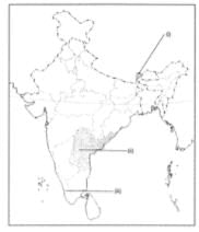
Answer: (a)
(i). Satpura Range
(ii). Anaimudi
(b) 1. Aravali Range
2. Chhotanagpur Plateau
78) (a) Two features are shown on the outline map of India. Identify these features and write their names on the lines marked on the map.
(i) A physiographic region where Barchans are found.
(ii) This region is part of the Deccan plateau.
(b) On the map, locate and label the following with appropriate symbols
1. A range of hills in Nagaland bordering Myanmar.
2. The highest mountain peak in the Karakoram Range.

Answer: (a) (i)Indian desert
(ii) Eastern Ghats
(b) 1. Naga hills
2.

79) (a)Two features are shown on the outline map of India. Identify these features and write their names on the hues marked on the map.
(i)The Southernmost point on the Indian mainland.
(ii) The highest peak in the Himalayas in India.
(b) On the map, locate and label the following with appropriate symbols
1. A region of the Peninsular plateau which is triangular in shape.
2. The Northern part of the Eastern Coastal plain.
Answer: (a) (i). Kanyakumari
(ii). Kanchenjunga
(b) 1. Deccan plateau
2. Northern Circar
80) How can you say that India is a vast country with varied landforms?
Answer:Our country has practically all major physical features of the earth i.e. mountains, plains, deserts, plateaus and islands.
81) Which factors modified the relief features of India?
Answer: Besides geological formations, a number of processes such as weathering, erosion and deposition have created and modified the relief to its present form.
82) What does convergent and divergent boundary mean?
Answer:While some plates come towards each other and form convergent boundary. Some plates move away from each other and form divergent boundary.
83) How is transform boundary different from convergent and divergent boundaries?
Answer: In the event of two plates coming together they may either collide and crumble, or one may slide under the other. At times they may also move horizontally past each other and form transform boundary.
84) What is the role of these tectonic movements?
Answer:The movement of these plates have changed the position and size of the continents over millions of years. Such movements have also influenced the evolution of the present landform features of India.
85) What was Gondwana land?
Answer:The Gondwana land included India, Australia, South Africa, South America and Antarctica as one single land mass.
86) What was the result of convectional currents?
Answer:The convectional currents split the crust into a number of pieces, thus leading to the drifting of Indo Australian plate after being separated from the Gondwana land towards north.
87) What was the result of collision of the Indo-Australian plate with Eurasian plate?
Answer: Due to this collision, the sedimentary rocks which were accumulated in the geosyncline known as the Tethys were folded to form the mountain system of western Asia and Himalaya.
88) How the Northern plains of India formed?
Answer: Formation of Himalayas resulted in the formation of a large basin. In due course of time this depression gradually got filled with deposition of sediments by rivers flowing from mountains in the north and the Peninsular plateau in the south. A flat land of extensive alluvial deposits led to the formation of Northern Plains of India.
89) What are the major physiographic divisions of India?
Answer:The Major physiographic divisions of India are:
(i) The Himalayan Mountains
(ii) The Northern Plains
(iii) The Peninsular Plateau
(iv) The Indian Desert
(v) The Coastal Plains
(vi) The Islands.
90) What is the total length of Himalayas?
Answer:The Himalayan ranges run in a west-east direction from Indus to the Brahmaputra. They form an arc, which covers a distance of about 2,400 Kms..
91) What is the width of Himalayas?
Answer:Their width varies from 400 kms in Kashmir to 150 Kms in Arunachal.
92) What do you know about 'Himadri'?
Answer: The northern most range of Himalayas is called Himadri. It is the most continuous range consisting of the loftiest peaks with an average height of 6,000 metres.
93) What is the other name for 'Himadari'?
Answer: Inner Himalayas.
94) Name the highest peak of Himalayas in India.
Answer: Kanchenjunga (8598 metres).
95) Name some of the highest peaks of Himalayas.
Answer: Dhaulagiri (8172 metres), Nanga Parbat (8126 metres), Annapurna (8078 metres), Nanda Devi (7817 metres), & Namcha Barwa (7756 metres).
96) Name the important passes located in Himalayas.
Answer: Karakoram Pass, Shipkila Pass, Bomdilass Pass.
97) Where is Himalayan range 'Himachal' located?
Answer: The range lying to the south of the Himadri forms the most rugged mountain system and is known as Himachal or lesser Himalaya.
98) What is the average altitude and width of 'Himachal'?
Answer:The altitude varies between 3,700 and 4,500 metres and average width is of 50 kms.
99) Which famous valleys are located in 'Himachal'?
Answer: The Famous valleys of Kashmir, the Kangra and Kullu are located in 'Himachal'.
100) Which is the outer most range of Himalayas?
Answer:The outermost range of Himalayas is called the 'Shiwaliks'.
101) What is average width and altitude of Shiwaliks?
Answer:They extend over a width of 10-50 kms and have a altitude varying between 900 and 1100 metres.
102) Why are ranges of Shiwalik prone to earthquakes?
Answer: These ranges are composed of unconsolidated sediments brought down by rivers from the main Himalayan ranges located farther north. Since they are still in the process of folding, they are prone to earthquakes.
103) What are 'Duns'?
Answer: The longitudinal valley lying between lesser Himalayas and the Shiwaliks are known as Duns.
104) Name some well known 'Duns'.
Answer: Dehra Dun, Kotii Dun &: Patlin Dun are some of the well known Duns.
105) Which part of Himalayas are called Punjab Himalayas?
Answer: The part of Himalayas lying between River Indus & Satluj has been traditionally known as 'Punjab Himalayas'.
106) Which are 'Kumaon Himalayas'?
Answer:The part of the Himalayas lying between Satluj and Kali rivers is known as 'Kumaon Himalayas'.
107) In which part of India are Assam Himalayas located?
Answer: The Kali and Teesta river demarcate the Nepal Himalayas and the part lying between Teesta and Dihang rivers is known as 'Assam Himalayas'.
108) Which hills are called 'PurvanchaT?
Answer: The Purvanchal comprises the Patkai hills, the Naga Hills, Manipur, the Mizo hills, Garo, Khasi and Jaintia hills.
109) How Purvanchal or Eastern hills are formed?
Answer:These hills running through the north eastern states are mostly composed of strong sandstones which are sedimentary rocks. They are covered with dense forests; they mostly run as parallel ranges &: valleys.
110) Which three main river system helped in forming Northern plains?
Answer: The three main river systems are?The Indus, the Ganga and the Brahmaputra.
111) How Northern Plain has become a fertile plain?
Answer: This plain is formed of alluvial soil. The deposition of alluvium in a vast basin lying at the foothills of the Himalayas over millions of years formed this fertile plain.
112) What is the total length & breadth of Northern Plains?
Answer: The plain being about 2400 kms and 240 to 320 kms broad.
113) How are riverine islands formed?
Answer:The rivers coming from northern plains are involved in depositional work. In the lower course, due to gentle slope, the velocity of the river decreases which results in the formation of riverine islands.
114) Name the highest peak of Himalayas.
Answer:Mount Everest (8848 metres).
|
23 videos|71 docs|28 tests
|
FAQs on Class 9 Geography Chapter 2 Extra Question Answers - Physical Features of India
| 1. What are the major physical features of India? |  |
| 2. What is the significance of the Himalayan mountain range in India? | |
| 3. How does the Indo-Gangetic plain contribute to India's agriculture? | |
| 4. What are the ecological benefits of the Western Ghats and the Eastern Ghats? | |
| 5. How does the Deccan Plateau contribute to India's mineral resources? | |


study material
,Viva Questions
,Class 9 Geography Chapter 2 Extra Question Answers - Physical Features of India
,MCQs
,Exam
,Summary
,practice quizzes
,past year papers
,Semester Notes
,Previous Year Questions with Solutions
,mock tests for examination
,Important questions
,Sample Paper
,video lectures
,Class 9 Geography Chapter 2 Extra Question Answers - Physical Features of India
,shortcuts and tricks
,Objective type Questions
,Class 9 Geography Chapter 2 Extra Question Answers - Physical Features of India
,Free
,ppt
,Extra Questions
;


Extra Question & Answers (Part - 3) - Physical Features of India Free PDF Download
Importance of Extra Question & Answers (Part - 3) - Physical Features of India
Extra Question & Answers (Part - 3) - Physical Features of India Notes
Extra Question & Answers (Part - 3) - Physical Features of India Grade 9 Questions
Study Extra Question & Answers (Part - 3) - Physical Features of India on the App
|
© EduRev
|
Education Revolution
|


|


