The Northern Plain - 1 Class 4 Worksheet SST
Q1: Fill in the blanks.
(i) _______________ soil is fertile and most suited for agriculture.
Ans: Loam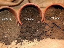 Loam soils seem to be the jackpot for all farmers. They include clay, sand, and silt and are the best possible combination of all negative and positive features. It is regarded as the best type of soil.
(ii) Satluj joins ___________ in Pakistan.
Ans: chenab
Jhelum and Ravi join Chenab, Beas joins Sutlej, and then Sutlej and Chenab join to form Panjnad.
(iii) The plains slope from ______________ to _____________.
Ans: east to west
The northern plains are the largest alluvial tract of the world. These plains extend approximately 3200 km from west to east. The average width of these plains varies between 150 and 300 km. In general, the width of the northern plains increases from east to west.
(iv) Indus, Ganga, Yamuna and Brahmaputra start from ___________ .
Ans: the Himalayas
The major Himalayan rivers are the Indus, Jhelum, Chenab, Beas, Ravi, Saraswati, Sutlej, Ganga (or the Ganges), Yamuna, and Brahmaputra.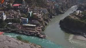
(v) The plains of Ganga and Brahmaputra lie to the _____________ of mountain ranges in the north.
Ans: south
The major Himalayan rivers are the Indus, Jhelum, Chenab, Beas, Ravi, Saraswati, Sutlej, Ganga (or the Ganges), Yamuna, and Brahmaputra.
(vi) The silt that rivers bring with them to the plains is called _____________.
Ans: Alluvium
Alluvium refers to the fine sediment and soil that rivers deposit on their floodplains, making the land fertile for agriculture.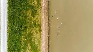
(vii) The Bhakra Nangal Dam is built on the river _____________.
Ans: Satluj
The Bhakra Nangal Dam, one of the largest dams in India, is constructed across the Sutlej River in Himachal Pradesh.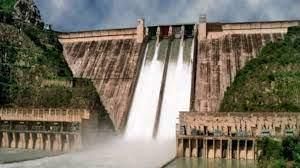
(viii) The Northern Plains can be divided into three rivers _____________.
Ans: basins
The Northern Plains of India are formed by the Indus, Ganga, and Brahmaputra river systems.
(ix) _____________and _____________ are folk dances of Punjab.
Ans: Bhangra and Gidda
Bhangra is a lively and energetic dance form, and Gidda is a traditional folk dance performed by women in Punjab.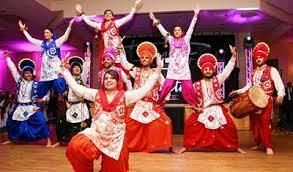
(x) _____________ is a traditional festival of Bihar.
Ans: Chhatt
Chhath Puja is a Hindu festival dedicated to the Sun God and is widely celebrated in the state of Bihar.
(xi) The Kaziranga Wildlife Sanctuary is famous for the one-horned _____________.
Ans: rhinoceros
Kaziranga National Park in Assam, India, is renowned for its population of Indian one-horned rhinoceroses.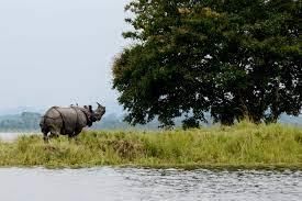
Q2: Complete the following statements.
(i) Some of the ancient cities on the bank of the Ganga are ____________
Ans: Rishikesh and Haridwar.
Most of the Indian cities are established on the banks of some river banks.Cities on bank of River Ganga – Rishikesh, Haridwar, Farrukhabad, Kanpur, Allahabad, Mirzapur, Varanasi.
(ii) The Western plain covers ________________________
Ans: parts of Gujarat, Maharashtra, Goa, Karnataka Kerala and Tamil Nadu.
It includes the states of Gujarat, Maharashtra, Goa, Karnataka Kerala and Tamil Nadu. The region consists of three sections: the Northern part of the coast is called the Konkan (Mumbai to Goa), the central stretch is called the Kanara or the "Karavali", while the southern stretch is referred to as the Malabar Coast.
(iii) The Ganga-Brahmaputra delta is called as ______________
Ans: Sunderban Delta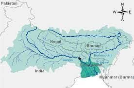 The Ganges Brahmaputra Delta, also named Ganges Delta, Sunderban Delta or Bengal Delta is situated in Asia where the Ganges and Brahmaputra rivers discharge into the Bay of Bengal. It is, with a surface area of some 100.000 km2, the world's largest Delta.
(iv) The Eastern Plain covers __________________
Ans: a large part of eastern India
The Eastern Plain in India is a vast low-lying region that covers a substantial portion of eastern India. It includes states like West Bengal, Bihar, Jharkhand, and parts of Odisha and Uttar Pradesh. This region is characterized by fertile alluvial soil and is watered by rivers like the Ganga, Brahmaputra, and their tributaries.
(v) The Ganga-Brahmaputra delta is called as ___________________
Ans: Sundarbans Delta
The Ganga-Brahmaputra delta, formed by the confluence of the Ganga and Brahmaputra rivers, is known as the Sundarbans Delta. It is located in the southern part of Bangladesh and the eastern part of India (West Bengal) and is famous for its unique mangrove forests and diverse wildlife, including the Bengal tiger.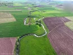
(vi) The North Central Plain includes _________________
Ans: the northern part of India between the Ganga and Yamuna rivers
The North Central Plain is a fertile region in northern India situated between the Ganga and Yamuna rivers. It includes parts of Uttar Pradesh and Haryana. This region is known for its agricultural productivity and is considered the heartland of India.
Q3: True or False.
(i) The Northern-Plain extends from Punjab to the West Bengal.
Ans: False
It is said that the Northern Plains extends from river satluj to river Brahmaputra from west to east and from Tarai of Himalayas in the north to the vindhyas in South from where peninsular region starts. Some states like Punjab, Haryana, U.P, Bihar, W.B, M.P, some parts of Gujarat lies in the northern plains.
(ii) Basin is the region watered by a river.
Ans: True
A river basin is the area of land over which surface run-off flows via streams, rivers, and lakes into the sea.
(iii) Sediment is the matter which floats on the surface of a river.
Ans: False
Sediment is solid material that is moved and deposited in a new location. Sediment can consist of rocks and minerals, as well as the remains of plants and animals.
(iv) Tributaries are the rivers joining another big river.
Ans: True
A tributary or affluent is a stream or river that flows into a larger stream or main stem river or a lake.
(v) Delta is the place from where any river originates.
Ans: False
Delta is a “depositional feature of a river formed at the mouth of the river. These are wetlands that form as rivers empty their water and sediment into another body of water, such as an ocean, lake, or another river.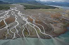 (vi) The soil that rivers bring with them makes the Northern Plains very fertile.
Ans: True
The alluvial soil deposited by rivers in the Northern Plains is highly fertile and supports extensive agricultural activities.
(vii) Punjab has rich deposits of coal and iron ore.
Ans: False
Punjab is not known for rich deposits of coal and iron ore; these resources are found in other states like Jharkhand and Odisha.
(viii) The Hooghly and Padma are tributaries of the Ganga.
Ans: False
The Hooghly is a distributary of the Ganga, while the Padma is a major river in Bangladesh that merges with the Ganga downstream.
(ix) Durga Puja is an important festival of West Bengal.
Ans: True
Durga Puja is a significant and widely celebrated festival in West Bengal, dedicated to the worship of Goddess Durga.
(x) Brahmaputra is also called Tsangpo in Tibet.
Ans: True
The Brahmaputra River is known as the Yarlung Tsangpo in Tibet before it enters India.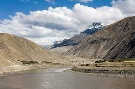
Q4: Multiple Choice Questions (MCQs).
(i) Which of these states does not lie in the Northern Plains?
(a) Uttar Pradesh
(b) Rajasthan
(c) Bihar
(d) Assam
Ans: (b)
Rajasthan is not part of the Northern Plains; it is a state in the northwestern part of India and includes desert and arid regions.
(ii) Which of these is a tributary of the Ganga?
(a) Alaknanda
(b) Kosi
(c) Gomti
(d) Hooghly
Ans: (a)
The Alaknanda River is a major tributary of the Ganga and originates from the Himalayas.
(iii) Which of these towns in the Northern Plains lies on the banks of a river?
(a) Allahabad
(b) Delhi
(c) Kolkata
(d) All of these
Ans: (d)
Allahabad, Delhi, and Kolkata all lie on the banks of rivers. Allahabad is situated at the confluence of the Ganga and Yamuna rivers, Delhi is along the Yamuna River, and Kolkata is located along the Hooghly River.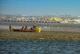
(iv) Which of these states has huge deposits of petroleum?
(a) Jharkhand
(b) West Bengal
(c) Uttar Pradesh
(d) Assam
Ans: (d)
Assam is known for its significant deposits of petroleum and natural gas, which contribute to India's energy resources.
Q5: Answer the following in brief.
(i) Why Ganga gets polluted?
Ans: Pollution of the Ganges poses significant threats to human health and the larger environment. It gets polluted because of human waste such as washing clothes and industrial waste such as chemicals and plastic.
(ii) What is alluvium?
Ans: Alluvium is a loose soil or sediments which are formed due to erosion by rainwater. It is typically made of small particles of silt and clay and larger particles of sand and gravel.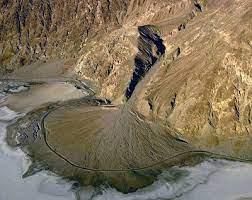
(iii) Name a tributary of the Ganga?
Ans: Ganga river has a large number of tributaries like Kali, Yamuna, Gomti,Gandak, Kosi and joins River Ganga at different points during its journey.
(iv) Which two Indian rivers join the Bay of Bengal?
Ans: The Ganges and Brahmaputra rivers, together with their tributaries, join the Bay of Bengal.
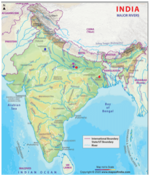
Q6: Map Based.
From the map of the Northern Plains:
- List the cities on the bank of the river Yamuna. Uttar Pradesh and Delhi (marked in Blue)
- List the cities on the bank of the river Ganga. Uttar Pradesh and Kolkata (marked in Red)
- Which city is on the confluence of the river Ganga and the river Yamuna? Allahabad (marked in Purple)
|
51 videos|275 docs|46 tests
|
FAQs on The Northern Plain - 1 Class 4 Worksheet SST
| 1. What are the major rivers that flow through the Northern Plain? |  |
| 2. How is the Northern Plain formed? |  |
| 3. What is the significance of the Northern Plain? |  |
| 4. What is the climate of the Northern Plain like? |  |
| 5. What are the major cities located in the Northern Plain? |  |


