Class 9 Geography Chapter 1 Map Based Question Answers - Contemporary India - I

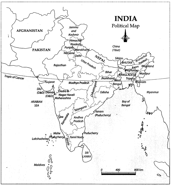
INDIA: Political Map
The Political Map of India shows all the States and Union Territories. Presently, India has 29 States and 7 Union Territories.
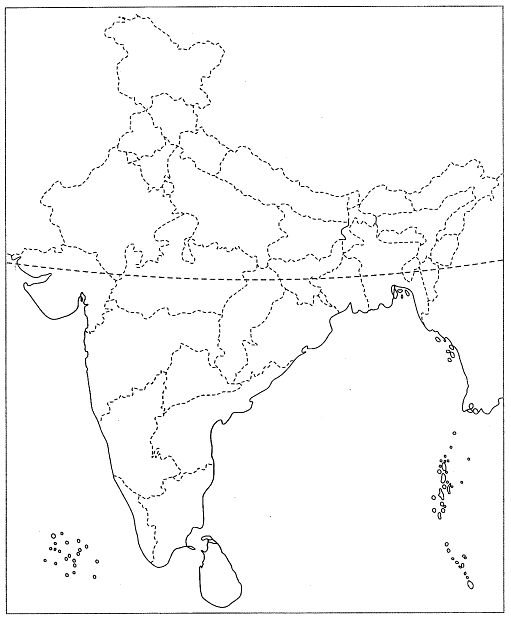
Q1: Locate and label the following items on the given map
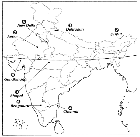
1. Capital of Uttarakhand
2. Capital of Asom
3. Capital of Madhya Pradesh
4. Capital of Tamil Nadu
5. Capital of India
6. Capital of Karnataka
7. Capital of Rajasthan
8. Capital of Gujarat
Ans:
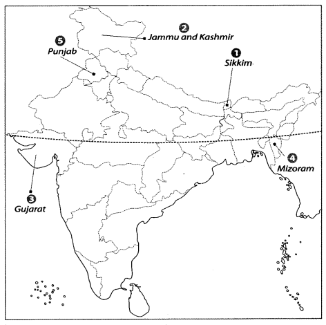
Q2: Locate and label the following items on the given map
1. The state which shares its boundaries with China, Nepal and Bhutan.
2. The state which shares its boundaries with both China and Pakistan.
3. The state having common land and sea boundary with Pakistan.
4. An Indian state that shares its boundary with Bangladesh and Myanmar.
5. Smallest among the States sharing border with Pakistan.
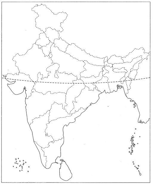
Ans:
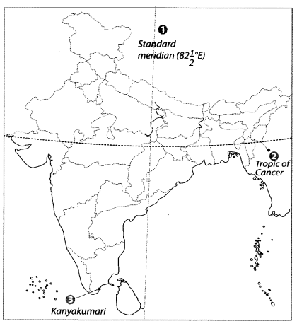
INDIA: Standard Meridian
This map shows the important geographical lines which pass through India. These are Standard Meridian and Tropic of cancer. This map also shows the Eastern, Western, Northern and Southern point of India.
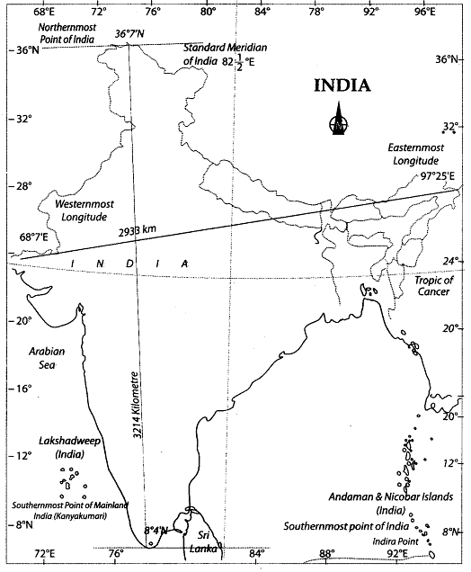
Tropic of Cancer passes through 8 states of India : Gujarat, Rajasthan, Madhya Pradesh, Chhattisgarh, Jharkhand, West Bengal, Tripura and Mizoram. Standard Meridian of India  Uttar Pradesh, Madhya Pradesh, Chhattisgarh, Odisha and Andhra Pradesh.
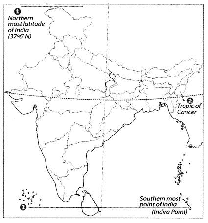
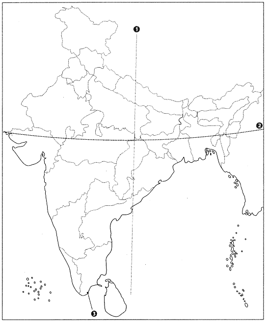
Q3: Locate and label the following items on the given map
1. Northernmost latitude of India
2. Tropic of Cancer
3. Southernmost point of India
Ans:
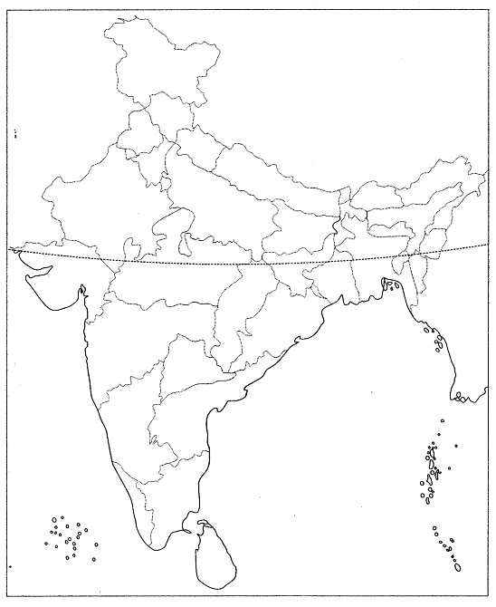
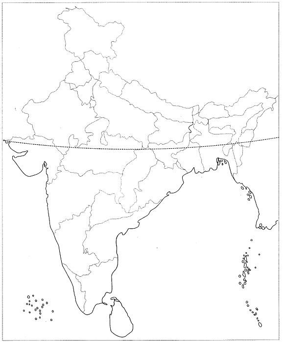
Q4: Features are marked by numbers in the given political outline map of India. Identify these features with the help of the following information and write their correct names on the lines marked in the map.
1. A longitude
2. Latitude which divides India into two equal halves.
3. Southernmost point of mainland of India.
Ans:
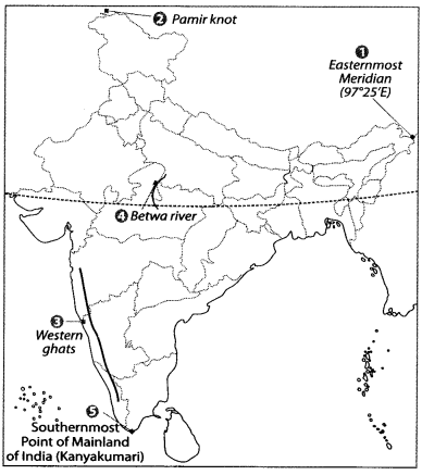
Q5: Locate and label the following items on the given political map with appropriate symbols.
1. Easternmost longitude
2. Pamir Knot
3. Western ghats
4. Betwa river
5. Southernmost point of mainland of India.
Ans:
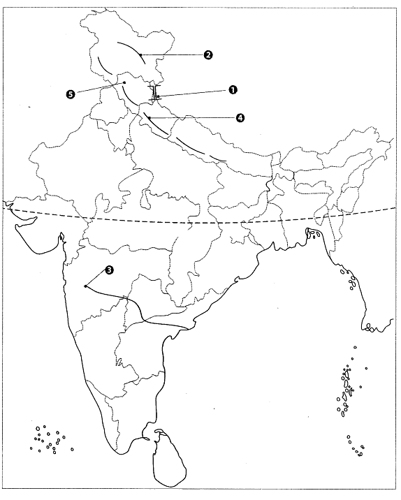
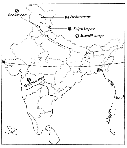
Q6: Features are marked by number in the political map of India. Identify these features with the help of the following information and write their Correct names on the lines marked in the map.
1. A mountain pass
2. A mountain range
3. A river known as Dakshin Ganga
4. The outermost range of Himalayas
5. World’s highest gravity dam
 Ans:
Ans:
1. Shipki La pass
2. Zaskar range
3. Godavari river
4. Shiwalik range
5. Bhakra dam
|
55 videos|637 docs|79 tests
|


Objective type Questions
,study material
,Semester Notes
,Exam
,video lectures
,Extra Questions
,Important questions
,past year papers
,ppt
,Free
,shortcuts and tricks
,Viva Questions
,Class 9 Geography Chapter 1 Map Based Question Answers - Contemporary India - I
,practice quizzes
,Sample Paper
,Summary
,MCQs
,Class 9 Geography Chapter 1 Map Based Question Answers - Contemporary India - I
,Class 9 Geography Chapter 1 Map Based Question Answers - Contemporary India - I
,mock tests for examination
,Previous Year Questions with Solutions
;


Map Based Questions: India – Size and Location Free PDF Download
Importance of Map Based Questions: India – Size and Location
Map Based Questions: India – Size and Location Notes
Map Based Questions: India – Size and Location Class 9
Study Map Based Questions: India – Size and Location on the App
|
© EduRev
|
Education Revolution
|


|


within 7 days!