Class 9 Geography Chapter 1 Map Based Question Answers - Contemporary India - I
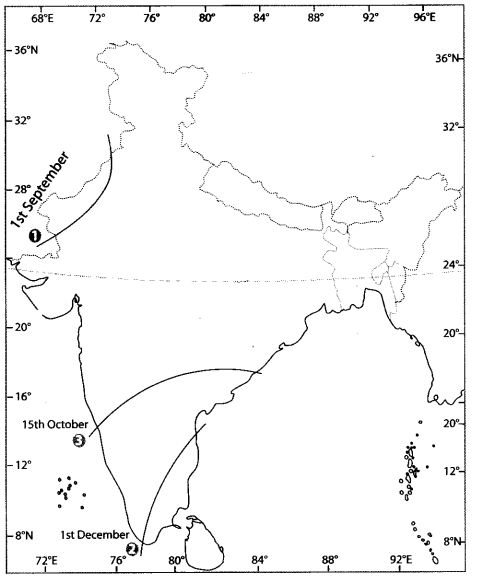
INDIA: The Retreating Monsoon
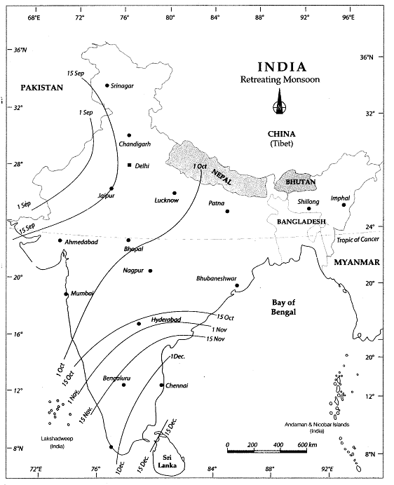
This map shows the retreat of the monsoon in India with normal dates.
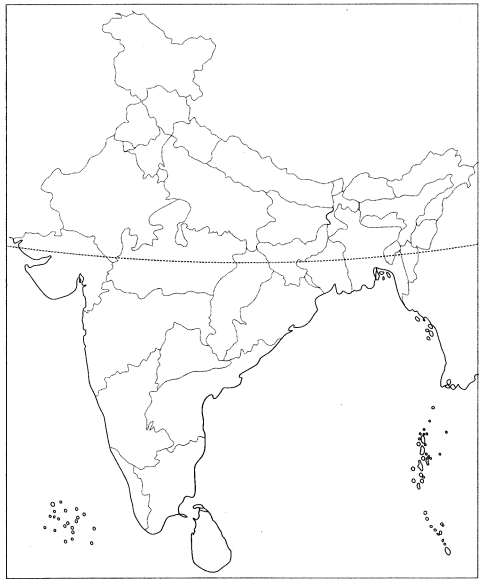
Q1: Locate and label the following items on the given map
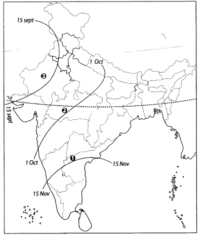
1. A line where the time period of withdrawal of monsoon is 15 November.
2. A line where the time period of withdrawal of monsoon is 1 October.
3. A line where the time period of withdrawal of monsoon is 15 September.
Ans:
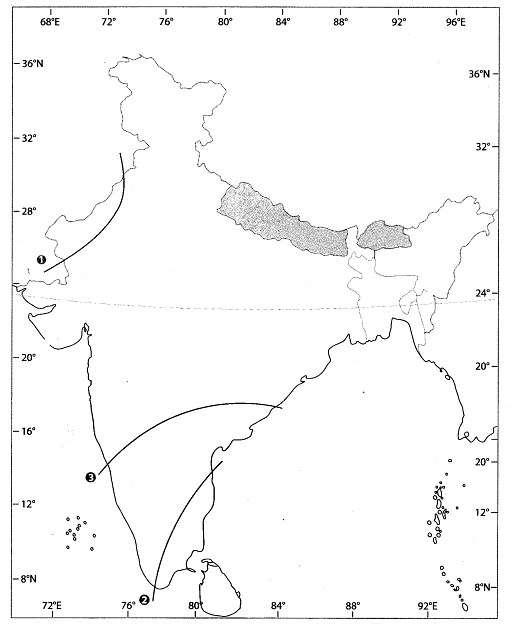
Q2: Features are marked by numbers in the given political map of India. Identify these features with the help – of the following information and write their correct names on the lines marked in the map.
1. Name the date of withdrawal of monsoon.
2. Name the date of withdrawal of monsoon.
3. Name the date of withdrawal of monsoon.
Ans:
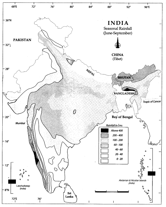
INDIA: Seasonal Rainfall
This map shows the average seasonal rainfall during the period June-September (in cm) in India.
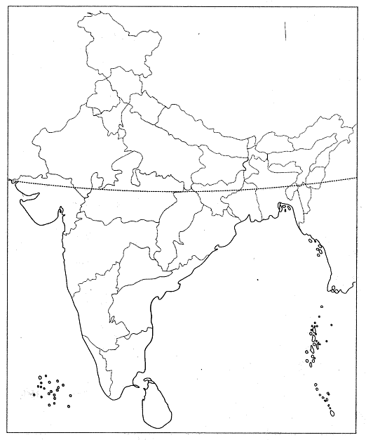
Q3: Locate and label the following items on the given map
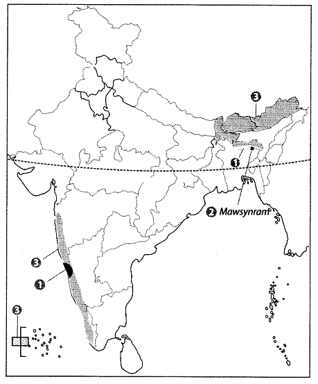
1. Any two areas with rainfall over 400 cm.
2. The place which receives the highest rainfall in the world.
3. Regions which receive rainfall between 200-400 cm.
Ans:
Rainfall and Prevailing Winds
A low pressure region is a region where the atmospheric pressure is lower than that of surrounding locations. A high pressure region is a region where the atmospheric pressure is greater than its surrounding environment. Winds always blow from high pressure to low pressure.
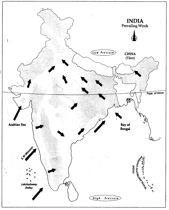
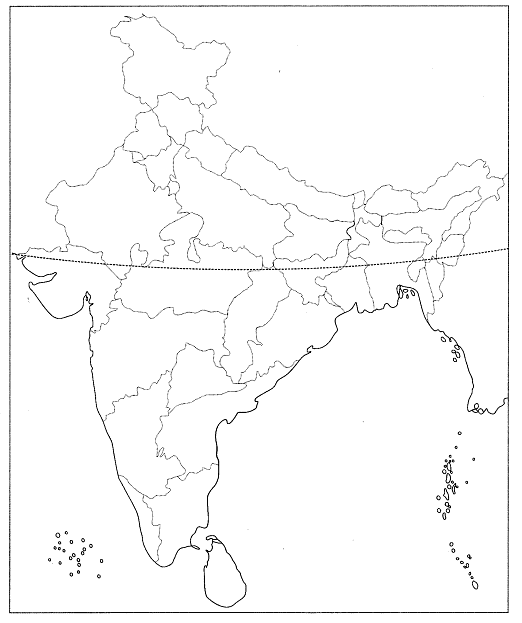
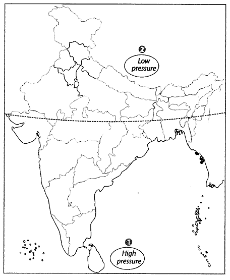
Q4: Locate and label the following items on the given map
1. A region which has high pressure during summer.
2. A region which has low pressure during summer.
Ans:
INDIA: Meteorological Stations
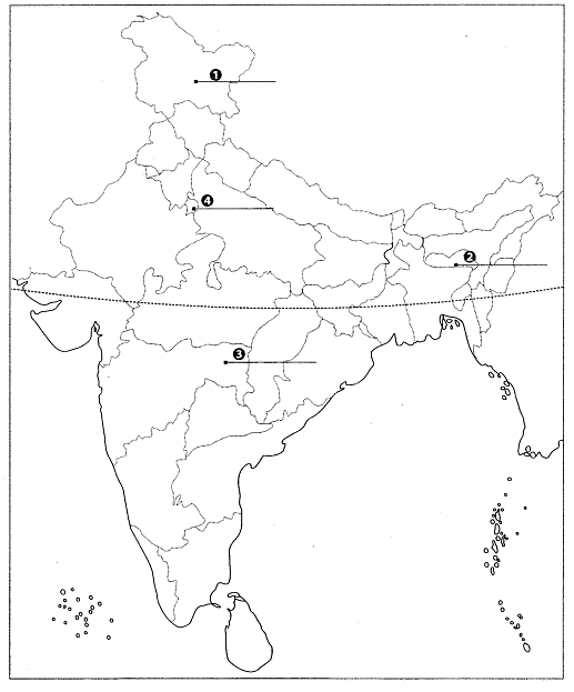
This map shows some meteorological stations in India. A meteorological station is a location where meteorological data are gathered, recorded and released.
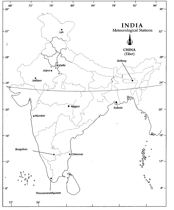
Q5: Features are marked by numbers in the given political map of India. Identify these features with the help of the following information and write their correct names on the lines marked in the map.
1. Meteorological station in Jammu and Kashmir.
2. Meteorological station in Meghalaya.
3. Meteorological station in Eastern Maharashtra.
4. Meteorological station.
Ans:
1. Leh
2. Shillong
3. Nagpur
4. Delhi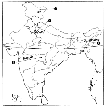
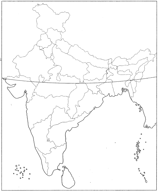
Q6: On the given political map of India, name and mark the any four meteorological stations.
Ans: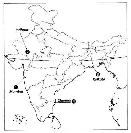
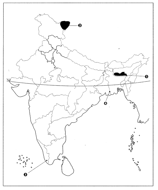
Q7: Features are Marked by numbers in the political outline map of India. Identify these features with the help of the following information and write their correct names on the lines marked in the map.
1. The state with the highest average rainfall in India.
2. A district which receives less than 10 cm rainfall annually.
3. Meteorological station of Kerala.
4. Meteorological station of West Bengal.
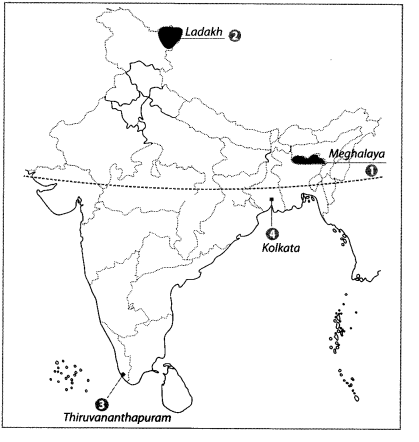
Ans:
1. Meghalaya
2. Ladakh
3. Thiruvananthapuram
4. Kolkata
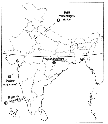
Q8: Locate and label the following items on the given map with appropriate symbols.
1. Pench National Park.
2. Delhi meteorological stations.
3. Nagarhole National Park
4. The Union Territory having the lowest sex ratio.
Ans:
|
56 videos|439 docs|80 tests
|


