Multiple Choice Questions (MCQs)
Q1. Which of the following regions is characterized by old and stable landmass?
(a) Peninsular Plateau
(b) Himalayas
(c) Indo-Ganga-Brahmaputra Plain
(d) Coastal Plains
Ans: (a) T is characterized by old and stable landmass, made up of ancient rocks such as gneisses and granites.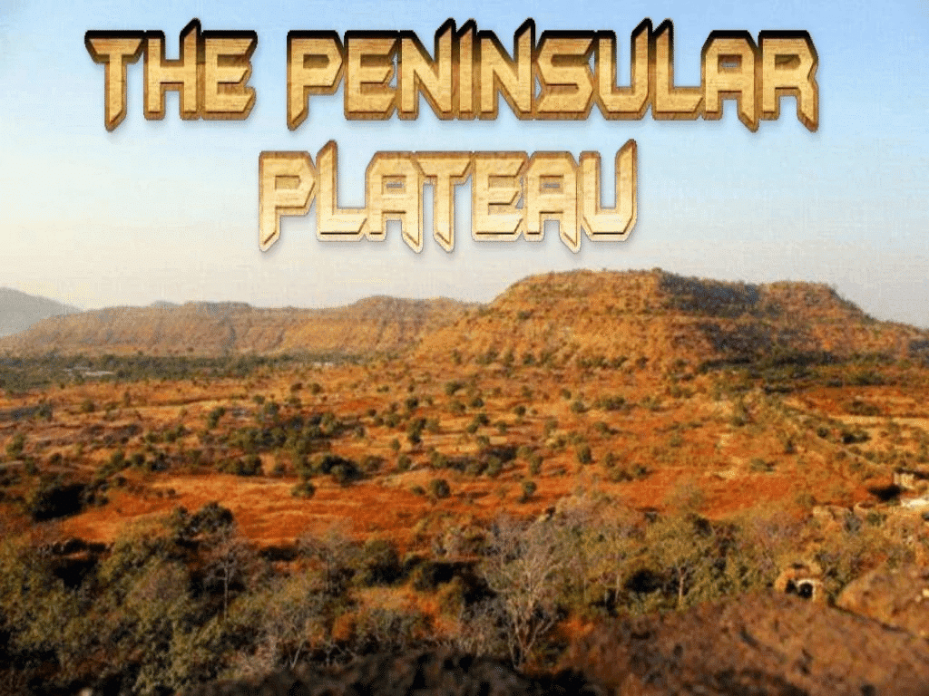
Q2. What is the primary cause of the Himalayas' current structure?
(a) Volcanic activity
(b) Tectonic activity and folding
(c) Wind erosion
(d) River deposition
Ans: (b) The Himalayas are primarily formed by tectonic activity and folding, resulting from the collision of the Indian plate with the Eurasian plate.
Q3. What is the geographical feature that divides the northern and southern parts of India?
(a) The Himalayas
(b) The Indo-Ganga-Brahmaputra Plain
(c) The Peninsular Plateau
(d) The Aravalis
Ans: (a) The Himalayas act as a physical, climatic, and cultural divide between the northern and southern parts of India.
Q4. Which of the following rivers does NOT form a delta before entering the Bay of Bengal?
(a) Mahanadi
(b) Godavari
(c) Krishna
(d) Luni
Ans: (d) The Luni River does not form a delta before entering the sea; it is an ephemeral river and does not reach the sea consistently.
Q5. The 'Sunderbans' is located at the mouth of which river?
(a) Ganga
(b) Godavari
(c) Brahmaputra
(d) Krishna
Ans: (a) The Sunderbans delta is located at the mouth of the Ganga River, known for its rich biodiversity.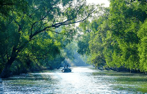
Short Answer Questions (Q/(a)
Q1. Define physiography in simple terms.
Ans: Physiography refers to the physical features of the Earth's surface, including mountains, valleys, plains, plateaus, rivers, and coastlines, and how these features are formed through natural processes.
Q2. What is the difference between the Western and Eastern Ghats?
Ans: The Western Ghats are continuous, higher in elevation, and more rugged, while the Eastern Ghats are discontinuous, lower in elevation, and more eroded by rivers.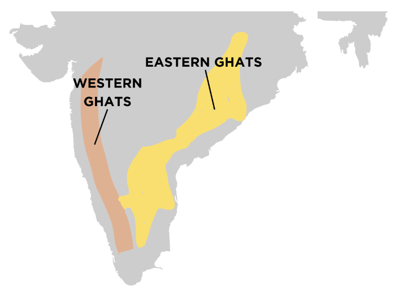
Q3. Why do the Peninsular rivers flow eastward towards the Bay of Bengal?
Ans: Peninsular rivers generally flow eastward due to the region's sloping terrain, with the western part being elevated and the eastern part sloping toward the Bay of Bengal.
Q4. How does the Himalayas impact India's climate?
Ans: The Himalayas act as a barrier that prevents cold winds from Central Asia from entering India, thus creating a temperate climate in the northern regions and monsoonal conditions in the rest of India.
Q5. What is the significance of the Bhabar region in the northern plains?
Ans: The Bhabar region, located at the foothills of the Shiwaliks, consists of coarse alluvial deposits like rocks and boulders. Rivers in this region disappear into the porous earth, which affects drainage.
Activity-Based Questions
1. Identify and describe two major landforms in your local region. How do these landforms influence human activity?
Ans: Landforms: A Plateau and a River Valley
1. Plateau: A plateau is a flat or gently sloping elevated area, often surrounded by steep cliffs. In many regions, plateaus are rich in minerals and can be used for mining activities.
2. River Valley: A river valley is the landform created by the flow of a river over time, typically characterized by fertile, flat land that is conducive to agriculture.
Influence on Human Activity:
1. Plateaus:
Agriculture: Due to their flat and stable surface, plateaus provide ideal conditions for farming. The fertile soil found in some plateaus can support crops, especially in regions with mild climates.
Mining: Many plateaus are rich in mineral resources, making them valuable for mining activities. Human settlements may also grow in these areas due to the economic opportunities provided by these resources.
2. River Valleys:
Agriculture: River valleys are known for their fertile soil, especially due to the alluvial deposits left by rivers during flooding. This makes river valleys prime locations for agriculture, supporting the cultivation of various crops.
Settlement: Rivers provide water for daily needs, transportation, and trade, making river valleys attractive for human settlement. The accessibility and resources available in these valleys have historically supported the growth of civilizations and towns.
In conclusion, plateaus and river valleys significantly influence human activities by supporting agriculture, mining, and settlement due to their geographic and environmental advantages.
2. Use an atlas to list major peaks in the Himalayan mountain range from the west to the east.
Ans: 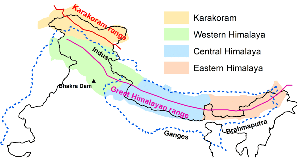
Western Himalayan Peaks: Nanga Parbat, K2
Central Himalayan Peaks: Mount Everest, Kanchenjunga
Eastern Himalayan Peaks: Makalu, Lhotse
Research-Based Question
1. Research the geomorphological features of the Indo-Ganga-Brahmaputra plain and explain their significance for agriculture.
Ans: The Indo-Ganga-Brahmaputra Plain is a vast alluvial region formed by the deposition of sediments from the rivers Indus, Ganga, and Brahmaputra over thousands of years. This plain is characterized by its flat, low-lying terrain, extensive floodplains, and rich alluvial soil.
Key Features:
Alluvial Deposits: The continuous deposition of sediments by the rivers over centuries has resulted in highly fertile soil. This soil is rich in nutrients, which is ideal for agriculture.
Floodplains: The floodplains of these rivers are periodically replenished with fresh silt, enhancing soil fertility and ensuring the availability of water for irrigation.
River Channels and Deltas: The rivers' channels and deltas create a network of natural irrigation systems, further promoting agricultural activities.
Significance for Agriculture:
Fertile Soil: The fertile alluvial soil supports a wide range of crops. The nutrient-rich soil ensures high agricultural productivity, making the region one of the most important agricultural zones in India.
Crop Diversity: Major crops grown in this region include rice, wheat, sugarcane, jute, and maize. The diverse climate and soil conditions allow for the cultivation of both food and cash crops.
Irrigation: The extensive river system provides natural irrigation, reducing dependency on rainfall and supporting year-round cultivation. The availability of water supports multiple cropping seasons, particularly for water-intensive crops like rice.
Conclusion:
The Indo-Ganga-Brahmaputra plain's geomorphological features, particularly its alluvial soil and river systems, make it a highly fertile and agriculturally productive region. These natural advantages allow for the cultivation of a wide variety of crops, ensuring food security and supporting the economy of the region.
Word search
1. The river that flows through the northern plains - Ganga
2. A major river that flows into the Bay of Bengal - Krishna
3. The region characterized by extensive plateaus - Peninsular
4. The mountain range dividing India into north and south - Himalayas
5. A type of coastline formed by submergence - Submerged


