Class 9 Geography Chapter 1 Question Answers - Contemporary India - I

Q1. What are perennial and non-perennial rivers? Give reasons why the Himalayan region consists of perennial rivers. (Important)
Ans: Perennial rivers flow continuously throughout the year, maintaining a steady flow, such as the Ganga. In contrast, non-perennial rivers are seasonal, primarily flowing during the rainy season, like the Subarnarekha. The rivers in the Himalayan region are predominantly perennial due to the following reasons:
- They originate from snowfields and glaciers, providing a constant water supply.
- During the monsoon, heavy rainfall increases their flow.
- In dry periods, melting snow and glaciers sustain their flow.
As a result, these rivers maintain their flow throughout the year.
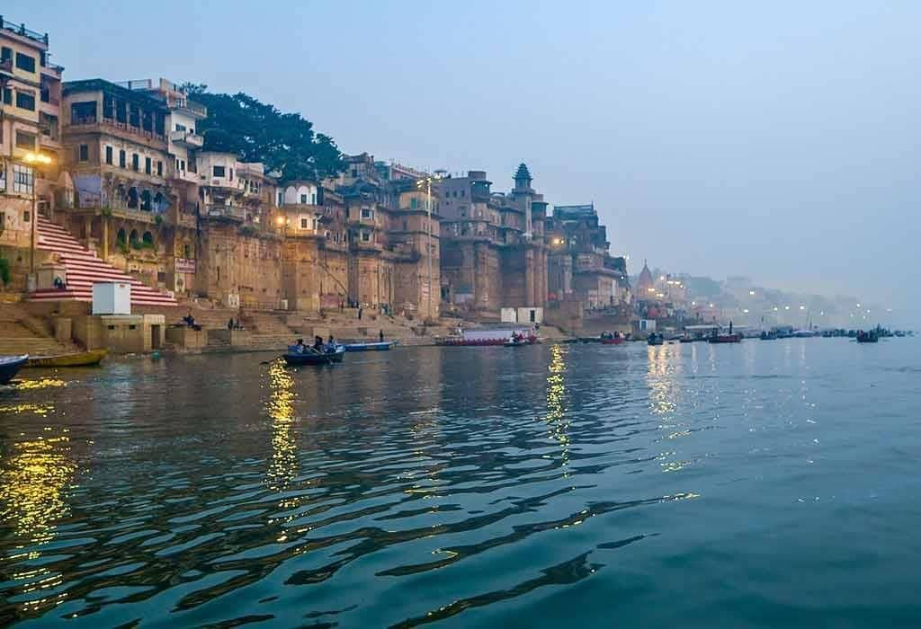 Ganga - Perennial River
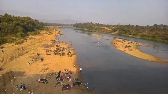 Subarnarekha: Non - Perennial River
Q2. Why is the Godavari often referred to as the 'Dakshin Ganga'? Write a note on the river Godavari and its tributaries. (Important)
Ans: The Godavari, the largest Peninsular river (1500 km), has the biggest drainage basin among Peninsular rivers, covering parts of Maharashtra, Madhya Pradesh, Odisha, and Andhra Pradesh. Due to its vast length and area, it is called the 'Dakshin Ganga'.
It originates from the Western Ghats in Nasik, Maharashtra, flows eastwards, and drains into the Bay of Bengal. Nearly half of its basin lies in Maharashtra. Major tributaries include the Wainganga, Penganga, Manjra, Purna, Wardha, and Pranhita.
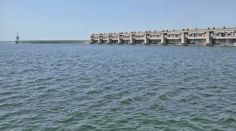 Godavari River
Q3. How are salt lakes formed? Give examples of salt lakes in India.
Ans: Salt lakes are characterised by their high salt content and typically form in arid or semi-arid regions with limited drainage. They are often seasonal in nature. Formation processes include:
- Wind action creates depressions that reach groundwater, forming shallow lakes. These lakes become salty due to high rates of evaporation.
- Temporary lakes can form in desert basins from short streams that drain into them, leading to high salinity from rapid evaporation.
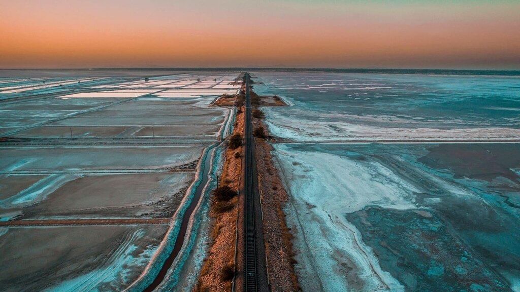
Example: The Sambhar Lake in Rajasthan is a notable salt lake, known for its salt production.
Q4. What is a lagoon? How does it differ from a lake?
Ans: A lagoon is a body of brackish or saltwater that is separated from the sea by sandbanks, bars, or reefs. They are often located near river deltas, such as the Ganges and Mahanadi. Notable examples include:
- Chilika Lake (Odisha)
- Pulicat Lake (Tamil Nadu)
Here are the main differences between lagoons and lakes:
- Location: Lagoons are found in coastal areas, while lakes can be located in highlands or inland basins.
- Water Type: Lagoons contain brackish water, whereas lakes can be either fresh or saltwater.
- Formation: Lagoons are formed by wind and wave action, while lakes can result from tectonic activity, rivers, glaciers, wind, or human actions.
Q5. What is a gorge? In what type of terrain does a gorge form?
Ans: A gorge is a steep-sided, narrow, I-shaped river valley typically found in the upper course of rivers within mountainous terrain. It forms as a result of the river's swift flow and vertical erosion as it descends steep slopes. Key characteristics of gorges include:
- Develop in areas with hard, resistant rocks.
- Result in steep, nearly vertical valley sides.
- Common in regions with youthful topography, such as recently uplifted areas.
Examples of notable gorges include:
- The Indus Gorge
- The Brahmaputra Gorge
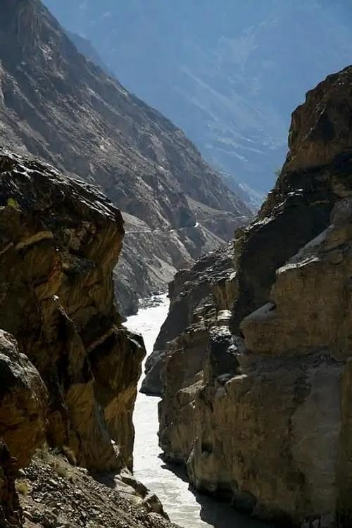 River Indus GorgeQ6. What type of channel does the river Brahmaputra have? Write a short note on the formation of this type of channel.
Ans: The Brahmaputra has a braided channel throughout its course in Assam.
Formation:
- During the monsoon, heavy rainfall increases the river's water volume.
- Rapid erosion adds silt to the river; when the load is too much, silt is deposited on the riverbed.
- This leads to the river splitting into multiple shifting channels, known as braided channels, creating islands between them.
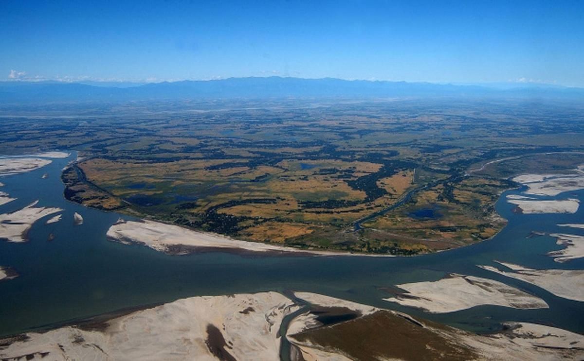
Example: Majuli Island, the world's largest riverine island, has been shaped by these floods.
Q7. Where are India’s most freshwater lakes located and why?
Ans: Most of India's freshwater lakes are located in the Himalayan region. These lakes are primarily of glacial origin, formed when glaciers carved out basins that later filled with snowmelt. Key lakes include:
- Wular Lake in Jammu and Kashmir, the largest freshwater lake in India, formed by tectonic activity.
- Dal Lake, known for its houseboats and tourism.
- Bhimtal and Nainital, popular tourist destinations.
- Loktak Lake and Barapani, important for their ecological significance.
In addition to natural lakes, human activities such as damming rivers for hydropower have created artificial lakes, like Guru Gobind Sagar from the Bhakra Nangal Project. Lakes play a crucial role in regulating river flow, preventing flooding during heavy rains, and providing recreational opportunities.
Q8. What is a river basin? Explain briefly.
Ans: A river basin is the area of land where all the rainwater and streams drain into a single river. Here are some key points about river basins:
- It includes all the land that contributes water to the river.
- River basins are separated by water divides, which are elevated areas like mountains.
- They play a crucial role in the ecosystem, supporting various wildlife and plant species.
- River basins are important for human activities, providing water for drinking, agriculture, and industry.
Q9. Write a note on the river Krishna and its tributaries.
The Krishna River originates from a spring near Mahabaleshwar and flows eastward to the Bay of Bengal. It spans approximately 1400 km, making it the second longest river in Peninsular India, following the Godavari. Key tributaries of the Krishna include:
- Tungabhadra
- Koyna
- Bhima
- Ghatprabha
- Musi
The river's drainage basin covers parts of Maharashtra, Karnataka, and Andhra Pradesh.
Q10. Name the three Himalayan river systems. Give two tributaries of each. (CBSE 2010)
Ans: Three Himalayan river systems are:
- The Indus river system
- The Ganga river system
- The Brahmaputra river system.
Tributaries:
- Indus river system – Satluj & Beas.
- Ganga river system – Yamuna & Ghaghara.
- Brahmaputra river system – Dibang & Lohit.
Q11. Which of the factors mainly controls the drainage system of the Indian subcontinent? Into which major groups are the Indian rivers divided? Write three points of difference between the two. (CBSE 2010)
Ans: The drainage system of the Indian subcontinent is primarily influenced by its physical features. The rivers are classified into two main groups:
- Himalayan Rivers
- Peninsular Rivers
Here are three key differences between these two groups:
- Source of Water: Himalayan Rivers are perennial, receiving water from both rain and melting snow, while Peninsular rivers are often seasonal, relying mainly on rainfall.
- Course Length: Himalayan rivers have long courses that cut through mountains, whereas Peninsular rivers are generally shorter and flow over flatter terrain.
- Erosional Activity: Himalayan rivers engage in significant erosion in their upper courses, transporting large amounts of silt, while Peninsular rivers have less erosional activity and form fewer depositional features.
Q12. Why are lakes of great value to human beings? Explain any three reasons.
(CBSE 2010)
Ans: Lakes are of great value to human beings for several reasons:
- Flood Regulation: Lakes help to regulate the flow of rivers. They prevent flooding during heavy rains and maintain a steady water flow during dry seasons.
- Hydropower Generation: Lakes are essential for developing hydel power, providing a renewable energy source.
- Tourism and Recreation: Lakes enhance natural beauty, attract tourists, and offer recreational activities, contributing to local economies.
Q13. Write any three features of the rivers originating in the Himalayas. (CBSE 2010)
Ans: Features of the rivers originating in the Himalayas:
- Perennial Flow: These rivers have water throughout the year, fed by both rainfall and melting snow.
- Intensive Erosion: In their upper courses, they actively erode the landscape, transporting large amounts of silt and sand.
- Long Courses: Himalayan rivers typically have long courses, carving through mountains and forming gorges.
Q14. What is a lake? How are lakes formed? (CBSE 2010)
Ans: A lake is a large body of water surrounded by land. Lakes can vary in size and characteristics. They play a crucial role in the environment and human life. Lakes are formed through various natural processes:
- Glacial Action: Some lakes are created when glaciers carve out depressions in the land, which later fill with water from melting ice.
- Tectonic Activity: Lakes like the Wular Lake in Jammu and Kashmir are formed due to geological movements.
- River Action: Meandering rivers can create ox-bow lakes when they form cut-offs in floodplains.
- Wind Action: Lakes can also be formed by wind erosion, particularly in coastal areas.
- Human Activities: Damming rivers for hydropower can create artificial lakes, such as Guru Gobind Sagar.
Q15. Describe any three important features of the river Brahmaputra. [2010 (T-1)]
Ans:
- The Brahmaputra flows through a high rainfall region, which allows it to carry a large volume of water and silt.
- It features a braided channel throughout its length in Assam, creating numerous riverine islands.
- During the rainy season, the river often overflows its banks, leading to widespread flooding in Assam and Bangladesh.
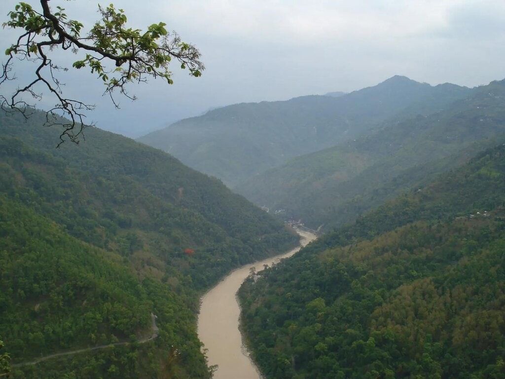 Brahmaputra RiverQ16. How does a river affect the economy of a country? [2010 (T-1)]
Ans: Rivers play a crucial role in a country's economy by providing essential resources and services. Here are some key points:
- Water Resource: Rivers are vital for various human activities, including drinking water, sanitation, and industry.
- Agriculture: They support irrigation, which is essential for farming, especially in countries like India where agriculture is a major livelihood.
- Navigation: Rivers facilitate transportation and trade, connecting different regions and promoting economic growth.
- Power Generation: Many rivers are harnessed for hydroelectric power, providing a renewable energy source.
- Urban Development: Settlements near rivers often grow into cities, contributing to urbanisation and economic activities.
Overall, rivers significantly enhance the economic landscape of a country.
Q17. What is the name of Brahmaputra in Tibet and Bangladesh? Give one feature of each. [2010 (T-1)]
Ans: Brahmaputra is known as the Tsangpo in Tibet and Jamuna (not to be confused with Yamuna in India) in Bangladesh.
- Tibet: The river carries a smaller volume of water and less silt due to the cold and dry climate.
- Bangladesh: During the rainy season, it overflows its banks, leading to severe flooding and significant siltation.
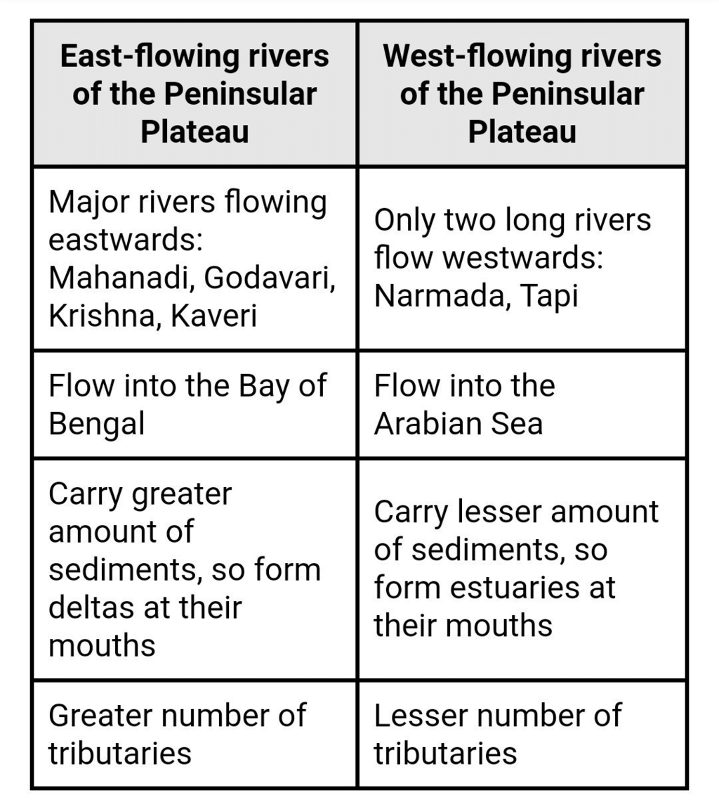
Q18. What are the differences between east-flowing and west-flowing rivers of the peninsular plateau? [2010 (T-1)]
Ans: The major rivers of the Peninsular Plateau such as the Mahanadi, the Godavari, the Krishna etc. are flowing eastward and merges into the Bay of Bengal. Only the river Narmada and Tapti are flowing towards west and merge into the Arabian Sea. The essential differences between the two rivers are as follows:
Q19. What are the causes of river pollution? Suggest some ways to overcome them? [2010 (T-1)]
Ans: The primary cause of river pollution is the disposal of untreated sewage and industrial waste into rivers. This significantly impacts water quality. To combat river pollution, consider the following measures:
- Implement strict regulations on industrial waste disposal.
- Promote the use of treatment plants for sewage before it enters rivers.
- Encourage community awareness and participation in clean-up initiatives.
- Support policies aimed at reducing agricultural runoff into waterways.
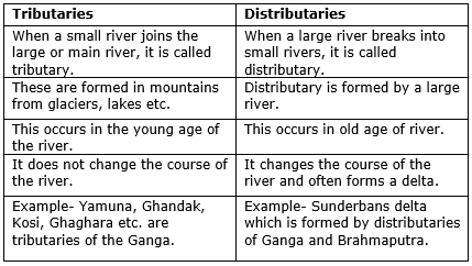
Q20. What is the difference between the tributary and the distributary? Write any three points. [2010 (T-1)]
Ans:
- A smaller stream joining with the mainstream is known as a tributary. A tributary generally carries water and silt to the main river. River Jamuna is an example of a tributary of the river Ganga.
- A Distributary is formed in the lower course of the river when the main channel of the river gets blocked with silt which forced the river to split branches. The Bhagirathi-Hooghly is a distributary of the river Ganga. The main function of the distributary is to distribute water through newly opened channels.
The three basic differences between tributaries and distributaries are given below:
Q21. Describe the three main features of the Narmada Basin. [2010 (T-1)]
Ans: The Narmada Basin has three main features:
- The Narmada River originates in the Amarkantak hills of Madhya Pradesh.
- It flows westward through a rift valley created by geological faulting.
- All its tributaries are short and join the main river at right angles.
|
55 videos|525 docs|78 tests
|
FAQs on Class 9 Geography Chapter 1 Question Answers - Contemporary India - I
| 1. What are the common types of drainage systems used in residential areas? |  |
| 2. How can I identify drainage problems in my yard? | |
| 3. What are the benefits of having a proper drainage system? | |
| 4. How can I improve drainage in my garden? | |
| 5. What maintenance is required for drainage systems? | |


Class 9 Geography Chapter 1 Question Answers - Contemporary India - I
,Important questions
,past year papers
,Extra Questions
,MCQs
,study material
,Sample Paper
,Semester Notes
,Previous Year Questions with Solutions
,Class 9 Geography Chapter 1 Question Answers - Contemporary India - I
,mock tests for examination
,shortcuts and tricks
,Exam
,Viva Questions
,Summary
,ppt
,Objective type Questions
,practice quizzes
,video lectures
,Class 9 Geography Chapter 1 Question Answers - Contemporary India - I
,Free
;


Short Answer Questions - Drainage Free PDF Download
Importance of Short Answer Questions - Drainage
Short Answer Questions - Drainage Notes
Short Answer Questions - Drainage Class 9
Study Short Answer Questions - Drainage on the App
|
© EduRev
|
Education Revolution
|


|


