UPSC Exam  >  UPSC Tests  >  Map Based Test - 1 - UPSC MCQ

Map Based Test - 1 - UPSC MCQ


Test Description

20 Questions MCQ Test - Map Based Test - 1

Map Based Test - 1 for UPSC 2024 is part of UPSC preparation. The Map Based Test - 1 questions and answers have been prepared according to the UPSC exam syllabus.The Map Based Test - 1 MCQs are made for UPSC 2024 Exam. Find important definitions, questions, notes, meanings, examples, exercises, MCQs and online tests for Map Based Test - 1 below.
Solutions of Map Based Test - 1 questions in English are available as part of our course for UPSC & Map Based Test - 1 solutions in Hindi for UPSC course. Download more important topics, notes, lectures and mock test series for UPSC Exam by signing up for free. Attempt Map Based Test - 1 | 20 questions in 25 minutes | Mock test for UPSC preparation | Free important questions MCQ to study for UPSC Exam | Download free PDF with solutions
Map Based Test - 1 - Question 1

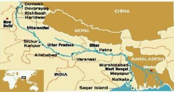
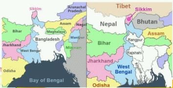
From which of the following cities Ganga flows?

1. Allahabad

2. Mayapur

3. Lucknow

4. Murshidabad

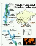
Detailed Solution for Map Based Test - 1 - Question 1

Map Based Test - 1 - Question 2

From which of the following countries Mekong river - 'Mother Ganga' of Southeast Asia flows?

1. Laos

2. Thailand

3. Cambodia

4. Myanmar

Detailed Solution for Map Based Test - 1 - Question 2

Mekong flows southeast from Tibet and enters the Yunnan province of China. It then snakes its way around to the border of China, Myanmar and Laos. 

 Its estimated length is 4,909 km (3,050 mi),[3] and it drains an area of 795,000 km2 (307,000 sq mi), discharging 475 km3 (114 cu mi) of water annually.[4] From the Tibetan Plateau the river runs through China, Myanmar, Laos, Thailand, Cambodia, and Vietnam. The extreme seasonal variations in flow and the presence of rapids and waterfalls in the Mekong make navigation difficult. Even so, the river is a major trade route between western China and Southeast Asia.

1 Crore+ students have signed up on EduRev. Have you? Download the App
Map Based Test - 1 - Question 3

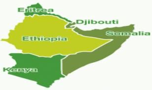
Which of the given countries are known as African Horn Countries?

1. Djibouti

2. Eritrea

3. Sudan

4. Somalia

5. Ethiopia

Detailed Solution for Map Based Test - 1 - Question 3

Map Based Test - 1 - Question 4

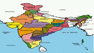
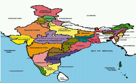
The Tropic of Cancer passes from how many states of India?

Detailed Solution for Map Based Test - 1 - Question 4

Map Based Test - 1 - Question 5

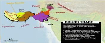
Which of the following countries comes into Golden Crescer?

1. Afghanistan

2. Pakistan

3. Iraq

4. Iran

Detailed Solution for Map Based Test - 1 - Question 5

Map Based Test - 1 - Question 6

Consider the following statements:

1. This is the national park which was established by Britishers in India.

2. The governing body of this national park is Project Tiger.

3. Fauna founds includes Tiger, Golden Jackal,Indian Pangolins ,Elephants etc.

Choose the correct option

Detailed Solution for Map Based Test - 1 - Question 6
  • Corbett National Park
  • In Uttrakhand- founded in 1936-formerly known as Hailey National Park.
  • This is the national park which was established by Britishers in India.
  • The governing body of this national park is Project Tiger.
  • Fauna founds includes Tiger, Golden Jackal .Indian Pangolins .Elephants etc.

Map Based Test - 1 - Question 7

How many states of India have Sea Coast?

Detailed Solution for Map Based Test - 1 - Question 7

Map Based Test - 1 - Question 8

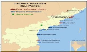
Arrange the Sea ports from North to South?

1. Gangavaram

2. Vishakhapatnam

3. Krishnapatnam

4. Kakinada

Choose the correct option

Detailed Solution for Map Based Test - 1 - Question 8

Map Based Test - 1 - Question 9

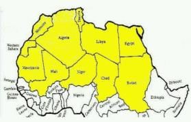
How many countries does Sahara Desert covers?

Detailed Solution for Map Based Test - 1 - Question 9

The enormous desert spans 11 countries: Algeria, Chad, Egypt, Libya, Mali, Mauritania, Morocco, Niger, Western Sahara, Sudan and Tunisia. 

Map Based Test - 1 - Question 10

Consider the following statements:

1. It is India’s first organic state.

2. It’s landlocked state.

3. This state is also known as Land of Flowers.

Choose the correct option

Detailed Solution for Map Based Test - 1 - Question 10

Map Based Test - 1 - Question 11

Arrange the following hill ranges from north to south direction:
1. Nallamala hills
2. Nilgiri hills
3. Anaimalai hills
4. Cardamon hills

Detailed Solution for Map Based Test - 1 - Question 11

The correct answer is option 2, i.e 1, 2, 3, 4.

  • The location of the hills asked in the question are mentioned below:
    • Nallamalas hills are a section of the Eastern Ghats which forms the eastern boundary of Rayalaseema region of the state of Andhra Pradesh and Mahabubnagar, Nalgonda districts of the state of Telangana, in India.
    • Nilgiri hills are the mountainous region of Tamil Nadu state, southeastern India. Nilgiri hills are the part of the Western Ghats, and the hills are separated from the Karnataka Plateau (north) by the Noyar River and from the Anaimalai and Palni hills (south) by the Palghat Gap.
    • Anaimalai or Anamala hills, also known as the Elephant Mountains, are the range of mountains that form the southern portion of the Western Ghats and span the border of Tamil Nadu and Kerala in Southern India.
    • Cardamom hills or Yela Mala hills are mountain range of southern India and part of the southern Western Ghats located in southeast Kerala and southwest Tamil Nadu in India.
Map Based Test - 1 - Question 12

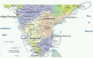
Which one of the following regions of India has a combination of mangrove forest, evergreen forest and deciduous forest?

Detailed Solution for Map Based Test - 1 - Question 12

The South Andaman forests have a profuse growth of epiphytic vegetation, mostly ferns and orchids. The Middle Andaman's harbors mostly moist deciduous forests.

North Andaman's is characterized by the wet evergreen type, with plenty of woody climbers. The North Nicobar Islands (including Car Nicobar and Battimalv) are marked by the complete absence of evergreen forests, while such forests form the dominant vegetation in the central and southern islands of the Nicobar group. Grasslands occur only in the Nicobars, and while deciduous forests are common in the Andamans, they are almost absent in the Nicobars.

Map Based Test - 1 - Question 13

Which of the following places have Sea Coast?

1. Udupi

2. Sivaganga

3. Kollam

4. Paradwip

Choose the correct option

Detailed Solution for Map Based Test - 1 - Question 13

Map Based Test - 1 - Question 14

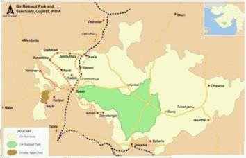
Consider the following statements:

1. This national park is a home of Asiatic lion.

2. This is a national park as well as wildlife Sanctuary.

3. The area near it is surrounded by four dams.

Detailed Solution for Map Based Test - 1 - Question 14
  • The seven major perennial rivers of the Gir region are
  • Hiran, Shetrunji, Datardi, Shingoda, Machhundri, Godavari and Raval.
  • The largest dam is Kamleshwar Dam.

Map Based Test - 1 - Question 15

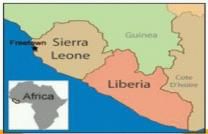
Which of the following are the neighboring countries of Sierra Leo?

1. Cote D’ Ivoire

2. Guinea

3. Liberia

4. Senegal

Detailed Solution for Map Based Test - 1 - Question 15

Map Based Test - 1 - Question 16

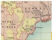
In how many states Chotanagpur plateau spreads?

Detailed Solution for Map Based Test - 1 - Question 16
It spreads in 5 states: Bihar,Jharkhand ,Chhattisgarh West Bengal ,Odisha

Map Based Test - 1 - Question 17

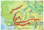
Which of these rivers flow from east to west?

1. Narmada

2. Godavari

3. Tapti

4. Mahi

5. Chambal

Detailed Solution for Map Based Test - 1 - Question 17

Map Based Test - 1 - Question 18

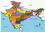
Which one of the following pairs of States of India indicates the easternmost and western most State?

Detailed Solution for Map Based Test - 1 - Question 18

Map Based Test - 1 - Question 19

India have how many neighboring countries?

Detailed Solution for Map Based Test - 1 - Question 19

Map Based Test - 1 - Question 20

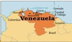
Trinidad and Tobago is nearest to which ot the following Country?

Detailed Solution for Map Based Test - 1 - Question 20

Information about Map Based Test - 1 Page
In this test you can find the Exam questions for Map Based Test - 1 solved & explained in the simplest way possible. Besides giving Questions and answers for Map Based Test - 1, EduRev gives you an ample number of Online tests for practice

Top Courses for UPSC

Download as PDF

Top Courses for UPSC