UPSC Exam  >  UPSC Tests  >  Test: Geography- 9 - UPSC MCQ

Test: Geography- 9 - UPSC MCQ


Test Description

25 Questions MCQ Test - Test: Geography- 9

Test: Geography- 9 for UPSC 2024 is part of UPSC preparation. The Test: Geography- 9 questions and answers have been prepared according to the UPSC exam syllabus.The Test: Geography- 9 MCQs are made for UPSC 2024 Exam. Find important definitions, questions, notes, meanings, examples, exercises, MCQs and online tests for Test: Geography- 9 below.
Solutions of Test: Geography- 9 questions in English are available as part of our course for UPSC & Test: Geography- 9 solutions in Hindi for UPSC course. Download more important topics, notes, lectures and mock test series for UPSC Exam by signing up for free. Attempt Test: Geography- 9 | 25 questions in 30 minutes | Mock test for UPSC preparation | Free important questions MCQ to study for UPSC Exam | Download free PDF with solutions
Test: Geography- 9 - Question 1

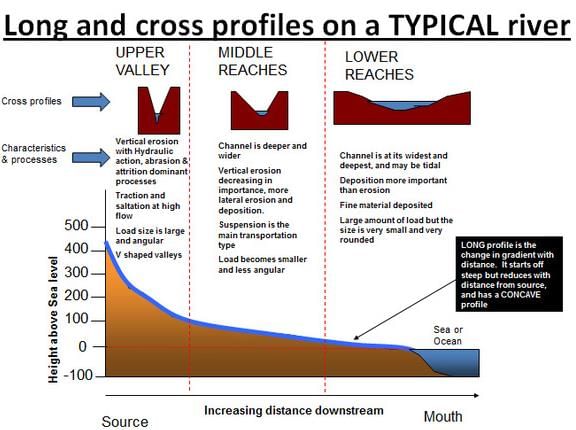
Consider the following features in a drainage system.

  1. Interlocking spurs
  2. Ox-bow lakes
  3. River cliffs
  4. Rapids and waterfalls

Which of the above will be found in the middle course of the river system?

Detailed Solution for Test: Geography- 9 - Question 1

Test: Geography- 9 - Question 2

Which of the following cannot be the use of Lagoons and backwaters?

  1. Fishing
  2. Irrigation of paddy crops
  3. Navigation

Select the correct answer code:

Detailed Solution for Test: Geography- 9 - Question 2

India has a vast coastline and the coast is very indented in some states. Due to this, a number of lagoons and lakes have formed. The States like Kerala, Odisha and West Bengal have vast surface water resources in these lagoons and lakes. Although, water is generally brackish in these water-bodies, it is used for fishing and irrigating certain varieties of paddy crops, coconut, etc.

1 Crore+ students have signed up on EduRev. Have you? Download the App
Test: Geography- 9 - Question 3

Well-rounded and Well-sorted sand grains indicate that sediment 

Detailed Solution for Test: Geography- 9 - Question 3

Sediment Maturity refers to the length of time that the sediment has been in the sedimentary cycle. Texturally mature sediment is sediment that is well rounded, (as rounding increases with transport distance and time) and well sorted (as sorting gets better as larger clasts are left behind and smaller clasts are carried away.  Because the weathering processes continues during sediment transport, mineral grains that are unstable near the surface become less common as the distance of transport or time in the cycle increases. Thus compositionally mature sediment is composed of only the most stable minerals.

Test: Geography- 9 - Question 4

Consider the following statements regarding Atmosphere.

  1. 99% of earth’s atmosphere is confined to the height of 320 km from earth’s surface.
  2. Hydrogen and Oxygen were the major constituents of early atmosphere.

Which of the above statements is/are incorrect?

Detailed Solution for Test: Geography- 9 - Question 4

The air is an integral part of the earth’s mass and 99 percent of the total mass of the atmosphere is confined to the height of 32 km from the earth’s surface.
Oxygen was absent in the early atmosphere. Atmospheric levels of oxygen did not rise until oxygenic photosynthesis was well established.

Test: Geography- 9 - Question 5

Continental shelf is formed due to:

  1. Rise in sea level
  2. Submergence of a part of a continent
  3. Sedimentary deposits brought down by rivers

Which of the above statements is/are correct?

Detailed Solution for Test: Geography- 9 - Question 5

Continental Shelf is the submerged edge of a continent which is a gently sloping plain that extends into the Ocean. The typical gradient is less than 1°. The average width of continental shelves is about 80 km. The largest continental shelf is the Siberian Shelf in the Arctic Ocean, which stretches to 1,500 kilometers in width. Because of the gentle slope, the continental shelf is influenced by the changes in the sea level.
The shelf is formed mainly due to
Rise in sea level

  • Submergence of a part of a continent
  • Sedimentary deposits brought down by rivers
Test: Geography- 9 - Question 6

Consider the following statements.

  1. Maize requires moderate temperature, rainfall and lots of sunshine.
  2. Cotton requires high temperature, light rainfall, and less than hundred frost-free days and bright sunshine for its growth.
  3. Jute grows well on alluvial soil and requires high temperature, heavy rainfall and humid climate.

Which of the above statements is/are correct?

Detailed Solution for Test: Geography- 9 - Question 6
  • Maize requires moderate temperature, rainfall and lots of sunshine. It needs well-drained fertile soils.
  • Cotton requires high temperature, light rainfall, two hundred and ten frost-free days and bright sunshine for its growth. It grows best on black and alluvial soils.
  • Jute was also known as the ‘Golden Fibre’. It grows well on alluvial soil and requires high temperature, heavy rainfall and humid climate. This crop is grown in the tropical areas. India and Bangladesh are the leading producers of jute.
Test: Geography- 9 - Question 7

Consider the following statements.

  1. Deltas are formed in low tide regions, whereas Estuaries are formed in high tide region with rift valleys.
  2. Estuaries are usually more fertile than delta regions.
  3. Delta region continuously interacts with the ocean unlike estuaries which does not.

Which of the above statements is/are correct?

Detailed Solution for Test: Geography- 9 - Question 7
  • Deltas are practically wetlands that are normally formed when a fast-moving river empties its sediments before joining a slow-moving water body such as a sea or an ocean or a lake. On the other hand, estuaries are semi-enclosed water bodies that constitute of salty water. It is normally an area where a river merges with a sea.
  • Deltas are normally shaped like a bird’s foot or fan-shaped, whereas, estuaries are fjord estuaries or tectonic estuaries.
  • Deltas are extremely fertile by nature that makes it suitable for agriculture and estuaries are not fertile and thus, not suitable for agriculture.
  • Deltas are formed in regions that experience coastal plants and low tides, whereas, estuaries are formed in regions that experience rift valleys and high tides.
Test: Geography- 9 - Question 8

Cinnamomum camphora (from where Camphor can be obtained) is naturally found in

Detailed Solution for Test: Geography- 9 - Question 8

Cinnamomum camphora is a species of evergreen tree that is commonly known under the names camphor tree, camphorwood or camphor laurel.

Test: Geography- 9 - Question 9

Consider the following statements:

  1. The enclosed seas in the low latitudes have lower temperature than the open seas.
  2. The enclosed seas in the high latitudes have higher temperature than the open seas

Which of the above statements is/are correct?

Detailed Solution for Test: Geography- 9 - Question 9

The enclosed seas in the low latitudes record relatively higher temperature than the open seas whereas the enclosed seas in the high latitudes have lower temperature than the open seas.

Test: Geography- 9 - Question 10

Consider the following statements regarding Ocean Currents.

  1. Ocean currents are not greatly influenced by coriolis force.
  2. The oceanic circulation pattern roughly corresponds to the earth’s atmospheric circulation pattern.
  3. In the southern hemisphere, the air circulation over the oceans in the middle latitudes is mainly cyclonic.

Which of the above statements is/are incorrect?

Detailed Solution for Test: Geography- 9 - Question 10

Major ocean currents are greatly influenced by the stresses exerted by the prevailing winds and coriolis force. The oceanic circulation pattern roughly corresponds to the earth’s atmospheric circulation pattern. The air circulation over the oceans in the middle latitudes is mainly anticyclonic (more pronounced in the southern hemisphere than in the northern hemisphere).

Test: Geography- 9 - Question 11

Consider the following matches of specific disasters and related nodal agencies for early warning in the Government of India.

  1. Cyclone: Indian Meteorological Department
  2. Tsunami: Indian National Centre for Oceanic Information Services
  3. Floods: Central Water Commission
  4. Landslides: Geological Survey of India

Select the correct answer code:

Detailed Solution for Test: Geography- 9 - Question 11

Guidelines issued by the Home Ministry, on disaster warning:

  • Indian Meteorological Department has been designated as nodal agency for early warning for cyclone, Indian Tsunami Early Warning Centre and Indian National Centre for Oceanic Information Services for Tsunami and Central Water Commission for floods.
  • The Geological Survey of India has been marked as nodal agency for issuing early warning for landslides, Snow and Avalanche Study Establishment for avalanches and Indian Meteorological Department for heat and cold waves.
Test: Geography- 9 - Question 12

Consider the following statements regarding ‘Drought Management in India’.

  1. There is no single, legally accepted definition of drought in India.
  2. Risk assessment and risk management of a drought falls within the purview of the Disaster Management Act, 2005.
  3. The Central government is the final authority to declare a region as drought affected.

Which of the above statements is/are correct?

Detailed Solution for Test: Geography- 9 - Question 12
  • Drought is generally considered as a deficiency in rainfall /precipitation over an extended period, usually a season or more, resulting in a water shortage causing adverse impacts on vegetation, animals, and/or people.
  • There is no single, legally accepted definition of drought in India. Some states resort to their own definitions of drought. State Government is the final authority when it comes to declaring a region as drought affected
  • The Supreme Court of India stated that drought would certainly fall within the definition of “disaster” as defined under Section 2(d) of the Disaster Management (DM) Act, 2005.
  • Since drought is a disaster, risk assessment and risk management as well as crisis management of a drought falls completely within the purview of the Disaster Management Act, 2005.
Test: Geography- 9 - Question 13

National Disaster Management Authority will involve in which of the following disasters?

  1. Urban Floods
  2. Heat Wave
  3. Nuclear and Radiological Disaster
  4. Chemical and Biological threat

Select the correct code:

Detailed Solution for Test: Geography- 9 - Question 13

On 23 December 2005, the Government of India enacted the Disaster Management Act, which envisaged the creation of the National Disaster Management Authority (NDMA), headed by the Prime Minister, and State Disaster Management Authorities (SDMAs) headed by respective Chief Ministers, to spearhead and implement a holistic and integrated approach to Disaster Management in India.
It involves in the following disasters
Natural Disaster:

  • Earthquakes
  • Floods
  • Landslides
  • Cyclones
  • Tsunamis
  • Urban Floods
  • Heat Wave

Man-Made Disasters

  • Nuclear and Radiological Disaster
  • Chemical Disaster
  • Biological Disaster
Test: Geography- 9 - Question 14

Consider the following statements regarding State Disaster Response Fund (SDRF).

  1. SDRF was constituted based on the recommendations of the 14th Finance Commission.
  2. The Central Government contributes 50% to SDRF and the remaining 50% is provided from the State Government.
  3. A State Government may use the funds available under the SDRF for providing immediate relief to the victims of natural disasters that they consider to be ‘disasters’ within the local context in the State.

Which of the above statements is/are incorrect?

Detailed Solution for Test: Geography- 9 - Question 14

SDRF has been constituted by each state under the provisions of Disaster Management act 2005.
It was constituted based on the recommendations of the 13th Finance Commission.

  • Funding: The Central Government contributes 75% of SDRF allocation for general category States/UTs and 90% for special category States/UTs.
  • Heads: The state executive committee headed by the Chief Secretary is authorized to decide on all matters relating to the financing of the relief expenditure from the SDRF.
    Disaster (s) covered under SDRF: Cyclone, drought, earthquake, fire, flood, tsunami, hailstorm, landslide, avalanche, cloudburst, pest attack, frost and cold waves.
  • Local Disaster: A State Government may use up to 10 percent of the funds available under the SDRF for providing immediate relief to the victims of natural disasters that they consider to be ‘disasters’ within the local context in the State and which are not included in the notified list of disasters of the Ministry of Home Affairs subject to the condition that the State Government has listed the State specific natural disasters and notified clear and transparent norms and guidelines for such disasters with the approval of the State Authority, i.e., the State Executive Authority (SEC).
Test: Geography- 9 - Question 15

Consider the following statements regarding National Disaster Response Fund (NDRF).

  1. NDRF is located in the “Public Accounts” of Government of India under “Reserve Funds not bearing interest”.
  2. The relief activities for all the calamities are monitored by the Ministry of Home Affairs.
  3. NDRF amount can be spent only towards meeting the expenses for emergency response, relief and rehabilitation.

Which of the above statements is/are correct?

Detailed Solution for Test: Geography- 9 - Question 15
  • National Disaster Response Fund is defined in Section 46 of the Disaster Management Act, 2005 (DM Act) as a fund managed by the Central Government for meeting the expenses for emergency response, relief and rehabilitation due to any threatening disaster situation or disaster. NDRF is constituted to supplement the funds of the State Disaster Response Funds (SDRF) of the states to facilitate immediate relief in case of calamities of a severe nature.
  • The DM Act defines “disaster” to mean ‘a catastrophe, mishap, calamity or grave occurrence in any area, arising from natural or man-made causes, or by accident or negligence which results in substantial loss of life or human suffering or damage to, and destruction of, property, or damage to, or degradation of, environment, and is of such a nature or magnitude as to be beyond the coping capacity of the community of the affected area.’
  • NDRF amount can be spent only towards meeting the expenses for emergency response, relief and rehabilitation. For projects exclusively for the purpose of mitigation, i.e, measures aimed at reducing the risk, impact or effect of a disaster or threatening disaster situation a separate fund called National Disaster Mitigation Fund has to be constituted.
  • NDRF is located in the “Public Accounts” of Government of India under “Reserve Funds not bearing interest”.
Test: Geography- 9 - Question 16

One can infer which of the following information from a population pyramid?

  1. Gender composition based on age groups
  2. Distribution of various age groups in a population
  3. Density of population
  4. Reproductive capabilities and likelihood of the continuation of a species

Select the correct answer code:

Detailed Solution for Test: Geography- 9 - Question 16

A population pyramid, also called an “age-gender-pyramid“, is a graphical illustration that shows the distribution of various age groups in a population (typically that of a country or region of the world), which forms the shape of a pyramid when the population is growing. It is also used in ecology to determine the overall age distribution of a population; an indication of the reproductive capabilities and likelihood of the continuation of a species.

Test: Geography- 9 - Question 17

Consider the following statements.

  1. The fertility rate refers to the number of live births per 1000 women in the child-bearing age group, usually taken to be 15 to 49 years.
  2. Reaping demographic dividend due to a higher population of working-age citizens is usually the last stage in the demographic transition of any society.

Which of the above statements is/are correct?

Detailed Solution for Test: Geography- 9 - Question 17
  • The fertility rate refers to the number of live births per 1000 women in the child-bearing age group, usually taken to be 15 to 49 years.
  • In the fourth stage, low birth rate and low death rate lead to Population stabilisation. In this stage, because of rapid economic development, standard of living of the people becomes very high.
  • The first stage has high fertility and high mortality because people reproduce more to compensate for the deaths due to epidemics and variable food supply.
  • In the second stage, birth-rate is high but death rate is low. It results in high growth rate of population.
  • In the third stage, a declining birth rate and low death rate lead to low population growth.
Test: Geography- 9 - Question 18

The term demographic trap is used by demographers to describe the combination of

  1. Sub-replacement level fertility rates
  2. High Fertility rate
  3. Declining mortality
  4. Increasing Mortality

Select the correct answer code:

Detailed Solution for Test: Geography- 9 - Question 18

The term demographic trap is used by demographers “to describe the combination of high fertility (birth rates) and declining mortality (death rates) in developing countries, resulting in a period of high population growth rate (PGR).”
Sub-replacement fertility in demography refers to any fertility rate below the replacement rate that would cause the population of a certain group of people to decrease over time.

Test: Geography- 9 - Question 19

The term “Sub Urbanisation” refers to 

Detailed Solution for Test: Geography- 9 - Question 19

Suburbanization is a population shift from central urban areas into suburbs, resulting in the formation of (sub)urban sprawl. As a consequence of the movement of households and businesses out of the city centers, low-density, peripheral urban areas grow. (Sub-urbanization is inversely related to urbanization, which denotes a population shift from rural areas into urban centres.)
Many residents of metropolitan regions work within the central urban area, and choose to live in satellite communities called suburbs and commute to work via automobile or mass transit.

Test: Geography- 9 - Question 20

The Census of India differentiates between urban and rural areas on which of the following criteria?

  1. Occupational structure
  2. Literacy rates
  3. Resource base
  4. Population size

Select the correct answer code:

Detailed Solution for Test: Geography- 9 - Question 20

For the Census of India 2011, the definition of urban area is as follows;
All places with a municipality, corporation, cantonment board or notified town area committee, etc.
All other places which satisfied the following criteria:

  • A minimum population of 5,000;
  • At least 75 per cent of the male main working population engaged in non-agricultural pursuits; and
  • A density of population of at least 400 persons per sq. km.
Test: Geography- 9 - Question 21

Which of the following contribute to Monsoon breaks in India?

  1. When rain-bearing storms are not very frequent along the monsoon trough
  2. Over the west coast, when winds blow parallel to the coast.
  3. Tropical depressions during the south-west monsoon period

Select the correct answer code:

Detailed Solution for Test: Geography- 9 - Question 21

During the south-west monsoon period after having rains for a few days, if rain fails to occur for one or more weeks, it is known as break in the monsoon. These dry spells are quite common during the rainy season. These breaks in the different regions are due to different reasons:
(i) In northern India rains are likely to fail if the rain-bearing storms are not very frequent along the monsoon trough or the ITCZ over this region.
(ii) Over the west coast the dry spells are associated with days when winds blow parallel to the coast.
Inflow of western cyclones generally known as disturbances during the winter season and tropical depressions during the south-west monsoon period into India, creating weather conditions favourable to rainfall.

Test: Geography- 9 - Question 22

Consider the following statements.

  1. These soils are widespread in the northern plains and the river valleys.
  2. They are depositional soils, transported and deposited by rivers and streams.
  3. In the Peninsular region, they are found in deltas of the east coast.

The above statements refer to

Detailed Solution for Test: Geography- 9 - Question 22

Alluvial soils are widespread in the northern plains and the river valleys. These soils cover about 40 per cent of the total area of the country. They are depositional soils, transported and deposited by rivers and streams. Through a narrow corridor in Rajasthan, they extend into the plains of Gujarat. In the Peninsular region, they are found in deltas of the east coast and in the river valleys.

Test: Geography- 9 - Question 23

High concentration of Teak and Sal forest are found in which topographic region 

Detailed Solution for Test: Geography- 9 - Question 23

Sal and teak forests are best grown in central highlands. Teak and sal are tropical deciduous trees. Suitable topographical and climatic conditions of central highlands are suitable for growth of teak and sal.

Test: Geography- 9 - Question 24

Consider the following statements:

  1. Roaring forties are the westerlies, lies between 40° and 50° latitude in Southern hemisphere.
  2. Horse latitudes are the low pressure and low temperature zone in 25-35 north and south latitude.

Which of the above statements is/are correct?

Detailed Solution for Test: Geography- 9 - Question 24

The Roaring Forties are extremely powerful westerly winds that blow in the Southern Hemisphere between latitudes 40° and 50°.
Horse latitudes are high temperature and high-pressure belts.

Test: Geography- 9 - Question 25

Consider the following statements.

  1. They are found in hills of the northeastern region and the Andaman and Nicobar Islands.
  2. These forests are well stratified.
  3. Species found in these forests include rosewood, mahogany, aini and ebony.

The above statements refer to

Detailed Solution for Test: Geography- 9 - Question 25
  • Tropical Evergreen forests are found in the western slope of the Western Ghats, hills of the northeastern region and the Andaman and Nicobar Islands.
  • They are found in warm and humid areas with an annual precipitation of over 200 cm and mean annual temperature above 220
  • Tropical evergreen forests are well stratified, with layers closer to the ground and are covered with shrubs and creepers, with short structured trees followed by tall variety of trees.
  • In these forests, trees reach great heights up to 60 m or above. There is no definite time for trees to shed their leaves, flowering and fruition. As such these forests appear green all the year round. Species found in these forests include rosewood, mahogany, aini, ebony, etc.
Information about Test: Geography- 9 Page
In this test you can find the Exam questions for Test: Geography- 9 solved & explained in the simplest way possible. Besides giving Questions and answers for Test: Geography- 9, EduRev gives you an ample number of Online tests for practice

Top Courses for UPSC

Download as PDF

Top Courses for UPSC