Class 7 Social Science Chapter 3 Let's Explore - Climates of India
| Table of contents |
|
| Page 47: Weather, Seasons and the Climate |
|
| Page 51: Factors Determining the Climate |
|
| Page 56: The Monsoons |
|
| Page 59: Climates and Disasters |
|
| Page 60 & 62: Climates and Disasters |
|

Page 47: Weather, Seasons and the Climate
Q: Which are your favourite seasons? Write a short essay explaining your reasons.
Ans: My favourite seasons are the monsoon and spring. The monsoon, or varshā, brings life to the land with its refreshing rains, filling rivers and making fields green. I love the sound of raindrops and the cool, humid air after a hot summer. It’s a time when farmers plant crops, and festivals like Onam celebrate the harvest. Spring, or vasanta, is equally special with its mild weather and blooming flowers. Trees like the mango and jacaranda burst into colour, and festivals like Vasanta Panchami fill the air with joy. 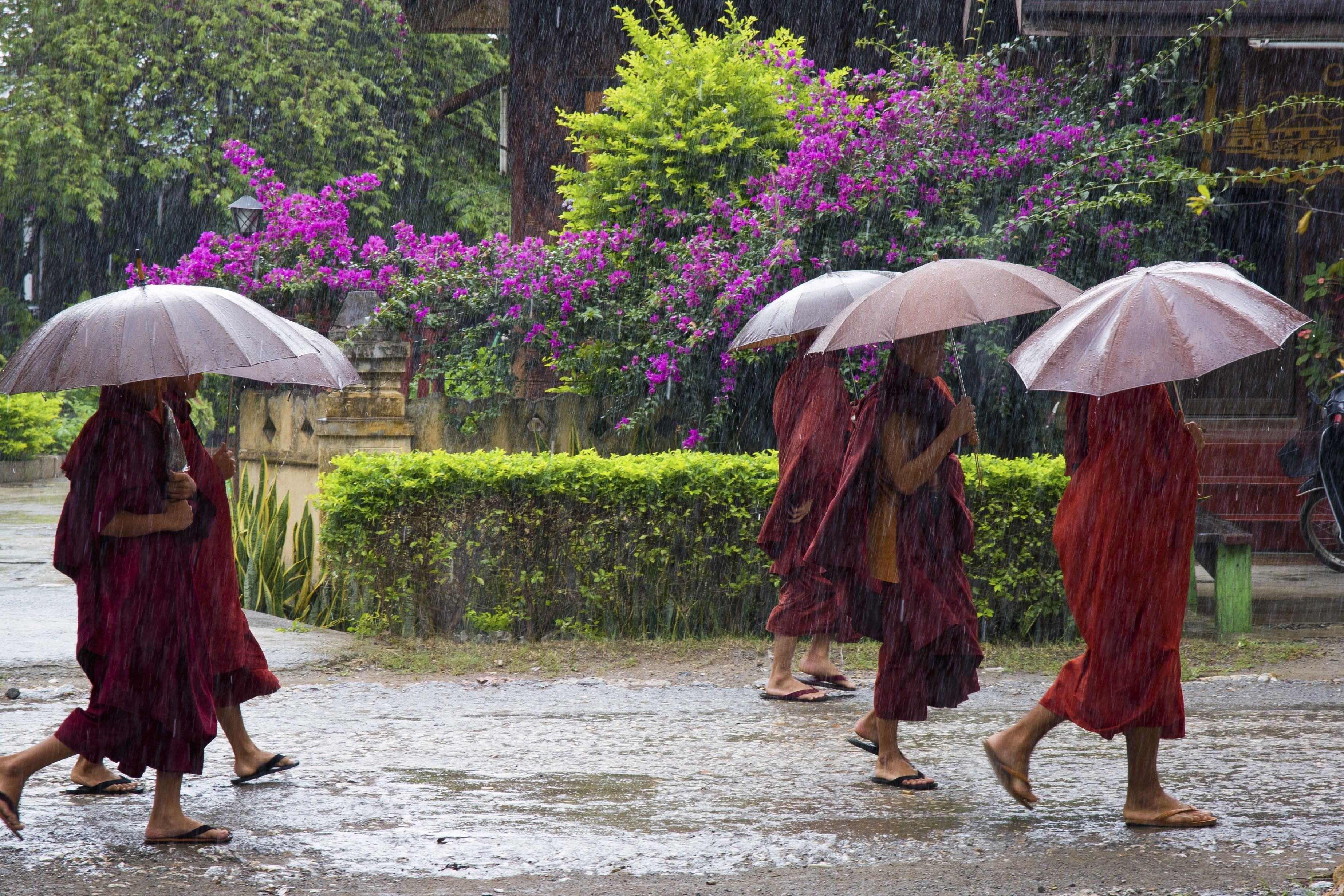 Monsoon Seasons
These seasons feel vibrant and full of hope, connecting me to nature’s cycles. They also allow outdoor activities like picnics or kite-flying, which are less comfortable in the extreme heat of summer or cold of winter. The preference for seasons may vary by region, but monsoon and spring are often cherished in India for their moderate climates and cultural significance.
Q: Discuss in groups of three or four and find out whether there are specific events connected to the seasons in your region. Collect information about them—songs, feasts with specific types of food, practices in different seasons, etc. Document these and share your discoveries with your class.
Ans: Seasonal Events in the Region(example for a North Indian context):
- Monsoon (Varshā): Celebrated with festivals like Teej, where women sing folk songs, wear green clothes, and enjoy sweets like ghewar. Communities perform rituals to welcome rain, such as prayers to Lord Indra.
- Spring (Vasanta): Vasanta Panchami honours Goddess Saraswati with yellow foods like kesar halwa and kite-flying. Schools hold cultural programs with songs like “Basant Ritu Aayi”.
- Autumn (Sharad): Sharad Purnima involves preparing kheer under moonlight and singing devotional songs. Navratri features garba and dandiya dances.
- Winter (Shishir): Lohri includes bonfires, singing Punjabi folk songs like “Sundar Mundariye”, and eating til-gur sweets.
- Documentation: Compile a chart listing each season, associated festivals, foods (e.g., ghewar for monsoon, kheer for autumn), songs, and practices (e.g., kite-flying in spring). Include photos or drawings of rituals.
- Class Sharing: Present findings through a group skit or poster, highlighting how seasons shape local culture. For example, discuss how monsoon feasts reflect gratitude for rain, vital for agriculture.
Q: Do you know which trees in your area change colours before the onset of winter? Are there trees that shed their leaves around this time? Why do you think this happens? Find out and document the local names of these trees.
Ans: Trees Changing Colours or Shedding Leaves(example for a North Indian region):
Trees Changing Colours: Chinar (local name: Chinar, botanical name: Platanus orientalis) in Kashmir turns vibrant red or orange before winter. Jacaranda (local name: Jacaranda) in some urban areas shows purple hues in autumn.
Trees Shedding Leaves: Neem (local name: Neem, botanical name: Azadirachta indica) sheds leaves in late autumn to conserve water. Peepal (local name: Peepal, botanical name: Ficus religiosa) partially sheds leaves before winter.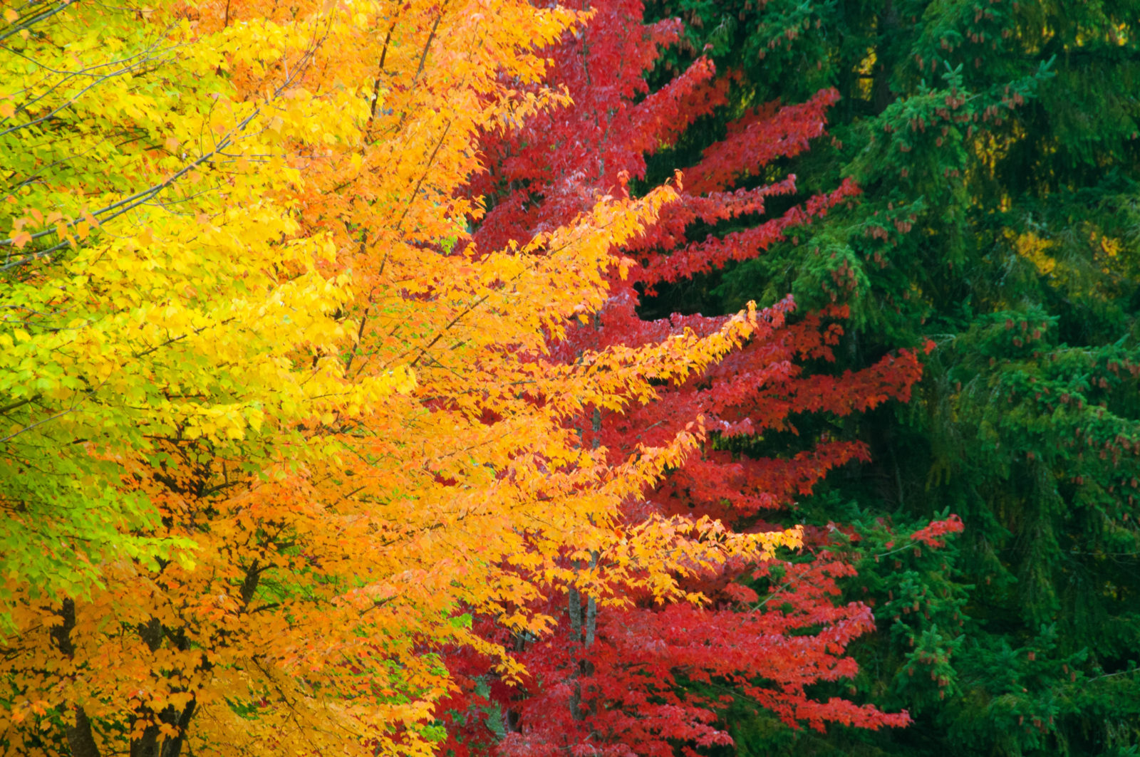 Trees Changing Colours
Reason for Changes: Trees change colours or shed leaves to prepare for winter’s cold and reduced sunlight. Chlorophyll breaks down, revealing pigments like red or yellow (e.g., in Chinar). Shedding leaves reduces water loss and energy use, as trees enter a dormant state to survive harsh conditions.
Documentation: Create a table listing trees, their local names, colour changes (e.g., Chinar: red-orange), shedding patterns, and reasons. Include sketches or photos of leaves. For example: “Neem sheds leaves in November to conserve water, common in Delhi.”
Page 51: Factors Determining the Climate
Q: Udhagamandalam (Ooty) and Coimbatore are almost at the same latitude. The range of summer temperatures in Ooty is 10-25°C while that in Coimbatore is 25-38°C. Why do you think there is such a difference in temperature between these two places?
Ans: The temperature difference between Ooty and Coimbatore, despite similar latitudes, is primarily due to altitude.
- Ooty: Located at ~2,240 meters above sea level in the Nilgiri Hills, Ooty has a cooler climate (10-25°C in summer). Higher altitude means lower atmospheric pressure and less dense air, which holds less heat. Additionally, being farther from the Earth’s surface, which absorbs solar heat, Ooty stays cooler.
- Coimbatore: At ~400 meters above sea level, Coimbatore is in the plains, closer to the Earth’s surface, where denser air traps more heat, resulting in higher temperatures (25-38°C in summer).
- Other Factors: Ooty’s hilly topography and vegetation may enhance cooling, while Coimbatore’s urban areas could create a warmer microclimate. Proximity to the sea has less impact here, as both are relatively inland, but Ooty’s elevation is the dominant factor.
Page 56: The Monsoons
Q: Since the ability to predict the monsoon rainfall has been an important aspect of life in India, our ancestors observed Nature around them carefully. They developed local traditional knowledge through their experience. This traditional knowledge is an important heritage we must preserve. For example, fishermen on the Konkan coast predict the onset of the monsoon when fishes that normally stay under water are seen at the surface; in parts of southern India monsoon is said to arrive within 50 days after the Golden Shower tree (Cassia fistula) blossoms. Some communities also believe that when crows build their nests high on tree-tops, it indicates less rainfall, whereas if the nests are lower, rainfall is likely to be heavy. Make a list of such local knowledge about rain, fog, snow, or hail in your area.
Ans: Local Traditional Knowledge on Weather Prediction(example for a mixed Indian context):
Rain: In Kerala, the blooming of the Kanikkonna (Golden Shower tree, Cassia fistula) signals the monsoon’s arrival within ~50 days. On the Konkan coast (Maharashtra), fishermen observe fish like mackerel rising to the surface, indicating monsoon onset due to changes in water currents. In Rajasthan, low-flying swallows suggest imminent rain, as they follow insects drawn to moist air.
Fog: In Punjab, farmers predict dense winter fog when evenings feel unusually chilly and still, linked to temperature inversions.
Snow: In Himachal Pradesh, villagers note that heavy cloud cover over the Himalayas with a sharp drop in temperature signals snowfall within a day.
Hail: In Uttar Pradesh, farmers believe a sudden darkening of clouds with a warm, humid afternoon predicts hailstorms, due to unstable atmospheric conditions.
Other Signs: In Odisha, high crow nests indicate less rainfall, while low nests suggest heavy rains, possibly reflecting humidity-driven behavior. In Tamil Nadu, loud frog croaking in ponds is a sign of approaching rain, as frogs sense rising humidity.
List Format:
- Kanikkonna blooms → Monsoon in 50 days (Kerala, Rain).
- Fish at surface → Monsoon onset (Konkan, Rain).
- Low-flying swallows → Rain soon (Rajasthan, Rain).
- Chilly, still evenings → Dense fog (Punjab, Fog).
- Heavy clouds, temperature drop → Snowfall (Himachal Pradesh, Snow).
- Dark clouds, humid air → Hailstorm (Uttar Pradesh, Hail).
- High crow nests → Less rain; low nests → Heavy rain (Odisha, Rain).
- Loud frog croaking → Rain approaching (Tamil Nadu, Rain).
Q: Reach out to your grandparents or elders in your neighbourhood. Ask them about the traditional festivals and dances they remember from their childhood and youth, especially those related to agriculture and rain. What rituals did they participate in? Then organise a cultural fest with your friends. You can showcase some of the dances, songs, and activities your elders shared with you. Whether it is a dance, harvest ritual, or a simple story about a prayer to rain gods, try to bring these traditions to life for your classmates.
Ans: Traditional Festivals and Rituals(example based on elders’ accounts in a North/South Indian context):
Monsoon-Related:
- Teej (North India): Elders recall women dancing to folk songs like “Kajri” and swinging on decorated swings, praying for rain. Rituals included offering sweets like ghewar to Lord Indra for abundant rainfall.
- Onam (Kerala): Grandparents describe Pookalam (floral rangoli) and Vallamkali (boat races), celebrating the harvest and rains. They performed prayers to King Mahabali for prosperity.
Harvest-Related:
- Baisakhi (Punjab): Elders participated in Bhangra and Gidda dances to celebrate wheat harvest, with songs like “Jind Mahi” and offerings of kheer at gurudwaras.
- Pongal (Tamil Nadu): Families cooked Pongal (rice dish) in clay pots outdoors, thanking the Sun God for the harvest. Kolattam stick dances were performed.
Rain Prayers: In Rajasthan, elders performed Havans and sang Malhar ragas to invoke rain during droughts, believing music pleased rain gods.
Cultural Fest Organization:
- Activities: Recreate Pookalam for Onam, perform Bhangra for Baisakhi, or sing Kajri for Teej. Share a story of a rain prayer ritual, like a Rajasthan Havan.
- Showcase: Set up stalls with drawings of Vallamkali boats or ghewar replicas. Perform a short Kolattam dance or narrate elders’ tales of monsoon celebrations.
- Class Engagement: Invite classmates to join dances or create their own Pookalam. Display a timeline of festivals linked to seasons, highlighting their agricultural roots.
Page 59: Climates and Disasters
Think Question: What are clouds? White lumps in the sky, you might say. But what are they made of? The answer is simple—water. But not just any water; clouds are masses of water droplets, ice crystals, or a mixture of both, that are suspended in the atmosphere.
Ans: Clouds Defined: Clouds are masses of water droplets, ice crystals, or both, suspended in the atmosphere. They form when water vapor in the air condenses due to cooling, often triggered by rising air in low-pressure systems.
Relevance to Cyclones: In cyclones, moist air from the sea rises in a low-pressure system, cools, and condenses into clouds, forming dense cloud bands around the cyclone’s eye. The “eye” remains cloudless due to sinking air, while surrounding clouds produce heavy rain. Understanding clouds as water in droplet or crystal form helps explain cyclone formation and precipitation patterns.
Page 60 & 62: Climates and Disasters
Q: Have you seen or read about floods? Look at the physical map of India. Discuss in pairs why you think floods occur in the areas mentioned above.
Ans: Flood-Prone Areas: The document mentions Uttar Pradesh, Bihar, Kerala, Andhra Pradesh, and Assam as particularly vulnerable to floods.
Reasons for Floods (Based on Physical Map Analysis):
- Uttar Pradesh and Bihar: Located in the Gangetic Plains, these states have flat topography and are drained by large rivers like the Ganga and its tributaries. Heavy monsoon rainfall causes rivers to overflow, flooding low-lying plains. Poor drainage in urban areas exacerbates flooding.
- Assam: Situated in the Brahmaputra Valley, Assam receives intense monsoon rains, and the Brahmaputra River often breaches its banks due to high water volume from the Himalayas. The region’s hilly terrain can also trigger flash floods.
- Kerala: On the western coastal strip, Kerala experiences a tropical wet climate with heavy monsoon rainfall. The Western Ghats cause orographic rainfall, and steep slopes lead to rapid runoff, flooding coastal plains. Urbanization blocking natural waterways worsens floods.
- Andhra Pradesh: Along the eastern coast, Andhra Pradesh faces heavy rainfall from the southwest and northeast monsoons. Flat coastal plains and river deltas (e.g., Godavari, Krishna) are prone to flooding when rivers swell or cyclones bring storm surges.
- Discussion Points: The physical map shows these areas as low-lying plains or coastal regions with major rivers, making them susceptible to monsoon-driven flooding. Human factors like deforestation and poor urban planning also contribute.
Q: Observe Fig. 3.15. Describe the effects they may have on people, plants, animals, and economic life.
Ans: Effects of Forest Fires (Fig. 3.15):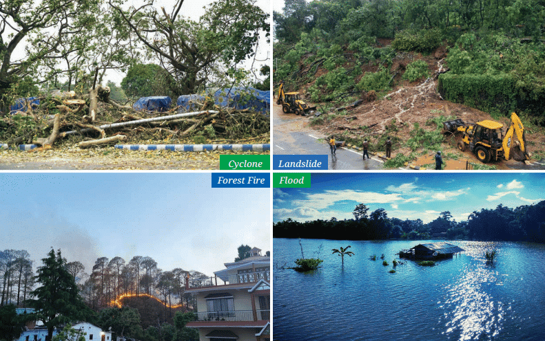
- People: Forest fires, like those in Uttarakhand or the Western Ghats, displace communities, destroy homes, and degrade air quality, causing respiratory issues. For example, smoke from fires can lead to health problems in nearby towns.
- Plants: Fires destroy vegetation, reducing forest cover and disrupting ecosystems. Native species may struggle to regrow, and soil fertility can decline due to nutrient loss.
- Animals: Wildlife is harmed or displaced, with many animals losing habitats or dying in fires. Species like deer or birds in forested areas (e.g., Madhya Pradesh) face survival challenges.
- Economic Life: Fires disrupt agriculture by damaging crops or grazing lands, affect tourism (e.g., in hill stations like Shimla), and require costly firefighting and rehabilitation efforts. Timber industries in states like Chhattisgarh suffer losses.
- Fig. 3.15 likely shows burning forests, emphasizing the widespread destruction of natural and economic resources.
Q: In groups of four or five, identify in each of the above disasters the part of natural causes and the part of human causes. Compare your conclusions.
Ans: Disasters and Causes(Cyclones, Floods, Landslides, Forest Fires):
Cyclones:
- Natural Causes: Low-pressure systems over warm ocean waters, high wind speeds, and moisture from seas (e.g., Bay of Bengal) form cyclones, as seen with Cyclone Fani (Fig. 3.13).
- Human Causes: Climate change, driven by fossil fuel emissions, increases sea temperatures, intensifying cyclone frequency and strength. Coastal development without proper planning increases vulnerability.
Floods:
- Natural Causes: Heavy monsoon rainfall, river overflow (e.g., Ganga in Bihar), and glacial lake outbursts in the Himalayas (e.g., Uttarakhand 2013) cause floods.
- Human Causes: Deforestation reduces soil absorption, urban concretization blocks drainage (e.g., in Kerala), and poor river management leads to breaches.
Landslides:
- Natural Causes: Heavy rainfall during monsoons and earthquakes in hilly regions (e.g., Sikkim, Himachal Pradesh) trigger landslides.
- Human Causes: Deforestation, improper construction on slopes (e.g., in Uttarakhand), and mining destabilize hills, increasing landslide risks.
Forest Fires:
- Natural Causes: Dry climatic conditions, droughts, and high winds fuel fires in states like Madhya Pradesh.
- Human Causes: Careless activities (e.g., unattended campfires), slash-and-burn agriculture, and climate change-induced droughts exacerbate fire risks.
Comparison: Natural causes like rainfall and topography are common triggers, but human activities (e.g., deforestation, emissions, poor planning) amplify the frequency and impact of all disasters. Groups may differ on the weight of human vs. natural causes but agree that mitigation requires addressing both.
Q: Discuss in the same groups series of preventive measures that could help avoid the above disasters.
Ans: Preventive Measures for Disasters:
Cyclones:
- Natural: Early warning systems by the IMD to track cyclone paths, as mentioned on Page 58.
- Human: Strengthen coastal infrastructure (e.g., mangroves, seawalls), enforce building codes, and reduce greenhouse gas emissions to mitigate climate change.
Floods:
- Natural: Preserve wetlands and forests to absorb rainfall, and dredge rivers to increase capacity.
- Human: Improve urban drainage systems, regulate construction in floodplains, and relocate vulnerable communities (e.g., in Assam).
Landslides:
- Natural: Stabilize slopes with vegetation and retaining walls in areas like the Western Ghats.
- Human: Enforce strict construction regulations, reforest hills (e.g., in Uttarakhand), and monitor seismic activity.
Forest Fires:
- Natural: Create firebreaks and controlled burns to reduce fuel in forests like those in Chhattisgarh.
- Human: Educate communities on fire safety, regulate agricultural burning, and use satellite monitoring to detect fires early.
Discussion: Groups should emphasize a mix of natural restoration (e.g., reforestation) and human interventions (e.g., policy enforcement, technology). Comparing conclusions may highlight the need for community involvement and government coordination to ensure effective prevention.
|
23 videos|204 docs|12 tests
|
FAQs on Class 7 Social Science Chapter 3 Let's Explore - Climates of India
| 1. What are the main factors that determine the climate of a region? |  |
| 2. How do monsoons affect the climate in India? | |
| 3. What are some common natural disasters linked to climate in India? | |
| 4. How do seasons change in India, and what impact do they have on daily life? | |
| 5. Why is understanding climate important for disaster management in India? | |


study material
,shortcuts and tricks
,Objective type Questions
,mock tests for examination
,Previous Year Questions with Solutions
,Exam
,past year papers
,video lectures
,Semester Notes
,Viva Questions
,Summary
,Class 7 Social Science Chapter 3 Let's Explore - Climates of India
,Sample Paper
,practice quizzes
,ppt
,Important questions
,Class 7 Social Science Chapter 3 Let's Explore - Climates of India
,Class 7 Social Science Chapter 3 Let's Explore - Climates of India
,MCQs
,Free
,Extra Questions
;


Let's Explore: Climates of India Free PDF Download
Importance of Let's Explore: Climates of India
Let's Explore: Climates of India Notes
Let's Explore: Climates of India Class 7 Questions
Study Let's Explore: Climates of India on the App
|
© EduRev
|
Education Revolution
|


|


