UPSC Exam > UPSC Notes > Geography for UPSC CSE > The Peninsular Plateau, Coastal Plain & Islands
The Peninsular Plateau, Coastal Plain & Islands | Geography for UPSC CSE PDF Download
| Table of contents |
|
| The Peninsular Plateau |
|
| The Central Highlands |
|
| The Deccan Plateau |
|
| The Coastal Plain and Islands |
|

The Peninsular Plateau
- Plateaus are elevated flatlands and are generally older than other landforms.
- The peninsular plateaus, also known as the Indian plateaus, are the oldest structure of the Indian subcontinent whose slow and steady movement towards north and north-east has been responsible for creation of the Himalyas and the Northern Plains in place of the Tethys seas of Geological time.
- This area is separated from the Indo-Gangetic plain by mountain ranges like the Vindhyas, Satpura, Mahadeo, Maikal, and Sarguja, which have heights ranging from 600 to 900 meters.
- The Peninsular plateau is usually divided into two major subdivisions with the Narmada valley as the line of demarcation.
- The region north of the Narmada valley is known as the Central Highlands and in south of the Narmada valley lies the Deccan Plateau.
The Central Highlands
These are bounded by the old Aravalli mountains on the west and the Vindhyas on the south.
- This region slopes northward to the Ganga plains.
- The Malwa Plateau is located in the western part of the Central Highlands. It consists of layers of lava that have been stacked upon one another.
- The central part of the Central Highlands contains several smaller plateaus, including Rewa, Baghelkhand, and Bundelkhand.
- The eastern area of the Central Highlands includes the Chotanagpur Plateau, which is known for its rich mineral resources.
- The Narmada River, flowing through a rift valley, marks the northern edge of the Deccan Plateau.
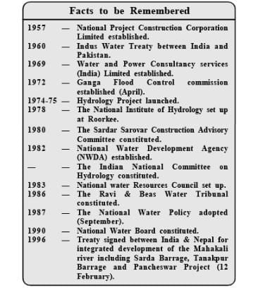
| Facts to be Remembered |
|
The Deccan Plateau
The Deccan Plateau stretches from the Vindhya Range in the north to the southern tip of the Indian Peninsula.
- This triangular plateau is at its widest in the north.
- The Vindhya Range and its eastern extension namely Mahadev Hills, Kaimur Hills and Maikal Range form its northern edge.
- Towards the west, the plateau has a steep slope which is considered to be the result of faulting.
- This steep slope gives rise to the Western Ghats, which extend almost continuously from the northern part of the plateau to the southern tip near Kanyakumari, covering a distance of approximately 1,280 kilometers.
- The Western Ghats are known by different regional names:
- Sahyadris in Maharashtra and Karnataka
- Nilgiris in Tamil Nadu
- Annamalai and the Cardamom Hills on the border of Kerala and Tamil Nadu
- The elevation of the Ghats increases towards the south. The highest peak, Anaimudi (2,695 m) is in Kerala.
- The most important gap in the Western Ghats is the Palghat gap which links Tamilnadu with Kerala.
- The Bhorghat and the Thalghat are other gaps laying in Maharastra state.
- The Deccan plateau is the highest along its western edge and gently slopes towards the Bay of Bengal in the east.
- The eastern edge of the Deccan plateau is marked by a series of scattered hills known as the Eastern Ghats.
- These hills rise steeply from the Coromandal coastal plain. The Eastern Ghats are well developed in the region between the Godavari and Mahanadi rivers.
- The Eastern Ghats and Western Ghats converge in the Nilgiri hills. Dodda Betta (2,637 m) is the highest peak in the Nilgiri hills.
- The surface of the Deccan plateau slopes gradually towards the east.
- While all the major rivers of the peninsular block flow into the Bay of Bengal, Narmada and Tapi are the only two rivers flowing in the opposite direction to fall in the Arabian Sea.
- The north-western part of the Deccan plateau in Maharashtra consists of an extensive lava plateau known as the deccan trap region.
- This consists of flat topped hill ranges forming on their flanks series of terraces.
- The rest of the Deccan plateau which consists of crystalline rocks, mainly granite in the south, has an undulating topography of rounded residual hills and shallow stream and river basins.
| Facts to be Remembered |
|
Significance of Peninsular Plateau
- Geological richness:The plateau is known for its strong geological stability and is largely unaffected by earthquakes, apart from areas like Kutch and Koyna. Almost all mineral-rich regions of India are found here, where various industries have developed. For example, Jharkhand, Orissa, Madhya Pradesh, and southeastern Rajasthan have significant deposits of ores such as manganese, iron, copper, bauxite, chromium, mica, rock phosphate, and more than seventy-five percent of India’s bituminous coal reserves.
- Karnataka and Andhra Pradesh produce gold, iron, chromium and porcelain clay.
- Telangana produces coal, mica, graphite and Corundum. Manganese, diamond, coal, slates, shale, sandstones, marbles, limestone, and phyllites are found in the lower Gondwana sedimentary rocks of Madhya Pradesh.
- Source of Irrigation and Hydroelectricity: The rivers which flow eastward of the Western Ghats have impetuous waterfalls in their reaches which have been harnessed for the production of hydroelectricity.
- Water from the Ghats is also stored in various locations for irrigation and hydroelectric energy.
- Agricultural Resources: A greater part of the north-west plateau is covered with basaltic lava which being rich in iron is conducive to production of cotton: while laterite soils are ideal for tea, rubber, coffee and millet.
- Tobacco, groundnuts and oilseeds are abundantly grown in this region.
- The low-lying plants area of the peninsula is important for growing rice, coconut, areca palms sago and variety of tropical fruits (mangoes, pineapples, bananas).
- Forest Resources: Deccan plateau, specially the slopes of Western Ghats and other highlands are covered with teak and softwood.
- More valuable forest of the Ghats are the varied mixed deciduous forest rich in evergreens (like ebony, mabogany, gum-kino, cedar, rosewood, cane, bamboos, sal, sandalwood, sissoo), tall grasses, shrubs and herbs—which provide commercial timber and fodder respectively.
- Rich Fauna: Because of the steep, high scarps on the crest and undulant eastern slopes, and typical swampy clearings between the hills, offering a much varied terrain with cover, fodder and water suit climatic vagaries, the Western Ghats are among the finest faunal tracts of India.
- Three mammals are exclusive to the southern reaches of these Ghats: the Nilgiri Thar (Nilgiri Ibex of hunters), the black nonkeys (Nilgiri Langur) and the lion-tailed macaque.
- Cultural Influence: The vindhyas and the Satpuras together constitute a main dividing line between the north and south India.
- They have acted as a cultural barrier against the spread of Aryans from the north and the south India.
- They have acted as a cultural barrier against the spread of Aryans from the north and the Dravidians from the south.
The Coastal Plain and Islands
- The peninsular plateau is bounded by coastal plains on the east and west. There is wide difference between the eastern and the western coastal plains.
- The west coast is narrower but more wet than the east coast, which is much wider but relatively dry.
- A number of river deltas occur on the east coast, viz., the Mahanadi, the Godavari, the Krishna and the Cauvery, because the slope of Eastern Ghats is gentle and it allows rivers to form deltas and hence the east coast is broad whereas the steep slopes of Western Ghats (Sahyadris) do not allow such depositional action along the west coast and hence the west coast is narrower.
- The deltas of east coast form the ‘granary’ of the five southern states—Andhra Pradesh, Tamil Nadu, Karnataka, Kerala and Pondicherry.
- The western coastal strips which have a large number of lagoons and backwaters, on other hand, are noted for spices, arecanuts, coconut, palms, etc.
Western Coastal Plains
These lie between the Western Ghats and the Arabian sea and stretch from Kutch in the north to Kanyakumari in the south. Kutch and Kathiawar peninsula and the Gujarat plain lie at their northern end.
- The Gujarat Plain is a broad and flat plain, occupied almost wholly by the state of Gujarat.
- The Kutch Peninula also consists of a very low and rifle land. The two important inlets here are the Gulf of Kutch and the Gulf of Cambay. Narmada, Sabarmati, Tapti and Mahi drain this area into the Gulf of Cambay.
- The Kathiawar Peninsula, also known as Saurashtra, which lies to the south of Kutch, is also a plain level area except for some hills rising into Mount Girnar (1,117m).
- The coastal area is covered with wind blown sand, but further south it is mostly alluvium brought by streams from the Western Ghats.
- Further south of the Daman, lie the western coastal plains proper which could be sub-divided regionally into the Konkan cost in Maharashtra Canara coast in Karnataka and Malabar coast in Kerala.
- Except the Gujarat plain and the Kathiawar peninsula the Western coast has a narrow alluvial margin interspersed by hilly terrain.
- The coastal region here is not very broad.
- The Malabar coast is broader and less hilly. All along the coast are numerous streams, all short and with limited catchment areas.
- There are a number of lagoons, backwaters (kayal) and small lakes, the largest of which is the Vembanad, about 60 km in length.
Eastern Coastal Plains
The coastal low lands extend from the mouth of the Ganga River to Kanyakumari.
- The northern part is called the Northern Circars or Kalinga coast, while the southern part is known as the Coromandel coast. In many areas, the east coast is wider than the west coast.
- The Carnatic region is the widest section, about 480 kilometers across. It is less rocky, but the shallow sea prevents large ships from coming close to shore.
- The surf can be hazardous for small boats. Rivers flowing eastward have created large deltas by depositing alluvial soil.
- Notable deltas include those of the Mahanadi, Godavari, Krishna, and Cauvery rivers. These deltas are unsuitable for harbours due to their silt-filled mouths.
- Several lakes are found along the east coast, with the largest being Chilka in Orissa, and Kolleru and Codicut in Andhra Pradesh.
| Facts To Be Remembered |
|
Significance of Coastal Plains
- Harbours: The coasts of India are very little indicted by larger inlets, the only significant ones being the Gulf of Cambay and the Rann of Kutch. The west coast has small inlets and east has delta creeks. Hence, natural harbours along the coasts are few. Bombay, Mamugao, Cochin, New Mangalore and Vishakhapatnam have natural harbours, but others do not. Hence, the facility of good port along the coast line.
- Specialise Crops: The coastal plains are associated with specialised crops of spices, pepper, ginger and cardamom on the west coast and rice, arecanut palms and coconuts on the east.
- Fisheries and Navigation: A large number of fishing villages abound near the coasts. The backwaters and lagoons on the coasts are linked together for navigation along the coast and the interior. Large catches of sardines, eel, anchovies, carp, silver fish, mullets marginal, etc. are caught near the coast.
- Economic Influence: The coast line has a large number of scenic spots and beaches that provide recreation to a large number of tourists.
- Besides, salt is manufactured along the west coast throughout the year except the rainy season.
- Historical Importance: Ancient forts and factories are found scattered along the coast line.
- The east coast is studded with fertile gardens, with magnificent temples (such as a Madurai, Thanjavur and Kancheepuram) and decorative Hindu monuments ) as at Mahabalipuram (with scores of ancient centre of culture and industry.
| Facts To Be Remembered |
|
The document The Peninsular Plateau, Coastal Plain & Islands | Geography for UPSC CSE is a part of the UPSC Course Geography for UPSC CSE.
All you need of UPSC at this link: UPSC
|
175 videos|624 docs|192 tests
|
FAQs on The Peninsular Plateau, Coastal Plain & Islands - Geography for UPSC CSE
| 1. What are the key features of the Peninsular Plateau? |  |
Ans. The Peninsular Plateau is characterized by its rugged terrain, rich mineral deposits, and denudation topography. It is primarily composed of ancient crystalline rocks and is divided into various plateaus, such as the Malwa Plateau, Deccan Plateau, and Chotanagpur Plateau. The plateau is also known for its interspersed valleys and river systems, including major rivers like the Narmada and Tapi.
| 2. How do the Coastal Plains differ from the Peninsular Plateau? | |
Ans. The Coastal Plains are low-lying areas adjacent to the coast, contrasting with the elevated terrain of the Peninsular Plateau. These plains are characterized by fertile soil and are primarily used for agriculture. The Eastern Coastal Plain is broader and has deltas formed by major rivers, while the Western Coastal Plain is narrower and features rocky cliffs in certain regions.
| 3. What are the major islands of India and their significance? | |
Ans. The major islands of India include the Andaman and Nicobar Islands in the Bay of Bengal and the Lakshadweep Islands in the Arabian Sea. These islands are significant for their biodiversity, unique ecosystems, and strategic location for maritime trade. They also serve as important tourist destinations due to their natural beauty and cultural heritage.
| 4. What are the climatic conditions of the Peninsular Plateau? | |
Ans. The Peninsular Plateau experiences a varied climate, with a tropical wet and dry climate prevailing in most areas. The region receives seasonal rainfall during the southwest monsoon, while the interior areas can experience extreme temperatures, with hot summers and cooler winters. The temperature range and rainfall patterns contribute to the diverse vegetation found in the plateau.
| 5. How do the Coastal Plains contribute to India's economy? | |
Ans. The Coastal Plains play a crucial role in India's economy by supporting agriculture, fishing, and trade. The fertile soil in these regions allows for the cultivation of cash crops like rice, coconut, and spices. Additionally, the proximity to the sea facilitates fishing activities and boosts maritime trade through major ports located along the coastline.
About this Document

3.1K Views

4.92/5
Rating

Oct 02, 2025
Last updated
Related Exams
Document Description: The Peninsular Plateau, Coastal Plain & Islands for UPSC 2025 is part of Geography for UPSC CSE preparation.
The notes and questions for The Peninsular Plateau, Coastal Plain & Islands have been prepared according to the UPSC exam syllabus. Information about The Peninsular Plateau, Coastal Plain & Islands covers topics
like The Peninsular Plateau, The Central Highlands, The Deccan Plateau , The Coastal Plain and Islands and The Peninsular Plateau, Coastal Plain & Islands Example, for UPSC 2025 Exam. Find important definitions, questions, notes, meanings, examples, exercises and tests below for The Peninsular Plateau, Coastal Plain & Islands.
Introduction of The Peninsular Plateau, Coastal Plain & Islands in English is available as part of our Geography for UPSC CSE
for UPSC & The Peninsular Plateau, Coastal Plain & Islands in Hindi for Geography for UPSC CSE course.
Download more important topics related with notes, lectures and mock test series for UPSC
Exam by signing up for free. UPSC: The Peninsular Plateau, Coastal Plain & Islands | Geography for UPSC CSE
Description
Full syllabus notes, lecture & questions for The Peninsular Plateau, Coastal Plain & Islands | Geography for UPSC CSE - UPSC | Plus excerises question with solution to help you revise complete syllabus for Geography for UPSC CSE | Best notes, free PDF download
Information about The Peninsular Plateau, Coastal Plain & Islands
In this doc you can find the meaning of The Peninsular Plateau, Coastal Plain & Islands defined & explained in the simplest way possible. Besides explaining types of
The Peninsular Plateau, Coastal Plain & Islands theory, EduRev gives you an ample number of questions to practice The Peninsular Plateau, Coastal Plain & Islands tests, examples and also practice UPSC
tests

Related Searches
ppt
,video lectures
,Previous Year Questions with Solutions
,The Peninsular Plateau
,Viva Questions
,Coastal Plain & Islands | Geography for UPSC CSE
,practice quizzes
,Semester Notes
,Coastal Plain & Islands | Geography for UPSC CSE
,Exam
,Coastal Plain & Islands | Geography for UPSC CSE
,MCQs
,Objective type Questions
,mock tests for examination
,The Peninsular Plateau
,study material
,past year papers
,Summary
,shortcuts and tricks
,Extra Questions
,The Peninsular Plateau
,Important questions
,Sample Paper
,Free
;


Additional Information about The Peninsular Plateau, Coastal Plain & Islands for UPSC Preparation
The Peninsular Plateau, Coastal Plain & Islands Free PDF Download
The The Peninsular Plateau, Coastal Plain & Islands is an invaluable resource that delves deep into the core of the UPSC exam.
These study notes are curated by experts and cover all the essential topics and concepts, making your preparation more efficient and effective.
With the help of these notes, you can grasp complex subjects quickly, revise important points easily,
and reinforce your understanding of key concepts. The study notes are presented in a concise and easy-to-understand manner,
allowing you to optimize your learning process. Whether you're looking for best-recommended books, sample papers, study material,
or toppers' notes, this PDF has got you covered. Download the The Peninsular Plateau, Coastal Plain & Islands now and kickstart your journey towards success in the UPSC exam.
Importance of The Peninsular Plateau, Coastal Plain & Islands
The importance of The Peninsular Plateau, Coastal Plain & Islands cannot be overstated, especially for UPSC aspirants.
This document holds the key to success in the UPSC exam.
It offers a detailed understanding of the concept, providing invaluable insights into the topic.
By knowing the concepts well in advance, students can plan their preparation effectively.
Utilize this indispensable guide for a well-rounded preparation and achieve your desired results.
The Peninsular Plateau, Coastal Plain & Islands Notes
The Peninsular Plateau, Coastal Plain & Islands Notes offer in-depth insights into the specific topic to help you master it with ease.
This comprehensive document covers all aspects related to The Peninsular Plateau, Coastal Plain & Islands.
It includes detailed information about the exam syllabus, recommended books, and study materials for a well-rounded preparation.
Practice papers and question papers enable you to assess your progress effectively.
Additionally, the paper analysis provides valuable tips for tackling the exam strategically.
Access to Toppers' notes gives you an edge in understanding complex concepts.
Whether you're a beginner or aiming for advanced proficiency, The Peninsular Plateau, Coastal Plain & Islands Notes on EduRev are your ultimate resource for success.
The Peninsular Plateau, Coastal Plain & Islands UPSC Questions
The "The Peninsular Plateau, Coastal Plain & Islands UPSC Questions" guide is a valuable resource for all aspiring students preparing for the
UPSC exam. It focuses on providing a wide range of practice questions to help students gauge
their understanding of the exam topics. These questions cover the entire syllabus, ensuring comprehensive preparation.
The guide includes previous years' question papers for students to familiarize themselves with the exam's format and difficulty level.
Additionally, it offers subject-specific question banks, allowing students to focus on weak areas and improve their performance.
Study The Peninsular Plateau, Coastal Plain & Islands on the App
Students of UPSC can study The Peninsular Plateau, Coastal Plain & Islands alongwith tests & analysis from the EduRev app,
which will help them while preparing for their exam. Apart from the The Peninsular Plateau, Coastal Plain & Islands,
students can also utilize the EduRev App for other study materials such as previous year question papers, syllabus, important questions, etc.
The EduRev App will make your learning easier as you can access it from anywhere you want.
The content of The Peninsular Plateau, Coastal Plain & Islands is prepared as per the latest UPSC syllabus.
|
© EduRev
|
Education Revolution
|


|


Signup to see your scores
go up
within 7 days!
within 7 days!
Takes less than 10 seconds to signup