GC Leong: Summary of Arid or Desert Landforms | Geography for UPSC CSE PDF Download
| Table of contents |

|
| Deserts |

|
| Types of Deserts |

|
| Mechanism of Desert/Arid Erosion |

|
| Landforms of Wind Erosion in Desert |

|
Deserts
- About l/5th of the world’s land is made up of deserts.
- Deserts which are absolutely barren, where nothing grows are known as true deserts.
- Insufficient & irregular rainfall, high temperature & rapid rate of evaporation are the main causes of desert’s aridity.
- Almost all the deserts are confined within 15 º- 30º parallels to north and south of equator known as trade wind deserts or tropical deserts.
- They lie in the trade wind belt on the western parts of the continents.
- Off shore trade winds are often bathed in cold currents which produces a desiccating (dehydrating) effect, hence moisture is not easily condensed into precipitation.
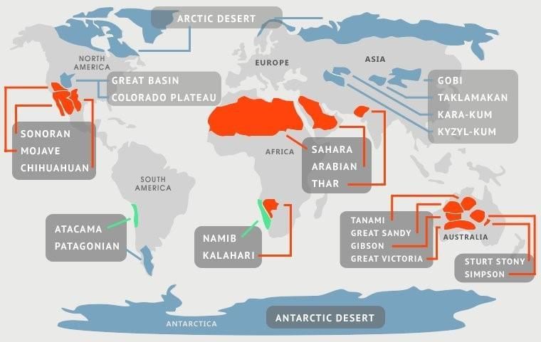 Major Deserts of the World
Types of Deserts
Deserts can be classified into various types based on their unique characteristics and landscapes. Here are the different types of deserts:1. Hamada / Rocky Desert
- Consist of large stretches of bare rocks, swept clear of sand & dust by wind.
- Exposed rocks are thoroughly smoothened, polished & highly sterile.
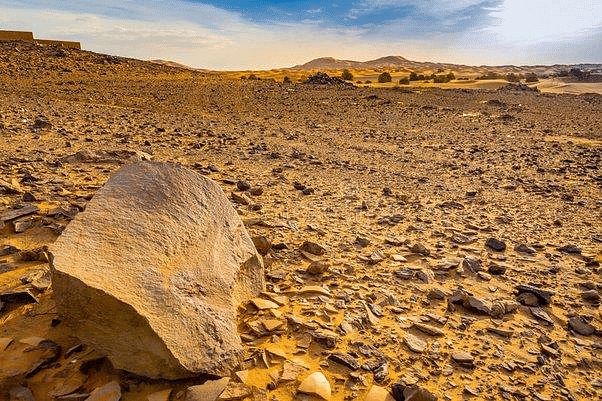 Hamada/Rocky Desert
2. Reg / Stony Desert
- Composed of extensive sheets of angular pebbles & gravels which the wind is not able to blow off.
- Stony deserts are more accessible than sandy deserts & large herds of camels kept there.
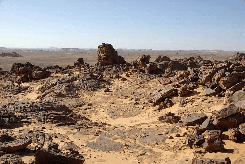 Rag/Stony Desert
3. Erg / Sandy Desert
- Also known as a sea of sand, erg deserts are formed by winds that create vast areas of rolling sand dunes.
- Winds deposit vast stretches of undulating sand dunes in the direction of winds.
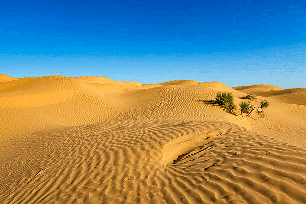 Erg/Sandy Desert
4. Badlands
- Consists of gully & ravines formed on hill slopes & rock surfaces by the extent of water action.
- Not fit for agriculture & survival.
- Finally leads to the abandonment of entire region by its inhabitants.
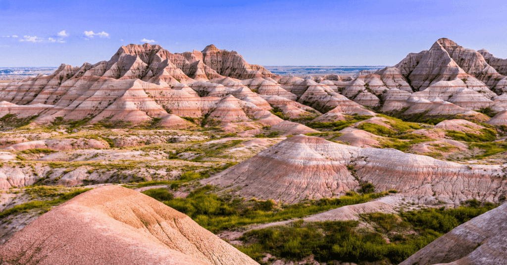 Badlands
5. Mountain Deserts
- Deserts which are found on the highlands such as on plateaus & mountain ranges, where erosion has dissected the desert highland into rough chaotic peaks & uneven ranges.
- Their steep slopes consist of Wadis (dry valleys) with sharp & irregular edges carved due to action of frost.
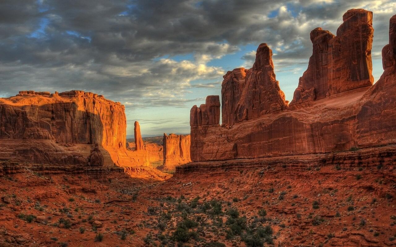 Mountain Deserts
Mechanism of Desert/Arid Erosion
Weathering
- In arid regions, the primary process that breaks down rocks into sand is weathering.
- Even though the amount of rain that falls in a desert is small, but manage to penetrate into rocks & sets up chemical reactions in various minerals it contains.
- Intense heating during the day & rapid cooling during the night by radiations, set up stresses in already weakened rocks, hence they eventually cracking.
- When water gets into cracks of a rock, it freezes at night as the temperature drops below the freezing point & expands by 10 % of its volume.
- Successive freezing will prise of fragments of rocks which get accumulated as screes.
- As heat penetrates rock, its outer surface gets heated & expands, leaving its inner surface comparatively cool.
- Hence, outer surface prise itself from the inner surface & peels off in successive thin layers, known as exfoliation.
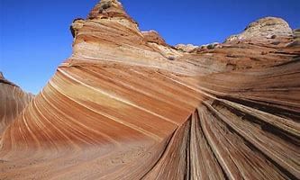 Weathering
Action of Wind
- Efficient in arid regions as little vegetation or moisture to bind the loose surface materials.
Wind erodes surfaces through various processes:
1. Deflation
- Involves lifting & blowing away of loose materials from the ground.
- Blowing capacity depending largely on the size of the material lifted from the surface.
- Finer dust & sands may be removed miles away from their place of origin & may get deposited even outside the desert margins.
- Deflation results in the lowering of the land surface to form large depressions called deflation hollows.
2. Abrasion
- Sand blasting of rock surfaces by wind when they hurl sand particles against them.
- This results in rock surfaces being scratched, polished & worn away.
- Abrasion is most effective near the base of the rocks, where the amount of material the wind is able to carry is greatest.
- This explains why telegraphic poles in the deserts are protected by covering of metal for a foot or two above the ground.
3. Attrition
- When wind borne particles roll against one another in collision, they wear each other away.
- Hence their sizes are greatly reduced & grains are rounded into millet seed sand.
Landforms of Wind Erosion in Desert
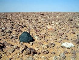 Wind Erosion
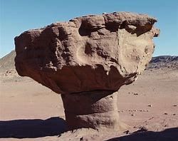
1. Rock pedestals / Mushroom rocks
- Formed by the sand blasting effect of winds against any projecting rock masses
- It wears down the softer layer leading to formation of irregular edges on alternate bands of softer & harder rocks.
- Grooves & hollows cut in the rock surfaces, carve them into grotesque looking pillar known as rock pedestals.
- Such rock pillars will be further eroded near their bases where friction is greatest.
- This process of undercutting produces rocks of mushroom shape called mushroom rocks.
2. Zeugen
- Tabular masses which have a layer of soft rocks lying beneath a surface layer of more resistant rocks.
- Difference in erosional effect of the wind on soft & resistant rock surfaces, carve them into weird looking ridge & furrow landscape.
- Mechanical weathering initiates their formation by opening up joints of the surface rocks.
- Wind abrasion further eats into underlying softer layer so that deep furrows are developed.
- The hard rocks then stand above the furrows as ridges or Zeugen.
- Zeugen may stand 10 to 100 feet above the sunken furrows.
- Continuous abrasion by winds gradually lowers the Zeugen & widens the furrow.
3. Yardangs
- Yardangs looks quite similar to Zeugen but instead of lying in horizontal starta upon one another, the hard & soft rocks of Yardangs are vertical bands.
- Rocks are aligned in the direction of prevailing winds.
- Winds abrasion excavates the bands of softer rocks into long, narrow corridors, separating the steep sided overhanding ridges of hard rocks called Yardangs.
4. Mesas & Buttes
- Mesa is a flat, table-like landform characterized by a very hard top layer and steep sides. These formations are commonly found in canyon areas.
- The hard surface layer of a mesa resists erosion by both wind and water, protecting the underlying rocks from being eroded away.
- Over time, continuous erosion can reduce the size of mesas, eventually transforming them into isolated flat-topped hills known as buttes. Many buttes are separated by deep gorges and canyons, distinguishing them from mesas.
5. Isenberg (Island Mountain)
- Isenbergs, also known as island mountains, are isolated hills that rise sharply from the surrounding ground.
- These hills are characterized by their very steep slopes and rounded tops.
- Isenbergs are often composed of hard rocks like granite or gneiss. They are remnants of a once extensive plateau that has eroded away over time, leaving these isolated hills behind.
6. Ventifacts & Dreikanter
- Ventifacts are generally pebbles faceted & edged by sand blasting
- Rock fragments weathered from mountains
- Are shaped & polished thoroughly by wind abrasion
- Smoothened on windward side
- If wind direction changes another facet is developed.
- Among the ventifacts, those with the three wind faceted surfaces are known as Dreikanter.
7. Deflation Hollows
- Wind lowers the ground by blowing away the unconsolidated material & hence forms small depressions
- Similarly, minor faulting can also initiate depressions which along with the eddying action of oncoming winds will wear off the weaker rocks until water table is reached.
- Water then seeps out forming oasis or swamps in deflation hollows or depressions.
- Large areas in western USA, was stripped of their natural vegetation & was completely deflated by strong winds, that moved materials as dust storms & creating what is now known as Great dust bowl.
Landforms of Wind Deposition in Deserts
- Materials eroded & transported by winds must come to rest somewhere.
- The finest dust travels enormous distances in the air sometimes as long as 2300 miles before they settle down.
- The dust from Sahara desert is sometimes blown across the Mediterranean to fall as blood rains in Italy or on the glaciers of Switzerland.
- Dust that settles in Hwang Ho basin (also known as Hwangtu - the yellow earth) from the Gobi desert has been accumulated over past centuries to a depth of several hundred feet.
- As wind borne materials are shifted according to their coarseness, it can be expected that the coarser sands will be too heavy to be blown out of desert limits.
- They remain as dunes or other depositional landforms within desert themselves.
1. Dunes
- Hills of sand formed by the accumulation of sand & shaped by the movement of winds, a striking characteristic of erg or sandy desert.
- Can be classified as active or live dunes, constantly on move or inactive fixed dunes, rooted with vegetation.
- Two most common types of dunes are Barchan & Seifs.
(a) Barchan Dune
- Crescent or moon shaped live dunes which advance steadily in the particular direction of prevailing winds.
- Initiated probably by a chance accumulation of sand across an obstacle, such as patch of grass or a heap of rocks
- They occur transversely to the wind, so that their horns thin out & become lower in the direction of the wind
- Mainly due to reduced frictional retardation of the winds around the edges.
- The windward side is convex & gently sloping whiles the leeward side, being sheltered, is concave & steep.
- The crest of sand dunes moves forward as more sand is accumulated by the prevailing wind.
- The sand is driven up the windward side & on reaching the crest slips down the leeward side so that the dune advances.
- The migration of Barchans may be a threat to desert life as they may encroach on an oasis buiying palm trees & houses.
- Long rooted sand holding trees & grasses are therefore planted to halt the advancement of the dunes to prevent areas of fertile land from being devastated.
(b) Seif or longitudinal dunes
- Long narrow ridges of sand, often over a hundred miles long, lying parallel to the direction of the prevailing winds, with their crustline rises & falls in alternate peaks & saddles in regular successions.
- Dominant wind blows straight along the corridor between the lines of the dunes so that they are swept clear of sand & remain smooth.
- The eddies that are setup in corridors, blow towards the side of the corridor & drops the sand to form the dune.
- In this manner, prevailing winds increases the length of the dunes into tapering linear ridges while occasional cross winds tends to increase their heights & width.
2. Loess
- The fine dust blown beyond the desert limits is deposited on neighbouring lands as loess.
- It is a yellow, friable (softly crumbled) material rich in lime, very coherent, extremely porous & is usually very fertile.
- Water sinks in readily so the surface is always dry, with streams may cut into thick mantle of soft loess to develop badland topography.
Landform due to Water Actions in Deserts
- Although rainfall is scanty in desert areas but thunderstorm & cloudburst do occur which leads to torrential downpour of rain, producing devastating effects
- A single rainstorm may bring several inches of rain within a few hours, drowning people who camp there & flooding mud baked houses into oasis;
- Also leads to formation of gullies & ravines (badland topography).
- As deserts have little vegetation to protect the surface soil, large quantity of rock waste are transported in sudden raging torrents known as flash floods.
- There is so much material in flash flood that the flow becomes liquid mud.
(a) When the masses of debris are deposited at the foot of the hill or at the mouth of the valley, an alluvial cone or fan or dry delta is formed, over which temporary stream discharges through several channels, depositing more material.
(b) Alluvial deposits are subjected to rapid evaporation by the hot sun & downward percolation of water into porous ground, & soon dry up leaving mounds of debris.
Temporary lakes
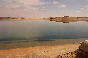 Temporary Lakes
- Also known as Playas, Salina or Salars.
- Formed in arid or semi-arid areas by intermittent streams flowing into depressions
- Contain high percentage of salts due to high evaporation & lower precipitation
Bajada & Pediment
- The floor of desert depression is made up of two features viz. Bajada & Pediment.
- Bajda -Depositional feature made up of alluvial material lay down by intermittent streams.
- Pediment -An erosional plain formed at the base of the surrounding mountain scarps -steep slope.
|
182 videos|620 docs|192 tests
|
FAQs on GC Leong: Summary of Arid or Desert Landforms - Geography for UPSC CSE
| 1. What are some examples of arid landforms? |  |
| 2. How are desert landforms formed? |  |
| 3. What role does wind play in shaping desert landforms? |  |
| 4. How do water erosion and flash floods contribute to desert landforms? |  |
| 5. What are the differences between desert landforms in hot deserts versus cold deserts? |  |


