
Best Study Material for Class 4 Exam
Class 4 Exam > Class 4 Notes > Social Studies for Class 4 > Chapter Notes: The Southern Plateaus
The Southern Plateaus Class 4 Notes SST
Plateaus
Have you ever seen a hill? It's a big, tall land formation that goes up high. But what about something that's not as big as a hill but still has some height? It's not flat like a plain, either. Well, that's where a plateau comes in!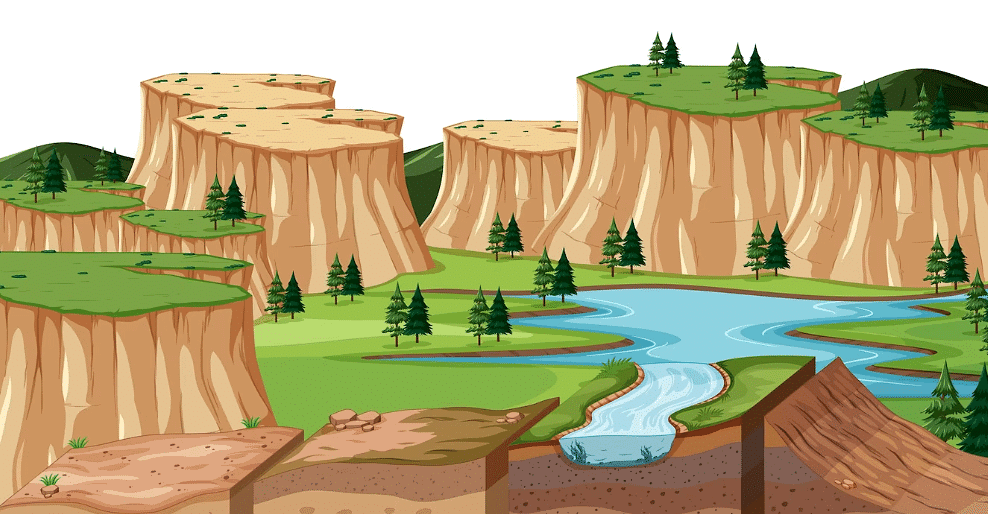 PlateauA plateau is like a "hill-like" thing, but not as big as a hill. It's a land area that is higher than the surrounding flat plains but not as high as a mountain. Picture a big, flat, or gently sloping surface that's raised up above the ground around it. It's like a giant, raised platform!
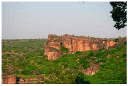 Plateau lands are special places on Earth. They are like flat areas but on a raised platform. The surface of a plateau is not smooth like a plain. It has rough and uneven slopes. That's why some people also call plateaus "Table Lands" because they look like giant tables.
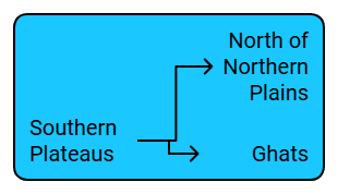 Image Caption
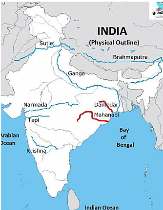
What are the Southern Plateaus?
In India, there are flat lands called plateaus located to the south of the northern plains. On the sides of these plateaus, there are hilly areas known as the Ghats.
- The Aravalli Ranges are in the northwest of the Southern Plateau region, and in the northeast are the Rajmahal Hills.
- The Southern Plateaus have a shape like a triangle. Kanyakumari marks the very bottom tip of the land and also the southern part of the plateau region.
- The Narmada River flows through the plateau, splitting it into two parts. The northern part is called Central Highlands, while the southern part is known as the Deccan Plateau.
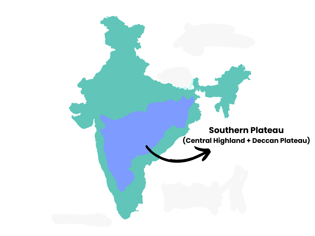 Southern Plateau shown on the map
- The plateau is divided into two parts by the River Narmada. The part in the north is called the Central Highlands, and the part in the south is known as the Deccan Plateau. The Plateau region covers the largest part of India.
- When you look at the plateau, you will notice that it slopes from the west towards the east. The land surface is rocky and not smooth. It has a lot of bumps and uneven parts.
- The soil on the plateau is not very deep, which means it's not as fertile as other places. However, something interesting happens when the rivers flow through the plateau. They wash away the rocks and create valleys with better soil. These valleys are more fertile and suitable for farming.
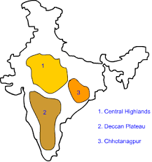
Central Highlands
The Central Highlands are in the middle of the southern plateaus. They have two important plateaus. One is called the Malwa Plateau in the northwest, and the other is the Chotanagpur Plateau in the northeast.
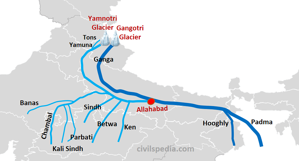
- They're bordered by different hill ranges and have a place called the Malwa Plateau in the middle. Many rivers from this area join bigger rivers like the Yamuna and Ganga.
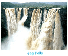
- When water falls from a high place like a mountain or plateau, it makes a waterfall. An example is Jog Falls in Karnataka. Some rivers in this area are Chambal, Betwa, and Son.
- The Chota Nagpur Plateau is part of this region, covering places like Jharkhand and parts of Odisha and Chhattisgarh. It's rich in coal and minerals.
The Deccan Plateau
The Deccan Plateau stretches from the Narmada River down to the bottom of India.
- It's surrounded by the Western and Eastern Ghats, which meet at the Nilgiri Hills.
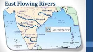
- Many rivers like the Godavari, Krishna, and Kaveri start from the Western Ghats and flow east.

- The Eastern Ghats are divided by rivers flowing from the Western Ghats, and most of these rivers flow into the Bay of Bengal.
- The longest river here is the Godavari.
Rivers Flowing in Plateau Region
A number of rivers flow through the Plateau region.
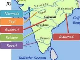
- Narmada and Tapti are the only two rivers that flow westward and join the Arabian Sea.
- Other rivers flow eastward and join the Bay of Bengal. Mahanadi, Godavari, Krishna, and Kaveri rise in the west. These are rain-fed rivers.

- Unlike the rivers rising from the Himalayas, these rivers dry up during the summer season. In cases of heavy rainfall, they are flooded.
- Chambal, Betwa, Ken, and Son rivers join the Yamuna and Ganga. These rivers have a northward flow. As the rivers go dry during the summer, there are no canal networks like in the northern plains.

- Irrigation in the Plateau region is mostly from tanks in which rainwater gets stored. A number of dams have been set up on the rivers to store water.
- The Godavari is the most sacred of all rivers in the South. It rises at Trimbak in Maharashtra.
- As the Ganga is to the people in the north, Kaveri is to the people in the south. It is also known as the Dakshina Ganga. Kaveri is the main river flowing through the State of Karnataka.
- The dam on the Krishna River is named Nagarjuna Sagar Dam. On the Southern Plateau, there are a number of waterfalls. The flowing river drops off the hill in a torrent.
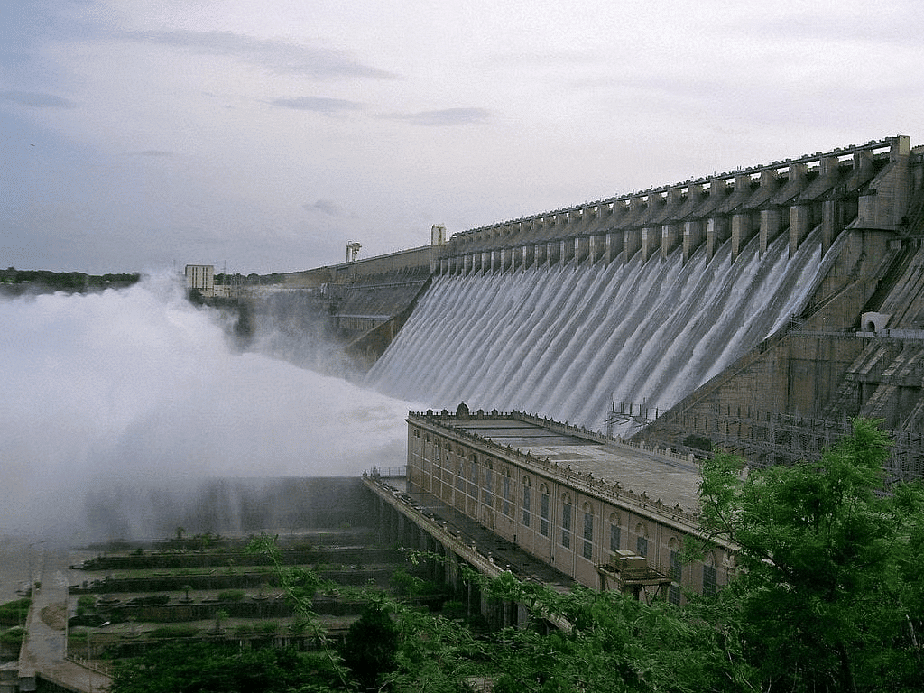 Nagarjuna Sagar Dam
- River Sharavati forms the famous Jog Falls.

Question for Chapter Notes: The Southern Plateaus
Try yourself:Which of the following rivers flow westwards in the Deccan Plateau?
View Solution
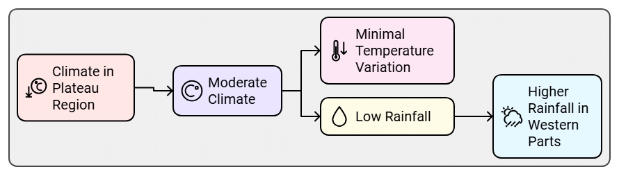
Climate in Plateau Region
The climate is neither very hot nor very cold. The temperatures do not show much difference over the years. Rainfall is low except in the western parts.
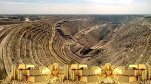
Minerals Found in the Plateau Region
A number of minerals are found, including mica, coal, iron and manganese.
- Mica is used as an insulator in electrical machines. It can stand heat and is not a conductor of electricity.
- River Damodar flows through the northeast. Most of India's coal is mined from the Damodar Valley.

- River Mahanadi has made the Chotanagpur Plateau a wide and fertile plain.
 |
Download the notes
Chapter Notes: The Southern Plateaus
|
Download as PDF |
Download as PDF
Vegetation in the Plateau Region
In between the Narmada and Krishna rivers lies the Central Plateau. The region is rich in black soil. The soil is very fertile and suited for the cultivation of cotton.
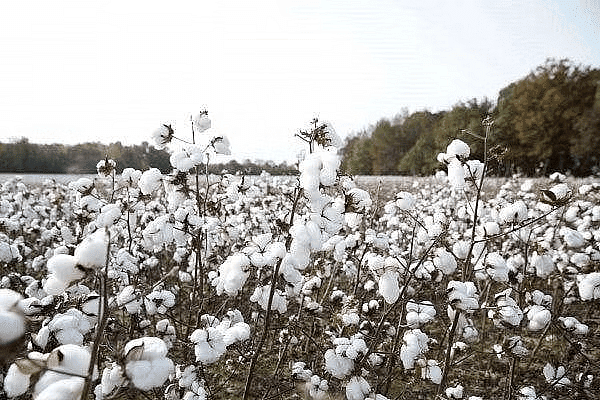 Cotton Cultivation in India
- The River Chambal flows in the north-western Plateau region. The river has cut deep ravines, which were at one time the abode of many Dacoit gangs.
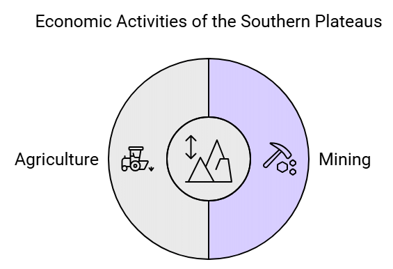
- The Plateau region is important for us in three ways. It has a rich store of minerals. There are forests that provide wood, teak, and sandalwood.
Cultural and Economic Significance
- There are tribal communities living in the Bastar region, and the Central Plateau between the Narmada and Krishna rivers has fertile black soil ideal for cotton cultivation.
- The region is also known for its forests that provide wood, teak, and sandalwood.
Overall, the plateau region is significant for its mineral wealth, forests, and fertile soil, making it a vital part of India's economy and culture.
 |
Take a Practice Test
Test yourself on topics from Class 4 exam
|
Practice Now |
Practice Now
Life in the Region
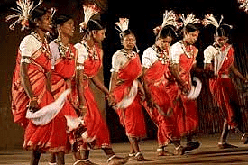
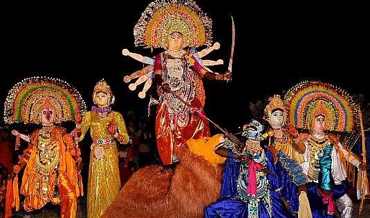
The southern plateaus cover many states like Madhya Pradesh, Chhattisgarh, Jharkhand, Odisha, Telangana, Andhra Pradesh, Tamil Nadu, Karnataka, and Maharashtra. These areas have a lot of valuable minerals like coal, iron, copper, and manganese, so mining is a big deal. People also do farming, growing crops like wheat, rice, millets, groundnuts, cotton, and sugarcane.
- Madhya Pradesh
- Farming and making mats are common jobs here.
- There are diamond mines in Panna, and cities like Indore, Bhopal, Gwalior, and Jabalpur are important for industries.

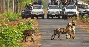
- There are national parks like Kanha and Bandhavgarh to protect tigers, and places like Pachmarhi, Sanchi, and Khajuraho attract tourists.
- Chhattisgarh
- Besides the minerals, tin is also found here.
- The state has lots of forests where people collect things like wood, tendu leaves, honey, and lac.

- Bhilai has a steel plant, and Saila is known for a folk dance called Saila.
- Jharkhand
- This state is rich in minerals, which has led to many industries in cities like Jamshedpur, Bokaro, Ranchi, and Dhanbad.

- People enjoy foods like litti-chokha and thekua, and Chhau is a popular dance.
- Netarhat is a place that tourists like to visit.
- This state is rich in minerals, which has led to many industries in cities like Jamshedpur, Bokaro, Ranchi, and Dhanbad.
- Telangana
- Hyderabad is a big city with industries like IT, automobiles, and pharmaceuticals. Most people here speak Telugu, and Kuchipudi is a popular dance.

- The state is known for bidri work.
- Hyderabad is a big city with industries like IT, automobiles, and pharmaceuticals. Most people here speak Telugu, and Kuchipudi is a popular dance.
- Karnataka
- Coffee and spices are grown here, and there are gold mines in Kolar. Bengaluru is a major city for the IT industry.

- Karnataka is famous for its sandalwood handicrafts, and people speak Kannada. Yakshagana is a popular dance-drama here.
- Coffee and spices are grown here, and there are gold mines in Kolar. Bengaluru is a major city for the IT industry.
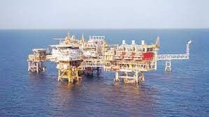
- Maharashtra
- This state is famous for cotton and oranges.
- Cities like Mumbai and Pune are industrial hubs.

- There are big oil deposits under the sea near Mumbai, called Mumbai High.
- People speak Marathi, and they celebrate festivals like Ganesh Chaturthi. Lavani is a popular folk dance here.
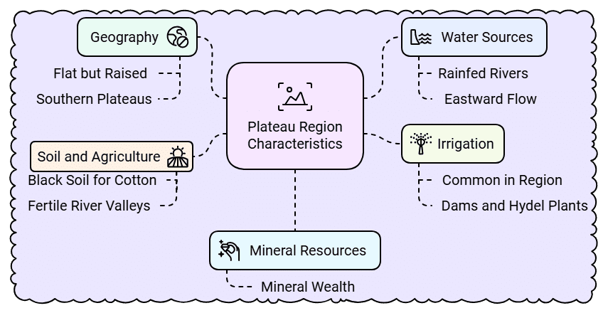 Image Caption
Things to Remember!
- Plateau lands are flat but on a raised platform.
- Plateau lands lie to the south of the northern plains. The southern Plateaus form the triangular south with Kanyakumari as the southernmost point.
- Rivers in the plateau region are rainfed and dry up in summer. Most rivers in the Plateau region flow eastwards.
- Tank irrigation is most common in the Plateau region.
- A number of dams have been built on the rivers to store water and run Hydel plants.
- The Plateau region is rich in minerals.
- The black soil of the valleys is most suited for the cultivation of cotton. Rice is also cultivated in the fertile river valleys.
Question for Chapter Notes: The Southern Plateaus
Try yourself:Which type of soil is predominantly found in the Southern Plateaus?
View Solution
The document The Southern Plateaus Class 4 Notes SST is a part of the Class 4 Course Social Studies for Class 4.
All you need of Class 4 at this link: Class 4
|
48 videos|123 docs|42 tests
|


FAQs on The Southern Plateaus Class 4 Notes SST
| 1. What are the Southern Plateaus? |  |
| 2. Which rivers flow through the Plateau region? | |
Ans. Several rivers flow through the Plateau region, including the Godavari, Krishna, and Tungabhadra. These rivers originate from the Western Ghats and traverse through the plateau, contributing to agriculture and providing water resources for various activities.
| 3. What is the climate like in the Plateau region? | |
Ans. The climate in the Plateau region is generally characterized by a tropical climate with distinct seasons. Summers can be hot and dry, while winters are cooler. The region receives moderate rainfall during the monsoon season, which is essential for agriculture.
| 4. What minerals are found in the Plateau region? | |
Ans. The Plateau region is rich in minerals, including coal, iron ore, bauxite, and manganese. These minerals are mined and contribute significantly to the economy of the region, supporting industries and providing employment opportunities.
| 5. What is the cultural and economic significance of the Southern Plateaus? | |
Ans. The Southern Plateaus hold cultural significance due to their diverse tribal communities and rich traditions. Economically, the region is vital for agriculture, mining, and forestry, contributing to the livelihood of its inhabitants and the overall economy of India.
Related Exams
About this Document

5.2K Views

4.97/5
Rating

Feb 23, 2025
Last updated
Document Description: Chapter Notes: The Southern Plateaus for Class 4 2025 is part of Social Studies for Class 4 preparation.
The notes and questions for Chapter Notes: The Southern Plateaus have been prepared according to the Class 4 exam syllabus. Information about Chapter Notes: The Southern Plateaus covers topics
like What are the Southern Plateaus?, Rivers Flowing in Plateau Region, Climate in Plateau Region, Minerals Found in the Plateau Region, Vegetation in the Plateau Region, Cultural and Economic Significance , Life in the Region, Things to Remember! and Chapter Notes: The Southern Plateaus Example, for Class 4 2025 Exam. Find important definitions, questions, notes, meanings, examples, exercises and tests below for Chapter Notes: The Southern Plateaus.
Introduction of Chapter Notes: The Southern Plateaus in English is available as part of our Social Studies for Class 4
for Class 4 & Chapter Notes: The Southern Plateaus in Hindi for Social Studies for Class 4 course.
Download more important topics related with notes, lectures and mock test series for Class 4
Exam by signing up for free. Class 4: The Southern Plateaus Class 4 Notes SST
Description
Full syllabus notes, lecture & questions for The Southern Plateaus Class 4 Notes SST - Class 4 | Plus excerises question with solution to help you revise complete syllabus for Social Studies for Class 4 | Best notes, free PDF download
Information about Chapter Notes: The Southern Plateaus
In this doc you can find the meaning of Chapter Notes: The Southern Plateaus defined & explained in the simplest way possible. Besides explaining types of
Chapter Notes: The Southern Plateaus theory, EduRev gives you an ample number of questions to practice Chapter Notes: The Southern Plateaus tests, examples and also practice Class 4
tests

Related Searches
Semester Notes
,Viva Questions
,The Southern Plateaus Class 4 Notes SST
,The Southern Plateaus Class 4 Notes SST
,video lectures
,Extra Questions
,shortcuts and tricks
,MCQs
,ppt
,Exam
,Objective type Questions
,past year papers
,Summary
,The Southern Plateaus Class 4 Notes SST
,Previous Year Questions with Solutions
,Important questions
,practice quizzes
,study material
,Free
,Sample Paper
,mock tests for examination
;


Additional Information about Chapter Notes: The Southern Plateaus for Class 4 Preparation
Chapter Notes: The Southern Plateaus Free PDF Download
The Chapter Notes: The Southern Plateaus is an invaluable resource that delves deep into the core of the Class 4 exam.
These study notes are curated by experts and cover all the essential topics and concepts, making your preparation more efficient and effective.
With the help of these notes, you can grasp complex subjects quickly, revise important points easily,
and reinforce your understanding of key concepts. The study notes are presented in a concise and easy-to-understand manner,
allowing you to optimize your learning process. Whether you're looking for best-recommended books, sample papers, study material,
or toppers' notes, this PDF has got you covered. Download the Chapter Notes: The Southern Plateaus now and kickstart your journey towards success in the Class 4 exam.
Importance of Chapter Notes: The Southern Plateaus
The importance of Chapter Notes: The Southern Plateaus cannot be overstated, especially for Class 4 aspirants.
This document holds the key to success in the Class 4 exam.
It offers a detailed understanding of the concept, providing invaluable insights into the topic.
By knowing the concepts well in advance, students can plan their preparation effectively.
Utilize this indispensable guide for a well-rounded preparation and achieve your desired results.
Chapter Notes: The Southern Plateaus
Chapter Notes: The Southern Plateaus Notes offer in-depth insights into the specific topic to help you master it with ease.
This comprehensive document covers all aspects related to Chapter Notes: The Southern Plateaus.
It includes detailed information about the exam syllabus, recommended books, and study materials for a well-rounded preparation.
Practice papers and question papers enable you to assess your progress effectively.
Additionally, the paper analysis provides valuable tips for tackling the exam strategically.
Access to Toppers' notes gives you an edge in understanding complex concepts.
Whether you're a beginner or aiming for advanced proficiency, Chapter Notes: The Southern Plateaus Notes on EduRev are your ultimate resource for success.
Chapter Notes: The Southern Plateaus Class 4 Questions
The "Chapter Notes: The Southern Plateaus Class 4 Questions" guide is a valuable resource for all aspiring students preparing for the
Class 4 exam. It focuses on providing a wide range of practice questions to help students gauge
their understanding of the exam topics. These questions cover the entire syllabus, ensuring comprehensive preparation.
The guide includes previous years' question papers for students to familiarize themselves with the exam's format and difficulty level.
Additionally, it offers subject-specific question banks, allowing students to focus on weak areas and improve their performance.
Study Chapter Notes: The Southern Plateaus on the App
Students of Class 4 can study Chapter Notes: The Southern Plateaus alongwith tests & analysis from the EduRev app,
which will help them while preparing for their exam. Apart from the Chapter Notes: The Southern Plateaus,
students can also utilize the EduRev App for other study materials such as previous year question papers, syllabus, important questions, etc.
The EduRev App will make your learning easier as you can access it from anywhere you want.
The content of Chapter Notes: The Southern Plateaus is prepared as per the latest Class 4 syllabus.
|
© EduRev
|
Education Revolution
|


|


Signup to see your scores
go up within 7 days!
Access 1000+ FREE Docs, Videos and Tests
Takes less than 10 seconds to signup