Worksheet: Globes and Maps - 1

Q1: Multiple Choice Questions (MCQs)
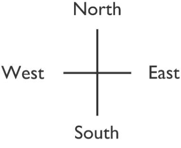
(i) North, South, East and West are four major
 (a) lines
(b) signs
(c) directions
(d) none of these
(ii) The South Pole is
(a) 90° S
(b) 90° N
(c) 0° N
(d) none of these
(iii) The total number of meridians is
(a) 180
(b) 360
(c) 90
(d) none of these
(iv) North-east lies between
(a) South and East
(b) North and West
(c) North and East
(d) none of these
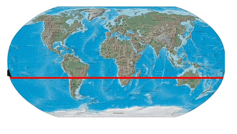
(v) The Tropic of Cancer is located at
(a) 23½° S
(b) 23½° N
(c) 25½° W
(d) none of these
Q2: Fill in the blanks
(i) A globe does not give_________ information.
(ii) An _______ is an imaginary line on which the earth rotates.
(iii) Including the Equator there are __________ latitudes.
(iv) Signs, symbols and colours are called __________ of the map.
(v) The imaginary lines drawn parallel to the Equator are known as parallels of _________.
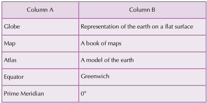
Q3: Match the following
Q4: True & False
(i) Meridians are straight vertical lines on the globe.
(ii) The Arctic Circle is in the Southern Hemisphere.
(iii) All places on the same longitude have the same local time.
(iv) The Prime Meridian is located at 0° longitude.
(v) There are 180 lines of latitude in total.
Q5: Give one word answer to the following
(i) What is a book of maps called?
(ii) What is the shape of the earth?
(iii) What is the ratio between the distance on the ground and the distance of the map known as?
(iv) What is the model of an earth called?
Q6: Short answer type questions
(i) Which are the four major directions?
(ii) Which are the important latitudes?
(iii) What is the main feature of a map?
Q7: Long answer type questions
(i) Write the features and limitations of a globe.

(ii) What do you mean by Northern Hemisphere and Southern Hemisphere?
(iii) Write short notes on:
(a) Longitude
(b) Eastern and Western Hemispheres
(c) International Date Line
You can find Worksheets Solutions here: Worksheet Solutions: Globes and Maps - 1
FAQs on Worksheet: Globes and Maps - 1
| 1. What's the difference between a globe and a map for Class 5 geography? |  |
| 2. How do you read latitude and longitude lines on a globe? | |
| 3. Why do maps look different from globes even though they show the same Earth? | |
| 4. What are the main types of map projections and how do they change what you see? | |
| 5. How do you find cardinal directions and use the compass rose on maps? | |


