Our India- Physical Features Class 3 Notes SST
| Table of contents |

|
| Physical Divisions of Our Country |

|
| 1. The Himalayan Region |

|
| 2. The Northern Plains |

|
| 3. The Great Indian Desert |

|
| 4. The Plateau Region |

|
| 5. The Coastal Plains |

|
| Keep in Mind |

|
Physical Divisions of Our Country
India is a very big country. It is the seventh-largest country in the world. India can be divided into the following different regions because of the nature of its land surfaces.
1. The Himalayan Region
2. The Northern Plain
3. The Great Indian Desert
4. The Plateau Region, and
5. The Coastal Plains
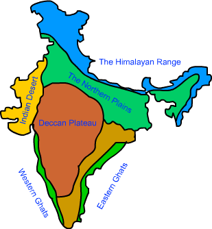 Physical Divisions of India
1. The Himalayan Region
The Himalayas form the northern boundary of India. The name Himalaya means the Home of Snow. It has snow peaks; it has glaciers where most of the Northern Rivers originate.
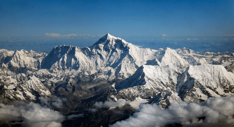
- Its vegetation is different from plains. Its animals and birds are different. Farming is difficult. The population is less.
- Villages are situated at far distances from each other. The number of cities is less in number than plains.
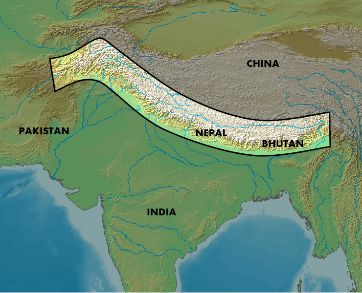 Map of The Himalayan Region
 - These places are visited by people from the plains during summer for pleasure trips.
- These are called hill stations.
- The Himalayas have the highest peaks of the world. Mount Everest is in Nepal, but a part of the Himalayas. K2 and Kanchenjunga are in India.
2. The Northern Plains
The Northern Plains, also known as the Gangetic plains, lie along the course of river Ganga.
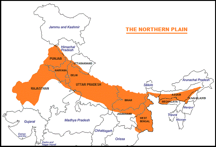
- It has generally flat fertile surface, most suitable for agriculture and farming.
- The climate is temperate and it gets rains during the monsoon season.
- The population is heavy. There are many villages and many cities.
- There are many industries. Every nature of pollution is there in cities which are very crowded.
3. The Great Indian Desert
The Great Indian Desert covers Rajasthan and touches Delhi. It has an extreme climate.
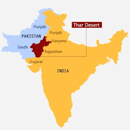 Location of Great Indian Desert or the Thar Desert
- Very hot in the day and very cold at the night.
- Generally, the soil is not suitable for farming. Some crops are grown without much water.
- Animal husbandry and sheep grazing are two occupations. Poultry farming has come up in a big way lately.

- Typical desert vegetation can be found in this region. There is not much population.Question for Chapter Notes: Our India- Physical FeaturesTry yourself:Which country contains the Thar desert?View Solution
4. The Plateau Region
The Plateau Region forms the Southern part of the country. Aravali hills and Satpura hills form the Northern part of the Plateau Region.
- Plateau is slightly elevated than the surrounding plains.
- The soil is black, rocky at some places, and less fertile than the Gangetic plains.
- It suits the growing of cotton. It has many rivers flowing through it during the rainy season.

- Climate is torrid, very hot in summer, and mildly cold in winter.
- The region has mixed vegetation.
- It does not have as much population as the Northern plains but has many cities with industrial setup.
5. The Coastal Plains
The Coastal Plains lie along the coastline on both sides of the plateau. The width of these plains varies from 25 to 50 kilometers.
- These are sheltered by the Eastern and Western Ghats. Climate is hot and humid all through the year.
- The plains are fertile and grow rice. Many of the ports lie in the coastal regions.
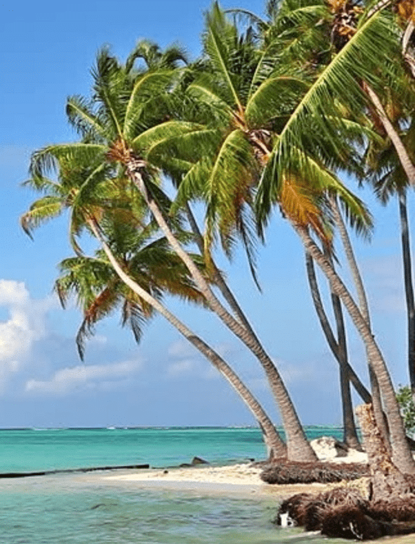 Coconut Trees grows in Coastal Regions
 - This region is heavily populated. Many industries run in this region. It has been known for Textile Industries.
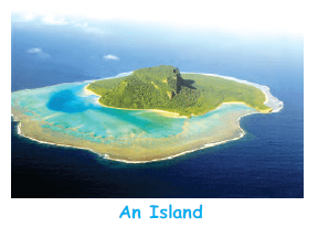
The islands of Andaman and Nicobar and Lakshadweep are also a part of India.
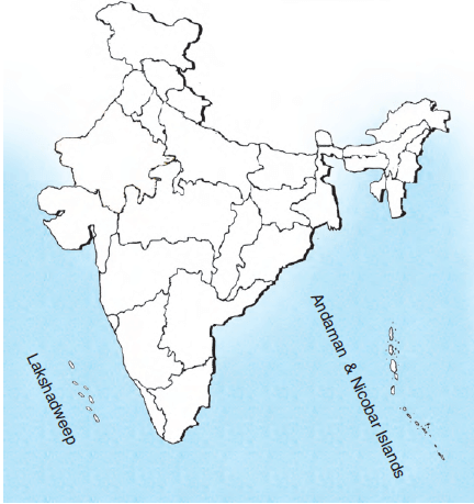
Keep in Mind
- India is the seventh largest country in the world
- Physical divisions of India include the mountains, the plains, the plateau, the desert and the coastal region
- The islands of Andaman and Nicobar and Lakshadweep are also a part of India.
|
15 videos|153 docs|22 tests
|
FAQs on Our India- Physical Features Class 3 Notes SST
| 1. What are the major physical divisions of India? |  |
| 2. What are the characteristics of the Himalayan Region in India? |  |
| 3. What is unique about the Northern Plains in India? |  |
| 4. How is the Great Indian Desert different from other regions in India? |  |
| 5. What are the characteristics of the Coastal Plains in India? |  |


