Our India- Physical Features - 2 Class 3 Worksheet SST
Q1: Multiple-Choice Questions (MCQs)
(i) Which mountain range is the highest in India and the world?
(a) Vindhya Rang
(b) Western Ghats
(c) Eastern Ghats
(d) Himalayas
Ans: (d)
The Himalayas are the highest mountain range in India and the world, with peaks like Mount Everest.
(ii) Which river is known as the "Sorrow of Bengal" due to its frequent flooding?
 (a) Ganges
(b) Yamuna
(c) Brahmaputra
(d) Indus
Ans: (c)
The Brahmaputra River is prone to flooding, causing damage in the Bengal region.
(iii) The Thar Desert is located mainly in which Indian state?
(a) Rajasthan
(b) Gujarat
(c) Haryana
(d) Punjab
Ans: (a)
The Thar Desert spans across Rajasthan and parts of Gujarat.
(iv) What is the longest river in India?
(a) Ganges
(b) Yamuna
(c) Brahmaputra
(d) Godavari
Ans: (d)
The Godavari River is the longest river in India, flowing through central and southern parts of the country.
(v) Which is the largest plateau in India?
(a) Deccan Plateau
(b) Indo-Gangetic Plain
(c) Malwa Plateau
(d) Chota Nagpur Plateau
Ans: (a)
The Deccan Plateau is the largest plateau in India, covering a substantial portion of the southern peninsula.
Q2: Fill in the Blanks
(i) The capital city of India is _____________, located in the northern part of the country.
Ans: The capital city of India is New Delhi, located in the northern part of the country.
(ii) India is known for its diverse _____________, with numerous languages spoken throughout the nation.
Ans: India is known for its diverse culture, with numerous languages spoken throughout the nation.
(iii) The famous monument, Taj Mahal, is located in the city of _____________.
Ans: The famous monument, Taj Mahal, is located in the city of Agra.
(iv) The national emblem of India features four lions standing back to back atop a _____________.
Ans: The national emblem of India features four lions standing back to back atop a Sarnath Pillar.
(v) The highest peak in India, _____________, is part of the Himalayan mountain range.
Ans: The highest peak in India, Mount Everest, is part of the Himalayan mountain range.

Q3: True/False Questions
(i) The Himalayas are the highest mountain range in the world.
Ans: True - The Himalayas are the highest mountain range, and they include some of the tallest peaks, including Mount Everest.
(ii) The Ganges River originates from the Himalayas.
Ans: True - The Ganges River originates from the Gangotri Glacier in the Himalayas.
(iii) Thar Desert receives a high amount of rainfall throughout the year.
Ans: False -The Thar Desert is known for its arid conditions and receives very little rainfall.
(iv) The Indian Ocean surrounds India on three sides.
Ans: True -The Indian Ocean surrounds India to the south, southeast, and southwest.
(v) The Deccan Plateau is characterized by its flat and fertile terrain.
Ans: False - The Deccan Plateau is known for its elevated and uneven terrain.
Q4: Answer the following questions
(i) What is the significance of the Himalayan region in India?
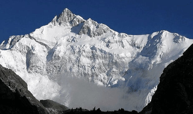
Ans: The Himalayan region forms the northern boundary of India and is known for its snow peaks, glaciers, and unique vegetation and wildlife. It attracts tourists during summers and is home to hill stations. Mount Everest, K2, and Kanchenjunga, some of the world's highest peaks, are part of this region.
(ii) How does the climate in the Great Indian Desert differ from other regions in India, and what are the primary occupations in this area?
Ans: The Great Indian Desert experiences extremely hot days and very cold nights. The soil is generally unsuitable for farming, but certain crops are grown with minimal water. Animal husbandry, sheep grazing, and poultry farming are common occupations in this arid region.
(iii) What are the main features of the Plateau Region in India, and how does it differ from the Northern Plains?
Ans: The Plateau Region is slightly elevated, has black and rocky soil suitable for cotton cultivation, and is crisscrossed by rivers during the rainy season. Unlike the Northern Plains, the climate in the Plateau Region is torrid, with hot summers and mildly cold winters. It has mixed vegetation and is less densely populated than the Northern Plains.

(iv) Describe the characteristics of the Coastal Plains in India and their importance to the country's economy.
Ans: The Coastal Plains, sheltered by the Eastern and Western Ghats, have a hot and humid climate and are fertile, supporting rice cultivation. They are heavily populated, house many industries, and are known for textile production. The presence of ports in these plains contributes significantly to India's trade and economy.
FAQs on Our India- Physical Features - 2 Class 3 Worksheet SST
| 1. What are the major physical features of India? |  |
| 2. What is the significance of the Himalayan mountain range in India? |  |
| 3. What is the Thar Desert and where is it located in India? |  |
| 4. What are the major rivers in India and what role do they play? |  |
| 5. What are the coastal plains in India and which regions do they cover? |  |


