UPSC Daily Current Affairs- 9th October 2023 | Current Affairs & Hindu Analysis: Daily, Weekly & Monthly PDF Download
GS-I
Mont Blanc
Subject: Geography
Why in News?
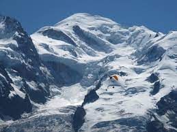
New research has revealed that Mont Blanc, France's highest mountain has witnessed a reduction in its height over the past two years.
About Mont Blanc:
- It is the highest peak (4,807 metres) in Europe.
- It is located in the Alps and lies along the French-Italian border and reaches into Switzerland.
- It is nicknamed as "the roof of Europe".
- Its name comes from the perennial snow cap that covers it, meaning literally “the white mountain”.
- The mountain stands in a range called the Graian Alps, between the regions of Aosta Valley, Italy, and Savoie and Haute-Savoie, France.
Key facts about Alps
- The Alps emerged during the Alpine orogeny an event that began about 65 million years ago as the Mesozoic Era was drawing to a close.
- They are young fold mountains with rugged relief and high conical peaks.
- The Alps arose as a result of the collision of the African and Eurasian tectonic plates in which the Alpine Tethys which was formerly in between these continents disappeared.
- The Alps extend north from the subtropical Mediterranean coast near Nice, France, to Lake Geneva before trending east-northeast to Vienna (at the Vienna Woods).
- There they touch the Danube River and meld with the adjacent plain.
- The Alps form part of France, Italy, Switzerland, Germany, Austria, Slovenia, Croatia, Bosnia and Herzegovina, Montenegro, Serbia, and Albania.
Source: BBC
Afghanistan’s deadliest earthquake in years
Subject: Geography
Why in News?
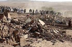
More than 2000 people have been killed and over 9,000 injured following powerful earthquakes in Afghanistan.
- As per the U.S. Geological Survey, the quakes hit 35 km northwest of the city of Herat on Saturday, with one of them measuring 6.3 magnitude.
- It was followed by three very strong aftershocks, measuring magnitude 6.3, 5.9 and 5.5, as well as lesser shocks.
Earthquake
- An earthquake is an intense shaking of the ground caused by movement under the earth’s surface.
- The location below the earth’s surface where the earthquake starts is called the
- The location directly above the hypocentre on the surface of the earth is called the epicentre.
- It happens when two blocks (tectonic plates) of the earth suddenly slip past one another releasing stored-up ‘elastic strain’ energy in the form of seismic waves.
- These spread through the earth and cause the shaking of the ground.
- They are measured on scales called the -
- Moment Magnitude Scale (Mw), based on the total moment (a product of the distance a fault moved and the force required to move it) release of the earthquake.
- The Richter scale (magnitude scale) - energy released (0-10).
- The intensity scale/Mercalli scale - visible damage (1-12).
- Earthquakes continue to remain the most common natural hazard that cannot be predicted as no early warning systems can be developed.
Alpide Belt
- About
- The Alpide Belt spans over 15,000 km, roughly following the boundary of the Eurasian and African tectonic plates.
- It spans from the Middle East to the Himalayas and Indonesia.
- It extends from the Himalayas in the east, through the Mediterranean region and across to the Azores in the Atlantic Ocean.
- Tectonic plates are formations of the Earth’s crust that move slowly, often creating pressure and friction between each other.
- The Alpide Belt spans over 15,000 km, roughly following the boundary of the Eurasian and African tectonic plates.
- Earthquake prone
- Albide Belt is the second most active region on Earth after the Pacific Ring of Fire.
- This belt experiences a high frequency of earthquakes and volcanic eruptions.
- This is primarily due to the collision of the Eurasian and African tectonic plates, which drag along and cause a build-up of immense pressure.
- This slow-building pressure eventually gets released through earthquakes and volcanic activity.
- One of the deadliest natural disasters in history, the 2004 Indian Ocean earthquake which led to a massive tsunami, fell within this belt.
News Summary: Why do so many devastating earthquakes happen in Afghanistan?
- Afghanistan is earthquake-prone because it's located in the mountainous Hindu Kush region, which is part of the Alpide belt.
- Additionally, the Earth's crust is especially lively in Afghanistan because it is where the Arabian, Indian and Eurasian tectonic plates meet.
- The boundary between the Indian and Eurasian plates exists near Afghanistan's border with Pakistan.
- Death tolls often rise when remote locations are hit, and decades of war have left infrastructure in a shambles, making relief and rescue operations difficult.
Source: Indian Express
GS-II
Israel’s Iron Dome and Yom Kippur war
Subject: International Relations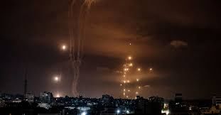
Why in News?
The Hamas militant group launched its worst attack inside the Jewish state’s territory since 1948, killing at least 250 Israelis and abducting several others.
- The surprise attack has brought back memories of the Yom Kippur war.
- Journalists have shared an undated video on X of the Iron Dome, Israel’s air defence system, intercepting rockets coming in from Gaza.
What is the Iron Dome?
- About
- It is a short-range, ground-to-air, air defence system that includes a radar and Tamir interceptor missiles that track and neutralise any rockets or missiles aimed at Israeli targets.
- It is used for countering rockets, artillery & mortars (C-RAM) as well as aircraft, helicopters and unmanned aerial vehicles.
- Genesis of Iron Dome
- It goes back to the 2006 Israeli-Lebanon war, when the Hezbollah fired thousands of rockets into Israel.
- The following year, Israel announced that its state-run Rafael Advance Systems would come up with a new air defence system to protect its cities and people.
- Success rate
- The Iron Dome was deployed in 2011. While Rafael claims a success rate of over 90%, with more than 2,000 interceptions, experts agree the success rate is over 80%.
How does Iron Dome work?
- The Iron Dome has three main systems that work together to provide a shield over the area where it is deployed, handling multiple threats. These are:
- Detection and tracking radar to spot any incoming threats,
- A battle management and weapon control system (BMC), and
- A missile firing unit.
- The BMC basically liaises between the radar and the interceptor missile.
- It is capable of being used in all weather conditions, including during the day and night.
- There is proximity fuse in each missile called which is a laser-controlled fuse. When passing within ten metres of the target, this activates and blasts the missile with shrapnel that destroys the target.
- The warhead is exploded in such a way that it caters for the velocity of the missile and the target.
Yom Kippur war
- About
- The Yom Kippur war, or the October war, or the Ramadan war, was fought between Israel on one side and Egypt and Syria on the other, from October 6 to 25, 1973.
- Yom Kippur is the holiest day in Judaism and Samaritanism.
- It is also known as the Day of Atonement. It is observed on the 10th day of the lunar month of Tishri, which falls in September or early October.
- It is also called the Fourth Arab-Israeli war, coming after three wars in 1949, 1956, and 1967.
- The Yom Kippur war, or the October war, or the Ramadan war, was fought between Israel on one side and Egypt and Syria on the other, from October 6 to 25, 1973.
- Background
- After its decisive victory in the Six-Day War of 1967, Israel had acquired an aura of invincibility.
- It also captured territories from its neighbours, including the Golan Heights from Syria and the Sinai Peninsula from
- Six years later, the two countries launched a coordinated attack on Israel.
- While Israel was aware of troops mobilisation, it had not expected an attack in the Holy Islamic month of Ramadan.
- Caught by surprise, Israel took time to mobilise its own soldiers, many of whom were on leave for Yom Kippur.
- Thus, initially, both Syria and Egypt made some gains.
- Aftermath
- Israel was able to stem the advance on both Syrian and Egyptian sides after three days and soon launched its own counter-strikes.
Why is the current violence being compared with the Yom Kippur war?
- This has been the deadliest attack on Israel since the Yom Kippur war.
- In the Yom Kippur war, more than 2,500 Israeli soldiers were killed.
- The second similarity is the criticism within Israel for the state being found unprepared.
- The recent attack came as a surprise, despite Israel’s advanced intelligence and interception systems.
- This attack came when many Israelis were preparing to observe Simchat Torah, which marks the end of the annual cycle of public Torah readings, and the beginning of a new one.
- The Torah constitutes the first five books of the Hebrew Bible.
What is the significance of the Yom Kippur war?
- Israel is not invincible
- The heavy casualties it suffered in the war, made it clear that Israel could be battered, if not beaten, in battle.
- In fact, many analysts believe that Egypt’s strategy behind launching the attack was not necessarily to defeat the militarily superior Israel, but to bruise it enough to bring it to the negotiating table.
- For Egypt
- Under the 1978 Camp David Accords, Israel returned the Sinai Peninsula to Egypt.
- The 1979 Egyptian–Israeli peace treaty was the first instance of an Arab country recognising Israel as a state.
- For Syria
- The war brought no happy consequences. Israel in fact ended up occupying even more of the strategically important and fertile plateau of Golan Heights, which it holds to this day.
Source: Indian Express
Toofan Al-Aqsa Crisis: Implications for Israel, the Region, and Beyond
Subject: International Relations

Why in News?
The recent escalation of violence between Hamas, the Palestinian terrorist group, and Israel has resulted in a significant loss of life and raised concerns internationally. At the heart of this conflict is Operation Al-Aqsa Deluge, initiated by Hamas, which has led to a series of events with far-reaching implications for the region.
Central idea
- The recent Hamas operation, Toofan Al-Aqsa (Al-Aqsa Flood), bears uncanny similarities to the launch of the 19-day Yom Kippur War that occurred 50 years ago. While the Yom Kippur War had inconclusive results, it led to a significant regional shift, ultimately resulting in Israel’s acceptance of the ‘land for peace’ formula at the Camp David Accords six years later.
Quick recap: Understand the conflict
- Muhammad Deif’s Statement: Muhammad Deif, the military commander of Hamas, delivered a recorded message, characterizing the operation as a moment for people to regain their revolution.
- The Significance of Al-Aqsa Mosque: Central to this conflict is the Al-Aqsa Mosque, one of the holiest sites in Islam after Mecca and Medina. Situated on a hill known as Temple Mount to Jews and the Noble Sanctuary to Muslims, the mosque is located in the heart of Jerusalem’s Old City. It houses two important Muslim holy sites: the Dome of the Rock and the Al-Aqsa Mosque (also known as the Qibli Mosque), dating back to the 8th century AD.
- Historical Context: The Al-Aqsa Mosque complex overlooks the Western Wall, a sacred site for Jews believed to have been constructed 3,000 years ago by King Solomon.
- Capture by Israel: In 1967, during the Middle East War, Israel captured the site and later annexed it, actions not recognized internationally.
- Triggering Tensions: The Al-Aqsa Mosque has been a long-standing focal point of Israeli-Palestinian tensions, leading to clashes and conflicts.
- 2021 Conflict: Recent clashes in 2021 resulted in a 10-day-long war, leading to casualties on both sides.
- April Clashes: In April of the same year, Israeli police clashed with Palestinians at the site, sparking cross-border exchanges of fire.
- International Concern: The ongoing violence, particularly centered around Al-Aqsa Mosque, has raised international concerns and has broader implications for regional stability.
Potential Outcomes of the Ongoing Conflict
- Israel’s Military Superiority: Israel is not under an existential threat from Hamas, and the outcome of the conflict is expected to favor Israel. A massive ground incursion into Gaza may follow to restore morale, re-establish strategic dominance, and rescue captives.
- Reevaluation of Israeli Strategies: The conflict’s experiences, including intelligence failures and overreliance on high-tech missile defense and artificial intelligence, may compel Israel to revise its strategic doctrines.
- Impact on Non-State Arab Militias: Depending on the conflict’s endgame, it could potentially boost the standing of non-state Arab militias such as Hamas, Islamic Jihad, Hezbollah, and others in the region.
- Geographic Confinement: The crisis is likely to remain geographically confined to Gaza and its immediate surroundings, due to limited support for Hamas and Islamic Jihad in the region.
- The Palestinian Authority’s Dilemma: The Palestinian Authority is divided between the West Bank and Gaza, with Fatah losing credibility. Hamas and Islamic Jihad are capitalizing on this to establish their presence in the West Bank.
- Regional Non-Support for Hamas: Regionally, there is little support for Hamas, except for Turkey. Egypt, in particular, does not favor Hamas, given its past ties to the Muslim Brotherhood. Gulf monarchies, except Qatar, strongly disapprove of Hamas.
- Iran’s Involvement: Iran has been a mentor to Hamas and Islamic Jihad and has attempted to supply weapons to Gaza. Iran’s involvement could escalate the crisis further.
Impact on the Region
- Risk of Delay in Regional Diplomacy: The crisis may delay regional diplomatic efforts, including the potential rapprochement between Saudi Arabia and Israel, due to Israel’s reluctance to make concessions sought by Riyadh.
- Repercussions for the Abraham Accords: The Abraham Accords, which normalized relations between Israel and some Arab states, could face challenges due to the ongoing conflict.
- Potential Iranian Gains: Iran may feel emboldened by the conflict, potentially affecting regional dynamics and tensions.
Impact on India
- While India is not directly affected, it could feel some indirect effects, such as an oil price rise, impacts on the Indian diaspora, and potential setbacks for regional economic initiatives.
- However, India’s reputation as a stable and fast-growing economy may be enhanced in this context.
Conclusion
- The Toofan Al-Aqsa crisis has regional implications that could alter the dynamics in the Middle East. As the situation evolves, it remains essential for stakeholders, including India, to monitor developments closely and prepare for potential repercussions while seeking avenues for diplomatic engagement and stability in the region.
Source: Indian Express
Comprehensive Nuclear Test Ban Treaty (CTBT): Russia to pull Out
Subject: International Relations

Why in News?
Russia has indicated that it may revoke the ratification of the Comprehensive Nuclear Test Ban Treaty (CTBT).
- The CTBT, a landmark multilateral agreement, stands at the crossroads of global nuclear security, aiming to curtail nuclear weapons testing and the dangers associated with it.
Genesis of CTBT:
- Nuclear Arms Race: The nuclear arms race between the United States and the Soviet Union in the mid-20th century led to over 2,000 nuclear tests between 1945 and 1996.
- Growing Concern: The international community expressed mounting concerns about the radioactive fallout from these tests and their detrimental effects on health and the environment.
(A) Early Attempts to Curb Nuclear Testing
- Limited Nuclear Test-Ban Treaty (LTBT): In 1963, the LTBT prohibited nuclear testing in the atmosphere, outer space, and underwater while permitting underground tests.
- Threshold Test Ban Treaty (TTBT): In 1974, the TTBT limited nuclear tests that produced yields exceeding 150 kilotons, aiming to reduce the explosive power of new nuclear warheads.
(B) CTBT Takes Shape
- Post-Cold War Opportunity: Following the end of the Cold War and the dissolution of the Soviet Union, the United Nations seized the opportunity to negotiate the CTBT.
- Comprehensive Ban: The CTBT, adopted on September 10, 1996, ushered in a comprehensive ban on all explosive nuclear testing, marking a pivotal moment in nuclear disarmament efforts.
- China, Egypt, India, Iran, Israel, North Korea, Pakistan, and US: They remain the eight Annex II States whose ratifications are essential for the CTBT’s entry into force, as per the United Nations.
Impact of CTBT
- Reducing Nuclear Tests: Since the CTBT’s adoption, there have been only 10 nuclear tests, with notable tests conducted by India, Pakistan, and North Korea, whereas major nuclear powers like the United States, China, France, and Russia refrained from further testing.
- Outstanding Ratifications: For the CTBT to enter into force, it requires ratification by 44 specific nuclear technology holder countries. Eight crucial nations, including the United States, China, India, and Pakistan, are yet to ratify the treaty, hindering its full implementation.
Source: Indian Express
GS-III
Aditya L1 SpacecraftTakes Route Correction
Subject: Science and Technology
Why in News?
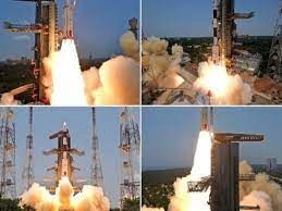
ISRO updated that a Trajectory Correction Maneuver (TCM) was performed on India’s first solar mission Aditya L1.
About Aditya L1 Mission:
- 'Aditya' literally means the Sun in Sanskrit.
- ISRO’s Aditya L1 mission is India's first space-based mission to study the Sun. It was launched from the Satish Dhawan Space Centre on 2nd September, 2023.
- Aditya-L1 will first be placed in a low earth orbit by ISRO's PSLV-C57 launch vehicle.
- After that, the spacecraft's orbit will be made more elliptical.
- On-board propulsion will be used to launch the spacecraft towards L1 point.
- As it moves towards L1, the spacecraft will exit Earth's gravitational Sphere of Influence (SOI).
- After it exits the SOI, the spacecraft will begin its cruise phase.
- The mission will take around 109 Earth days after launch to reach the halo orbit around the L1 point, which is about 1,500,000 km from Earth.
What are the Objectives of the Aditya L1?
- The mission's main objective is to expand our knowledge of the Sun, and how its radiation, heat, flow of particles, and magnetic fields affect us.
- Below is the list of other objectives that the mission will embark upon:
- To study the upper atmospheric layers of the Sun called chromosphere and corona. While the corona is the outermost layer, the chromosphere is just below it.
- To examine coronal mass ejections (CMEs), which are large expulsions of plasma and magnetic fields from the Sun's corona.
- To analyse the corona's magnetic field and the driver of the space weather.
- To understand why the Sun's not-so-bright corona is a million degree Celsius hot when the temperature on the surface of the Sun is just about 5,500 degrees Celsius.
- To help scientists know the reasons behind the acceleration of particles on the Sun, which leads to the solar wind - the constant flow of particles from the Sun.
What are the Lagrange Points?
- There are five Lagrange points, L1 to L5, between any two-celestial body system.
- At these positions, the gravitational pull of the celestial bodies equals the centripetal force required to keep a smaller third body in orbit.
- In simpler words, the forces acting on the third body cancel each other out.
- The points can be used as ‘parking spots’ for spacecraft in space to remain in a fixed position with minimal fuel consumption, according to NASA.
- They have been named after Italian-French mathematician Joseph-Louis Lagrange (1736-1813), who was the first one to find the positions.
- So, between the Earth and the Sun, a satellite can occupy any of five Lagrangian points.
What is a Halo Orbit?
- NASA says a spacecraft can “orbit” about an unstable Lagrange point with a minimum use of thrusters for stationkeeping.
- Such an orbit is known as a halo orbit as “it appears as an ellipse floating over the planet”.
- A halo orbit, however, isn’t the usual orbit because the unstable Lagrange point doesn’t exert any attractive force on its own.
Why will Aditya Spacecraft go around L1 Point?
- It’s because L1 gets a continuous and unhindered view of the Sun.
- L2 is located behind the Earth, and thus obstructs the view of the Sun, while L3 is behind the Sun which is not a great position to communicate with Earth.
- L4 and L5 are good and stable locations but are much farther from Earth compared to L1, which is directly between the Sun and the Earth.
- The European Space Agency’s (ESA) Solar and Heliospheric Observatory spacecraft (SOHO) is also stationed at a halo orbit around the L1 point of the Earth-Sun system.
- The spacecraft has been operational since 1996 and has discovered more than 400 comets, studied the outer layers of the Sun and examined solar winds.
Significance/Need of Studying Sun from Space:
- According to ISRO, the Sun emits radiation/light in nearly all wavelengths along with various energetic particles and magnetic fields.
- The atmosphere of the Earth as well as its magnetic field acts as a protective shield and blocks a number of harmful wavelength radiations including particles and fields.
- This means studying the Sun from Earth can’t provide a complete picture and it becomes crucial to observations from outside the planet’s atmosphere i.e., from space.
News Summary:
- ISRO updated that a Trajectory Correction Maneuver (TCM) was performed on India’s first solar mission Aditya L1.
- The spacecraft propulsion system was fired for 16 seconds on October 6 to correct its trajectory towards the L1 point.
- The space agency said that the manoeuvre“was needed” to correct the trajectory of the spacecraft was evaluated after it was inserted in the path towards the L1 point on September 19.
- The spacecraft left the Earth’s sphere of influence eight days ago — the second spacecraft by the Indian space agency after Mangalyaan that has left the Earth’s sphere of influence.
Source: The Hindu
NASA’s APEP Mission: Studying Solar Eclipse’s Impact on Earth’s Ionosphere
Subject: Science and Technology

Why in News?
NASA is set to launch on a groundbreaking mission known as Atmospheric Perturbations around the Eclipse Path (APEP).
- The project is spearheaded by an Indian-origin engineering physics professor.
Exploring the APEP Mission
- Triple Rocket Launch: The APEP mission involves the deployment of three meticulously equipped rockets, each armed with an array of cutting-edge scientific instruments.
- Objective: The primary mission objective is to unravel the enigma of how the upper atmosphere reacts during a solar eclipse, particularly during the pivotal moments of sudden light reduction.
- Ionospheric Dynamics: Solar eclipses trigger profound transformations in the ionosphere, generating cascading waves throughout this atmospheric layer.
- Comprehensive Measurements: The mission’s scientific instruments will meticulously measure variations in electric and magnetic fields, density, and temperature.
- Launch Location: APEP will be launched from the White Sands Missile Range in New Mexico, with a specific focus on exploring the ionosphere.
- Impact on Satellite Communications: NASA postulates that the ionosphere’s temperature and density will diminish during the eclipse, leading to disruptive wave-like disturbances that could affect GPS and satellite communications.
Mission Process
- Strategic Rocket Positioning: The three rockets will be strategically positioned just beyond the path of annularity, where the Moon directly aligns with the Sun.
- Simultaneous Measurements: NASA’s paramount goal is to attain the first-ever simultaneous measurements from multiple locations within the ionosphere during a solar eclipse.
- Precision of Rockets: Rockets offer precision in launching at precisely the right moment and probing lower altitudes inaccessible to orbiting satellites.
- Sounding Rockets’ Selection: The APEP mission team opted for sounding rockets due to their unparalleled ability to pinpoint and measure specific spatial regions with exceptional accuracy.
- Multi-Altitude Data: These rockets are adept at capturing data at varying altitudes as they ascend and descend during their suborbital flights.
- Altitude Range: Data collection will span altitudes ranging from 45 to 200 miles (70 to 325 kilometres) above the Earth’s surface along the rockets’ flight trajectories.
Source: The Hindu
Javan Rhinos
Subject: Environment and Ecology

Why in News?
Indonesian officials recently reported the sighting of a new Javan rhino calf in Ujung Kulon National Park, home to the last surviving population of the critically endangered species.
About Javan Rhino:
- The Javan rhino, also known as the lesser-one-horned rhino, is the most threatened of the five rhino species.
- Scientific Name: Rhinoceros sondaicus
- Distribution:
- They once lived throughout northeast India and Southeast Asia.
- Today, the entire population of the Javan rhinos is found in the Ujung Kulon National Park on the very western tip of Java, Indonesia.
- Habitat: They inhabit forests, marshy areas, and regions of thick bush and bamboo.
- Population: In 2020, park managers, relying on camera trap data to identify and track the animals, estimated that no more than 68–74 surviving individuals remained.
- Features:
- It is a smaller and lighter relative of the greater one-horned rhino. They can reach a height of 1.7 m (5.6 ft) and weigh up to 2,300 kg (5,070 lb).
- They have grey or grey-brown skin, almost black when wet, with pink colouring in the folds.
- Similar to the Indian rhino, the Javan rhinoceros has a single horn, unlike the other three species of rhinos, which have two.
- It has the smallest of horns for all species of rhinoceros measuring less than 20 cm (7.9 in) in length.
- Lifespan: 30 to 45 years in the wild.
- They’re herbivorous, only eating plants.
- They’re solitary animals, except for mating pairs and mothers with young.
- Conservation Status:
- IUCN Red List: Critically Endangered
Source: Indian Express
|
44 videos|5271 docs|1113 tests
|


