Geography - 3 | Current Affairs & Hindu Analysis: Daily, Weekly & Monthly - UPSC PDF Download
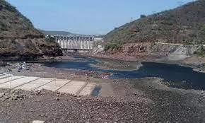
Drop in India’s Reservoir Water Levels
India, a country heavily dependent on monsoon rains, confronted a substantial challenge in August 2023 due to an unprecedented shortfall in rainfall.
- Consequently, water levels in the nation's vital reservoirs experienced a steep decline, sparking concerns about water supply for households, industries, and power generation.
- August is traditionally a month when India's reservoirs witness a substantial increase in water storage levels. However, August 2023 deviated from this norm, emerging as the driest August in over 120 years. Instead of the anticipated 255 mm of rainfall, the country received only around 162 mm, resulting in a 36% deficit in rainfall.
How Drought-Affected are India’s Reservoirs?
- As of August 31, 2023, the Central Water Commission (CWC) reported that the live storage in the 150 reservoirs stood at 113.417 billion cubic meters (BCM), constituting 63% of their total live storage capacity.
- This reflected a 23% decrease compared to the storage during the same period in 2022 and a 10% reduction compared to the average of the last 10 years.
- Water levels in the reservoirs exhibited variations across diverse regions and river basins. The southern region, experiencing a 60% rainfall deficiency in August, recorded the lowest storage level at 49% of its combined capacity.
- In contrast, the eastern region, which received normal rainfall, boasted the highest storage level at 82% of its combined capacity.
- Several river basins showed highly deficient or deficient water levels, including:
Highly Deficient:
- Pennar basin in Karnataka and Andhra Pradesh
- Mahanadi basin in Chhattisgarh and Odisha
Deficient:
- Subarnarekha, Brahmani, and Vaitarni basins in Jharkhand, West Bengal, and Odisha
- Kaveri basin in Karnataka and Tamil Nadu
- Mahi basin in western India
- Krishna basin in Maharashtra, Karnataka, and Telangana
- Water storage in the reservoirs across the eastern, western, central, and southern regions, except the northern region, is lower than the previous year (2022).
What Are the Consequences of this Water Scarcity?
Agriculture:
- The reservoirs provide irrigation water for crops, especially during the rabi season. The reduced water availability can affect crop production and farmers’ incomes.
Power:
- The reservoirs also supply water for hydropower generation, which accounts for over 12% of India’s total electricity generation.
- The dry August led to an unexpected increase in power demand, primarily for irrigation purposes.
- Power generation reached a record high in August, necessitating additional electricity production by coal-fired power plants due to the precarious water levels in the reservoirs.
Environment:
- The reservoirs also support biodiversity and ecosystem services, such as flood control, groundwater recharge, fisheries and recreation. The lower water levels can affect these functions and cause ecological damage.
Impact on Water Supply:
- India's annual rainfall primarily occurs during the southwest monsoon season, making these reservoirs vital for water supply year-round. This scarcity in water storage threatens households.
What are the Causes for the Rainfall Deficit?
El Niño:
- El Niño is a climatic phenomenon that occurs when the sea surface temperature in the central and eastern Pacific Ocean rises above normal.
- It affects the global weather patterns and reduces rainfall in India during the monsoon season.
- According to the India Meteorological Department (IMD), El Niño was present during August 2023 and was expected to continue till September.
- The IMD has forecasted that rainfall in September will likely not be more than 10% deficient.
- However, the looming threat of El Niño in the equatorial Pacific Ocean, which is still gaining strength, poses a significant risk to India's water resources.
Indian Ocean Dipole (IOD):
- The Indian Ocean Dipole (IOD) is defined by the difference in sea surface temperature between two areas (or poles, hence a dipole) – a western pole in the Arabian Sea (western Indian Ocean) and an eastern pole in the eastern Indian Ocean south of Indonesia.
- The IOD affects the climate of Australia and other countries that surround the Indian Ocean Basin, and is a significant contributor to rainfall variability in this region.
- According to IMD, IOD was expected to turn favourable for the monsoon rainfall this year, but did not have much impact.
Way Forward
- Promote efficient water management practices in agriculture, including the adoption of drip irrigation and rainwater harvesting techniques.
- Encourage crop diversification and the cultivation of drought-resistant crops to reduce the reliance on water-intensive farming.
- Water innovation initiatives, such as desalination, wastewater treatment, smart water technologies, and climate-resilient agriculture, can help enhance water supply and efficiency and cope with water challenges and uncertainties.
- Invest in renewable energy sources like solar and wind power to reduce the dependency on hydropower generation, especially during dry periods.
- Raise awareness among the public about responsible water usage and the importance of conservation.
Carrying Capacity of Himalayan States
The Central government has petitioned the Supreme Court to instruct the 13 Himalayan states in the country to conduct an assessment of their 'carrying capacity' and has proposed the establishment of an expert panel to scrutinize the action plans submitted by each state.
- This endeavor is imperative to guarantee the sustainable development and safeguarding of the delicate Himalayan ecosystem.
Understanding Carrying Capacity:
- Carrying capacity denotes the maximum population size that an ecosystem or environment can support in a sustainable manner over a specific period, without causing substantial degradation or harm to its natural resources and overall health.
- Conducting carrying capacity assessments is pivotal for comprehending and managing the equilibrium between human activities and the conservation of natural ecosystems, ensuring their long-term viability.
What are the Government Initiatives Related to the Conservation of the Himalayan Region?
National Mission on Sustaining Himalayan Ecosystem (2010):
- Covers 11 states (Himachal Pradesh, Uttarakhand, Sikkim, all northeast states, and West Bengal) and 2 UTs (Jammu & Kashmir and Ladakh).
- Part of the National Action Plan on Climate Change (NAPCC), comprising eight missions.
- Indian Himalayas Climate Adaptation Programme (IHCAP):
- It aims to enhance the resilience of vulnerable communities in the Indian Himalayas by strengthening the capacities of Indian institutions in climate science, with a specific focus on glaciology and related areas
SECURE Himalaya Project:
- Integral to the "Global Partnership on Wildlife Conservation and Crime Prevention for Sustainable Development" (Global Wildlife Program), funded by the Global Environment Facility (GEF).
- Focuses on promoting sustainable management of alpine pastures and forests in the high-range Himalayan ecosystems.
Mishra Committee Report 1976:
- Named after MC Mishra, the then Garhwal commissioner in erstwhile Uttar Pradesh. It provided findings on land subsidence in Joshimath.
- Recommendations included imposing restrictions on heavy construction work, blasting, excavation for road repairs and other construction activities, and tree felling in the region.
Pacific Weather Changing: More Multi- Year El Nino and La Nina
A recent scientific inquiry has expressed apprehensions regarding the influence of human activities on the duration and dynamics of El Nino and La Nina occurrences.
- The research indicates a transformation in the behavior of the Walker Circulation, a pivotal atmospheric element of the El Nino-Southern Oscillation (ENSO), since the industrial era, suggesting a potential increase in the frequency of multi-year El Nino and La Nina events.
Insights from Recent Research
- The Walker Circulation, instrumental in steering global weather patterns, became the focal point of investigation to ascertain the impact of greenhouse gas emissions on this vital climate influencer.
- The study's revelations suggest a gradual slowing of the transition from El Nino to La Nina over time. This trend implies a potential rise in the occurrence of multi-year climate patterns in the future, elevating the risks associated with droughts, wildfires, intense rainfall, and floods.
- While the overall robustness of the Walker Circulation has not experienced a decline, there are speculations among researchers regarding its potential weakening due to increased levels of carbon dioxide. Numerous climate models project a probable decrease in the Walker Circulation by the close of this century.
- The research also underscored a correlation between volcanic eruptions and the diminishing strength of the Walker Circulation, often leading to conditions resembling El Nino. Noteworthy El Nino events in the twentieth century coincided with volcanic eruptions, including Mount Agung in 1963, El Chichón in 1982, and Mount Pinatubo in 1991.
What Could Result from More Frequent Multi-year El Nino and La Nina Events?
- Heightened Occurrence of Extreme Weather Events: The increased frequency of multi-year El Niño and La Niña events has the potential to disrupt global weather patterns, influencing precipitation, temperature, wind, and atmospheric pressure. This may lead to more frequent and intense episodes of droughts, floods, heatwaves, cold spells, storms, and wildfires.
Impact on Natural Disasters:
- Floods and Droughts: Multi-year El Niño events may elevate the risk of prolonged droughts followed by severe flooding in various regions. Conversely, multi-year La Niña events can bring excessive rainfall and flooding in some areas, succeeded by extended periods of drought in others.
- Tropical Cyclones: ENSO events can affect the frequency and intensity of tropical cyclones, and multi-year occurrences may result in variations in cyclone activity across different ocean basins, impacting the vulnerability of coastal regions.
- Agricultural and Food Security Implications: Multi-year El Niño-induced droughts may lead to diminished crop yields, affecting global food supplies and prices. On the other hand, multi-year La Niña events may enhance crop production in certain regions but could also bring about excessive rainfall and waterlogging, causing damage to crops.
Economic and Societal Ramifications:
- Economic Costs: The cumulative impacts of multi-year ENSO events could incur significant economic costs due to infrastructure damage, increased energy demand, and disruptions to global trade in commodities like food and minerals.
- Health Risks: Altered weather patterns may contribute to the spread of diseases, with heightened risks of waterborne diseases during floods and vector-borne diseases during extended droughts.
Environmental Consequences:
- Ecosystem Stress: Multi-year events may exert stress on terrestrial and marine ecosystems, resulting in coral bleaching, forest fires, and disruptions to habitats. Rapid and persistent changes in temperature and precipitation may challenge ecosystems' ability to adapt.
- Biodiversity Impact: Environmental shifts can influence the distribution and survival of species, especially those sensitive to climate variations, potentially leading to cascading effects on biodiversity.
Study on Joshimath Sinking
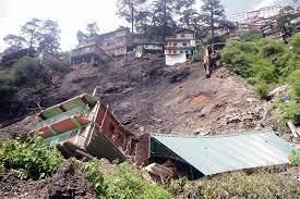
Recent investigations carried out by eight prominent institutions in India, including the Indian Space Research Organisation (ISRO), sought to understand the factors behind the land subsidence observed in Joshimath town, Uttarakhand.
- These separate studies presented independent analyses, shedding light on the causes behind the sinking of this Himalayan town.
Reports by Institutions on Joshimath's Subsidence
Central Building Research Institute (CBRI):
- According to the CBRI's findings, Joshimath town comprises 44%, 42%, and 14% of masonry, RCC (Reinforced Cement Concrete), and other (traditional, hybrid) construction types, respectively.
- Notably, 99% of these structures are non-engineered and do not adhere to the National Building Code of India, 2016.
Additional Insights:
- Joshimath is situated on Vaikrita rock formations characterized by coarse mica-garnet-kyanite and sillimanite-bearing psammitic metamorphics, overlaid by morainic deposits.
- These deposits, consisting of irregular boulders and varying thicknesses of clay, exhibit reduced cohesion and are susceptible to gradual subsidence and landslide-induced subsidence.
National Institute of Hydrology (NIH) Report:
- The NIH report extensively mapped springs, drainage networks, and subsidence-prone areas, indicating potential connections between land subsidence and subsurface water in Joshimath. The report recommended prioritizing the safe disposal of water from upper reaches and efficient waste management.
Wadia Institute of Himalayan Geology (WIHG) Report:
- WIHG cited earthquakes as a contributor to the slow and gradual land subsidence in Joshimath. The primary cause identified was internal erosion resulting from subsurface drainage, possibly triggered by rainwater infiltration, ice melting, or wastewater discharge from households and hotels.
ISRO's Perspective:
- ISRO suggested that subsidence in the Joshimath region could be attributed to the toe-cutting phenomenon and slope instability caused by the seepage of local drainage water into the soil.
- Terrain and edaphic characteristics were also identified as factors influencing subsidence, with loose and unconsolidated moraine materials on the slope (resulting from past landslides) and recent flash flood events contributing to the land sinking.
How to Safeguard Joshimath?
- Experts strongly advocate a comprehensive halt to developmental activities and hydroelectric projects in the region. The immediate priority, however, is the relocation of residents to a safer area, coupled with a reimagining of the town's layout to accommodate new variables and evolving geographical factors.
- A critical aspect requiring thorough examination and redevelopment is drainage planning. Joshimath is grappling with inadequate drainage and sewer management, causing an infiltration of waste into the soil and internal destabilization. Addressing this, the state government has tasked the irrigation department with investigating the issue and formulating a new drainage system plan.
- Replantation in vulnerable sites is another recommended measure to enhance soil retention capacity. A collaborative effort involving the government, civil bodies, and military organizations such as the Border Roads Organisation (BRO) is deemed essential to rescue Joshimath.
- Despite existing weather forecasting technology capable of alerting locals to imminent events, there's a pressing need to enhance its coverage. The state government must also give due consideration to scientific studies outlining the root causes of the current crisis.
Understanding Landslides:
- A landslide is characterized by the movement of a mass of rock, debris, or earth down a slope.
- It falls under the category of mass wasting, signifying any downward movement of soil and rock influenced directly by gravity.
- The term encompasses five modes of slope movement: falls, topples, slides, spreads, and flows.
Surge in Human Settlements in Flood-Prone Areas
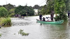
A recent investigation by the World Bank reveals a significant surge of 122% in human settlements within some of the globe's most vulnerable flood zones since 1985. This surge exacerbates the susceptibility of millions to water-related disasters intensified by climate change, with the surge being particularly pronounced in middle- and low-income nations.
- Conversely, regions deemed more secure witnessed an 80% increase in the expansion of human settlements.
Key Findings from the Study
Global Pattern of Settlement Expansion:
- A majority of countries, notably in East Asia, witnessed a higher growth of settlements in both regular and ultra-high flood zones compared to arid areas.
- Libya, grappling with severe flooding in September 2023, experienced an 83% surge in settlement expansion within the most hazardous flood zones.
- Pakistan, facing catastrophic floods in both 2022 and 2023, observed an 89% rise in settlements within vulnerable regions.
Noteworthy Deviations:
- In the United States, the growth of settlements in dry areas surged by 76%, while settlements in the highest flood-risk zones increased by only 46%.
- Several countries, including India, France, Sweden, Austria, Finland, Japan, and Canada, registered more growth in dry settlements compared to extremely wet areas.
What are the Possible Factors Behind Increasing Human Settlements in Flood Zones?
- Rural to Urban Migration: As countries experience economic growth, urbanization near waterways becomes prevalent. Settlements often expand into flood-prone areas as cities grow.
- For Example: Dar es Salaam, Tanzania, exemplifies this issue, growing from a fishing village to over seven million people.
- Economic Factor: Low-income populations often cannot afford to live in safer, less flood-prone areas. They might be forced to live in flood-prone zones because of housing affordability constraints.
- Lack of Regulatory Enforcement: In some countries, land-use planning and zoning regulations might not be effectively enforced. This can result in settlements proliferating in flood-prone areas without adequate safeguards.
- Cultural and Historical Ties: Some communities have deep cultural or historical connections to flood-prone regions, and this can influence their decisions to remain or settle in these areas despite the risks.
- Tourism and Recreation: Coastal and riverfront areas, despite their vulnerability to flooding, continue to draw tourists and recreation enthusiasts because of their inherent appeal.
- The demand for resorts, hotels, and vacation homes can lead to settlement in these areas, even if it's only seasonal.
Way Forward
- Strict Land Use Policies: Implement and enforce stringent land use regulations that prohibit or restrict new construction in high-risk flood zones.
- Designate flood-prone areas as 'no-build' zones and enforce these restrictions consistently.
- Infrastructure Investment: There is a need to Invest in resilient infrastructure, including better flood defences, early warning systems, and floodplain mapping.
- Improve drainage systems to mitigate the impact of flooding in existing settlements.
- Government Support and Relocation Assistance: The government can offer financial incentives for residents to relocate from flood-prone areas to safer zones.
- Also, the government needs to strengthen emergency response and preparedness measures in flood-prone areas to minimize the loss of life and property during flood events.
- Public Awareness and Education: Launch public awareness campaigns to educate citizens about the risks associated with living in flood-prone areas.
- Promote community-based education programs on flood preparedness and the importance of avoiding such areas.
|
38 videos|5269 docs|1114 tests
|
FAQs on Geography - 3 - Current Affairs & Hindu Analysis: Daily, Weekly & Monthly - UPSC
| 1. What is the current water level situation in India's reservoirs? |  |
| 2. What is meant by the carrying capacity of Himalayan states? |  |
| 3. How is the Pacific weather changing and what is the impact of more multi-year El Nino and La Nina events? |  |
| 4. What does the study on Joshimath sinking reveal? |  |
| 5. Why is there a surge in human settlements in flood-prone areas? |  |


