Geography: March 2025 UPSC Current Affairs | Geography for UPSC CSE PDF Download
| Table of contents |
|
| Wallace Line |
|
| Rising Avalanche Risks |
|
| Hydrogen Peroxide |
|
| Bangus Valley Latest News |
|
| Carbon Intensity |
|
| Red Color of Mars |
|

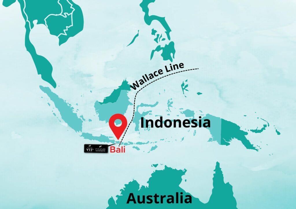
Wallace Line
 Why in News?
In the 19th century, Alfred Wallace made a significant observation regarding the differences in species composition between Asia and Australia. This observation led to the identification of the Wallace Line, which serves as a crucial biogeographical boundary.
Key Takeaways
- The Wallace Line is an imaginary boundary separating the distinct faunal regions of Asia and Australia.
- It runs through the Makassar Strait, marking a major division with stark species differences on either side.
- Species west of the line are predominantly Asian, while those east are characteristic of the Australian ecosystem.
Additional Details
- Geographical Location: The Wallace Line traverses the Makassar Strait, located between the east coast of Borneo and the western coast of Sulawesi. It also extends between Bali and Lombok, effectively separating the Sunda and Sahul continental shelves.
- Species Distribution:
- To the west: Regions like Bali, Borneo, and Java host species such as monkeys, apes, rhinos, and tigers, typical of the Asian ecosystem.
- To the east: Areas including Lombok and Australia are home to unique fauna like tree kangaroos and cockatoos, associated with the Australian ecosystem.
- Wallacea Region: This region, situated between the Wallace Line and the Weber Line, includes islands such as Sulawesi, Flores, Lombok, and Timor. These islands exhibit lower biodiversity compared to nearby continents but are home to unique species like the Komodo dragon and babirusa.
- Continental Drift: Approximately 85 million years ago, Australia separated from Antarctica and began drifting northwards, leading to the isolation of species and fostering independent evolution.
- Deep Oceanic Barriers: The line coincides with deep oceanic waters, which remained submerged during ice ages, restricting species movement between Asia and Australia.
- Geological Climate Change: Species adapted to the differing climates of Asia and Australia faced challenges in migrating across the line.
The Wallace Line serves as a pivotal concept in understanding biogeography, illustrating the profound impact of geographical boundaries on species distribution and evolution. This line not only highlights the unique biodiversity of the regions it separates but also emphasizes the historical processes that have shaped them.
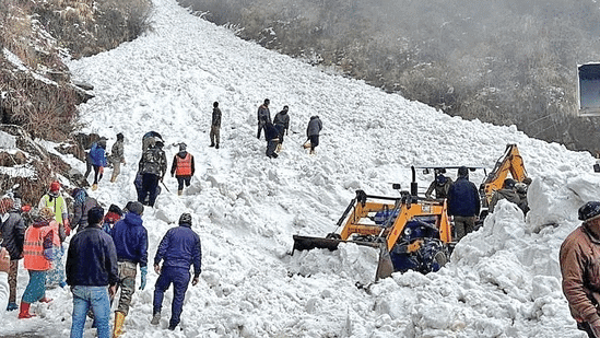
Rising Avalanche Risks
 Why in News?
A massive avalanche occurred in Uttarakhand’s Chamoli district, burying people and properties under snow and debris. Warmer temperatures, increased rainfall, and reduced snowfall are altering snow conditions, leading to a higher frequency of avalanches in the Himalayas.
Key Takeaways
- Avalanche risks are increasing due to climate change.
- Recent events highlight the urgent need for mitigation strategies.
Additional Details
- Avalanche: An avalanche is the rapid flow of snow, ice, and debris down a mountain slope. It often carries earth, rocks, and rubble, causing destruction. The risk of avalanches peaks from December to April due to heavy winter snowfall and spring thaw.
- Types of Avalanches:
- Loose Snow Avalanche: Starts from a single point and spreads in an inverted V-shape; less dangerous due to lower volume and speed.
- Slab Avalanche: Occurs when a cohesive snow slab breaks away, reaching speeds of 50–100 km/h, causing significant destruction.
- Gliding Avalanche: Involves the snowpack sliding down a smooth surface, creating a broad fracture line.
- Wet-Snow Avalanche: Triggered by rising temperatures or rain, as meltwater weakens the snow layer bonds.
- Causes of Avalanche:
- Natural Factors: Continuous snowfall increases snowpack weight, while windy conditions can enhance instability. Temperature changes can weaken snow layers, and seismic activity can destabilize them.
- Human-Induced Factors: Deforestation and adventure tourism activities can trigger avalanches, while global warming increases avalanche risks through freeze-thaw cycles.
- Differences from Landslides:
- Avalanches involve snow movement in snowy regions, while landslides involve soil, rocks, or mud.
- Avalanches occur on weak snow layers, whereas landslides happen on steep land slopes.
- Himalayan Vulnerability: The Himalayas are prone to avalanches due to rising temperatures, wetter snow, melting permafrost, increased wind speeds, and steep terrain.
In conclusion, global warming and climate change are intensifying avalanche risks in the Himalayas by altering snowpack stability, increasing rainfall, and accelerating glacier melt. Proactive measures such as early warning systems, protective infrastructure, and controlled avalanche triggering are essential to mitigate these risks and safeguard communities.
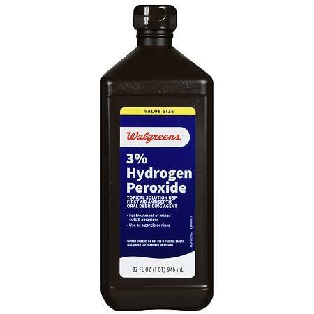
Hydrogen Peroxide
Why in News?
Researchers have innovated an effective, eco-friendly, and energy-efficient method for synthesizing hydrogen peroxide (H₂O₂) using a hydrazone-linked Covalent Organic Framework (COF). This novel approach facilitates the production of H₂O₂ under visible light without the need for external sacrificial electron donors or additional reagents, offering a cleaner and more efficient alternative to traditional methods.
Key Takeaways
- New method synthesizes hydrogen peroxide efficiently and sustainably.
- Utilizes a hydrazone-linked Covalent Organic Framework for production under visible light.
- Eliminates the need for external reagents, enhancing eco-friendliness.
Additional Details
- Hydrogen Peroxide (H₂O₂): A colorless liquid with a bitter taste at room temperature; it is highly unstable and decomposes into oxygen and water, releasing heat.
- Uses: Commonly used as an antiseptic for wounds (in diluted solutions) and as a disinfectant in hospitals and clinics.
- Industrial Applications: Acts as a bleaching agent in the paper, textile, and cosmetic industries.
- Rocket Propulsion: High concentrations of H₂O₂ are utilized as a propellant due to their oxidation properties.
- Chemical Applications: Used in food processing for sterilization purposes.
- Hazards: Recognized as a strong oxidizer, it may lead to spontaneous ignition when in contact with combustible materials.
- Peroxide Chemicals: These are organic compounds characterized by containing a peroxide functional group, which comprises two linked oxygen atoms.
This breakthrough in hydrogen peroxide synthesis not only contributes to greener chemistry but also opens new avenues for its application across various fields, highlighting the importance of sustainable practices in chemical production.
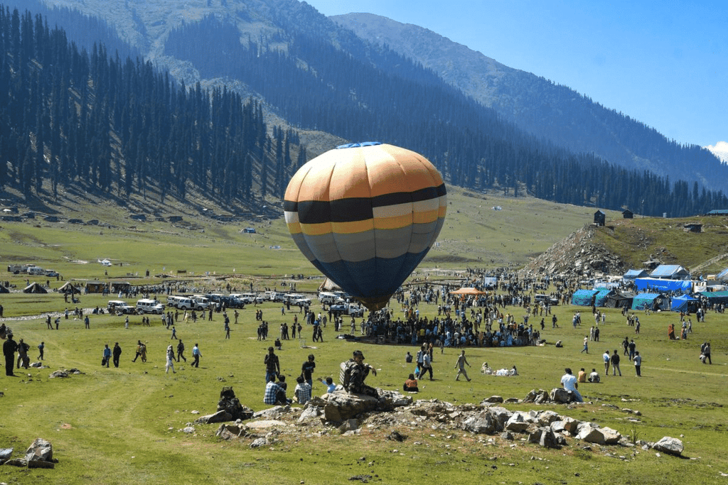
Bangus Valley Latest News
Why in News?
The Jammu and Kashmir government has recently implemented new regulations for Bangus Valley, a remote tourist destination near the Line of Control (LoC) in north Kashmir. This initiative aims to promote the area as a prime ecotourism spot.
Key Takeaways
- Bangus Valley is situated in the northern part of the Kupwara district, at an altitude of approximately 10,000 feet above sea level.
- The valley covers an area of about 300 square kilometers and is known for its diverse ecological systems.
Additional Details
- Geographical Features: Bangus Valley consists of a linear elliptical bowl aligned east-west and is surrounded by various mountain ranges, contributing to its unique landscape.
- A smaller valley, Lokut Bangus (Small Bangus), is located to the northeast of the main valley, characterized by lush meadows and dense coniferous forests.
- Trans-Himalayan Range: This region is north of the Great Himalayan Range and is known for its arid plateaus and high-altitude deserts, playing a crucial role in ecological balance.
Overall, Bangus Valley's natural beauty, including its green meadows, mountains, and flowing streams, makes it an ideal location for outdoor activities such as trekking and camping, enhancing its appeal as an ecotourism destination.
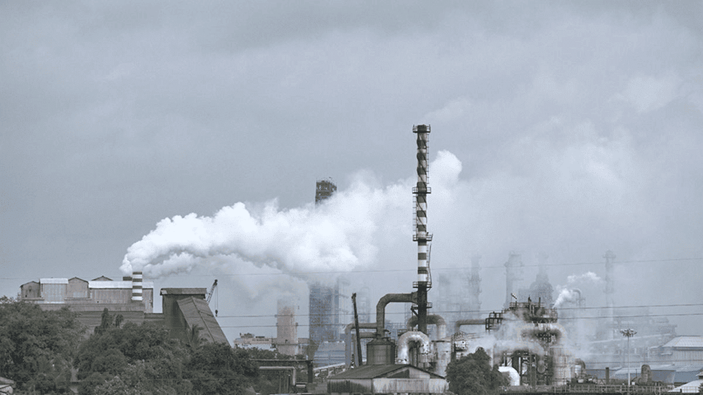
Carbon Intensity
Why in News?
Carbon intensity is a significant metric that quantifies the amount of carbon dioxide (CO₂) emissions produced per unit of output within a specific sector or economy. This measure is essential for monitoring advancements in emission reduction efforts, particularly as economies grow or production levels increase.
Key Takeaways
- Carbon intensity helps assess the environmental impact of various sectors, such as the steel industry, by measuring CO₂ emissions against production levels.
- National carbon intensity is calculated by dividing a country's gross domestic product (GDP) growth per capita by its total CO₂ emissions.
- It is crucial for India to achieve its climate goals as part of the Paris Agreement (2015), aiming to reduce emissions intensity of GDP by 45% by 2030 from 2005 levels.
- Maintaining a lower carbon intensity is vital for promoting sustainable economic growth while minimizing environmental damage.
Additional Details
- National Carbon Intensity: This refers to the overall carbon emissions of a country in relation to its economic output, providing insight into how efficiently a nation is producing goods while managing its carbon footprint.
- For example, the carbon intensity in the steel sector can be represented as the amount of steel produced per tonne of CO₂ emitted, illustrating the sector's efficiency and environmental impact.
In summary, carbon intensity is a crucial indicator for understanding and improving the balance between economic development and environmental sustainability. It supports India in its efforts to meet international climate commitments while fostering growth.
Red Color of Mars
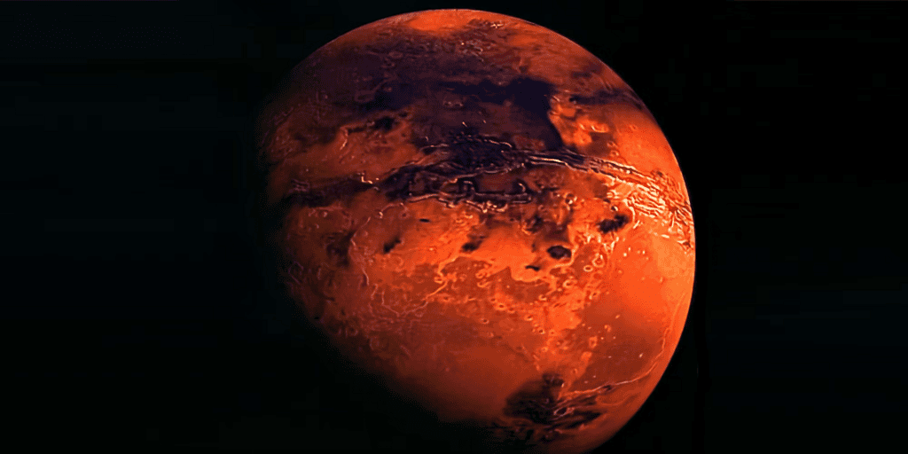
The study, based on data from several space missions and ground-level observations, suggests that Mars' red color is primarily due to Ferrihydrite—a water-formed iron oxide—rather than the previously assumed Hematite.
- Ferrihydrite forms in cool, water-rich conditions, whereas hematite forms in dry, warm conditions.
- It suggests that Mars once had liquid water, potentially supporting life. Additionally, the study revealed hydrogen bound to iron-rich minerals, further indicating past interactions with liquid water on Mars.
Mars: Mars is the 4th planet from the Sun and the second-smallest in the Solar System after Mercury.
- About half Earth's size, it hosts Olympus Mons (largest volcano), and has 2 moons (Phobos and Deimos).
- Mars completes a rotation every 24.6 hours, making its day nearly identical in length to Earth's (23.9 hours). Martian days are called sols.
- A year on Mars lasts 669.6 sols, which is the same as 687 Earth days.
- Its axis is tilted at 25 degrees relative to its orbit, similar to Earth’s axial tilt of 23.4 degrees.
- Mars experiences seasons like Earth, but they are longer in duration.
Important Mars Missions:
- NASA's Mars Mission, India’s MOM, UAE’s Hope
- Tianwen-1: China's Mars Mission
|
175 videos|624 docs|192 tests
|
FAQs on Geography: March 2025 UPSC Current Affairs - Geography for UPSC CSE
| 1. What is the Wallace Line and why is it significant in biogeography? |  |
| 2. What are the rising avalanche risks and what factors contribute to them? | |
| 3. How is hydrogen peroxide used in various industries, and what are its environmental impacts? | |
| 4. What are the latest developments in the Bangus Valley region? | |
| 5. What is carbon intensity and how does it affect climate change? | |


Semester Notes
,Extra Questions
,past year papers
,mock tests for examination
,Sample Paper
,Exam
,shortcuts and tricks
,MCQs
,Geography: March 2025 UPSC Current Affairs | Geography for UPSC CSE
,study material
,Viva Questions
,Free
,Objective type Questions
,Previous Year Questions with Solutions
,Geography: March 2025 UPSC Current Affairs | Geography for UPSC CSE
,ppt
,video lectures
,Important questions
,Summary
,practice quizzes
,Geography: March 2025 UPSC Current Affairs | Geography for UPSC CSE
;


Geography: March 2025 UPSC Current Affairs Free PDF Download
Importance of Geography: March 2025 UPSC Current Affairs
Geography: March 2025 UPSC Current Affairs Notes
Geography: March 2025 UPSC Current Affairs UPSC Questions
Study Geography: March 2025 UPSC Current Affairs on the App
|
© EduRev
|
Education Revolution
|


|


