Savindra Singh Summary :Earth's Movement (Endogenetic and Exogenetic Forces) | Geography Optional for UPSC PDF Download
| Table of contents |
|
| Introduction |
|
| Folds |
|
| Nappes |
|
| Crustal Fracture |
|
| Rift Valleys and Grabens |
|
| Rift Valleys: Their Genesis and Theories |
|

Introduction
 Geological Landscapes
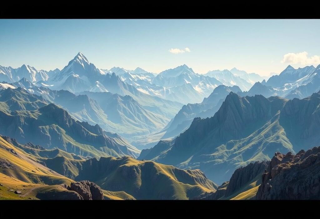
Geological processes, driven by both internal and external forces, play a crucial role in the formation, alteration, and preservation of Earth’s landforms, such as mountains, plateaus, and valleys. These processes involve shifts in the Earth’s surface, illustrating the fundamental principle of change in nature.
Types of Geological Changes
Geological changes can be broadly classified into two categories based on the time scale over which they occur:
- Long-Period Changes: These changes happen very slowly, over thousands or millions of years. They are not something we can observe within a human lifetime. Examples include the gradual formation of mountains through tectonic activity, the uplift of plateaus, and the slow wearing down of landforms through erosion.
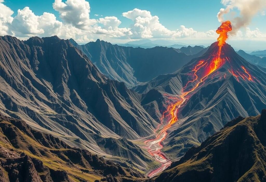
- Short-Period Changes: These changes occur rapidly and can be observed in a matter of seconds to hours. Examples include sudden events like earthquakes, volcanic eruptions, landslides, and flash floods, which can dramatically alter the landscape in a short period.
Classification of Forces
 Geological Dynamics
Forces affecting Earth’s crust can be classified into two categories:
(i) Endogenetic Forces
(ii) Exogenic Forces
(i) Endogenetic Forces
Definition: Endogenetic forces originate from within the Earth and cause both horizontal and vertical movements.
1. Horizontal Movements:
- Definition: Horizontal movements refer to the lateral displacement of Earth’s crust.
- Types: These movements can be further categorized into:
- (a) Convergent Movements: Where two tectonic plates move towards each other, leading to the formation of mountains and other geological features.
- (b) Divergent Movements: Where plates move apart, resulting in the creation of new crust, such as mid-ocean ridges.
- (c) Transform Movements: Where plates slide past each other, causing faults and earthquakes.
2. Vertical Movements:
- Definition: Vertical movements involve the upward or downward displacement of the Earth’s crust.
- Types: These movements include:
- (a) Upliftment: The rising of land, which can lead to the formation of plateaus and mountain ranges.
- (b) Subsidence: The sinking of land, resulting in the creation of basins and depressions.
3. Resulting Landforms:
- Mountains: Formed by the folding and faulting of the Earth’s crust due to endogenetic forces.
- Plateaus: Elevated flatlands created by upliftment or volcanic activity.
- Faults: Fractures in the Earth’s crust where blocks of land have moved past each other.
- Folds: Bends in the Earth’s crust resulting from compressional forces.
4. Sudden Events:
- Earthquakes: Sudden shaking of the ground caused by the release of stress along faults.
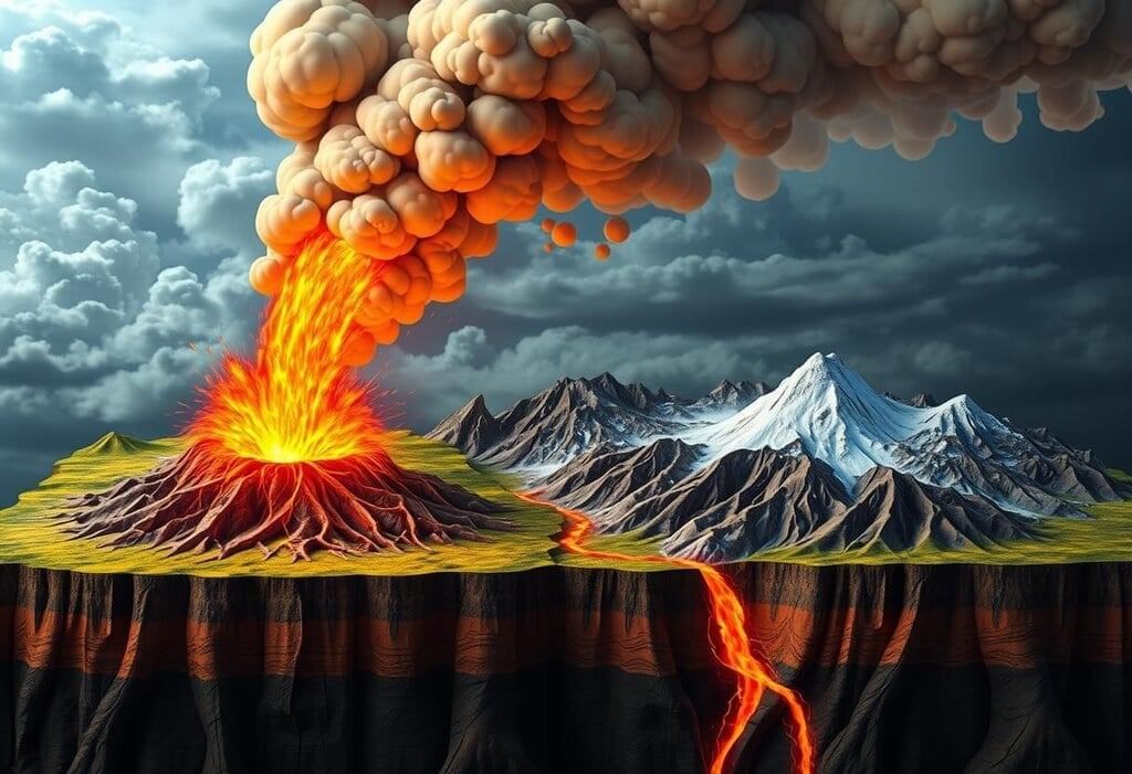
- Volcanic Eruptions: Explosive events where magma from the Earth’s interior reaches the surface, creating new landforms.
5. Origin of Forces: Although the exact origins of endogenetic forces are not fully understood, they are generally associated with thermal conditions within the Earth that cause rocks to expand and contract. These processes create stress and strain in the crust, leading to various geological activities.
Types of Geological Movements and Their Effects
 Geological Dynamics
- Horizontal Movements: These movements cause sideways shifts in the Earth's crust, which can create folds and faults.
- Vertical Movements: These involve the rising or sinking of land, leading to the creation of plateaus and basins.
- Sudden Movements: Caused by strong forces, these movements result in quick occurrences such as earthquakes.
- Diastrophic Movements: These are gradual movements over time, influenced by tectonic forces, shaping significant landforms.
Categories of Endogenetic Forces
 Geological Chaos
Endogenetic forces are categorized based on their intensity into two main types:
1. Sudden Forces
2. Diastrophic Forces
Sudden Forces and Movements
Characteristics. Sudden forces originate deep within the Earth and trigger rapid, destructive events such as volcanic eruptions and earthquakes. These events are referred to as "extreme events." Their effects can be severe in populated areas and become apparent within minutes, despite being the result of long-term internal processes.
Geological Role. Sudden forces are considered constructive as they create new landforms.
- Volcanic Eruptions. These events lead to the formation of volcanic cones, mountains, lava plateaus (such as the Deccan Plateau in India and the Columbia Plateau in the USA), and lava plains.
- Earthquakes. Earthquakes are responsible for the creation of faults, fractures, and lakes.
Diastrophic Forces and Movements
Diastrophic forces operate slowly, with their impacts becoming visible over thousands to millions of years. While this is generally true, it is important to note that some diastrophic processes can occur relatively quickly, depending on the geological context. These forces are also constructive and play a significant role in shaping large landforms such as mountains, plateaus, and faults.
Subcategories of Diastrophic Movements. Diastrophic movements are further divided into two subcategories:
1. Epeirogenetic Movements
- Definition. The term "epeirogenetic" is derived from "epiros," meaning continent, and "genesis," meaning origin. It refers to vertical movements that cause the uplift or sinking of land masses.
- Types of Epeirogenetic Movements :
- Upward Movement (Emergence). Uplift can occur both on land and near coastlines.
- Downward Movement (Submergence). Sinking can take place both on land and in coastal areas.
- Scope. Epeirogenetic movements affect large areas of continents.
2. Orogenetic Movements
- Definition. The term "orogenetic" is derived from "oros," meaning mountain, and "genesis," meaning formation. Orogenetic movements involve horizontal movements caused by tangential forces.
- Types of Forces in Orogenetic Movements :
- Tensional (Divergent) Forces. These forces act in opposite directions, leading to the formation of ruptures, cracks, and faults in the Earth's crust.
- Compressional (Convergent) Forces. These forces push together, causing bending, folding, or warping of the crust.
- Crustal Bending in Orogenetic Movements :
- Warping. Warping affects large areas of the crust and can involve:
- Upwarping. An upward movement of crustal sections.
- Downwarping. A downward bending that creates basins or depressions in the crust.
- Broad Warping. Large-scale warping of crustal regions.
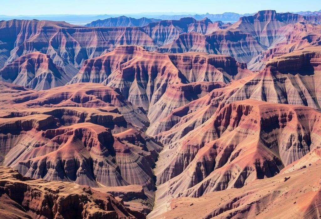
- Folding. Compressional forces squeeze and buckle rocks, leading to the formation of wave-like bends in the rock layers known as folds.
Folds
 Wave-Like Geology
- Definition: Folds are bends in the Earth's crust caused by compressive forces. There are two main types of folds:
- Anticlines:These are upfolds where the rock layers bend upwards. The limbs of an anticline slope in opposite directions.
- Symmetrical Anticline: Both limbs slope evenly.
- Asymmetrical Anticline: The limbs slope unevenly.
- Gentle Anticline: The dip angle is less than 40°, sometimes as low as 1–2°.
- Steep Anticline: The dip angle ranges from 40° to 90°.
- Synclines: These are downfolds where the rock layers bend downwards, forming a trough. The limbs of a syncline tilt towards the centre. Intense folding can create shapes similar to a canoe.
Components of Folds
- Limbs: The two sides of a fold.
- Middle Limb: The part shared between an anticline and a syncline.
- Axis of Fold: The line that divides the angle between the limbs, known as the axis of anticline or syncline.
- Dip: The angle at which rock layers slope compared to a flat surface, measured by direction (e.g., 60° N.E.) and angle (e.g., 60° using a clinometer).
- Strike: The horizontal line along a layer of rock, at a right angle to the dip direction.
Types of Folds
- Anticlines: Upfolded rock layers, with limbs sloping in opposite directions.
- Synclines: Downfolded troughs, where the limbs tilt towards the centre.
- Anticlinorium: Large structures formed by several interacting folds, including minor anticlines and synclines, created by complex geological processes (also known as fan fold).
- Synclinorium:. large syncline that includes minor anticlines and synclines, resulting from irregular folding.
Fold Characteristics and Types
Folds vary based on rock flexibility, compressive force strength, and duration:
- Symmetrical Folds: Evenly inclined limbs, formed by moderate, regular compressive forces (rare in nature).
- Asymmetrical Folds: Limbs with different angles and lengths; one limb is longer and less steep, while the other is shorter and steeper.
- Monoclinal Folds: One limb is moderately inclined and the other nearly vertical, often due to vertical or uneven horizontal forces, potentially leading to faulting.
- Isoclinal Folds: Parallel limbs formed by strong compressive forces, not horizontal.
- Recumbent Folds: Parallel, horizontal limbs due to intense compressive forces.
- Overturned Folds: One limb is pushed over another due to extreme compressive forces.
- Plunge Folds: The fold axis is tilted, creating a plunge angle with the horizontal.
- Fan Folds: Broad folds with minor anticlines and synclines (either anticlinorium or synclinorium).
- Open Folds: Limb angle between 90° and 180° (obtuse), resulting from moderate compressive forces.
- Closed Folds: Limb angle is acute, due to strong compressive forces.
Nappes
- Definition: Nappes are complex folded structures where one limb of a recumbent fold overrides another due to strong horizontal compressive forces.
- Formation:
- The limbs of the recumbent fold become parallel and horizontal.
- Further compression causes one limb to slide forward along a thrust plane, creating an overthrust fold.
- Excessive compression may break the fold axis, reversing the structure, causing the broken limb (nappe) to move several kilometres away, overriding distant rock layers.
- Types:
- Autochthonous Nappe: Overrides a nearby fold.
- Exotic Nappe: Overrides a fold that is far away.
- Examples:
- Alps: Four main nappes (Helvetic, Pennine, Austride, Dinaride) stacked like waves. Erosion of the upper nappes reveals the lower ones, forming structural windows (e.g., in the eastern Alps).
- Himalayas: Nappes found in the regions of Kashmir, Simla, Garhwal, and Kumaun.
- Structural Windows: Exposed lower parts of nappes due to the erosion of overlying nappes.
Crustal Fracture
 Tectonic Landscapes
- Definition: Crustal fracture refers to the movement of rocks along a surface due to stretching or squeezing forces. These forces can act horizontally, vertically, or in both directions.
- Types:
- Joints: These are cracks in the Earth's crust that do not involve significant movement of the rock on either side of the crack.
- Faults: Unlike joints, faults are cracks where there is noticeable movement of the rock on either side of the fracture.
- Definition: Crustal fractures are cracks in the Earth's crust where there is movement along a fault surface. These fractures are caused by internal stress forces acting on the crust.
- Components:
- Fault Plane: This is the surface along which movement occurs during a fault. The fault plane can be vertical, inclined, horizontal, or curved.
- Fault Dip: This refers to the angle between the fault surface and a flat horizontal line, indicating how steeply the fault plane is inclined.
- Upthrown Side: The upthrown side of a fault is the block of rock that is elevated relative to the other side of the fault.
- Downthrown Side: In contrast, the downthrown side is the block of rock that is lower relative to the other side of the fault.
- Hanging Wall: The hanging wall is the upper part of the fault, located above the fault plane.
- Foot Wall: The foot wall is the lower part of the fault, situated below the fault plane.
- Fault Scarp: A fault scarp is a steep slope or cliff formed by faulting. It is important to note that fault scarps are different from slopes created by erosion, as they result from the abrupt movement of the Earth's crust along a fault line.
- Movement: The movement along faults can be vertical, with displacements of up to hundreds of meters, or horizontal, with displacements of up to kilometers. This movement typically occurs gradually over time.
- Significance: Faults are significant geological features because they represent areas of weakness in the Earth's crust where movement has occurred over time. They play a crucial role in shaping the Earth's landscape and are often associated with seismic activity.
Types of Faults
Based on Slip Direction.
- Dip-Slip Faults: In these faults, movement occurs down the slope of the fault plane.
- Strike-Slip Faults: Here, movement occurs sideways along the fault plane.
- Oblique-Slip Faults: These faults exhibit a combination of dip-slip and strike-slip movements.
Specific Types.
- Normal Faults: In normal faults, blocks of the Earth's crust move apart due to stretching forces. The fault surface is typically at an angle of about 45° to the horizontal, leading to the formation of fault scarps.
- Reverse (Thrust) Faults: These faults occur when blocks of the crust push towards each other due to compressional forces. The fault angle is usually less than 30° to the horizontal, resulting in the shortening of the faulted area.
Strike-Slip (Wrench/Tear/Transcurrent) Faults:
- Right-Lateral (Dextral): In right-lateral strike-slip faults, the far side of the fault moves to the right.
- Left-Lateral (Sinistral): In left-lateral strike-slip faults, the far side moves to the left.
- Strike-slip faults typically do not feature clear fault scarps.
- Step Faults: These are characterized by a series of parallel faults where blocks have shifted downward in the same direction.
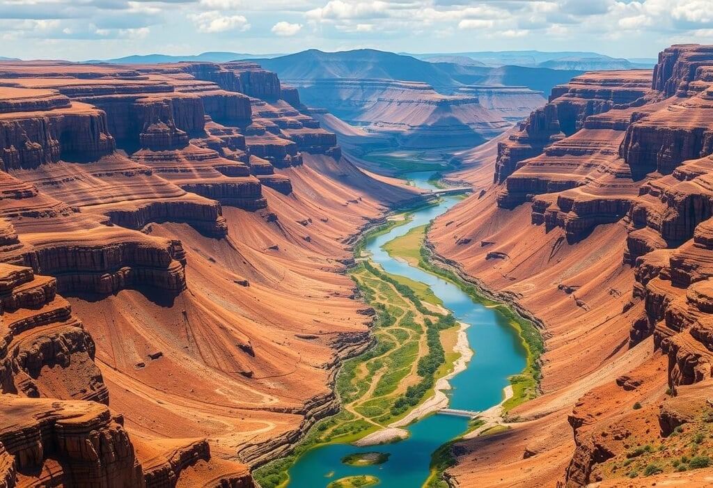
Rift Valleys and Grabens
 Tectonic Wonders
Definition: Rift valleys and grabens are long, narrow depressions formed by both horizontal and vertical movements within the Earth. They are surrounded by parallel normal faults and are known for their unique geological features.
Formation Mechanisms: The formation of rift valleys involves the sinking of the central part of the crust between two stable side blocks or the rising of side blocks while keeping the central part intact.
Characteristics: Rift valleys are characterized by their long, narrow, and deep structure. Some rift valley floors are below sea level, such as the Dead Sea, which is 867 meters below sea level, and the Jordan Rift Valley, which is 433 meters below sea level.
Examples:
- Continental Rift Valleys: Examples include the Rhine Rift Valley (320 km long), bordered by mountains such as the Vosges, Hardt, Black Forest, and Odenwald mountains; the Jordan-Red Sea-Zambezi Valley (4,800 km long); Death Valley in the USA; and the Dead Sea in Asia. There are controversial examples in India, such as the Narmada, Damodar, Son, and Tapi valleys.
- Oceanic Rift Valleys: These include ocean deeps and trenches like the Bortle Trough (4.8 km deep) and Java Deep (6.4 km deep), as well as the Central Plain in Scotland and Spencer Bay in South Australia.
Rift Valleys: Their Genesis and Theories
The formation of rift valleys is a subject of ongoing debate, with no universally accepted explanation. Researchers propose various theories, primarily categorized into the tensional and compressional hypotheses.
Tensional Hypothesis
Explanation: This theory likens the formation of rift valleys to the collapse of a keystone in an arch. Tension creates parallel fractures, pulling apart the side blocks and causing the central block to sink.
Critiques:
- Crustal rocks lack the space found in a building arch, making it difficult for them to sink without underlying magma.
- Not all instances of sinking are associated with volcanic activity.
- Tensional forces should facilitate, not hinder, the rise of lava, which is contrary to the compressive forces.
Conclusion: The tensional hypothesis is largely rejected due to its flawed assumptions and the absence of volcanic evidence.
Compressional Hypothesis
Explanation: Proposed by researchers like Wayland and Baily Willis, this theory suggests that rift valleys arise from compressive forces at depth. Side blocks, acting as horsts along thrust faults, rise while the central block descends, creating a valley that is narrower at the top and wider below.
Mechanism: Intense compression leads to the overriding of side blocks, with the middle block sinking under the pressure of the rising blocks.
Support: This hypothesis accounts for the formation of rift valleys without relying on pulling forces.
E.C. Bullard's Hypothesis (1933-34)
Concept: Bullard proposed, based on gravity surveys, that rift valleys form through a series of compression phases rather than gravity-driven sinking.
Stages of Formation:
- First Stage: Horizontal compressive forces cause crustal rocks on a rigid plateau to buckle, leading to the formation of a crack at point A, which deepens with increasing forces.
- Second Stage: One block thrusts over another at the crack, causing the other block to sink. The uplifted block (A-C) creates a new crack (B) in the sinking block (A-D) due to stress.
- Third Stage: The crack at B widens, with part of the sinking block (B-D) overriding another part (A-B), creating a rift valley between the uplifted blocks (A-C, B-D).
Factors Influencing Width: The width of the rift valley depends on the elasticity of the rocks, the depth of the valley, and the density of the substratum. For instance, a substratum density of 3.3 can yield a width of 40 km at a depth of 20 km and 65 km at a depth of 40 km.
Conclusion: Neither the tensional nor the compressional hypotheses adequately explain all aspects of rift valley formation, highlighting the complexity of this geological process.
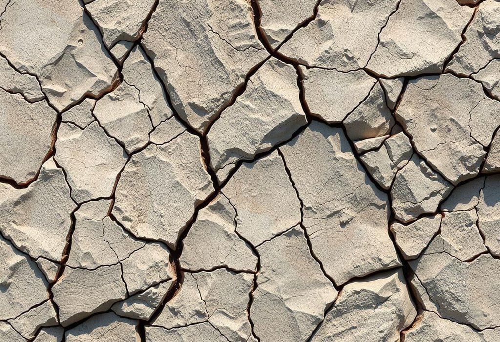
Denudation refers to the process of wearing down and reshaping the Earth's surface, primarily through the actions of exogenetic forces. These forces, originating from the atmosphere, are responsible for the erosion and alteration of landforms initially created by endogenetic processes. Denudation encompasses three main components: weathering, erosion, and deposition, collectively known as planation processes.
Weathering
Weathering is a static process that involves the breakdown and decomposition of rock in its original location.
Types of Weathering.
- Physical (Mechanical) Weathering. Involves the physical breakdown of rocks into smaller pieces without changing their chemical composition.
- Chemical Weathering. Involves the chemical alteration of minerals within the rock, leading to the formation of new minerals and soluble products.
- Biological Weathering. Involves the actions of living organisms, such as plants, animals, and microorganisms, that contribute to the breakdown of rocks.
- Significance of Weathering. Weathering is crucial as it produces soils that are essential for sustaining ecosystems. Soils formed through weathering provide the necessary nutrients and habitat for various organisms, playing a vital role in the Earth's ecological balance.
Erosion
Erosion is a dynamic process that involves the removal and movement of materials from one location to another.
Agents of Erosion.
- Running Water (Rivers). Rivers play a significant role in eroding and transporting materials along their courses.
- Groundwater. Groundwater can contribute to erosion through processes such as dissolution and the movement of soil and rock materials.
- Sea Waves. Coastal erosion is influenced by the action of sea waves, which erode shorelines and transport materials.
- Glaciers. Glacial erosion occurs when glaciers move, carrying and depositing large amounts of rock and sediment.
- Periglacial Processes. These processes occur in cold climates and involve the movement and transport of materials due to freeze-thaw cycles and other mechanisms.
- Wind. Wind erosion involves the removal and transport of fine particles, particularly in arid and semi-arid regions.
Clarification on Periglacial Processes. Periglacial processes refer to the physical and geological processes that occur in cold climates, often associated with the presence of permafrost. These processes can involve significant material transport and contribute to landscape formation in these regions.
Deposition
- Deposition occurs when agents of erosion deposit eroded materials in new locations, leading to the creation of various landforms.
 Eroded Landscapes
Landforms
 Geological Wonders
- Exogenetic processes are responsible for creating landforms through the processes of erosion and deposition. These processes will be discussed in more detail in later chapters (14 and 16).
- Endogenetic forces shape the Earth's surface through sudden events such as earthquakes and volcanism, as well as gradual movements known as diastrophic processes, which include epeirogenetic (uplifting and sinking of large areas of the Earth's crust) and orogenetic (mountain-building) activities.
- These endogenetic forces give rise to various geological features, including:
- Mountains
- Faults
- Rift valleys
- Orogenetic processes are responsible for the formation of complex folds in the Earth's crust, such as anticlines (upward folds), synclines (downward folds), and nappes (overturned folds). They also lead to the development of different types of faults, including normal faults (caused by extension), reverse faults (caused by compression), and strike-slip faults (caused by horizontal displacement).
- The formation of rift valleys is still a subject of debate among geologists, with some suggesting that they are created by tensional forces (pulling apart) while others argue for compressional forces (pushing together).
- Exogenetic forces counteract the effects of endogenetic processes by eroding and reshaping existing landforms through weathering (the breakdown of rocks) and deposition (the accumulation of materials). These exogenetic processes play a crucial role in the ongoing evolution of the Earth's surface.
|
303 videos|635 docs|252 tests
|
FAQs on Savindra Singh Summary :Earth's Movement (Endogenetic and Exogenetic Forces) - Geography Optional for UPSC
| 1. What are the different types of folds in geology? |  |
| 2. How do nappes form, and what is their significance in geological studies? | |
| 3. What are rift valleys, and how do they differ from grabens? | |
| 4. What are the characteristics that help identify a fold in geological formations? | |
| 5. What are the endogenetic and exogenetic forces, and how do they affect the Earth's structure? | |


shortcuts and tricks
,mock tests for examination
,Summary
,Viva Questions
,past year papers
,Extra Questions
,Savindra Singh Summary :Earth's Movement (Endogenetic and Exogenetic Forces) | Geography Optional for UPSC
,Objective type Questions
,MCQs
,Sample Paper
,Previous Year Questions with Solutions
,Exam
,video lectures
,practice quizzes
,ppt
,Semester Notes
,Free
,Important questions
,Savindra Singh Summary :Earth's Movement (Endogenetic and Exogenetic Forces) | Geography Optional for UPSC
,study material
,Savindra Singh Summary :Earth's Movement (Endogenetic and Exogenetic Forces) | Geography Optional for UPSC
;


Savindra Singh Summary :Earth's Movement (Endogenetic and Exogenetic Forces) Free PDF Download
Importance of Savindra Singh Summary :Earth's Movement (Endogenetic and Exogenetic Forces)
Savindra Singh Summary :Earth's Movement (Endogenetic and Exogenetic Forces) Notes
Savindra Singh Summary :Earth's Movement (Endogenetic and Exogenetic Forces) UPSC Questions
Study Savindra Singh Summary :Earth's Movement (Endogenetic and Exogenetic Forces) on the App
|
© EduRev
|
Education Revolution
|


|


within 7 days!