UPSC Exam  >  UPSC Tests  >  World Geography Practice Test 1 - UPSC MCQ

World Geography Practice Test 1 - UPSC MCQ


Test Description

25 Questions MCQ Test - World Geography Practice Test 1

World Geography Practice Test 1 for UPSC 2024 is part of UPSC preparation. The World Geography Practice Test 1 questions and answers have been prepared according to the UPSC exam syllabus.The World Geography Practice Test 1 MCQs are made for UPSC 2024 Exam. Find important definitions, questions, notes, meanings, examples, exercises, MCQs and online tests for World Geography Practice Test 1 below.
Solutions of World Geography Practice Test 1 questions in English are available as part of our course for UPSC & World Geography Practice Test 1 solutions in Hindi for UPSC course. Download more important topics, notes, lectures and mock test series for UPSC Exam by signing up for free. Attempt World Geography Practice Test 1 | 25 questions in 25 minutes | Mock test for UPSC preparation | Free important questions MCQ to study for UPSC Exam | Download free PDF with solutions
World Geography Practice Test 1 - Question 1

Which country is the largest producer of tea in the world?

Detailed Solution for World Geography Practice Test 1 - Question 1

China (1,000,130 tonnes)

China is indisputably the largest producer of tea in the world, producing 1,700,000 tonnes in 2013 alone – a figure that was approximately 30-35% of the total amount produced in the world that year.


Its strong skills in production shouldn't be seen as a surprise, given its long history with the drink – legend has it that tea was introduced in China by emperor and herbalist Shennong in 2737 BCE. It has been consumed as everything from a beverage to a medicine, and is at the center of countless cultural rituals in the nation.


Several varieties are produced in China including green, oolong, white, pu-erh, yellow, and jasmine teas to name a few.

World Geography Practice Test 1 - Question 2

Pennine is world famous breed of:- 

Detailed Solution for World Geography Practice Test 1 - Question 2

Horses have been present and used in the Dales area from early times. Horse remains dating to Roman times were found in the Ribchester area of the Dales, during North Pennines Archaeology's excavations at land behind the Black Bull Inn in 2009. The Romans themselves named an ancient British tribe to the east of the Pennines the Gabrantovici, or 'horse-riding warriors'. The history of the modern Dales pony is strongly linked to the history of lead mining in the Dales area of England, which stretches from the Derbyshire peaks to the Scottish borders. Lead has been mined in this area since Roman times,and Richard Scrope, then Chancellor of England, owned lead mines at Wensleydale in the 14th century. Iron ore, fuel for smelting, and finished lead were all carried on pack ponies, with each pony carrying up to 240 lb (110 kg) at a time. Pack pony trains of up to 20 ponies worked 'loose' (not led), under the supervision of one mounted train leader.
The modern Dales pony is descended from a number of breeds, with the original working ponies being bred by crossing the Scottish Galloway pony with native Pennine pony mares in the Dales area in the late 1600s.

1 Crore+ students have signed up on EduRev. Have you? Download the App
World Geography Practice Test 1 - Question 3

Which of the following is busiest ocean trade route?

Detailed Solution for World Geography Practice Test 1 - Question 3

It connects the South Amrica to North America(Panama Canal) , Africa to Europe and Europe to Asia (through Gibraltar Strait connecting Mediterranean Sea ).It is the trade route between the continents and is always full of cargo ships being carried around continent to Page on continent.it spreads over 32 million square.

World Geography Practice Test 1 - Question 4

Which among the following State is not a natural source of Crude Oil in India ?

World Geography Practice Test 1 - Question 5

Which of the following oceans are connected by Panama Canal?

Detailed Solution for World Geography Practice Test 1 - Question 5

The Panama Canal (Spanish: Canal de Panamá) is a man-made 48-mile (77 km) waterway in Panama that connects the Atlantic Ocean with the Pacific Ocean. The canal cuts across the Isthmus of Panama and is a key conduit for international maritime trade.

World Geography Practice Test 1 - Question 6

The Goldmines of South Africa are near which of the following ? 

Detailed Solution for World Geography Practice Test 1 - Question 6

The "Golden Arc" which stretches from Johannesburg to Welkom was once a massive inland lake, and that silt and gold deposits from alluvial gold settled in the area to form the gold-rich deposits that South Africa is famous for.

World Geography Practice Test 1 - Question 7

Which one of the following countries is the largest producer of coal in the world?

Detailed Solution for World Geography Practice Test 1 - Question 7

China has been by far the biggest coal producing country over the last three decades. The country produced about 3.6 billion tonnes (Bt) of coal in 2012 accounting for over 47% of the world's total coal output

World Geography Practice Test 1 - Question 8

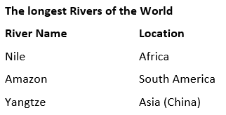
Select the longest river of Asia from the following

Detailed Solution for World Geography Practice Test 1 - Question 8

World Geography Practice Test 1 - Question 9

Which of the following is dubbed as a ‘living fossil’ ? 

Detailed Solution for World Geography Practice Test 1 - Question 9

Sphenodon punctatus, also called as Tuatara is currently the living fossil because it received a second opportunity to keep inhabiting the incredible islands of New Zealand.All species of the Sphenodontia members apart from the Tuatara, declined and eventually became extinct about 60 million years ago. Only Tuatara survived to become a "living fossil". The introduction of foreign mammals has been one of the main factors of the recent decline of tuataras, especially the introduction of the Pacific rat. So, massive eradication of the rats was undertaken and no predators invaded New Zealand which made them survive again.

World Geography Practice Test 1 - Question 10

The altitude of troposphere in our atmosphere is about

Detailed Solution for World Geography Practice Test 1 - Question 10

The troposphere is the lowest layer of Earth's atmosphere. Most of the mass (about 75-80%) of the atmosphere is in the troposphere. Most types of clouds are found in the troposphere, and almost all weather occurs within this layer.

World Geography Practice Test 1 - Question 11

The “Ninety East Ridge” is a submarine volcanic ridge located in __?

Detailed Solution for World Geography Practice Test 1 - Question 11

The Ninety East Ridge is an 5500 km long, north-south-oriented, submarine volcanic ridge in the eastern Indian Ocean that formed from magmatism associated with the deep seated Kerguelen mantle plume as the Indian plate drifted rapidly northward during the Late Cretaceous.

World Geography Practice Test 1 - Question 12

Which is the difference between asteroids and comets?
1. Asteroids are small rocky planetoids, while comets are formed of frozen gases held together by rocky and metallic material.
2. Asteroids are found mostly between the orbits of Jupiter and Mars, while comets are found mostly between Venus and Mercury.
3. Comets show a perceptible glowing tail, while asteroids do not.

Which of the statements given above is/are correct? 

Detailed Solution for World Geography Practice Test 1 - Question 12

The main difference between asteroids and comets is their composition, as in, what they are made of. Asteroids are made up of metals and rocky material, while comets are made up of ice, dust and rocky material. Both asteroids and comets were formed early in the history of the solar system about 4.5 billion years ago. Asteroids formed much closer to the Sun, where it was too warm for ices to remain solid. Comets formed farther from the Sun where ices would not melt. Comets which approach the Sun lose material with each orbit because some of their ice melts and vaporizes to form a tail.

World Geography Practice Test 1 - Question 13

Which of the following steps can, possibly reduce the intensity of natural disasters recently experienced in Uttarakhand ?      

World Geography Practice Test 1 - Question 14

Three storey agriculture is practiced in which of the following country:- 

Detailed Solution for World Geography Practice Test 1 - Question 14

Sky Greens’Singapore vertical farming provides both an efficient and environmentally sound solution. Jack Ng founded Sky Greens, the world’s first low-carbon hydraulic water-driven urban vertical farm that reduces the amount of energy and land needed for traditional farming techniques. Within a greenhouse, the three storeys-high vertical systems are able to produce five to ten times more per unit area compared to conventional farms. The greenhouse and low-carbon hydraulic system allows lettuces and cabbages to be grown year-round using less energy and water. While Sky Greens produce is a premium good, it is still priced competitively and found at grocery stores in Singapore. For a small country that imports the majority of their food from China, Indonesia, and even Europe and the United States, projects like Sky Greens could be a valuable way to feed a growing population.

World Geography Practice Test 1 - Question 15

One carbon credit is equivalent to 

Detailed Solution for World Geography Practice Test 1 - Question 15

A carbon credit is a financial instrument that allows the holder, usually an energy company, to emit one ton of carbon dioxide. Credits are awarded to countries or groups that have reduced their greenhouse gases below their emission quota

World Geography Practice Test 1 - Question 16

Which among the following is the highest peak in Africa?

Detailed Solution for World Geography Practice Test 1 - Question 16

Mount Kilimanjaro is the highest mountain on the African continent. Its summit is 19,340 feet (5,895 meters) above sea level. It is located in Tanzania. with its three volcanic cones, "Kibo", "Mawenzi", and "Shira", is a dormant volcano in Tanzania.

World Geography Practice Test 1 - Question 17

The logo of Indian Ecomark Scheme is      

Detailed Solution for World Geography Practice Test 1 - Question 17

Ecomark or Eco mark is a certification mark issued by the Bureau of Indian Standards (the national standards organization of India) to products conforming to a set of standards aimed at the least impact on the ecosystem. The marking scheme was started in 1991.

World Geography Practice Test 1 - Question 18

Which is the hottest area of the sun ?    

Detailed Solution for World Geography Practice Test 1 - Question 18

The hottest part of the Sun is its core. The surface of the Sun is a mere 5,800 Kelvin, while the center of the Sun is around 15 million Kelvin. That's hot. Although the surface of the Sun is relatively cool, the corona can get much hotter.

World Geography Practice Test 1 - Question 19

Which of the following terms is related to rearing of honey-bees ?    

Detailed Solution for World Geography Practice Test 1 - Question 19

Sericulture: The commercial rearing of silk worms.Pisciculture: Breeding of fish in specially constructed tanks and ponds.Viticulture: Cultivation of Grapes.Horticulture: Growing vegetables, flowers and fruits for commercial use.

World Geography Practice Test 1 - Question 20

The petroleum producing places, Kirkuk, Mosul and Basara are situated in :

Detailed Solution for World Geography Practice Test 1 - Question 20

According to the Oil & Gas Journal , Iraq is one of the top holders of proved oil reserves in the world. Iraq has five supergiant fields (defined as holding more than 5 billion barrels of oil reserves) in the south. The resource in place held by these supergiant fields accounts for about 50% of Iraq’s total estimated reserves. An estimated 20% of oil resources are located in northern Iraq, including the areas of Kirkuk, Irbil, and Mosul. 

World Geography Practice Test 1 - Question 21

Which one of the following can one come across if one travels through the Strait of Malacca: 

Detailed Solution for World Geography Practice Test 1 - Question 21

Srait of Malacca, waterway connecting the Andaman Sea (Indian Ocean) and the South China Sea (Pacific Ocean). It runs between the Indonesian island of Sumatra to the west and peninsular (West) Malaysia and extreme southern Thailand to the east and has an area of about 25,000 square miles (65,000 square km). The strait is 500 miles (800 km) long and is funnel-shaped,

World Geography Practice Test 1 - Question 22

Terrarosia is typically developed in geographical region of-

Detailed Solution for World Geography Practice Test 1 - Question 22

Terra rossa is a type of red clay soil produced by the weathering of limestone. When limestone weathers, the clay contained in the rocks is left behind, along with any other non-soluble rock material. Under oxidizing conditions, when the soils are above the water table, iron oxide (rust) forms in the clay. This gives it a characteristic red to orange colour.Terra rossa is typically found in regions with a Mediterranean climate

World Geography Practice Test 1 - Question 23

Within which country’s geographical boundary, does the Tropic of Cancer cross the 0°- meridian ?      

Detailed Solution for World Geography Practice Test 1 - Question 23

A prime meridian is a meridian (a line of longitude) in a geographical coordinate system at which longitude is defined to be 0°. Together, a prime meridian and its antimeridian (the 180th meridian in a 360°-system) form a great circle. This great circle divides the sphere, e.g., the Earth, into two hemispheres. If one uses directions of East and West from a defined prime meridian, then they can be called Eastern Hemisphere and Western Hemisphere.

There are 8 countries, 3 continents and 6 water bodies lies on Prime Meridian passes.

Europe

United Kingdom, Spain, France

Africa

Ghana, Algeria, Mali, Togo, Burkina Faso

Antarctica

Antarctica

Water Bodies

Arctic Ocean, Norwegian Sea, Greenland Sea, Mediterranean Sea, Atlantic Ocean, Southern Ocean.

World Geography Practice Test 1 - Question 24

Which of the following rivers is known as the “Sorrow of China”?

Detailed Solution for World Geography Practice Test 1 - Question 24

The river Hwang Ho was also known as the ‘Sorrow of China’ because it often used to change its course after floods. This caused major damage to crops and canals dug for the purpose of irrigation. It also affected human life on a large scale and caused widespread distress.

World Geography Practice Test 1 - Question 25

Who was the propounder of ‘Continental Drift Theory’?

Detailed Solution for World Geography Practice Test 1 - Question 25

Alfred Wegener

In the mid-20th century, the theory of continental drift was referred to as the "Taylor-Wegener hypothesis", although this terminology eventually fell out ofcommon use. Alfred Wegener first presented his hypothesis to the German Geological Society on 6 January 1912.

Information about World Geography Practice Test 1 Page
In this test you can find the Exam questions for World Geography Practice Test 1 solved & explained in the simplest way possible. Besides giving Questions and answers for World Geography Practice Test 1, EduRev gives you an ample number of Online tests for practice

Top Courses for UPSC

Download as PDF

Top Courses for UPSC