


All Exams >
Super TET >
Environment & Social Studies for Super TET >
All Questions
All questions of Introduction to Physiographic Regions for Super TET Exam
Which state does not share its boundary with Myanmar ?- a)Arunachal Pradesh
- b)Mizoram
- c)Manipur
- d)Sikkim
Correct answer is option 'D'. Can you explain this answer?
Which state does not share its boundary with Myanmar ?
a)
Arunachal Pradesh
b)
Mizoram
c)
Manipur
d)
Sikkim
|
|
Kiran Sharma answered |
State not sharing boundary with Myanmar
Sikkim is the state that does not share its boundary with Myanmar. The other three states, Arunachal Pradesh, Mizoram, and Manipur share their boundaries with Myanmar.
Explanation:
- Arunachal Pradesh: It is located in the northeastern part of India and shares its international boundary with Myanmar in the east. The boundary is marked by the Patkai Hills and the Hukawng Valley.
- Mizoram: It is also located in the northeastern part of India and shares its international boundary with Myanmar in the east and south. The boundary is marked by the Chin Hills and the Rakhine Yoma mountain ranges.
- Manipur: It is located in the northeastern part of India and shares its international boundary with Myanmar in the east. The boundary is marked by the Kabaw Valley and the Manipur River.
- Sikkim: It is located in the northeastern part of India and shares its borders with Nepal in the west, Bhutan in the east, and Tibet (China) in the north. It does not share its boundary with Myanmar.
Conclusion:
Thus, the correct answer is option 'D' - Sikkim, as it is the state that does not share its boundary with Myanmar.

India shares its land boundaries with ___________ countries.- a)Seven
- b)Eight
- c)Six
- d)Nine
Correct answer is option 'A'. Can you explain this answer?
India shares its land boundaries with ___________ countries.
a)
Seven
b)
Eight
c)
Six
d)
Nine
|
|
Rounak Sharma answered |
India shares its land boundaries with Seven countries.
The seven countries with which India shares land boundaries are:
1. Pakistan - India shares its northwestern land boundary with Pakistan. The boundary between India and Pakistan is known as the Radcliffe Line.
2. China - India shares its northeastern land boundary with China. The boundary between India and China is known as the McMahon Line.
3. Nepal - India shares its northern land boundary with Nepal. The boundary between India and Nepal is an open border.
4. Bhutan - India shares its northeastern land boundary with Bhutan. The boundary between India and Bhutan is known as the Indo-Bhutan Border.
5. Bangladesh - India shares its eastern land boundary with Bangladesh. The boundary between India and Bangladesh is known as the Radcliffe Line.
6. Myanmar - India shares its eastern land boundary with Myanmar. The boundary between India and Myanmar is known as the Indo-Myanmar Border.
7. Afghanistan - India shares a small portion of its northwestern land boundary with Afghanistan. The boundary between India and Afghanistan is known as the Durand Line.
These seven countries have a significant impact on India's foreign policy and regional security. India maintains friendly relations with most of these countries, with occasional border disputes arising with Pakistan and China.
Many places in India are famous for particular minerals. Which of these pairs are correctly matched?1. Zawar : Uranium2. Khetri : Copper3. Balaghat : Manganese4. Jaduguda : ZincSelect the correct answer using the codes given below.- a)1 and 2 only
- b)1 and 3 only
- c)1 and 4 only
- d)2 and 3 only
Correct answer is option 'D'. Can you explain this answer?
Many places in India are famous for particular minerals. Which of these pairs are correctly matched?
1. Zawar : Uranium
2. Khetri : Copper
3. Balaghat : Manganese
4. Jaduguda : Zinc
Select the correct answer using the codes given below.
a)
1 and 2 only
b)
1 and 3 only
c)
1 and 4 only
d)
2 and 3 only

|
Ankita Jawale answered |
Khatri nagar which is located 10 km far from khatri known as 'Tamba project (copper project ) khatri nagar was built by Hindustan copper Limited which is a public sector under the "Government of India" and user his jurisdiction. India contributes 2 % in worlds copper production.
Balaghat distric of M.P is famous for production of manganese . About 80% of the manganese production in India comes from Balaghat. zawar is famous for zinc mines created by Hindustan Zinc Limited.
Balaghat distric of M.P is famous for production of manganese . About 80% of the manganese production in India comes from Balaghat. zawar is famous for zinc mines created by Hindustan Zinc Limited.
The direction of wind around a low pressure in northern hemisphere is:
- a)Clockwise
- b)Perpendicular to isobars
- c)Anti-clock wise
- d)Parallel to isobars
Correct answer is option 'C'. Can you explain this answer?
The direction of wind around a low pressure in northern hemisphere is:
a)
Clockwise
b)
Perpendicular to isobars
c)
Anti-clock wise
d)
Parallel to isobars
|
|
Shreya Mehta answered |
Low pressure systems are characterized by rising air that cools and condenses to form clouds and precipitation. As air rises in a low pressure system, it creates a region of lower pressure at the surface. Air flows from areas of higher pressure to areas of lower pressure, so in the Northern Hemisphere, air flows towards a low pressure system in a counterclockwise direction.
Explanation:
Coriolis Effect:
The Coriolis Effect is an important factor in the movement of air around low pressure systems. The Coriolis Effect is a result of the Earth's rotation on its axis, which causes objects in the Northern Hemisphere to be deflected to the right of their intended path. This means that air flowing towards a low pressure system in the Northern Hemisphere will be deflected to the right, causing it to flow in a counterclockwise direction around the low pressure system.
Rising Air:
As air rises in a low pressure system, it creates a region of lower pressure at the surface. Air flows from areas of higher pressure to areas of lower pressure, so in the Northern Hemisphere, air flows towards a low pressure system. This air is deflected to the right by the Coriolis Effect, causing it to flow in a counterclockwise direction around the low pressure system.
Conclusion:
In conclusion, the direction of wind around a low pressure system in the Northern Hemisphere is counterclockwise. This is due to the Coriolis Effect, which causes air to be deflected to the right in the Northern Hemisphere. As air flows towards a low pressure system, it is deflected to the right, causing it to flow in a counterclockwise direction around the low pressure system.
Some areas in India receive very high annual rainfall of more than 200 cm. These include:1. Major parts of Assam.2. West coast from Thiruvananthapuram to Mumbai.3. Ladakh region of Jammu Kashmir.Select the correct answer using the codes given below.- a)2 and 3 only
- b)1 and 3 only
- c)1 and 2 only
- d)1, 2 and 3
Correct answer is option 'C'. Can you explain this answer?
Some areas in India receive very high annual rainfall of more than 200 cm. These include:
1. Major parts of Assam.
2. West coast from Thiruvananthapuram to Mumbai.
3. Ladakh region of Jammu Kashmir.
Select the correct answer using the codes given below.
a)
2 and 3 only
b)
1 and 3 only
c)
1 and 2 only
d)
1, 2 and 3
|
|
Maheshwar Kulkarni answered |
Areas in India with high annual rainfall
1. Major parts of Assam
2. West coast from Thiruvananthapuram to Mumbai
Explanation:
Assam is a state in the northeastern region of India, which receives very high annual rainfall due to its location in the Himalayan foothills and the influence of the southwest monsoon. The state receives an average annual rainfall of around 2,500 mm, with some areas receiving more than 3,000 mm.
The west coast of India, which includes the states of Kerala, Karnataka, Goa, and Maharashtra, also receives very high annual rainfall due to its proximity to the Arabian Sea and the influence of the southwest monsoon. The region receives an average annual rainfall of around 2,500 mm, with some areas receiving more than 3,000 mm.
3. Ladakh region of Jammu Kashmir
The Ladakh region of Jammu and Kashmir, located in the northernmost part of India, receives very low annual rainfall due to its location in the rain shadow area of the Himalayas. The region receives an average annual rainfall of less than 100 mm, making it one of the driest regions in India.
Therefore, the correct answer is option 'C' - 1 and 2 only, as Ladakh region of Jammu Kashmir does not receive very high annual rainfall.
Days and nights are equal throughout the globe when the sun is above: - a)Poles
- b)Equator
- c)Tropic of Cancer
- d)Tropic of Capricorn
Correct answer is option 'B'. Can you explain this answer?
Days and nights are equal throughout the globe when the sun is above:
a)
Poles
b)
Equator
c)
Tropic of Cancer
d)
Tropic of Capricorn

|
Saanvi Reddy answered |
Explanation: An equinox is an astronomical event in which the plane of Earth's equator passes through the center of the Sun, which occurs twice each year, around 20 March and 23 September. On an equinox, day and night are of approximately equal duration all over the planet
Excluding the moon, the celestial object that generally appears bright in the sky is- a)Jupiter
- b)Polestar
- c)Sirius
- d)Venus
Correct answer is option 'D'. Can you explain this answer?
Excluding the moon, the celestial object that generally appears bright in the sky is
a)
Jupiter
b)
Polestar
c)
Sirius
d)
Venus
|
|
Anjali Kapoor answered |
Venus is the third-brightest object in the sky, after the sun and moon. That's partly because sunlight is easily reflected by acidic clouds in the atmosphere of Venus.
A piece of land surrounded by water from all sides in an ocean, sea, lake or river, is called- a)Estuary
- b)An island
- c)Peninsula
- d)None of these
Correct answer is option 'B'. Can you explain this answer?
A piece of land surrounded by water from all sides in an ocean, sea, lake or river, is called
a)
Estuary
b)
An island
c)
Peninsula
d)
None of these
|
|
Alok Verma answered |
A piece of land that is completely surrounded by water on all sides is known as an island.
A peninsula is a piece of land that is bordered by water on three sides but connected to the mainland. Peninsulas are formed through a gradual rise in water level, surrounding land at low elevation.
A peninsula is a piece of land that is bordered by water on three sides but connected to the mainland. Peninsulas are formed through a gradual rise in water level, surrounding land at low elevation.
An estuary is a partially enclosed coastal body of brackish water with one or more rivers or streams flowing into it, and with a free connection to the open sea.
A meridian is- a)The circle of the earth passing through the poles and a point on the Earth's surface
- b)The distance between the Earth and the Moon
- c)The axis around circle of the earth away from the equator towards the poles
- d)The latitudinal circle of the earth away from the equator towards the poles
Correct answer is option 'A'. Can you explain this answer?
A meridian is
a)
The circle of the earth passing through the poles and a point on the Earth's surface
b)
The distance between the Earth and the Moon
c)
The axis around circle of the earth away from the equator towards the poles
d)
The latitudinal circle of the earth away from the equator towards the poles
|
|
Nikita Singh answered |
A (geographic) meridian (or line of longitude) is the half of an imaginary great circle on the Earth's surface, a coordinate line terminated by the North Pole and the South Pole, connecting points of equal longitude, as measured in angular degrees east or west of the Prime Meridian.
The direction of wind around a low pressure in northern hemisphere is:- a)clockwise
- b)perpendicular to isobars
- c)anti-clock wise
- d)parallel to isobars
Correct answer is option 'C'. Can you explain this answer?
The direction of wind around a low pressure in northern hemisphere is:
a)
clockwise
b)
perpendicular to isobars
c)
anti-clock wise
d)
parallel to isobars
|
|
Alok Verma answered |
If a low-pressure area forms in the atmosphere, air flows towards this region, but will be deflected perpendicular to its velocity by the Coriolis force. Instead of flowing straight towards the low pressure area, the air ends up circulating around it.
This pattern of air flow is called a cyclone. In the Northern Hemisphere the direction of rotation around a low pressure area is counter-clockwise or anti-clockwise.
Which of the following sequences present the correct location of the ranges in the Satpura region from West to East?- a)Barwani hills - Mahadeo range - Maikal range
- b)Mahadeo range - Barwani hills - Maikal range
- c)Mahadeo range - Maikal range - Barwani hills
- d)Maikal range - Mahadeo range - Barwani hills
Correct answer is option 'A'. Can you explain this answer?
Which of the following sequences present the correct location of the ranges in the Satpura region from West to East?
a)
Barwani hills - Mahadeo range - Maikal range
b)
Mahadeo range - Barwani hills - Maikal range
c)
Mahadeo range - Maikal range - Barwani hills
d)
Maikal range - Mahadeo range - Barwani hills
|
|
Prisha Tiwari answered |
Satpura region
The Satpura range is one of the seven major mountain ranges in India. It stretches over an area of about 800 km, from the west to the east. The Satpura range is located in central India, covering parts of Madhya Pradesh, Maharashtra, and Gujarat.
Ranges in the Satpura region
The Satpura range is divided into three major ranges as follows:
1. Maikal range - located in the east
2. Mahadeo range - located in the central part
3. Barwani hills - located in the west
Correct sequence of ranges from West to East
The correct sequence of the ranges in the Satpura region from the west to the east is as follows:
Barwani hills - Mahadeo range - Maikal range
Explanation
The Barwani hills are located in the western part of the Satpura range, in the state of Gujarat. The Mahadeo range is located in the central part of the Satpura range, covering parts of Madhya Pradesh and Maharashtra. The Maikal range is located in the eastern part of the Satpura range, covering parts of Madhya Pradesh and Chhattisgarh.
Therefore, option 'A' which presents the correct sequence of the ranges in the Satpura region from the west to the east as Barwani hills - Mahadeo range - Maikal range is the correct answer.
Temperature increases in ________- a)Stratosphere
- b)Thermosphere
- c)Both (a) & (b)
- d)None of these
Correct answer is option 'C'. Can you explain this answer?
Temperature increases in ________
a)
Stratosphere
b)
Thermosphere
c)
Both (a) & (b)
d)
None of these
|
|
Eesha Bhat answered |
The correct answer is C as Temperature increases in both
a)Stratosphere
b)Thermosphere
a)Stratosphere
b)Thermosphere
The earth reaches its perihelion in:- a)October
- b)September
- c)July
- d)January
Correct answer is option 'D'. Can you explain this answer?
The earth reaches its perihelion in:
a)
October
b)
September
c)
July
d)
January
|
|
Sanchita Bose answered |
Explanation: When the earth is closest to the sun (perihelion), around 3rd January each year
With reference to International Date Line (IDL), consider the following statements:
1. A traveller crossing the International Date Line from east to west gains a day and while crossing the dateline from west to east he loses a day.
2. The International Date Line I the mid-Pacific curves from the normal 180-degree meridian at the Bering Strait, Fiji, Tonga and other islands to prevent confusion of the day and date in some of the groups that are cut through by the meridian.
Which of the statements given above is/are correct?
- a) 1 only
- b) Neither 1 nor 2
- c) 2 only
- d)Both 1 and 2
Correct answer is option 'D'. Can you explain this answer?
With reference to International Date Line (IDL), consider the following statements:
1. A traveller crossing the International Date Line from east to west gains a day and while crossing the dateline from west to east he loses a day.
2. The International Date Line I the mid-Pacific curves from the normal 180-degree meridian at the Bering Strait, Fiji, Tonga and other islands to prevent confusion of the day and date in some of the groups that are cut through by the meridian.
Which of the statements given above is/are correct?
a)
1 only
b)
Neither 1 nor 2
c)
2 only
d)
Both 1 and 2
|
|
Sonal Basak answered |
- Crossing the International Date Line from east to west, you gain a day. From west to east, you lose a day. This is due to the way time zones are structured globally.
- The International Date Line isn't a straight line. It deviates around the Bering Strait, Fiji, Tonga, and other islands to avoid splitting countries or islands into different days, minimizing confusion.
- Both statements are accurate, confirming why the correct answer is D: Both 1 and 2.
- The International Date Line isn't a straight line. It deviates around the Bering Strait, Fiji, Tonga, and other islands to avoid splitting countries or islands into different days, minimizing confusion.
- Both statements are accurate, confirming why the correct answer is D: Both 1 and 2.
Correct answer is D.
Which of the following is/are not characteristics of El nino?- a)Increased surface pressure over the Indian Ocean, Australia and Indonesia
- b)Rise in warm air near Peru
- c)Fall in air pressure over eastern and central Pacific ocean and Tahiti.
- d)Below-average sea surface temperatures across the east-central Equatorial Pacific
Correct answer is option 'D'. Can you explain this answer?
Which of the following is/are not characteristics of El nino?
a)
Increased surface pressure over the Indian Ocean, Australia and Indonesia
b)
Rise in warm air near Peru
c)
Fall in air pressure over eastern and central Pacific ocean and Tahiti.
d)
Below-average sea surface temperatures across the east-central Equatorial Pacific
|
|
Puja Sengupta answered |
Explanation: Below-average sea surface temperatures across the east-central Equatorial Pacific is a characteristic of La Nina which is anti El-Nino.
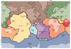
The largest of all plates is _____ plate.- a)Eurasian
- b)North American
- c)Pacific
- d)None of these
Correct answer is option 'C'. Can you explain this answer?
The largest of all plates is _____ plate.
a)
Eurasian
b)
North American
c)
Pacific
d)
None of these

|
Vaibhav Chauhan answered |
Explanation: The Pacific Plate is an oceanic tectonic plate that lies beneath the Pacific Ocean. At 103 million square kilometers, it is the largest tectonic plate.
Which among the following is known as ” Doctor Wind”?- a)Loo
- b)Chinook
- c)Harmattan
- d)None of the above
Correct answer is option 'C'. Can you explain this answer?
Which among the following is known as ” Doctor Wind”?
a)
Loo
b)
Chinook
c)
Harmattan
d)
None of the above
|
|
Aravind Basu answered |
Answer: c
Explanation: The Harmattan is a dry and dusty northeasterly trade wind which blows from the Sahara Desert over the West African subcontinent into the Gulf of Guinea between the end of November and the middle of March (winter)
The eastern most point in India is- a)Indira point
- b)Indira col
- c)Kanyakumari
- d)Kibithu
Correct answer is option 'D'. Can you explain this answer?
The eastern most point in India is
a)
Indira point
b)
Indira col
c)
Kanyakumari
d)
Kibithu
|
|
Prerna Das answered |
The Eastern most point in India is Kibithu. This point is located in the state of Arunachal Pradesh and is situated at an altitude of 1,200 meters above sea level. Kibithu is a small town located near the international border between India and China.
Reasons why Kibithu is the easternmost point in India:
Geographical location: Kibithu is located at the easternmost end of the Himalayan range, which runs from north to south through the Indian subcontinent. It is situated in the easternmost part of Arunachal Pradesh, which is the easternmost state in India.
International border: Kibithu is located near the international border between India and China. The border runs along the McMahon Line, which was drawn in 1914 by the British colonial government to establish the boundary between Tibet and British India.
Importance of Kibithu:
Strategic location: Kibithu is located in a strategically important area, as it is near the international border between India and China. The town is also located near the tri-junction point between India, China, and Myanmar.
Military presence: Due to its strategic location, Kibithu has a significant military presence. The Indian Army has a base in Kibithu, which is responsible for guarding the border with China.
Tourism: Kibithu is also a popular tourist destination, as it offers stunning views of the Himalayan range and nearby valleys. The town is also known for its trekking routes and adventure sports.
In conclusion, Kibithu is the easternmost point in India, located in Arunachal Pradesh near the international border with China. Its strategic location and military presence make it an important area for India's national security, while its natural beauty and tourism potential make it a popular destination for adventure seekers.
What does 'Roaring forties' refer to?
- a)The tract of stormy westerly winds between latitudes 20-30o
- b)Whirl winds caused in Atlantic Ocean
- c)The region between latitudes 40º and 50ºS where the prevailing westerly winds blow over the open oceans with great regularity and strength
- d)None of these
Correct answer is option 'C'. Can you explain this answer?
What does 'Roaring forties' refer to?
a)
The tract of stormy westerly winds between latitudes 20-30o
b)
Whirl winds caused in Atlantic Ocean
c)
The region between latitudes 40º and 50ºS where the prevailing westerly winds blow over the open oceans with great regularity and strength
d)
None of these
|
|
Sagar Nair answered |
Explanation: The Roaring Forties are strong westerly winds found in the Southern Hemisphere, generally between the latitudes of 40 and 50 degrees.
Consider the following towns:
1. Karachi
2. Dhaka
3. Mandalay
4. Jodhpur
Which of the following is the correct order of the towns from north to south ?
- a)4 1 2 3
- b)4 3 2 1
- c)1 2 3 4
- d)4 2 3 1
Correct answer is option 'A'. Can you explain this answer?
Consider the following towns:
1. Karachi
2. Dhaka
3. Mandalay
4. Jodhpur
Which of the following is the correct order of the towns from north to south ?
a)
4 1 2 3
b)
4 3 2 1
c)
1 2 3 4
d)
4 2 3 1
|
|
Saanvi Mehta answered |
To accurately determine the order from north to south, we should verify the latitudes once more:
- Mandalay, Myanmar: Latitude approximately 21.98° N
- Dhaka, Bangladesh: Latitude approximately 23.81° N
- Karachi, Pakistan: Latitude approximately 24.86° N
- Jodhpur, India: Latitude approximately 26.29° N
Correct order from north to south:
- Jodhpur (26.29° N) - The northernmost town.
- Karachi (24.86° N) - Further south than Jodhpur but north of Dhaka.
- Dhaka (23.81° N) - Further south than Karachi.
- Mandalay (21.98° N) - The southernmost town.
So, the correct order from north to south is:
- Jodhpur
- Karachi
- Dhaka
- Mandalay
Consider the following statements about forests soils :
1. They are rich in humus
2. They are deficient in phosphorous and potash
Which of the statements given above is/are correct ?
- a)1 only
- b)2 only
- c)Neither 1 nor 2
- d)Both 1 and 2
Correct answer is option 'D'. Can you explain this answer?
Consider the following statements about forests soils :
1. They are rich in humus
2. They are deficient in phosphorous and potash
Which of the statements given above is/are correct ?
a)
1 only
b)
2 only
c)
Neither 1 nor 2
d)
Both 1 and 2
|
|
Akash Majumdar answered |
Explanation:
1. Rich in humus:
- Forest soils are typically rich in organic matter, including humus, which is formed from the decomposition of plant and animal materials.
- Humus helps to improve soil structure, fertility, and moisture retention, making forest soils ideal for supporting diverse plant and animal life.
2. Deficient in phosphorous and potash:
- While forest soils are generally nutrient-rich due to the presence of organic matter, they can be deficient in certain essential nutrients like phosphorous and potash.
- Phosphorous and potash are important for plant growth and development, and their deficiency can limit the productivity of forest ecosystems.
Conclusion:
Both statements are correct. Forest soils are rich in humus but may be deficient in phosphorous and potash, highlighting the importance of nutrient management in forest ecosystems.
Atoll refers to- a)A narrow strip of land separating two seas
- b)A hill top
- c)A strait joining two-seas
- d)A horse-shoe or ring-shaped coral reef
Correct answer is option 'D'. Can you explain this answer?
Atoll refers to
a)
A narrow strip of land separating two seas
b)
A hill top
c)
A strait joining two-seas
d)
A horse-shoe or ring-shaped coral reef
|
|
Rishabh Sen answered |
Explanation: An atoll is a ring-shaped coral reef, island, or series of islets. An atoll surrounds a body of water called a lagoon. Sometimes, atolls and lagoons protect a central island. Channels between islets connect a lagoon to the Open Ocean or sea.
Salinity is expressed as the amount of salt in grams dissolved in sea water per- a)10 gm
- b)1,000 gm
- c)100 gm
- d)10,000 gm
Correct answer is option 'B'. Can you explain this answer?
Salinity is expressed as the amount of salt in grams dissolved in sea water per
a)
10 gm
b)
1,000 gm
c)
100 gm
d)
10,000 gm
|
|
Vaibhav Chauhan answered |
Explanation: Salinity is the term used to define the total content of dissolved salts in sea water (Table 13.4). It is calculated as the amount of salt (in gm) dissolved in 1,000 gm (1 kg) of seawater. It is usually expressed as parts per thousand (o/oo) or ppt.
The International Date-line passes through the:- a)Bering Strait
- b)Florida Strait
- c)Gibraltar Strait
- d)Malacca Strait
Correct answer is option 'A'. Can you explain this answer?
The International Date-line passes through the:
a)
Bering Strait
b)
Florida Strait
c)
Gibraltar Strait
d)
Malacca Strait
|
|
S R Khan answered |
The International Date Line passes through the Bering Strait between the Diomede Island.
The sun is directly overhead at noon on 21st June at:- a) The equator
- b) 23.5° S
- c) 23.5° N
- d) 66.5° N
Correct answer is option 'C'. Can you explain this answer?
The sun is directly overhead at noon on 21st June at:
a)
The equator
b)
23.5° S
c)
23.5° N
d)
66.5° N
|
|
Rohit Jain answered |
The correct option is Option C.
At that time, sun's rays are overhead at the tropic of cancer (23.5°N). The Tropic of Cancer passes through the middle of India. It remains till the end of May in India. Before summer solstice i.e., 21st June, monsoon starts in India which brings a cooling effect to the climate of India.
At that time, sun's rays are overhead at the tropic of cancer (23.5°N). The Tropic of Cancer passes through the middle of India. It remains till the end of May in India. Before summer solstice i.e., 21st June, monsoon starts in India which brings a cooling effect to the climate of India.
With reference to laterite soil, consider the following statements:1. They are the result of intense leaching.2. They are poor in organic matter.Which of the statements given above is/are correct?- a) 1 only
- b) 2 only
- c) Both 1 and 2
- d) Neither 1 nor 2
Correct answer is option 'C'. Can you explain this answer?
With reference to laterite soil, consider the following statements:
1. They are the result of intense leaching.
2. They are poor in organic matter.
Which of the statements given above is/are correct?
a)
1 only
b)
2 only
c)
Both 1 and 2
d)
Neither 1 nor 2
|
|
Divya Mukherjee answered |
Laterite Soil:
Laterite soil is a type of soil that is commonly found in tropical regions. It is formed by the weathering of rocks in hot and wet climates. Here, we will analyze the given statements about laterite soil.
Statement 1: They are the result of intense leaching.
Leaching refers to the process of removal of soluble substances from the soil by percolating water. In the case of laterite soil, the intense leaching process is one of the primary factors responsible for its formation. The heavy rainfall in tropical regions causes the downward movement of water through the soil, taking away the soluble nutrients and minerals along with it. This leaching process leaves behind a residual soil that is laterite in nature.
Statement 2: They are poor in organic matter.
Laterite soils are known to be poor in organic matter. This is because the hot and humid climate of tropical regions accelerates the decomposition of organic matter, leading to a fast rate of nutrient cycling. As a result, the organic matter content in laterite soils is low compared to other soil types. The low organic matter content also affects the soil fertility, as organic matter plays a crucial role in retaining moisture, improving soil structure, and providing essential nutrients to plants.
Explanation of the Correct Answer:
The correct answer is option C, which means both statements 1 and 2 are correct. Laterite soils are indeed the result of intense leaching, as explained earlier. Additionally, they are also poor in organic matter due to the fast decomposition rate in the tropical climate. Therefore, both statements accurately describe the characteristics of laterite soils.
Conclusion:
Laterite soils are unique soil types found in tropical regions. They are formed as a result of intense leaching and are poor in organic matter. Understanding the characteristics of laterite soil is important for agricultural practices and land management in these regions.
Which of the following INCORRECT about cirrus clouds?- a) They formed at high altitudes
- b) They are thin and detatched clouds
- c) They are white and grey in colour
- d) None of the above
Correct answer is option 'C'. Can you explain this answer?
Which of the following INCORRECT about cirrus clouds?
a)
They formed at high altitudes
b)
They are thin and detatched clouds
c)
They are white and grey in colour
d)
None of the above
|
|
Preethi Shah answered |
Cirrus clouds are thin and detached clouds that form at high altitudes. They are composed of ice crystals and are typically white or light grey in color. However, option C states that they are white and grey in color, which is incorrect.
Explanation:
Cirrus clouds are high-level clouds that form above 20,000 feet (6,000 meters) in the atmosphere. They are often found in the upper troposphere and the lower stratosphere. These clouds are composed of ice crystals due to the extremely cold temperatures at these altitudes.
Cirrus clouds are characterized by their thin and wispy appearance. They have a fibrous or hair-like structure, which gives them a unique appearance in the sky. These clouds are often described as being "feathery" or "curly."
Although cirrus clouds are typically white or light grey in color, their appearance can vary depending on several factors such as the angle of the sun, the presence of other clouds, and the size and shape of the ice crystals within the cloud. Under certain lighting conditions, cirrus clouds can appear pink, orange, or even purple.
Cirrus clouds are commonly associated with fair weather conditions, but they can also indicate the approach of a warm front or an upper-level disturbance. They are often the first sign of an approaching weather system.
In summary, cirrus clouds are thin and detached clouds that form at high altitudes. They are composed of ice crystals and can appear white, light grey, or even have a tint of color depending on various factors. Option C, which states that they are white and grey in color, is incorrect.
Albedo is the fraction of solar energy reflected from the Earth back into space. Consider the following :1. Fresh snow2. Ocean ice3. Rivers on high mountains.The correct order of their Albedo is:- a)1 > 2 > 3
- b)2 > 3 > 1
- c)2 > 1 > 3
- d)1 > 3 > 2
Correct answer is option 'A'. Can you explain this answer?
Albedo is the fraction of solar energy reflected from the Earth back into space. Consider the following :
1. Fresh snow
2. Ocean ice
3. Rivers on high mountains.
The correct order of their Albedo is:
a)
1 > 2 > 3
b)
2 > 3 > 1
c)
2 > 1 > 3
d)
1 > 3 > 2
|
|
Saanvi Mehta answered |
Answer: a)
Explanation: High-frequency radiowaves are reflected from the E layer. D layer is the lowest of the ionosphere layers, which absorbs the highest amount of harsh x-ray radiation. During the night, there is a minimal amount of ionization taking place. There is a high amount of energy dissipation because of rapid collisions of the ions. During day time all three- D, E and F layer are present, but D layer does not help in communication. This is because its density is greatly reduced. The D layer is normally not dense enough to reflect the radio waves. However, the E layer is, so the VLF signals go through the D layer, bounce off the E layer, and go back down through the D layer to the ground. The signals lose energy as they penetrate through the D layer and hence radios pick up weaker signals from the transmitter during the day.
Which of the following is NOT a Direct source for obtaining information about the interior of earth?- a)Volcanic eruption
- b)Meteorites
- c)Mines
- d)All of the above
Correct answer is option 'B'. Can you explain this answer?
Which of the following is NOT a Direct source for obtaining information about the interior of earth?
a)
Volcanic eruption
b)
Meteorites
c)
Mines
d)
All of the above

|
Capstone Ias Learning answered |
Meteorites are INDIRECT source of information about the Earth’s Interior.
- Meteorites and Earth are born from the same nebular cloud. Thus, they are likely to have a similar internal structure.
- When meteoroids fall to the earth, their outer layer is burnt during their fall due to extreme friction and the inner core is exposed.
- The heavy material composition of their cores confirms the similar composition of the inner core of the earth.
But because they are not from inside the earth, they act as an INDIRECT source of information due to similar composition.
Consider the following statements:1. The Himalayas form an arc that covers a distance of about 2,400 km from Jammu & Kashmir in the west to Arunachal Pradesh in the east.2. The width of the Himalayas varies from 400 km in Kashmir to 150 km in Arunachal Pradesh.3. The Great Himalayas are composed mostly of sedimentary rocks.Which of the statements given above is/are correct?- a)1 Only
- b)1 and 2 Only
- c)1 and 3 Only
- d)1, 2 and 3
Correct answer is option 'B'. Can you explain this answer?
Consider the following statements:
1. The Himalayas form an arc that covers a distance of about 2,400 km from Jammu & Kashmir in the west to Arunachal Pradesh in the east.
2. The width of the Himalayas varies from 400 km in Kashmir to 150 km in Arunachal Pradesh.
3. The Great Himalayas are composed mostly of sedimentary rocks.
Which of the statements given above is/are correct?
a)
1 Only
b)
1 and 2 Only
c)
1 and 3 Only
d)
1, 2 and 3
|
|
Nilotpal Desai answered |
Overview of the Statements
In analyzing the statements about the Himalayas, we break them down to determine their accuracy.
Statement 1: Distance of the Himalayas
- The Himalayas indeed form an arc that stretches approximately 2,400 km from Jammu & Kashmir in the west to Arunachal Pradesh in the east.
- This statement is correct.
Statement 2: Width of the Himalayas
- The width of the Himalayas varies widely across different regions. It is about 400 km in Kashmir and narrows down to around 150 km in Arunachal Pradesh.
- This statement is also correct.
Statement 3: Composition of the Great Himalayas
- The Great Himalayas are primarily made up of igneous and metamorphic rocks, not sedimentary rocks.
- This statement is incorrect.
Conclusion
- Based on the analysis:
- Statements 1 and 2 are correct.
- Statement 3 is incorrect.
Therefore, the correct answer is option B: 1 and 2 Only.
This analysis highlights the geological significance and geographical extent of the Himalayas while clarifying common misconceptions about their composition.
Consider the following statements: - Seamount is a mountain with pointed summits, rising from the seafloor.
- Seamounts are of coral origin.
Which of the above statements is/ are correct?- a) Only 1
- b) Only 2
- c) Both 1 & 2
- d) None of the above
Correct answer is option 'B'. Can you explain this answer?
Consider the following statements:
- Seamount is a mountain with pointed summits, rising from the seafloor.
- Seamounts are of coral origin.
Which of the above statements is/ are correct?
a)
Only 1
b)
Only 2
c)
Both 1 & 2
d)
None of the above
|
|
Akshara Chavan answered |
Answer: b)
Explanation: Seamount is a mountain with pointed summits, rising from the seafloor that does not reach the surface of the ocean. Seamounts are volcanic in origin.
The North Atlantic Sea route is regarded as an important internationsl trade route because- a)It is the oldest sea route
- b)It connects two industrially developed parts of the world
- c)Trade winds will help the shipping
- d)There are lesser number of sea storms in this waterway
Correct answer is option 'B'. Can you explain this answer?
The North Atlantic Sea route is regarded as an important internationsl trade route because
a)
It is the oldest sea route
b)
It connects two industrially developed parts of the world
c)
Trade winds will help the shipping
d)
There are lesser number of sea storms in this waterway

|
UPSC Achievers answered |
-The Northern Sea Route, especially the Northeast Passage, is a shipping lane officially defined by Russian legislation between the Atlantic Ocean and the Pacific Ocean specifically running along the Russian Arctic coast from Murmansk on the Barents Sea, along Siberia, to the Bering Strait and the Far East.
- The North Atlantic Sea route is regarded as an important international trade route because it connects two industrially developed parts of the world.
Which of the following is the southernmost of the Lakshadweep islands?- a)Bitra
- b)Kavaratti
- c)Amini
- d)Minicoy
Correct answer is option 'D'. Can you explain this answer?
Which of the following is the southernmost of the Lakshadweep islands?
a)
Bitra
b)
Kavaratti
c)
Amini
d)
Minicoy
|
|
Manoj Kapoor answered |
The correct answer is option D, Minicoy. Minicoy is the southernmost island among the Lakshadweep islands.
Here is a detailed explanation:
- **Lakshadweep Islands**: Lakshadweep is a group of islands located in the Arabian Sea. It is an archipelago consisting of 36 islands, out of which only 10 are inhabited. These islands are known for their pristine beaches, coral reefs, and marine biodiversity.
- **Geographical Location**: Lakshadweep is situated off the southwestern coast of India. It is located between 8° and 12° North latitude and 71° and 74° East longitude. The islands are about 200 to 440 km away from the Kerala coast.
- **Minicoy**: Among the Lakshadweep islands, Minicoy is the southernmost island. It is located at a latitude of approximately 8° 17' North and a longitude of around 73° 3' East. Minicoy is the second-largest island in the Lakshadweep archipelago.
- **Bitra**: Bitra is one of the smallest islands in the Lakshadweep group and is located towards the northern part of the archipelago. It is situated at a latitude of about 11° 36' North and a longitude of approximately 72° 12' East.
- **Kavaratti**: Kavaratti is the capital of Lakshadweep and one of the most developed islands in the archipelago. It is located at a latitude of around 10° 33' North and a longitude of about 72° 38' East. Kavaratti is not the southernmost island among the Lakshadweep group.
- **Amini**: Amini is another inhabited island in Lakshadweep, but it is not the southernmost. It is located at a latitude of approximately 11° 6' North and a longitude of around 72° 45' East.
In conclusion, among the given options, Minicoy is the southernmost of the Lakshadweep islands. It is known for its beautiful beaches, lagoons, and traditional culture.
Which of the following statements is NOT correct?- a) The continental shelf is the extended margin of a continent.
- b) It is the shallowest part of the ocean.
- c) It has an average gradient of 3° or even less.
- d) None of the above
Correct answer is option 'C'. Can you explain this answer?
Which of the following statements is NOT correct?
a)
The continental shelf is the extended margin of a continent.
b)
It is the shallowest part of the ocean.
c)
It has an average gradient of 3° or even less.
d)
None of the above
|
|
Hrishikesh Iyer answered |
Answer: c)
Explanation: The continental shelf is the extended margin of each continent occupied by relatively shallow seas and gulfs. It is the shallowest part of the ocean showing an average gradient of 1° or even less. The shelf typically ends at a very steep slope, called the shelf break.
Upward and downward movement of ocean water is known as the :- a) Tide
- b) Current
- c) Wave
- d) None of the above
Correct answer is option 'C'. Can you explain this answer?
Upward and downward movement of ocean water is known as the :
a)
Tide
b)
Current
c)
Wave
d)
None of the above
|
|
Dhruba Ghoshal answered |
Tides
Tides refer to the regular rise and fall of ocean water. The rise and fall of ocean water are caused by the gravitational force of the moon and the sun on the Earth's oceans. The gravitational force of the moon is stronger on the side of the Earth facing the moon, and weaker on the opposite side of the Earth. This causes a bulge of water on the side facing the moon, and a bulge of water on the opposite side of the Earth.
High Tide
High tide refers to the point in time when ocean water is at its highest level. This occurs when the gravitational force of the moon and the sun are in alignment, creating a stronger gravitational pull on the Earth's oceans. High tide occurs twice a day, roughly every 12 hours and 25 minutes.
Low Tide
Low tide refers to the point in time when ocean water is at its lowest level. This occurs when the gravitational force of the moon and the sun are not in alignment, creating a weaker gravitational pull on the Earth's oceans. Low tide also occurs twice a day, roughly every 12 hours and 25 minutes.
Importance of Tides
Tides are important for a variety of reasons. They affect navigation and shipping, as the depth of water changes with the tides. They also affect marine life, as many marine organisms rely on the tides for feeding and breeding. Tides can also be harnessed for renewable energy, such as tidal power.
Conclusion
Tides refer to the regular rise and fall of ocean water, caused by the gravitational force of the moon and the sun on the Earth's oceans. High tide and low tide occur twice a day, roughly every 12 hours and 25 minutes. Tides are important for navigation, marine life, and renewable energy.
Which of the following comes under the phenomena of mass movement?1. Soil creep2. Weathering3. LandslideSelect the correct answer using the codes given below.- a)1 and 2 only
- b)2 and 3 only
- c)1 and 3 only
- d)1, 2 and 3
Correct answer is option 'C'. Can you explain this answer?
Which of the following comes under the phenomena of mass movement?
1. Soil creep
2. Weathering
3. Landslide
Select the correct answer using the codes given below.
a)
1 and 2 only
b)
2 and 3 only
c)
1 and 3 only
d)
1, 2 and 3
|
|
Kajal Chopra answered |
Phenomena of Mass Movement
Mass movement is the movement of a large mass of rock, soil, or debris down a slope or a cliff. It is caused by different factors like gravity, weathering, and erosion. The different types of mass movement are landslides, rockfalls, debris flows, soil creep, and mudflows.
Types of Mass Movement
1. Soil Creep
Soil creep is a type of mass movement where the soil slowly moves downhill under the influence of gravity. It is characterized by the slow, imperceptible movement of soil down a slope. The movement is caused by the expansion and contraction of the soil due to temperature changes, freeze-thaw cycles, and wetting and drying.
2. Landslide
A landslide is a type of mass movement where a mass of rock, soil, or debris suddenly moves downhill. It is caused by different factors like heavy rain, earthquakes, human activities, and volcanic eruptions. Landslides can be very destructive and can cause damage to property and loss of life.
3. Weathering
Weathering is the process of breaking down rocks and minerals into smaller pieces. It is caused by different factors like temperature changes, freeze-thaw cycles, and chemical reactions. Weathering can weaken the rock and make it more susceptible to mass movement.
Conclusion
The correct answer is option C, i.e., 1 and 3 only. Soil creep and landslides are the types of mass movement, while weathering is a process that can weaken the rock and make it more prone to mass movement. Understanding the different types of mass movement and their causes is important for predicting and mitigating their effects.
Lines joining places of equal rainfall are known as- a)Isotherms
- b)Isobars
- c)Isohots
- d)Isohyets
Correct answer is option 'D'. Can you explain this answer?
Lines joining places of equal rainfall are known as
a)
Isotherms
b)
Isobars
c)
Isohots
d)
Isohyets
|
|
Varun Kapoor answered |
Rainfall and air moisture. An isohyet or isohyetal line (from ὕετος or huetos, meaning 'rain') is a line joining points of equal rainfall on a map in a given period . A map with isohyets is called an isohyetal map.
River rejuvenation can occur due to:1. Uplift of land over which the river is flowing.2. Rise in sea-level.Which of the statements given above is/are correct?- a)1 only
- b)2 only
- c)Both 1 and 2
- d)Neither 1 nor 2
Correct answer is option 'A'. Can you explain this answer?
River rejuvenation can occur due to:
1. Uplift of land over which the river is flowing.
2. Rise in sea-level.
Which of the statements given above is/are correct?
a)
1 only
b)
2 only
c)
Both 1 and 2
d)
Neither 1 nor 2
|
|
Krish Nambiar answered |
Answer: a)
Explanation: Easy one. Ladkah region receives very low rainfall and is an example of cold desert.
Consider the following statements:
1. Karewa soil is found predominantly in the Himachal Himalayas.
2. Karewa soil is known for the cultivation of saffron and other dry fruits.
3. The snowline in the Eastern Himalayas is at a higher altitude than in the Western Himalayas.
Which of the statements given above is/are correct?
- a)1 Only
- b)1 and 2 Only
- c)2 and 3 Only
- d)1, 2 and 3
Correct answer is option 'C'. Can you explain this answer?
Consider the following statements:
1. Karewa soil is found predominantly in the Himachal Himalayas.
2. Karewa soil is known for the cultivation of saffron and other dry fruits.
3. The snowline in the Eastern Himalayas is at a higher altitude than in the Western Himalayas.
Which of the statements given above is/are correct?
a)
1 Only
b)
1 and 2 Only
c)
2 and 3 Only
d)
1, 2 and 3

|
Wizius Careers answered |
- Statement 1 is incorrect. Karewa soil is found in the Valley of Kashmir, which is part of the Pir Panjal Range, not the Himachal Himalayas.
- Statement 2 is correct. Karewa soil is indeed known for the cultivation of saffron and other dry fruits.
- Statement 3 is correct. The snowline in the Western Himalayas is at a lower altitude than in the Eastern Himalayas due to the increase in latitude.
Thus, statements 1 and 3 are correct. Therefore, the correct option is C: 1 and 3 Only.
The country that shares longest border with India is- a)China
- b)Bangladesh
- c)Nepal
- d)Pakistan
Correct answer is option 'B'. Can you explain this answer?
The country that shares longest border with India is
a)
China
b)
Bangladesh
c)
Nepal
d)
Pakistan
|
|
Priya Mukherjee answered |
Border of India with Bangladesh
India shares its longest border with Bangladesh. The border between India and Bangladesh is about 4,096 kilometers long. The border stretches through the Indian states of West Bengal, Assam, Meghalaya, Tripura, and Mizoram.
History of the Border
The border between India and Bangladesh was created in 1947, during the partition of India. At that time, East Pakistan (which later became Bangladesh) was a part of Pakistan. The border was created between India and East Pakistan.
In 1971, East Pakistan declared independence from Pakistan and became Bangladesh. Since then, India and Bangladesh have shared a friendly relationship and have been working together on various issues.
Importance of the Border
The India-Bangladesh border is important for several reasons. It is a porous border, which means that people and goods can easily cross the border. The border is also important for trade and commerce between the two countries.
The border is also important for security reasons. The border is guarded by the Border Security Force (BSF) on the Indian side and the Border Guards Bangladesh (BGB) on the Bangladesh side. The two forces work together to ensure that the border is secure.
Challenges of the Border
The India-Bangladesh border faces several challenges. One of the biggest challenges is illegal immigration. People from Bangladesh often cross the border into India illegally in search of better economic opportunities. This has led to tensions between the two countries.
The border is also used for smuggling of goods and weapons. The two countries are working together to combat these challenges and ensure that the border is secure.
Conclusion
In conclusion, the India-Bangladesh border is the longest border that India shares with any country. The border is important for trade, commerce, and security. While the border faces several challenges, the two countries are working together to ensure that the border is secure.
Gipmochi mountain lies between China, Bhutan and the Indian state of:- a)Manipur
- b)Assam
- c)Sikkim
- d)Arunachal Pradesh
Correct answer is option 'C'. Can you explain this answer?
Gipmochi mountain lies between China, Bhutan and the Indian state of:
a)
Manipur
b)
Assam
c)
Sikkim
d)
Arunachal Pradesh
|
|
Mahi Banerjee answered |
Gipmochi Mountain and its Location
Gipmochi Mountain is a mountain peak located in the Eastern Himalayas region. It lies between China, Bhutan, and the Indian state of Sikkim. The mountain is situated at an altitude of 7,102 meters (23,294 feet) above sea level, making it one of the highest peaks in the region.
Sikkim - The Indian State
Sikkim is a small state in northeastern India. It is bordered by Nepal to the west, Tibet to the north and east, and the Indian state of West Bengal to the south. The state is known for its beautiful landscapes, rich culture, and diverse flora and fauna. Sikkim is also home to some of the highest peaks in the Eastern Himalayas, including Kangchenjunga, which is the third-highest mountain in the world.
Gipmochi Mountain and Sikkim
Gipmochi Mountain is part of the Himalayan range that runs through Sikkim. It is located in the northern part of the state, close to the border with China and Bhutan. The mountain is a popular destination for trekking and mountaineering enthusiasts, who come from all over the world to explore the beautiful landscapes and challenging terrain.
Conclusion
In conclusion, Gipmochi Mountain is a beautiful and challenging peak located in the Eastern Himalayas region, between China, Bhutan, and the Indian state of Sikkim. It is a popular destination for adventure seekers who want to explore the natural beauty of the region and test their mountaineering skills.
Tropical cyclones do not form over equator. This is because1. Equator is a zone of wind convergence.2. The temperature over equator is too high.3. There are no fronts over equator.Select the correct answer using the codes given below.- a) 1 and 2 only
- b) 1 and 3 only
- c) 2 and 3 only
- d) None of the above
Correct answer is option 'D'. Can you explain this answer?
Tropical cyclones do not form over equator. This is because
1. Equator is a zone of wind convergence.
2. The temperature over equator is too high.
3. There are no fronts over equator.
Select the correct answer using the codes given below.
a)
1 and 2 only
b)
1 and 3 only
c)
2 and 3 only
d)
None of the above
|
|
Sonal Basak answered |
Answer: d)
Explanation: Tropical cyclone does not form over the equator because the coriolis force is zero at the equator. Even though equator is a zone of wind convergence, it has nothing to do with tropical cyclone as such. Temperature is highest north and south of equator and not exactly at equator. Fronts are required for formation of temperate cyclone and not tropical ones. So even though statement 3 is correct it is not a reason.
Among the following hills/ranges of Eastern Ghat, which is the southernmost:- a)Javadi Hills
- b)Palkonda Range
- c)Nallamala Hills
- d)Shevaroy Hills
Correct answer is option 'D'. Can you explain this answer?
Among the following hills/ranges of Eastern Ghat, which is the southernmost:
a)
Javadi Hills
b)
Palkonda Range
c)
Nallamala Hills
d)
Shevaroy Hills
|
|
Sarthak Goyal answered |
Eastern Ghats and Southernmost Hill Range
Eastern Ghats are a discontinuous range of mountains along India's eastern coast. They run parallel to the Bay of Bengal and extend from Odisha in the north to Tamil Nadu in the south. The Eastern Ghats are divided into several smaller hill ranges, and among them, the Shevaroy Hills is the southernmost.
Shevaroy Hills
The Shevaroy Hills are a range of hills located in the eastern part of Tamil Nadu, India. They are part of the Eastern Ghats and are situated on the eastern side of the Kaveri river. The Shevaroy Hills are known for their scenic beauty and are a popular tourist destination. The highest peak in the range is Shevaroyan Temple, which stands at an elevation of 1,623 meters (5,325 feet) above sea level.
Other Hill Ranges of Eastern Ghats
Javadi Hills: Javadi Hills are a range of hills in the Eastern Ghats, located in the northern part of Tamil Nadu and southeastern part of Andhra Pradesh.
Palkonda Range: Palkonda Range is a range of hills in the Eastern Ghats, located in the northern part of Andhra Pradesh.
Nallamala Hills: Nallamala Hills are a range of hills in the Eastern Ghats, located in the southern part of Andhra Pradesh.
Conclusion
In summary, the Shevaroy Hills is the southernmost hill range of the Eastern Ghats. The Javadi Hills, Palkonda Range, and Nallamala Hills are other hill ranges in the Eastern Ghats.
A deep, long and wide trough or basin with very steep concave high walls at its head as well as in sides is known as:- a)Cirque
- b)Glacial valley
- c)Lateral Moraine
- d)Esker
Correct answer is option 'A'. Can you explain this answer?
A deep, long and wide trough or basin with very steep concave high walls at its head as well as in sides is known as:
a)
Cirque
b)
Glacial valley
c)
Lateral Moraine
d)
Esker
|
|
Pritam Shah answered |
Explanation: A deep, long and wide trough or basin with very steep concave high walls at its head as well as in sides is known as:
With reference to ownership of forests in India, consider the following statements:1. Most of the forests are owned by corporate bodies.2. A negligible portion of less than one percent is privately owned.Which of the statements given above is/are correct?- a)1 only
- b)2 only
- c)Both 1 and 2
- d)Neither 1 nor 2
Correct answer is option 'B'. Can you explain this answer?
With reference to ownership of forests in India, consider the following statements:
1. Most of the forests are owned by corporate bodies.
2. A negligible portion of less than one percent is privately owned.
Which of the statements given above is/are correct?
a)
1 only
b)
2 only
c)
Both 1 and 2
d)
Neither 1 nor 2
|
|
Srestha Bajaj answered |
Answer: b)
Explanation: Beaches in coastal areas are a depositional landform and not erosional. A wave-cut platform is the narrow flat area often found at the base of a sea cliff. They along with capes and bays are erosional landform.
Consider the following statements about Jet Stream circulations choose the correct ones:
1. Jet stream is a current of fast moving air found in the upper levels of the atmosphere somewhere between 10-15 km above the earth’s surface
2. The position of jet stream denotes the location of the strongest surface temperature contrast.
3. Winds of jet stream are stronger in summer than winter.
4. Jet streams generally blow from west to east.
Choose the correct answer
- a)Only 1, 2 and 3
- b)Only 1 and 2
- c)Only 1, 2 and 4
- d)All of the above
Correct answer is option 'C'. Can you explain this answer?
Consider the following statements about Jet Stream circulations choose the correct ones:
1. Jet stream is a current of fast moving air found in the upper levels of the atmosphere somewhere between 10-15 km above the earth’s surface
2. The position of jet stream denotes the location of the strongest surface temperature contrast.
3. Winds of jet stream are stronger in summer than winter.
4. Jet streams generally blow from west to east.
Choose the correct answer
a)
Only 1, 2 and 3
b)
Only 1 and 2
c)
Only 1, 2 and 4
d)
All of the above
|
|
Devansh Datta answered |
-
Jet stream is a current of fast moving air found in the upper levels of the atmosphere somewhere between 10-15 km above the earth’s surface: This statement is correct. Jet streams are fast-flowing, narrow air currents in the upper atmosphere that move at speeds of around 100-200 mph (160-320 km/h). They are typically found between 10-15 km above the Earth's surface, and are driven by large temperature differences between the polar regions and the tropics.
-
The position of jet stream denotes the location of the strongest surface temperature contrast: This statement is also correct. Jet streams are associated with strong horizontal temperature gradients in the atmosphere. These gradients are caused by differences in the amount of solar energy received by different regions of the Earth's surface. Where these temperature gradients are strongest, the jet stream tends to be located.
-
Winds of jet stream are stronger in summer than winter: This statement is incorrect. In fact, the winds of the jet stream are generally stronger in winter than in summer. This is because the temperature contrast between the polar regions and the tropics is typically greater in winter, which results in stronger temperature gradients and stronger jet stream winds.
-
Jet streams generally blow from west to east: This statement is correct. Jet streams in the Northern Hemisphere generally flow from west to east, while those in the Southern Hemisphere flow from east to west. This is due to the rotation of the Earth, which causes the Coriolis effect and deflects the flow of air masses to the right in the Northern Hemisphere and to the left in the Southern Hemisphere.
Western Ghats run through many states in India. Which of the following is not among them?- a)Andhra Pradesh
- b)Gujarat
- c)Kerala
- d)Both (a) and (b)
Correct answer is option 'A'. Can you explain this answer?
Western Ghats run through many states in India. Which of the following is not among them?
a)
Andhra Pradesh
b)
Gujarat
c)
Kerala
d)
Both (a) and (b)
|
|
Anand Verma answered |
Answer: a)
Explanation: Both are notable points about forest soils. The top layers of forest soils are rich in humus.
Which one of the following process is responsible for transforming liquid into vapour?- a) Condensation
- b) Transpiration
- c) Evaporation
- d) Precipitation
Correct answer is option 'A'. Can you explain this answer?
Which one of the following process is responsible for transforming liquid into vapour?
a)
Condensation
b)
Transpiration
c)
Evaporation
d)
Precipitation
|
|
Rohit Jain answered |
Evaporation happens when a liquid substance becomes a gas. When water is heated, it evaporates. The molecules move and vibrate so quickly that they escape into the atmosphere as molecules of water vapor.
Erosion in coastal areas forms different types of landform. Which of the following is/are erosional landform of coastal areas?1. wave-cut platforms2. Beaches3. Capes and baysSelect the correct answer using the codes given below.- a)1 and 2 only
- b)1 and 3 only
- c)2 and 3 only
- d)1, 2 and 3
Correct answer is option 'C'. Can you explain this answer?
Erosion in coastal areas forms different types of landform. Which of the following is/are erosional landform of coastal areas?
1. wave-cut platforms
2. Beaches
3. Capes and bays
Select the correct answer using the codes given below.
a)
1 and 2 only
b)
1 and 3 only
c)
2 and 3 only
d)
1, 2 and 3
|
|
Harshitha Yadav answered |
Erosional Landforms in Coastal Areas
Erosion in coastal areas is a natural process that leads to the formation of various landforms. Some of the erosional landforms of coastal areas are:
1. Wave-cut platforms:
Wave-cut platforms are flat surfaces formed due to the continuous erosion of the base of a cliff by the action of waves. The waves erode the rock at the base of the cliff, causing it to retreat. This creates a flat platform at the base of the cliff.
2. Capes and bays:
Capes and bays are also formed due to the erosion of coastal areas by the action of waves. A cape is a narrow, rocky promontory that juts out into the sea, while a bay is an indentation in the coastline. The constant erosion by waves can cause the coastline to be irregular, forming capes and bays.
3. Beaches:
Beaches are also formed due to erosion in coastal areas. The waves erode the rock and sand along the coast, creating a sloping surface that leads to the sea. The eroded material is then deposited on the shore, forming a beach.
Conclusion:
Thus, the correct answer is option C, which includes wave-cut platforms and capes and bays, as they are formed due to erosion in coastal areas. Beaches, although formed due to erosion, are not strictly an erosional landform as they are also formed due to the deposition of eroded material.
The world grasslands are useful for many economic activities like :1. Pastoral farming2. Wheat cultivation3. Safari tourismSelect the correct answer using the codes given below.- a)1 and 2 only
- b)1 and 3 only
- c)2 and 3 only
- d)1, 2 and 3
Correct answer is option 'D'. Can you explain this answer?
The world grasslands are useful for many economic activities like :
1. Pastoral farming
2. Wheat cultivation
3. Safari tourism
Select the correct answer using the codes given below.
a)
1 and 2 only
b)
1 and 3 only
c)
2 and 3 only
d)
1, 2 and 3
|
|
Milan Kulkarni answered |
Answer: d)
Explanation: All the above are feature of western ghats. The hill ranges of eastern ghats have no structural or topographic continuity.
Chapter doubts & questions for Introduction to Physiographic Regions - Environment & Social Studies for Super TET 2025 is part of Super TET exam preparation. The chapters have been prepared according to the Super TET exam syllabus. The Chapter doubts & questions, notes, tests & MCQs are made for Super TET 2025 Exam. Find important definitions, questions, notes, meanings, examples, exercises, MCQs and online tests here.
Chapter doubts & questions of Introduction to Physiographic Regions - Environment & Social Studies for Super TET in English & Hindi are available as part of Super TET exam.
Download more important topics, notes, lectures and mock test series for Super TET Exam by signing up for free.
Environment & Social Studies for Super TET
233 videos|312 docs|72 tests
|
|
© EduRev
|
Education Revolution
|


|


Signup to see your scores
go up within 7 days!
Access 1000+ FREE Docs, Videos and Tests
Takes less than 10 seconds to signup