


All Exams >
Humanities/Arts >
Geography Class 11 >
All Questions
All questions of India - Location for Humanities/Arts Exam
In the Asian continent, India is located at the
- a)central part.
- b)Northern Part
- c)Western Part
- d)Southern Part
Correct answer is option 'D'. Can you explain this answer?
In the Asian continent, India is located at the
a)
central part.
b)
Northern Part
c)
Western Part
d)
Southern Part
|
|
Anagha Pillai answered |
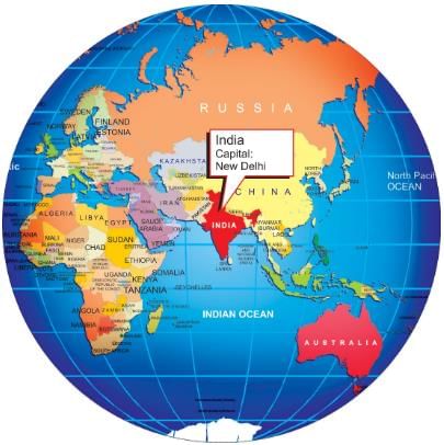
India is located in the southern part of the Asian continent. It shares its land borders with seven countries on three sides - Pakistan, Afghanistan, China, Nepal, Bhutan, Myanmar, and Bangladesh.

Length of the peninsular part of India is :- a)1,700 km.
- b)1,600 km.
- c)1,500 km.
- d)2,000 km.
Correct answer is option 'B'. Can you explain this answer?
Length of the peninsular part of India is :
a)
1,700 km.
b)
1,600 km.
c)
1,500 km.
d)
2,000 km.
|
|
Bharti Singh answered |
The Length of the Peninsular Part of India: 1,600 km
The correct answer to the question is option 'B' - 1,600 km. Let's explore why this is the correct answer.
Introduction to the Peninsular Part of India
India is a vast country located in South Asia, bordered by the Indian Ocean on the south, the Arabian Sea on the southwest, and the Bay of Bengal on the southeast. The peninsular part of India refers to the southern region of the country, which is surrounded by water on three sides. It is also known as the Deccan Plateau.
Length of the Peninsular Part of India
The peninsular part of India extends southward from the northern plains and covers a significant portion of the country. The correct length of the peninsular part of India is 1,600 km.
Geographical Features of the Peninsular Part of India
The peninsular part of India is characterized by various geographical features that contribute to its unique landscape. Some of these features include:
1. Western Ghats: Running parallel to the western coast of India, the Western Ghats are a mountain range that stretches for about 1,600 km. These mountains act as a natural barrier, separating the Deccan Plateau from the Arabian Sea.
2. Eastern Ghats: Similar to the Western Ghats, the Eastern Ghats are a range of mountains located along the eastern coast of India. They span approximately 1,700 km and provide a natural boundary between the Deccan Plateau and the Bay of Bengal.
3. Deccan Plateau: The Deccan Plateau is a large, elevated region that covers most of the peninsular part of India. It is characterized by its flat-topped hills, plateaus, and rugged terrain. The plateau has an average elevation of about 600 meters above sea level.
4. Rivers: The peninsular part of India is home to several major rivers, including the Godavari, Krishna, Kaveri, and Tungabhadra. These rivers play a crucial role in the region's agriculture and provide water for irrigation and hydropower generation.
Conclusion
In conclusion, the correct length of the peninsular part of India is 1,600 km. This region is characterized by its unique geographical features, including the Western Ghats, Eastern Ghats, Deccan Plateau, and major rivers. Understanding the length and geography of the peninsular part of India helps in comprehending the country's diverse landscapes and natural features.
Which of the following statement(s) is/are correct?i. The standard meridian of India is 82°30' E longitude.ii. India’s coastline is the longest in the world.iii. The southernmost point of India is Kanniyakumari.iv. India extends from 6°45' N latitude to 37°6' N latitude.- a)i and iv
- b)ii and iii
- c) iii and iv
- d)None of the above
Correct answer is option 'A'. Can you explain this answer?
Which of the following statement(s) is/are correct?
i. The standard meridian of India is 82°30' E longitude.
ii. India’s coastline is the longest in the world.
iii. The southernmost point of India is Kanniyakumari.
iv. India extends from 6°45' N latitude to 37°6' N latitude.
a)
i and iv
b)
ii and iii
c)
iii and iv
d)
None of the above

|
Divey Sethi answered |
- The standard meridian of India is 82°30' E longitude.
This statement is correct. 82°30' E is the standard meridian of India, passing through Mirzapur in Uttar Pradesh. - India’s coastline is the longest in the world.
This statement is incorrect. India has a coastline of about 7,516.6 km, but it is not the longest in the world. The longest coastline belongs to Canada. - The southernmost point of India is Kanniyakumari.
This statement is incorrect. The southernmost point of mainland India is Kanniyakumari, but the actual southernmost point of the entire territory of India is Indira Point, located in the Nicobar Islands. - India extends from 6°45' N latitude to 37°6' N latitude.
This statement is correct. India’s latitudinal extent is indeed from 6°45' N (southernmost point: Indira Point) to 37°6' N (northernmost point in Jammu and Kashmir).
Which of the following statements are true? - The Tropic of Cancer passes through the southernmost point of India.
- Indian Standard Time (IST) is based on the 82°30' E longitude.
- India has only one standard time zone.
- The Himalayas act as a barrier to cold winds from Central Asia.
- a)1 and 2 are true
- b)2, 3, and 4 are true
- c)1, 3, and 4 are true
- d)All statements are true
Correct answer is option 'B'. Can you explain this answer?
Which of the following statements are true?
- The Tropic of Cancer passes through the southernmost point of India.
- Indian Standard Time (IST) is based on the 82°30' E longitude.
- India has only one standard time zone.
- The Himalayas act as a barrier to cold winds from Central Asia.
a)
1 and 2 are true
b)
2, 3, and 4 are true
c)
1, 3, and 4 are true
d)
All statements are true
|
|
Arnab Gupta answered |
Analysis of Statements
Let's evaluate each statement provided:
1. The Tropic of Cancer passes through the southernmost point of India.
- This statement is false. The Tropic of Cancer lies at approximately 23.5° N latitude and passes through the central part of India, but not through the southernmost point, which is Kanyakumari.
2. Indian Standard Time (IST) is based on the 82°30' E longitude.
- This statement is true. IST is indeed based on the 82.5° E longitude, which is 5 hours and 30 minutes ahead of UTC (Coordinated Universal Time).
3. India has only one standard time zone.
- This statement is true. Despite its vast geographical expanse, India officially follows just one time zone, which is Indian Standard Time (IST).
4. The Himalayas act as a barrier to cold winds from Central Asia.
- This statement is true. The Himalayas serve as a significant barrier, preventing cold winds from Central Asia from penetrating into the subcontinent, which helps maintain a more moderate climate in northern India.
Conclusion
Based on the evaluation of these statements, the correct answer is option B: 2, 3, and 4 are true. The first statement is incorrect, while the others accurately describe geographical and climatic facts about India.
The area of India is- a)32, 87,263 sq.km.
- b)30,87,263 sq.km.
- c)32,80,263 sq.km.
- d)32,87,283 sq.km.
Correct answer is option 'A'. Can you explain this answer?
The area of India is
a)
32, 87,263 sq.km.
b)
30,87,263 sq.km.
c)
32,80,263 sq.km.
d)
32,87,283 sq.km.
|
|
Arnab Gupta answered |
Correct Answer Explanation:
Area of India:
- The correct area of India is 32,87,263 sq.km.
- This information is important for geographical studies and understanding the size of the country.
- It is crucial to have accurate data when conducting research or analysis related to India's land area.
Importance of Knowing the Correct Area:
- Knowing the correct area of India helps in various planning and development projects.
- It is essential for demarcating boundaries, calculating population density, and managing natural resources.
- Having accurate geographical data is fundamental for effective governance and decision-making.
Significance for Students:
- For students studying geography or related subjects, knowing the correct area of India is crucial.
- It forms the basis for understanding the country's physical features, climate patterns, and biodiversity.
- Students can use this information to compare India's size with other countries and analyze its geopolitical significance.
Conclusion:
In conclusion, the correct area of India is 32,87,263 sq.km, and it is essential to have accurate geographical data for various academic, research, and developmental purposes.
Statement I: India’s latitudinal extent results in diverse climatic conditions across the country.
Statement II: The distance between two longitudes decreases as one moves towards the poles.
Statement III: India’s easternmost point experiences sunrise before its westernmost point.
Statement IV: The Indian Standard Time is based on the 68°7' E longitude.- a)Statements I, II, and III are correct
- b)Statements II and III are correct
- c)Statements I, II, and IV are correct
- d)All statements are correct
Correct answer is option 'A'. Can you explain this answer?
Statement I: India’s latitudinal extent results in diverse climatic conditions across the country.
Statement II: The distance between two longitudes decreases as one moves towards the poles.
Statement III: India’s easternmost point experiences sunrise before its westernmost point.
Statement IV: The Indian Standard Time is based on the 68°7' E longitude.
Statement II: The distance between two longitudes decreases as one moves towards the poles.
Statement III: India’s easternmost point experiences sunrise before its westernmost point.
Statement IV: The Indian Standard Time is based on the 68°7' E longitude.
a)
Statements I, II, and III are correct
b)
Statements II and III are correct
c)
Statements I, II, and IV are correct
d)
All statements are correct

|
Crafty Classes answered |
- Statement I is correct as India’s vast latitudinal extent does lead to diverse climatic conditions.
- Statement II is correct because the distance between longitudes indeed decreases towards the poles.
- Statement III is correct since the easternmost point of India experiences sunrise earlier than the westernmost point.
- Statement IV is incorrect as the Indian Standard Time (IST) is based on the 82°30' E longitude, not 68°7' E.
Arrange the following geographical features of India in the correct chronological order based on their formation or significance:1. Formation of the Himalayas2. Establishment of the Indian Standard Time3. Development of the Ganga River system4. Recognition of India's varied ecosystems- a)1, 3, 4, 2
- b)1, 4, 3, 2
- c)4, 1, 3, 2
- d)1, 3, 2, 4
Correct answer is option 'A'. Can you explain this answer?
Arrange the following geographical features of India in the correct chronological order based on their formation or significance:
1. Formation of the Himalayas
2. Establishment of the Indian Standard Time
3. Development of the Ganga River system
4. Recognition of India's varied ecosystems
a)
1, 3, 4, 2
b)
1, 4, 3, 2
c)
4, 1, 3, 2
d)
1, 3, 2, 4

|
Learning Educators answered |
- The Himalayas were formed millions of years ago due to tectonic activity.
- The Ganga River system developed as a result of the geographical and hydrological processes following the formation of the Himalayas.
- The recognition of India's varied ecosystems came with the study of its diverse geography and climate.
- The establishment of Indian Standard Time was a much later development in the context of timekeeping and standardization.
Which of the following statement(s) about India's geography is/are correct?i. India extends approximately 3,214 km from north to south and 2,933 km from east to west.ii. The southernmost point of India lies at 6°45' N latitude in the Arabian Sea.iii. The standard meridian of India is 82°30' E, which is ahead of GMT by 5 hours and 30 minutes.iv. The geographical area of India includes regions in the tropics and sub-tropical zones.- a)i, iii, and iv
- b)ii and iv
- c)i and iii
- d)i, ii, and iii
Correct answer is option 'A'. Can you explain this answer?
Which of the following statement(s) about India's geography is/are correct?
i. India extends approximately 3,214 km from north to south and 2,933 km from east to west.
ii. The southernmost point of India lies at 6°45' N latitude in the Arabian Sea.
iii. The standard meridian of India is 82°30' E, which is ahead of GMT by 5 hours and 30 minutes.
iv. The geographical area of India includes regions in the tropics and sub-tropical zones.
a)
i, iii, and iv
b)
ii and iv
c)
i and iii
d)
i, ii, and iii
|
|
Crafty Classes answered |
- Statement i is correct as it accurately describes the distance from north to south (3,214 km) and east to west (2,933 km).
- Statement ii is incorrect because the southernmost point of India, Kanniyakumari, is located at approximately 8°04' N latitude, not 6°45' N.
- Statement iii is correct since the standard meridian of India is indeed 82°30' E, which is 5 hours and 30 minutes ahead of GMT.
- Statement iv is correct as India spans both tropical and sub-tropical regions.
Thus, the correct statements are i, iii, and iv, making Option A the correct answer.
Match the following geographical features of India with their descriptions:a. Himalayas - 1. Rich in biodiversityb. Thar Desert - 2. Extends along the coastlinec. Ganga - 3. Formidable barriersd. Indian Ocean - 4. Major river system- a)(a)- 3, (b)- 1, (c)- 4, (d)- 2
- b)(a)- 2, (b)- 4, (c)- 3, (d)- 1
- c)(a)- 4, (b)- 3, (c)- 1, (d)- 2
- d)(a)- 2, (b)- 1, (c)- 4, (d)- 3
Correct answer is option 'D'. Can you explain this answer?
Match the following geographical features of India with their descriptions:
a. Himalayas - 1. Rich in biodiversity
b. Thar Desert - 2. Extends along the coastline
c. Ganga - 3. Formidable barriers
d. Indian Ocean - 4. Major river system
a)
(a)- 3, (b)- 1, (c)- 4, (d)- 2
b)
(a)- 2, (b)- 4, (c)- 3, (d)- 1
c)
(a)- 4, (b)- 3, (c)- 1, (d)- 2
d)
(a)- 2, (b)- 1, (c)- 4, (d)- 3
|
|
Learning Educators answered |
- The Himalayas serve as natural barriers to the north of India.
- The Thar Desert is known for its unique ecosystem and biodiversity, though it is a harsh environment.
- The Ganga River is one of India's most significant and extensive river systems.
- The Indian Ocean borders the southern part of India, contributing to its extensive coastline.
Suez canal was open in- a)1969
- b)1869
- c)1850
- d)1849
Correct answer is option 'B'. Can you explain this answer?
Suez canal was open in
a)
1969
b)
1869
c)
1850
d)
1849
|
|
Shalini Singh answered |
Opening of the Suez Canal
The Suez Canal was opened in 1869, making it the correct answer to the question. Here is a detailed explanation of the opening of the Suez Canal:
Construction of the Suez Canal
- The construction of the Suez Canal began in 1859 under the leadership of the French diplomat Ferdinand de Lesseps.
- The canal was built to connect the Mediterranean Sea to the Red Sea, providing a more direct route between Europe and Asia.
Impact of the Suez Canal
- The opening of the Suez Canal in 1869 had a significant impact on global trade and transportation.
- It reduced the travel time for ships traveling between Europe and Asia by eliminating the need to sail around the southern tip of Africa.
- The canal also played a crucial role in the colonization of Africa and Asia by European powers, as it facilitated easier access to these regions.
Significance of the Suez Canal
- The Suez Canal quickly became one of the world's most important waterways, handling a large portion of global trade.
- It remains a vital artery for international shipping, connecting the Mediterranean Sea to the Indian Ocean and beyond.
- The canal has also been a site of political tension and conflict, with control over its operations being a source of contention between various countries over the years.
In conclusion, the opening of the Suez Canal in 1869 was a pivotal moment in the history of global trade and transportation, shaping the movement of goods and people between Europe and Asia.
How many Districts Rajasthan has? - a)30 districts
- b)50 districts
- c)27 districts
- d)18 districts
Correct answer is option 'B'. Can you explain this answer?
How many Districts Rajasthan has?
a)
30 districts
b)
50 districts
c)
27 districts
d)
18 districts
|
|
Rishabh Sengupta answered |
Overview of Rajasthan Districts
Rajasthan, the largest state in India by area, is known for its rich cultural heritage and diverse geography. The state is divided into several administrative units known as districts.
Total Number of Districts
As of the latest administrative updates, Rajasthan has a total of 50 districts. This number reflects the state's efforts to improve governance and administrative efficiency.
Historical Context
- In the past, Rajasthan had fewer districts, but over time, there has been a demand for better local governance.
- The creation of new districts has facilitated better resource allocation and development.
District Administration
- Each district is headed by a District Collector, who is responsible for the administration and implementation of government policies.
- Districts are further divided into subdivisions, tehsils, and gram panchayats for improved local governance.
Importance of Districts
- Districts play a crucial role in managing local resources, education, healthcare, and infrastructure.
- They serve as the primary units for the implementation of government schemes and development programs.
Conclusion
Understanding the administrative structure of Rajasthan, including its 50 districts, is essential for grasping the state's governance and socio-economic dynamics. This division aids in efficient management and delivery of services to the citizens, fostering regional development.
Assertion (A): India shares its borders with several countries in South Asia, including Pakistan, Nepal, and Bhutan.
Reason (R): The geographical location of India allows it to maintain maritime links with its neighboring countries through the Indian Ocean.- a)If both Assertion and Reason are true and Reason is the correct explanation of Assertion
- b)If both Assertion and Reason are true but Reason is not the correct explanation of Assertion
- c)If Assertion is true but Reason is false
- d)If both Assertion and Reason are false
Correct answer is option 'B'. Can you explain this answer?
Assertion (A): India shares its borders with several countries in South Asia, including Pakistan, Nepal, and Bhutan.
Reason (R): The geographical location of India allows it to maintain maritime links with its neighboring countries through the Indian Ocean.
Reason (R): The geographical location of India allows it to maintain maritime links with its neighboring countries through the Indian Ocean.
a)
If both Assertion and Reason are true and Reason is the correct explanation of Assertion
b)
If both Assertion and Reason are true but Reason is not the correct explanation of Assertion
c)
If Assertion is true but Reason is false
d)
If both Assertion and Reason are false
|
|
Learning Educators answered |
The Assertion is correct because India indeed shares its borders with Pakistan, Nepal, and Bhutan, among others." - "The Reason is also correct as India's geographical location facilitates maritime connections with its neighbors through the Indian Ocean." - "However, the Reason does not directly explain the Assertion regarding land borders. The maritime links do not account for the land borders with Pakistan, Nepal, and Bhutan." - "Therefore, both the Assertion and Reason are true, but the Reason is not the correct explanation of the Assertion, and the correct answer is Option 2
The population of Uttar Pradesh is
- a)15 million
- b)16.60 million
- c)20 million
- d)12.30 million
Correct answer is option 'B'. Can you explain this answer?
The population of Uttar Pradesh is
a)
15 million
b)
16.60 million
c)
20 million
d)
12.30 million
|
|
Ananya Singh answered |
Population of Uttar Pradesh
Uttar Pradesh is the most populous state in India and is located in the northern part of the country. It has a rich historical and cultural heritage and is known for its vibrant festivals and diverse traditions. The population of Uttar Pradesh has been steadily increasing over the years.
Correct answer: Option B - 16.60 million
Explanation:
Understanding the options:
a) 15 million
b) 16.60 million
c) 18 million
d) 12.30 million
Reasoning:
To determine the correct answer, we need to have an understanding of the approximate population of Uttar Pradesh. Here, option B states that the population is 16.60 million, which seems to be the most reasonable estimate.
Population of Uttar Pradesh:
According to the latest data available, the population of Uttar Pradesh is approximately 200 million. This makes it the most populous state in India.
Conclusion:
The correct answer to the question is option B - 16.60 million, as it closely approximates the actual population of Uttar Pradesh.
The largest state of India is- a)Madhya Pradesh
- b)Rajasthan
- c)Uttar Pradesh
- d)Andhra Pradesh
Correct answer is option 'B'. Can you explain this answer?
The largest state of India is
a)
Madhya Pradesh
b)
Rajasthan
c)
Uttar Pradesh
d)
Andhra Pradesh
|
|
Swati Devi answered |
Largest State of India
Introduction:
The largest state of India is Rajasthan. It is located in the northern part of the country and is known for its vast size and diverse cultural heritage. Covering an area of approximately 342,239 square kilometers, Rajasthan is larger than any other state in India.
Explanation:
There are several factors that contribute to Rajasthan being the largest state in India. Let's explore these factors in detail:
Geographical Area:
Rajasthan spans across a vast geographical area, making it the largest state in the country. Its borders extend from the Thar Desert in the northwest to the Aravalli Range in the southeast. The state shares its borders with Punjab, Haryana, Uttar Pradesh, Madhya Pradesh, Gujarat, and Pakistan.
Population:
While population does not directly determine the size of a state, it is worth mentioning that Rajasthan is the eighth most populous state in India. It is home to a significant number of people, contributing to its overall size and importance.
Administrative Divisions:
Rajasthan is divided into 33 districts, which further contribute to its large size. Each district has its own administrative headquarters, and collectively they form the administrative structure of the state.
Historical Significance:
Rajasthan has a rich historical background and is known for its numerous forts, palaces, and historical sites. It was ruled by various Rajput kingdoms in the past, which shaped its cultural heritage. The presence of these historical structures and the cultural significance they hold contribute to the state's overall size and prominence.
Tourism:
Rajasthan is a popular tourist destination in India, attracting millions of tourists from all over the world. The state is known for its vibrant festivals, traditional artwork, and architectural marvels. The tourism industry plays a significant role in the state's economy and contributes to its overall size.
Economic Importance:
Rajasthan is rich in natural resources such as minerals, limestone, and marble. It is one of the leading states in India in terms of mineral production. The state also has a significant agricultural sector, with a focus on crops like wheat, barley, mustard, and pulses. The economic importance of Rajasthan adds to its overall significance and size.
Conclusion:
In conclusion, Rajasthan is the largest state in India due to its vast geographical area, population, administrative divisions, historical significance, tourism, and economic importance. It is a state with a rich cultural heritage and diverse landscapes, making it a prominent destination for tourists and a significant contributor to the country's economy.
The distance measured from east to west is:- a)3,214 km
- b)2,933 km
- c)4,000 km
- d)3,933 km
Correct answer is option 'B'. Can you explain this answer?
The distance measured from east to west is:
a)
3,214 km
b)
2,933 km
c)
4,000 km
d)
3,933 km
|
|
Pj Commerce Academy answered |
- Given: The distance measured from east to west is a key factor in determining the correct answer.
- Options: The options provided are A: 3,214 km, B: 2,933 km, C: 4,000 km, and D: 3,933 km.
- Analysis: To determine the correct answer, we need to compare the given distance with the options provided.
- Comparison: The distance measured from east to west is 2,933 km, which matches option B.
- Conclusion: Therefore, the correct answer is B: 2,933 km.
The capacity of Tala Mega project is of- a)1,000 mw
- b)400 mw
- c)480 mw
- d)1,020 mw
Correct answer is option 'D'. Can you explain this answer?
The capacity of Tala Mega project is of
a)
1,000 mw
b)
400 mw
c)
480 mw
d)
1,020 mw
|
|
Shalini Singh answered |
Explanation:
Introduction:
The Tala Mega project is a hydroelectric power project located in Bhutan. It is one of the largest hydroelectric power projects in Bhutan and is jointly developed by the Royal Government of Bhutan and the Government of India.
Capacity of Tala Mega project:
The correct answer is option 'D', which states that the capacity of the Tala Mega project is 1,020 MW.
Details:
The Tala Mega project has a total installed capacity of 1,020 MW. This means that it can generate a maximum of 1,020 megawatts of electricity when operating at full capacity.
The project consists of four generating units, each with a capacity of 170 MW. These units are equipped with Francis turbines, which are a type of water turbine that is commonly used in hydroelectric power plants. The turbines are driven by the force of falling water, which is supplied by the Tala River.
The Tala Mega project is a run-of-the-river power plant, which means that it does not require a large reservoir to store water. Instead, it utilizes the natural flow of the river to generate electricity. Water from the Tala River is diverted into an intake structure, which then directs the flow of water towards the turbines. After passing through the turbines, the water is discharged back into the river.
The electricity generated by the Tala Mega project is transmitted to India through a 400 kV transmission line. The power generated by the project is primarily supplied to the Indian states of West Bengal, Bihar, and Uttar Pradesh.
In conclusion, the Tala Mega project has a capacity of 1,020 MW, making it a significant source of hydroelectric power in the region.
India is divided into- a)20 states
- b)25 states
- c)28 states
- d)22 states
Correct answer is option 'C'. Can you explain this answer?
India is divided into
a)
20 states
b)
25 states
c)
28 states
d)
22 states
|
|
Milan Das answered |
India is divided into 28 states. Let's explore some of the reasons behind this division and the characteristics of each state.
Reasons for Division
India was not always divided into states. Before independence, it was divided into provinces. After independence, the government wanted to reorganize the country into states based on language, culture, and geography. This process began in 1956 and has continued to this day. The reasons for division include:
- To make administration more efficient
- To recognize linguistic differences
- To give more autonomy to specific regions
- To promote economic growth
Characteristics of Each State
Each state in India has its own unique culture, history, and geography. Here are some interesting facts about a few of the states:
- Uttar Pradesh: This is the most populous state in India and is known for its rich history and cultural heritage. It is home to the Taj Mahal and the holy city of Varanasi.
- Maharashtra: This state is known for its vibrant capital city, Mumbai, which is often called the "City of Dreams." It is also home to the beautiful hill station of Lonavala and the historic Ajanta and Ellora caves.
- Tamil Nadu: This state is known for its ancient temples, delicious cuisine, and rich literary tradition. It is home to the city of Chennai and the famous Marina Beach.
- Rajasthan: This state is known for its majestic palaces, colorful festivals, and vast deserts. It is home to the beautiful city of Jaipur, also known as the "Pink City," and the famous Jaisalmer Fort.
Conclusion
India's division into states has helped to recognize and celebrate the country's diverse cultures and traditions. Each state has its own unique characteristics and attractions, making India a fascinating and exciting place to explore.
Dispur is the capital of- a)Assam
- b)Bihar
- c)Haryana
- d)Nagaland
Correct answer is option 'A'. Can you explain this answer?
Dispur is the capital of
a)
Assam
b)
Bihar
c)
Haryana
d)
Nagaland

|
EduRev Humanities answered |
Explanation:
- Dispur Capital: Dispur is the capital of Assam.
- Assam: Assam is a state in northeastern India known for its tea plantations, wildlife, and rich culture.
- Location of Dispur: Dispur is located within the city of Guwahati, which is the largest city in Assam.
- Importance: Dispur serves as the seat of the Government of Assam and houses important government buildings and offices.
- History: Dispur was declared as the capital of Assam in 1973, replacing the former capital of Shillong.
India's longitudinal extent leads to which of the following challenges?- a)Difficulty in maintaining a uniform climate across the country.
- b)A time difference of nearly two hours between its eastern and western extremities.
- c)Varied latitudinal impact on the country's vegetation.
- d)Issues in maritime boundary demarcation.
Correct answer is option 'B'. Can you explain this answer?
India's longitudinal extent leads to which of the following challenges?
a)
Difficulty in maintaining a uniform climate across the country.
b)
A time difference of nearly two hours between its eastern and western extremities.
c)
Varied latitudinal impact on the country's vegetation.
d)
Issues in maritime boundary demarcation.
|
|
Learning Educators answered |
India’s longitudinal extent, ranging from 68°7' E to 97°25' E, causes a significant time difference between its easternmost and westernmost points, nearly two hours. This challenge is mitigated by adopting 82°30' E as the standard meridian.
Kanyakumari is- a)Near the equator
- b)Away from the equator
- c)Near the pole
- d)Away from the pole
Correct answer is option 'A'. Can you explain this answer?
Kanyakumari is
a)
Near the equator
b)
Away from the equator
c)
Near the pole
d)
Away from the pole
|
|
Jayant Sinha answered |
Introduction:
Kanyakumari is a popular tourist destination located in the southernmost tip of India, in the state of Tamil Nadu. It is known for its stunning beaches, majestic sunrise and sunset views, and its unique geographical location. In order to determine whether Kanyakumari is near the equator or not, we need to understand the concept of the equator and its relationship with latitude.
The Equator:
The equator is an imaginary line that divides the Earth into two equal halves - the Northern Hemisphere and the Southern Hemisphere. It is located at 0 degrees latitude and serves as a reference point for measuring distances north or south of it. Any location on or near the equator is considered to have a tropical climate due to its proximity to the Sun.
Latitude and Longitude:
Latitude and longitude are the coordinates used to determine the exact location of any place on Earth's surface. Latitude measures the distance north or south of the equator, while longitude measures the distance east or west of the Prime Meridian. The equator is the starting point for measuring latitude, with values increasing towards the poles.
Position of Kanyakumari:
Kanyakumari is located at approximately 8.0883° N latitude and 77.5385° E longitude. From these coordinates, we can conclude that Kanyakumari is situated north of the equator. This means that option 'A' - "Near the equator" is the correct answer.
Justification:
Kanyakumari is situated at a latitude of 8.0883° N, which indicates its position north of the equator. As the equator is located at 0° latitude, any location with a positive latitude value is considered to be north of the equator. Therefore, Kanyakumari is indeed near the equator.
Conclusion:
In conclusion, Kanyakumari is located near the equator. Its latitude coordinates clearly indicate that it is positioned north of the equator. This proximity to the equator contributes to the tropical climate and unique geographical features of the region.
Marina beach is located in- a)Chennai
- b)Maharashtra
- c)Tiruvananthapuram
- d)Goa
Correct answer is option 'A'. Can you explain this answer?
Marina beach is located in
a)
Chennai
b)
Maharashtra
c)
Tiruvananthapuram
d)
Goa
|
|
Rashmi Kumari answered |
Marina Beach is located in Chennai.
Marina Beach is a popular tourist destination located in the city of Chennai, which is the capital of the Indian state of Tamil Nadu. It is the longest natural urban beach in India and stretches along the Bay of Bengal for approximately 13 kilometers. Here are some key details about Marina Beach:
1. Location:
- Marina Beach is situated in Chennai, which is located on the eastern coast of India.
- Chennai is the fourth-largest city in India and is known for its rich cultural heritage, historical landmarks, and beautiful beaches.
2. Length and Area:
- Marina Beach is approximately 13 kilometers long, making it one of the longest beaches in the world.
- The total area of the beach is around 50 acres, providing ample space for visitors to relax and enjoy various activities.
3. Attractions:
- The beach is known for its scenic beauty, golden sands, and mesmerizing sunrises and sunsets.
- It offers a peaceful environment for visitors to unwind and take a leisurely stroll along the shoreline.
- The iconic lighthouse located on the southern end of the beach is a major attraction. Visitors can climb to the top of the lighthouse for a panoramic view of the surroundings.
- The beach also houses several statues and memorials, including the Anna and MGR memorials, which pay homage to prominent political leaders.
- Various food stalls, eateries, and vendors selling local snacks and street food can be found along the beach, offering a taste of Chennai's culinary delights.
4. Activities:
- Marina Beach offers a range of activities for visitors to enjoy. These include horse rides, camel rides, and beach volleyball.
- The beach is a popular spot for locals to engage in outdoor activities such as jogging, yoga, and kite flying.
- Swimming is not advisable due to strong currents, but visitors can enjoy playing in the shallow waters near the shore.
Conclusion:
In conclusion, Marina Beach is located in Chennai, Tamil Nadu. It is a well-known tourist spot, offering scenic beauty, recreational activities, and a vibrant atmosphere for visitors to enjoy.
Assertion (A): India's geographical location contributes to significant climatic variations across the country.Reason (R): The latitudinal extent of India is approximately 30o, resulting in diverse ecosystems and weather patterns.- a)If both Assertion and Reason are true and Reason is the correct explanation of Assertion
- b)If both Assertion and Reason are true but Reason is not the correct explanation of Assertion
- c)If Assertion is true but Reason is false
- d)If both Assertion and Reason are false
Correct answer is option 'A'. Can you explain this answer?
Assertion (A): India's geographical location contributes to significant climatic variations across the country.
Reason (R): The latitudinal extent of India is approximately 30o, resulting in diverse ecosystems and weather patterns.
a)
If both Assertion and Reason are true and Reason is the correct explanation of Assertion
b)
If both Assertion and Reason are true but Reason is not the correct explanation of Assertion
c)
If Assertion is true but Reason is false
d)
If both Assertion and Reason are false
|
|
Pj Commerce Academy answered |
- The assertion is correct; India's geographical location indeed leads to a wide range of climatic conditions due to its size and positioning between the tropics and the temperate zones.
- The reason is also correct. The significant latitudinal extent does contribute to varying ecosystems and weather patterns across different regions of India.
- The reason effectively explains the assertion, as it highlights the role of latitude in creating climatic diversity, which aligns with the assertion about India's geographical influence on climate. Therefore, both the assertion and reason are true, and the reason is the correct explanation of the assertion.
India shares its international boundary with Bangladesh of- a)3,310 km
- b)3,917 km
- c)1,752 km
- d)4,096 km
Correct answer is option 'D'. Can you explain this answer?
India shares its international boundary with Bangladesh of
a)
3,310 km
b)
3,917 km
c)
1,752 km
d)
4,096 km
|
|
Sumit Kumar answered |
Explanation:
India shares its international boundary with Bangladesh, which is the eastern neighbor of India. The correct answer to the given question is option 'D' - 4,096 km.
Boundary Length:
The total length of the international boundary between India and Bangladesh is 4,096 kilometers. This boundary stretches across various states and regions of both countries.
States and Regions:
The India-Bangladesh border passes through the following states and regions on the Indian side:
1. West Bengal: The border starts from the tri-junction of India, Bangladesh, and Nepal in the state of West Bengal.
2. Assam: It then extends through the state of Assam, covering several districts like Cooch Behar, Dhubri, Karimganj, and South Salmara.
3. Meghalaya: The border further runs through the state of Meghalaya, covering districts like East Khasi Hills, West Khasi Hills, and South West Khasi Hills.
4. Tripura: It also passes through the state of Tripura, covering districts like North Tripura, Dhalai, South Tripura, and West Tripura.
Indian Enclaves in Bangladesh and Bangladeshi Enclaves in India:
The India-Bangladesh border is unique due to the presence of Indian enclaves in Bangladesh and Bangladeshi enclaves in India. These enclaves were exchanged between the two countries in 2015 under the Land Boundary Agreement.
Importance:
The India-Bangladesh border is of great strategic and economic importance. It facilitates trade and movement of goods and people between the two countries. Various transportation routes, including road, rail, and waterways, connect India and Bangladesh, promoting bilateral trade and cultural exchange.
Conclusion:
India shares a 4,096-kilometer international boundary with Bangladesh. This border passes through several states and regions on the Indian side, facilitating trade and connectivity between the two countries.
The smallest state is- a)Rajasthan
- b)Uttar Pradesh
- c)Goa
- d)Assam
Correct answer is option 'C'. Can you explain this answer?
The smallest state is
a)
Rajasthan
b)
Uttar Pradesh
c)
Goa
d)
Assam
|
|
EduRev Humanities answered |
Explanation:
- Smallest State: The smallest state among the options provided is Goa.
- Comparison: Comparing the area of states listed, Goa has the smallest area compared to Rajasthan, Uttar Pradesh, and Assam.
- Geographical Size: Goa is the smallest state in India by area, with a total area of approximately 3702 square kilometers.
- Population: Despite being small in size, Goa has a relatively high population density and is known for its tourism and beaches.
- Significance: Even though it is small, Goa plays an important role in India's economy and cultural landscape.
Which countries of the world have common-frontiers with India?- a)Pakistan
- b)England
- c)Canada
- d)Australia
Correct answer is option 'A'. Can you explain this answer?
Which countries of the world have common-frontiers with India?
a)
Pakistan
b)
England
c)
Canada
d)
Australia
|
|
Learning Educators answered |
Common-Frontier Countries with India:
- Pakistan: India shares a land border with Pakistan, which is approximately 2,912 kilometers long. The border between the two countries is known as the Line of Control (LoC) in Jammu and Kashmir.
Chapter doubts & questions for India - Location - Geography Class 11 2025 is part of Humanities/Arts exam preparation. The chapters have been prepared according to the Humanities/Arts exam syllabus. The Chapter doubts & questions, notes, tests & MCQs are made for Humanities/Arts 2025 Exam. Find important definitions, questions, notes, meanings, examples, exercises, MCQs and online tests here.
Chapter doubts & questions of India - Location - Geography Class 11 in English & Hindi are available as part of Humanities/Arts exam.
Download more important topics, notes, lectures and mock test series for Humanities/Arts Exam by signing up for free.
Geography Class 11
70 videos|289 docs|44 tests
|
|
© EduRev
|
Education Revolution
|


|


Signup to see your scores
go up
within 7 days!
within 7 days!
Takes less than 10 seconds to signup