Agro Climatic Zones in India | Agriculture Optional for UPSC PDF Download
| Table of contents |

|
| Introduction |

|
| Primary Objectives of Agro Climatic Zone Classification |

|
| Climatic Zones |

|
| Distinct Features of Climatic Zones |

|
| Conclusion |

|
Introduction
The former Planning Commission, now known as NITI Aayog, suggested a more scientific approach to agricultural planning by considering agro-climatic regions in India. These regions are defined based on various factors such as soil type, climate (including temperature and rainfall patterns), their variations, and the availability of water resources. In essence, this approach can be seen as an expansion of climate classification, with a specific focus on its relevance to agriculture.
Agro-climatic zone in News
The Agro-climatic zone is currently in the news due to several factors. Firstly, changes in climate patterns and an increase in extreme weather events have brought attention to cropping patterns and agricultural issues. Additionally, there have been recent calls to prioritize certain crops and offer specific incentives, potentially leading to a shift in the distribution of agriculture and its suitability in various regions with available resources.
Primary Objectives of Agro Climatic Zone Classification
- To optimise agricultural production.
- To increase farm income.
- To generate more rural employment.
- To make judicious use of the available irrigation water.
- To reduce the regional inequalities in the development of agriculture.
Climatic Zones
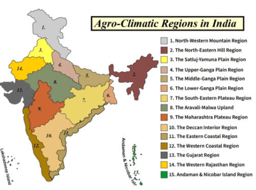
India is geographically divided into 15 agro-climatic regions, which are further subdivided into 72 more homogeneous sub-zones. These 15 agro-climatic zones encompass various states and regions of India.
Here is a breakdown of these zones:
- Zone 1 – Western Himalayan Region: Jammu and Kashmir, Uttar Pradesh
- Zone 2 – Eastern Himalayan Region: Assam, Sikkim, West Bengal and all North-Eastern states
- Zone 3 – Lower Gangetic Plains Region: West Bengal
- Zone 4 – Middle Gangetic Plains Region: Uttar Pradesh, Bihar
- Zone 5 – Upper Gangetic Plains Region: Uttar Pradesh
- Zone 6 – Trans-Gangetic Plains Region: Punjab, Haryana, Delhi and Rajasthan
- Zone 7 – Eastern Plateau and Hills Region: Maharashtra, Uttar Pradesh, Orissa and West Bengal
- Zone 8 – Central Plateau and Hills Region: MP, Rajasthan, Uttar Pradesh
- Zone 9 – Western Plateau and Hills Region: Maharashtra, Madhya Pradesh and Rajasthan
- Zone 10 – Southern Plateau and Hills Region: Andhra Pradesh, Karnataka, Tamil Nadu
- Zone 11 – East Coast Plains and Hills Region: Orissa, Andhra Pradesh, Tamil Nadu and Pondicherry
- Zone 12 – West Coast Plains and Ghat Region: Tamil Nadu, Kerala, Goa, Karnataka, Maharashtra
- Zone 13 – Gujarat Plains and Hills Region: Gujarat
- Zone 14 – Western Dry Region: Rajasthan
- Zone 15 – The Islands Region: Andaman and Nicobar, Lakshadweep
Distinct Features of Climatic Zones
Zone 1 – Western Himalayan Region
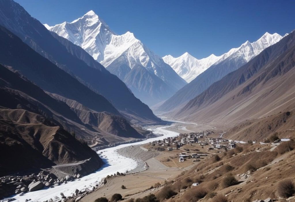
- This region encompasses Jammu and Kashmir, Himachal Pradesh, and the Kumaun-Garhwal areas of Uttarakhand.
- It exhibits significant relief variations, with mild summer temperatures (ranging from 5°C to 30°C in July) and severe cold conditions during the winter (with temperatures from 0°C to -4°C in January).
- The average annual rainfall in this zone is approximately 150 cm.
- Different vegetation zones can be observed along the hill slopes, with varying elevations.
- Valleys and duns in this region have thick layers of alluvial soil, while the hill slopes are characterized by thin brown hilly soils.
- Perennial streams are abundant due to the high rainfall and snow-covered mountain peaks, including those of the Ganga, Yamuna, Jhelum, Chenab, Satluj, and Beas rivers.
- These water sources serve as a vital irrigation supply for canals and a source of cost-effective hydel power for agricultural and industrial purposes.
- Key crops cultivated in this region include maize, wheat, potato, and barley.
- Additionally, certain areas of Jammu and Kashmir and Himachal Pradesh are known for producing temperate fruits like apples and pears.
Zone 2 – Eastern Himalayan Region
- The Eastern Himalayan region includes Sikkim, the Darjeeling area in West Bengal, Arunachal Pradesh, Assam hills, Nagaland, Meghalaya, Manipur, Mizoram, and Tripura.
- This area is characterized by its rugged topography, dense forest cover, and a sub-humid climate, with annual rainfall exceeding 200 cm. The temperature ranges from 25°C to 33°C in July and 11°C to 24°C in January.
- The soil in this region is brownish, with thick layers and relatively lower fertility.
- Shifting cultivation, known as "Jhum," is practiced across approximately one-third of the cultivated land, and food crops are predominantly grown for subsistence.
- Major crops cultivated in this zone include rice, potato, maize, tea, and various fruits such as oranges, pineapples, limes, and lychees.
Zone 3 – Lower Gangetic Plains Region

- This region covers eastern Bihar, West Bengal, and the Assam valley.
- Annual rainfall in this region typically ranges from 100 cm to 200 cm.
- July temperatures vary between 26°C and 41°C, while January temperatures range from 9°C to 24°C.
- Groundwater is abundant in this region, with a high water table. Wells and canals serve as the primary sources of irrigation.
- Waterlogging and marshy areas are prevalent issues in certain parts of this zone.
- Rice is the primary crop, and it sometimes yields three successive crops (Aman, Aus, and Boro) in a year.
- Other significant crops include jute, maize, potato, and various pulses. Planning strategies focus on improving rice farming, horticulture (with crops like bananas, mangoes, and citrus fruits), pisciculture, poultry, livestock, forage production, and seed supply.
Zone 4 – Middle Gangetic Plains Region
- This region encompasses eastern Uttar Pradesh and Bihar, excluding the Chotanagpur plateau.
- It is a fertile alluvial plain, drained by the Ganga River and its tributaries.
- July temperatures in the region typically range from 26°C to 41°C, while January temperatures vary from 9°C to 24°C.
- Annual rainfall ranges from 100 cm to 200 cm. The region has significant groundwater resources and surface runoff from perennial rivers, which are harnessed for irrigation through tube wells, canals, and wells.
- Major crops include rice, maize, millets during the Kharif season, and wheat, gram, barley, peas, mustard, and potatoes during the Rabi season.
Zone 5 – Upper Gangetic Plains Region
- This region covers the central and western parts of Uttar Pradesh.
- It features a sub-humid continental climate with July temperatures ranging from 26°C to 41°C, January temperatures from 7°C to 23°C, and an average annual rainfall between 75 cm and 150 cm.
- The soil is sandy loam. It boasts a high irrigation intensity of 131 percent and a cropping intensity of 144 percent.
- Main irrigation sources include canals, tube wells, and wells. This region is characterized by intensive agriculture, with major crops being wheat, rice, sugarcane, millets, maize, gram, barley, oilseeds, pulses, and cotton.
Zone 6 – Trans-Gangetic Plains Region
- The Trans-Ganga Plain comprises Punjab, Haryana, Delhi, Chandigarh, and Ganganagar district in Rajasthan.
- Its climate exhibits semi-arid characteristics, with July temperatures ranging from 26°C to 42°C, January temperatures from 7°C to 22°C, and an average annual rainfall between 70 cm and 125 cm.
- Private tube wells and canals are the primary means of irrigation.
- Major crops in this region include wheat, sugarcane, cotton, rice, gram, maize, millets, various pulses, and oilseeds
Zone 7 – Eastern Plateau and Hills Region
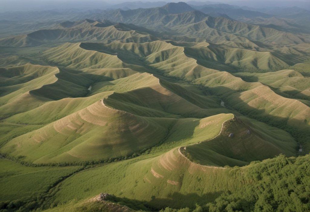
- This zone encompasses the Chotanagpur plateau, Rajmahal Hills, Chhattisgarh plains, and Dandakaranya.
- The region experiences temperatures of 26°C-34°C in July, 10°C-27°C in January, and an annual rainfall ranging from 80 cm to 150 cm.
- Soils in the area are primarily red and yellow with occasional patches of laterites and alluvium.
- Due to its plateau structure and non-perennial streams, the region faces a shortage of water resources.
- Rainfed agriculture is practiced here, with crops like rice, millets, maize, oilseeds, ragi, gram, and potatoes being cultivated.
Zone 8 – Central Plateau and Hills Region
- This region covers Bundelkhand, Baghelkhand, Bhander plateau, Malwa plateau, and Vindhyachal hills.
- It exhibits a climate that ranges from semi-arid in the western part to sub-humid in the eastern part. July temperatures range from 26°C to 40°C, January temperatures range from 7°C to 24°C, and the average annual rainfall falls between 50 cm and 100 cm.
- Soils in this area are mixed, including red, yellow, and black soils. Crops grown here include millets, gram, barley, wheat, cotton, sunflower, and more.
- The region faces a scarcity of water resources.
Zone 9 – Western Plateau and Hills Region
- This region comprises the southern part of the Malwa plateau and the Deccan plateau in Maharashtra.
- The climate here features July temperatures between 24°C and 41°C, January temperatures between 6°C and 23°C, and an average annual rainfall of 25 cm to 75 cm.
- Approximately 65 percent of the area is net sown, with only 12.4 percent of the region being irrigated.
- Principal crops in this area include jowar, cotton, sugarcane, rice, bajra, wheat, gram, pulses, potatoes, groundnuts, and oilseeds.
- The region is known for its cultivation of oranges, grapes, and bananas.
Zone 10 – Southern Plateau and Hills Region
- This zone covers southern Maharashtra, Karnataka, western Andhra Pradesh, and northern Tamil Nadu.
- It experiences July temperatures ranging from 26°C to 42°C, January temperatures between 13°C and 21°C, and annual rainfall between 50 cm and 100 cm.
- The climate is semi-arid, with only 50 percent of the area cultivated, 81 percent engaged in dryland farming, and a low cropping intensity of 111 percent.
- The region predominantly grows low-value cereals and minor millets, while coffee, tea, cardamom, and spices are cultivated on the hilly slopes of the Karnataka plateau.
Zone 11 –East Coast Plains and Hills Region
- This region encompasses the Coromandel and Northern Circar, which are significant coastal plains in India.
- The climate here is sub-humid maritime, with May and January temperatures ranging from 26°C-32°C and 20°C-29°C, respectively, and annual rainfall between 75 cm-150 cm.
- The soils in this area are primarily alluvial, loam, and clay, and they face the issue of alkalinity.
- The region contributes to 20.33 percent of rice and 17.05 percent of groundnut production in the country.
- Main crops cultivated in this region include rice, jute, tobacco, sugarcane, maize, millets, groundnuts, and oilseeds.
Zone 12 – West Coast Plains and Ghats Region
- This region extends over the Malabar and Konkan coasts and the Sahyadris, characterized by laterite and coastal alluvial soils.
- It has a humid climate with annual rainfall exceeding 200 cm and average temperatures of 26°C-32°C in July and 19°C-28°C in January.
- Main crops in this region comprise rice, coconut, oilseeds, sugarcane, millets, pulses, and cotton.
- The region is renowned for its plantation crops and spices, which are cultivated on the hill slopes of the Ghats.
Zone 13 – Gujarat Plains and Hills Region
- This region includes Kathiawar and the fertile valleys of the Mahi and Sabarmati rivers.
- It experiences an arid and semi-arid climate with average annual rainfall ranging from 50 cm-100 cm, and monthly temperatures between 26°C-42°C in July and 13°C-29°C in January.
- The soils vary from regur in the plateau region to alluvium in the coastal plains and red and yellow soils in Jamnagar.
- Major crops grown in this region are groundnuts, cotton, rice, millets, oilseeds, wheat, and tobacco, making it an important oilseed-producing area.
Zone 14 – Western Dry Region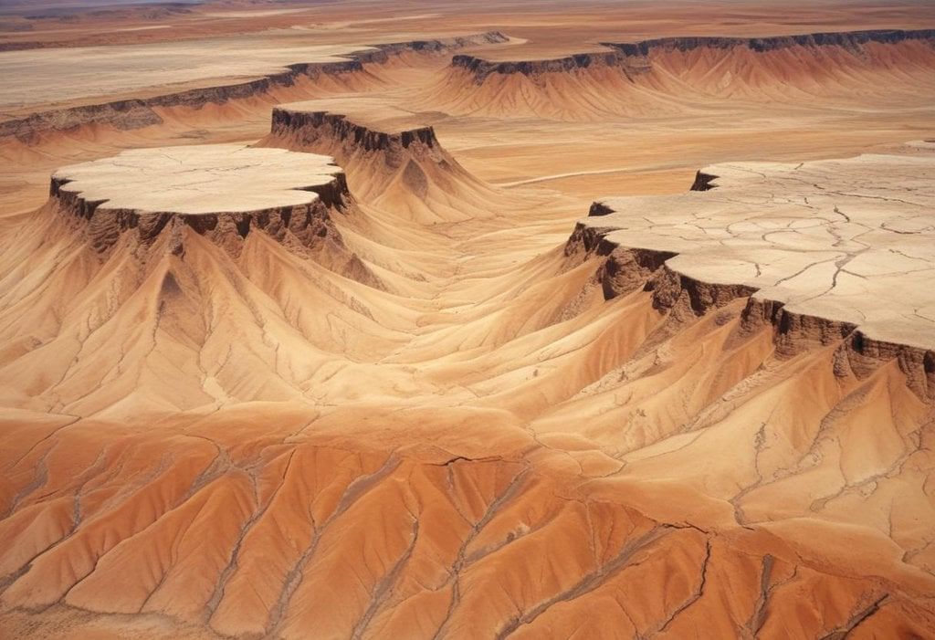
- This area is in western Rajasthan, to the west of the Aravalli Range.
- It has a hot sandy desert, very little rain (less than 25 cm per year on average), high evaporation, big temperature differences (from 28°C to 45°C in June, and from 5°C to 22°C in January), no rivers that flow all year, and not much plant life.
- The water under the ground is usually far down and salty, and hunger and very dry weather happen a lot.
- There's a lot of land for each person. Only 1.2% of the land has forests, and just 4.3% is grasslands.
- Almost 42% of the land can be used for farming or is left unused.
- Only 6.3% of the land can get water artificially, out of 44.4% that can be farmed on.
- Main crops in this area are bajra, jowar, and moth in one growing season, and wheat and gram in another.
- Animals are very important for the environment in the desert.
Zone 15 – The Islands Region
- The island region includes Andaman-Nicobar and Lakshadweep, which experience typically equatorial climates.
- Annual rainfall is less than 300 cm, with Port Blair having mean July and January temperatures of 30°C and 25°C, respectively.
- The soils vary from sandy along the coast to clayey loam in valleys and lower slopes.
- Primary crops grown in this region are rice, maize, millets, pulses, areca nut, turmeric, and cassava.
- Coconut cultivation covers nearly half of the area.
- The region is covered with dense forests, and agriculture is in a relatively underdeveloped stage.
Conclusion
The Agro Climatic zone strategy serves the purpose of ensuring comprehensive economic and agricultural growth. It extends its importance not only to agriculture but also encompasses allied activities such as poultry, animal husbandry, and the implementation of crop diversification and rotation, which should receive due attention. Additionally, the promotion of region-specific agro-processing clusters and agro-based industries is essential to boost farmers' income and socio-economic progress. The classification of Agro-climatic zones is based on various scientific principles, considering multiple contributing factors. Therefore, it is imperative to align agricultural practices with the requirements and available resources.
|
52 videos|224 docs
|
FAQs on Agro Climatic Zones in India - Agriculture Optional for UPSC
| 1. What are the primary objectives of Agro Climatic Zone Classification? |  |
| 2. How are climatic zones categorized in India? |  |
| 3. What are some distinct features of climatic zones in India? |  |
| 4. How does Agro Climatic Zone Classification help in agricultural planning? |  |
| 5. Why is it important to consider Agro Climatic Zones in India for sustainable agricultural development? |  |


