|
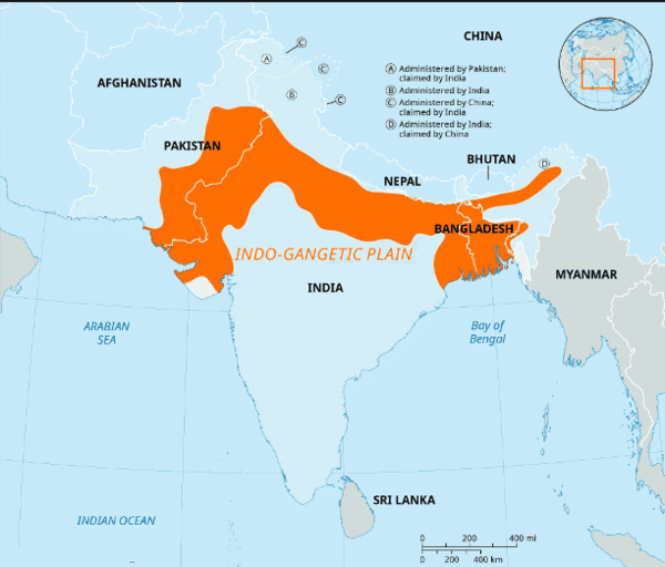
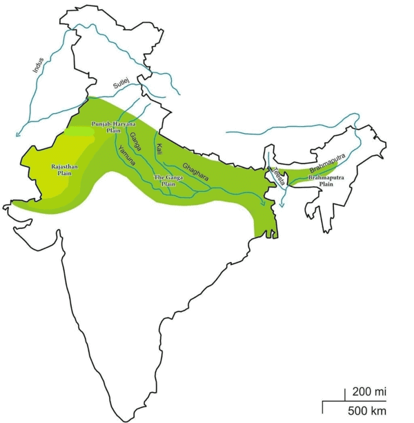
The Indo-Gangetic Plains are primarily formed by the accumulation of ___ sediments transported by major rivers. |
Card: 1 / 36 |
|
True or False: The Indo-Gangetic Plains are the smallest expanse of alluvial plain in the world. |
Card: 3 / 36 |
|
False. The Indo-Gangetic Plains are the largest expanse of alluvial plain globally.
|
Card: 4 / 36 |
|
150-300 km, widening to 500 km in the west and narrowing to 60-100 km in the east.
|
Card: 6 / 36 |
|
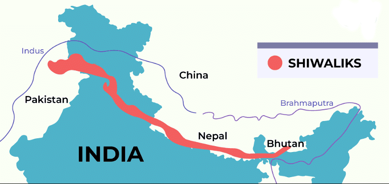
Fill in the blank: The Indo-Gangetic Plains are bordered by the Shiwalik range to the ___ and the Desert to the ___. |
Card: 7 / 36 |
|
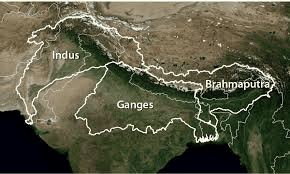
The Indo-Gangetic Plains were primarily formed by sediment deposits from which three river systems? |
Card: 9 / 36 |
|
True or False: The Indo-Gangetic Plains are located entirely within the Himalayan region. |
Card: 11 / 36 |
|
False. The Indo-Gangetic Plains are situated between the Peninsular region and the Himalayas. |
Card: 12 / 36 |
|
Fill in the blank: Rivers from the Himalayas carried substantial sediment loads, which were deposited in the ___ between the Peninsula and the Himalayas. |
Card: 13 / 36 |
|
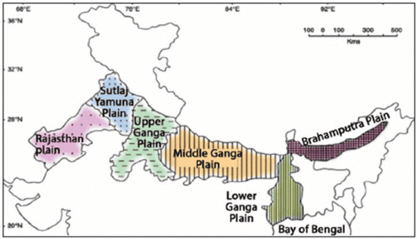
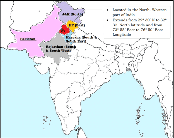
The Rajasthan Plain primarily encompasses the ___ and parts of ___ in Pakistan. |
Card: 15 / 36 |
|
True or False: The Rajasthan Plain is characterized by fertile agricultural land. |
Card: 17 / 36 |
 Unlock all Flashcards with EduRev Infinity Plan Starting from @ ₹99 only
|
|
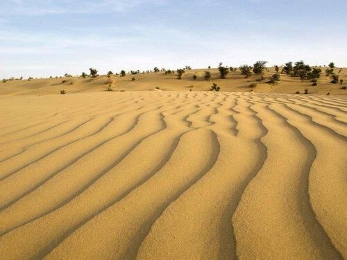
True or False: The eastern part of the Thar desert is characterized by rocky terrain and shifting sand dunes. |
Card: 21 / 36 |
|
True; the eastern part is rocky, while the western part has shifting sand dunes. |
Card: 22 / 36 |
|
The Punjab region is known as the 'Land of Five Rivers' because it is located between which two major rivers? |
Card: 23 / 36 |
|
The Punjab region is located between the Indus River and its tributaries, which include the Beas, Ravi, Chenab, Jhelum, and Satluj rivers. 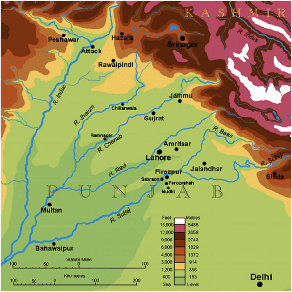 |
Card: 24 / 36 |
|
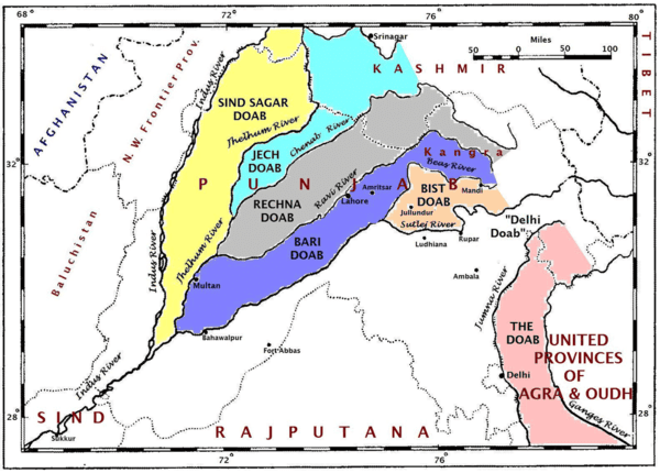
Fill in the blank: The five 'Doabs' of the Punjab Plain include Bist-Jalandhar Doab, Bari Doab, Rachna Doab, Chaj Doab, and ___ Doab. |
Card: 25 / 36 |
|
True or False: The Ganga Plain is the most extensive part of the Indo-Gangetic Plains, covering an area of approximately 3.75 lakh square kilometers. |
Card: 27 / 36 |
|
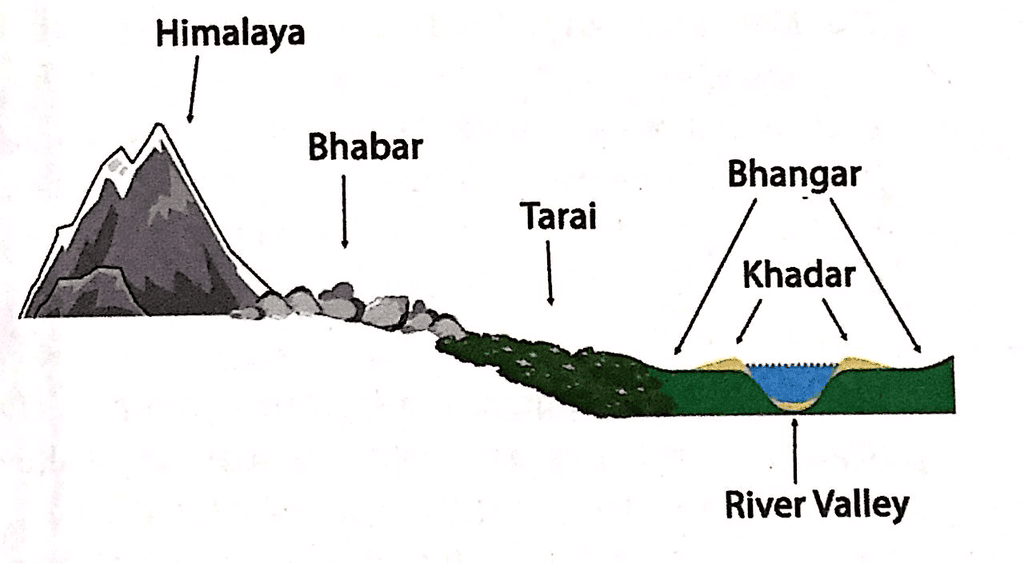
Bet Lands consist of Khadar-rich floodplains where fertile soils are deposited annually, enhancing their fertility. 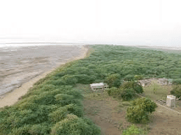 |
Card: 30 / 36 |
|
Fill in the blank: The Upper Ganga Plain is characterized by its rich fertility, supporting crops such as rice, wheat, and ___. |
Card: 31 / 36 |
|
True or False: The Ganga Plain slopes towards the northwest, affecting the flow of water in the region. |
Card: 33 / 36 |
|
Short Answer: Describe the significance of the Chos in the Punjab-Haryana Plain. |
Card: 35 / 36 |
|
Chos are the northern region of the plain near the Shiwalik hills, characterized by significant erosion from numerous streams known as Chhos. 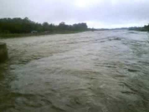 |
Card: 36 / 36 |


