Geography: October 2024 Current Affairs | General Test Preparation for CUET UG - CUET Commerce PDF Download
Little Prespa Lake
Why in News?
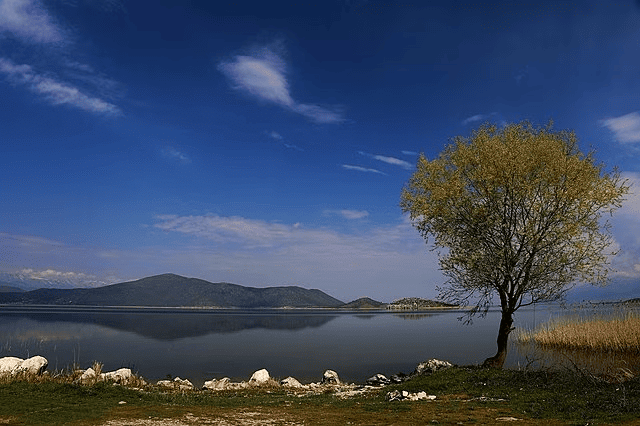
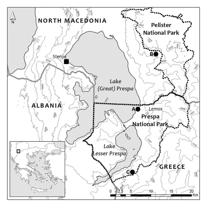
Little Prespa Lake, situated on the border between Albania and Greece, is experiencing a significant decline in water levels. Once a vibrant body of water, it has now devolved into a marshy area, with most of its surface turning into swamps or completely dried land. This transformation is attributed to various environmental challenges, particularly climate change, which has led to higher temperatures, reduced snowfall, and diminished rainfall. Additionally, the diversion of the Devoll River for irrigation purposes in the 1970s has contributed to a considerable loss of water in the lake.
About Lake Prespa
- Lake Prespa is recognized as one of the oldest tectonic lakes in Europe.
- It holds the distinction of being the highest tectonic lake on the Balkan Peninsula, situated at an elevation of 853 meters.
- The Balkan Peninsula is located in southeastern Europe and includes several countries such as Albania, Bulgaria, Croatia, Greece, Moldova, North Macedonia, Romania, Serbia, Slovenia, and Bosnia and Herzegovina.
- The lake is comprised of two distinct lakes:
- Great Prespa Lake, which lies on the border of Albania and Greece.
- Small Prespa Lake, which is located entirely within the territory of Albania.
- Both lakes are nestled between two national parks, which span three different countries:
- Prespa National Park, which encompasses areas in both Greece and Albania.
- Galicica National Park, located in the Republic of North Macedonia.
- The Galicica Mountains serve as a natural barrier, separating Lake Prespa from Lake Ohrid, another ancient and deep lake found in Europe.
Chagos Archipelago and Diego Garcia Island
Why in News?
Recently, the United Kingdom (UK) consented to transfer sovereignty of the strategically vital Chagos Archipelago to Mauritius. Nevertheless, the UK will retain sovereign rights over Diego Garcia Island, which is part of the archipelago.
What are the Key Facts Regarding the Chagos Archipelago?
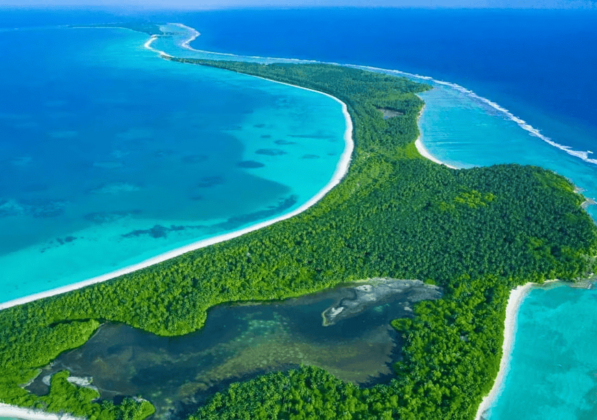
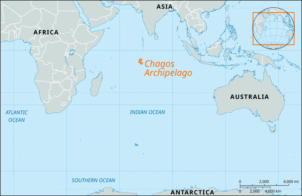
- Geography of the Chagos Archipelago: The Chagos Archipelago is made up of 58 islands and is situated about 500 km to the south of the Maldives in the Indian Ocean.
- History of the Chagos Archipelago:
- The French were the first to colonize Mauritius along with the Chagos Islands in 1715.
- In the late 18th century, the French imported slave labor from Africa and India to establish coconut plantations.
- The British took control of the region in 1814 following the defeat of Napoleon Bonaparte.
- In 1965, the UK established the British Indian Ocean Territory (BIOT), which included the Chagos Islands as a significant part.
- Mauritius’ Claims Over Chagos:
- Chagos was administratively attached to Mauritius, which was another British colony in the Indian Ocean.
- When Mauritius achieved independence in 1968, Chagos remained under British control, with Mauritius receiving a £3 million grant for the detachment.
- Strategic Importance of Chagos and Diego Garcia:
- In 1966, Britain entered an agreement with the United States allowing military use of the BIOT.
- Access to Diego Garcia was restricted, and it became illegal for individuals to enter without a permit.
- Diego Garcia, the largest island in the archipelago, became a fully operational military base in 1986.
- It played a crucial role in US military operations during the "war on terror" following the September 11 attacks in 2001.
- International Pressure on the UK:
- In 2019, the International Court of Justice (ICJ) issued an advisory opinion urging the UK to withdraw its colonial administration from the territory unconditionally within six months.
- The ICJ declared the 1965 detachment of Chagos from Mauritius before its independence as illegal.
What are the Key Details of the UK-Mauritius Agreement?
- Sovereignty Over Chagos: The agreement grants Mauritius full sovereignty over the Chagos Archipelago, with the exception of Diego Garcia.
- Resettlement of Chagossians: Mauritius is now permitted to resettle its citizens on the Chagos Archipelago, excluding Diego Garcia, where approximately 2,000 islanders were evicted for the US naval base.
- Trust Fund: The UK has committed to establishing a new trust fund to benefit the people of Chagos.
Rare Rain in the Sahara Desert
Why in News?
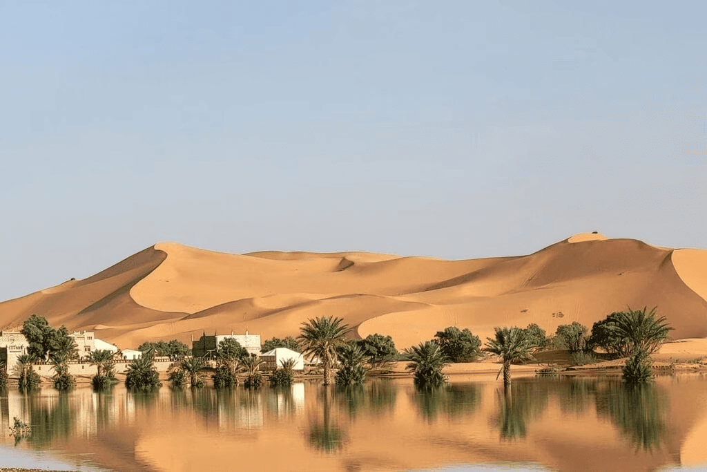
- Recently, an unusual and significant rainfall event has occurred in the Sahara Desert of Morocco, leading to flooding of palm trees and sand dunes. This rain has been linked to a northward movement of the Intertropical Convergence Zone (ITCZ), which has shifted further north than it typically does. This shift has resulted in downpours reminiscent of equatorial regions within the Sahara.
- The ITCZ has generated a strong extratropical cyclone that has swept across northwestern Africa. An extratropical cyclone is a low-pressure system that forms in latitudes outside the tropics and is capable of bringing substantial rainfall. The repositioning of the ITCZ may be associated with record-high ocean temperatures, which are indicative of climate change.
Sahara Desert
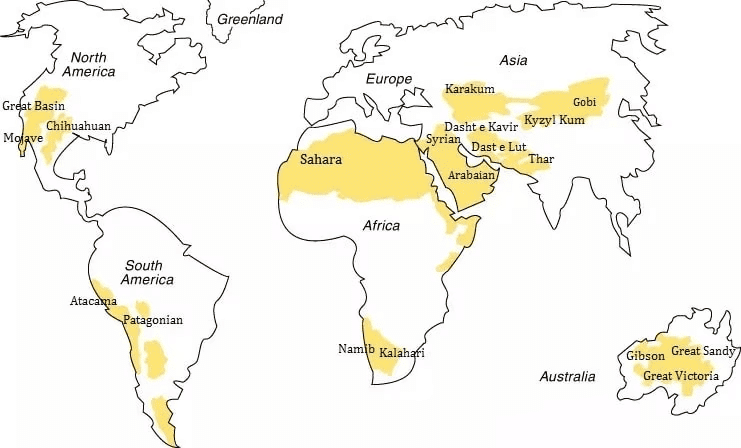
- The Sahara Desert is recognized as the largest hot desert in the world.
- It spans approximately 4,800 kilometers in length.
- The maximum width of the Sahara is about 1,800 kilometers.
- It covers around 31% of the entire African continent.
- The desert stretches across 11 North African countries, including:
- Algeria
- Egypt
- Mali
- Morocco
- Western Sahara
- Tunisia
- Chad
- Libya
- Mauritania
- Niger
- Sudan
Volcanic Eruption and Ionospheric Disturbances
Why in News?
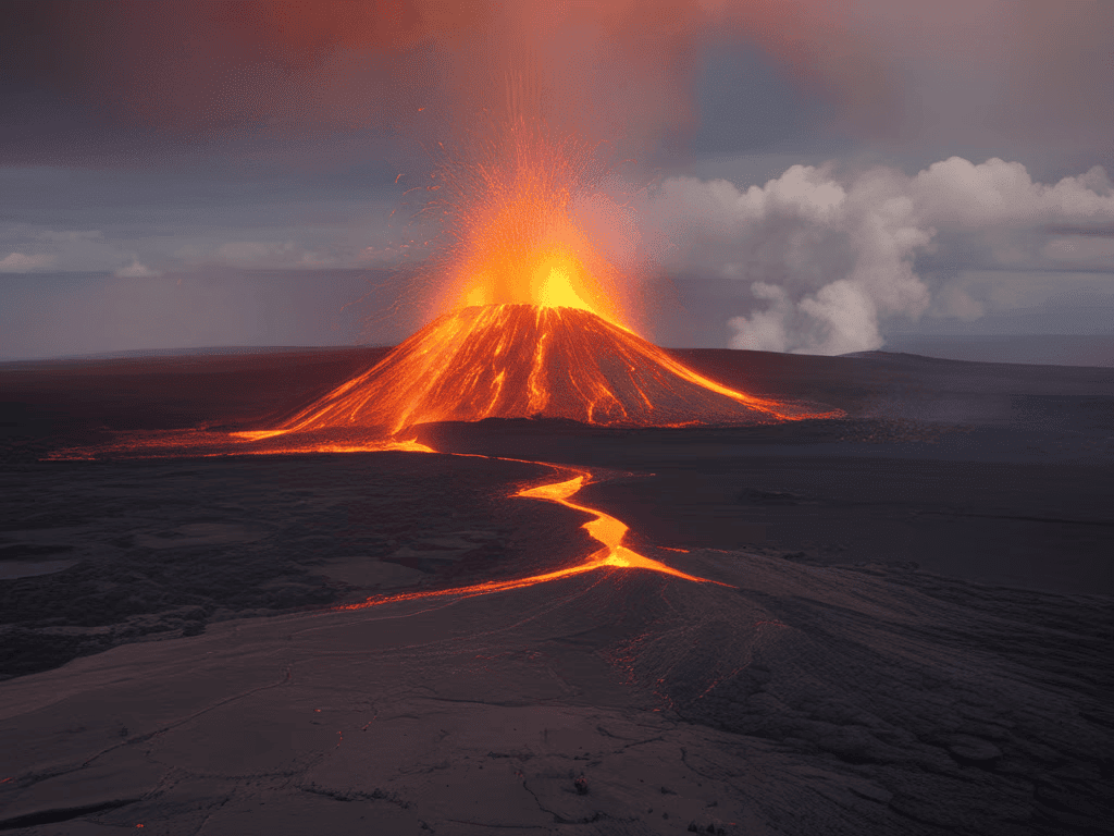
Recently, a new study revealed a connection between the Tonga volcano eruption and the formation of Equatorial Plasma Bubbles (EPBs) over the Indian subcontinent. Tonga volcano is a submarine volcano located in the South Pacific Ocean.
What are the Key Highlights of the Study?
- Volcanic Eruption and Space Weather: The eruption of the Tonga volcano caused disturbances in the ionosphere, contributing to space weather events that can disrupt satellite signals.
- Atmospheric Gravity Waves: The eruption generated significant atmospheric gravity waves that traveled into the upper atmosphere, creating favorable conditions for the development of EPBs. These waves result from the upward push of buoyancy and the downward pull of gravity.
- Plasma Instabilities: Observations indicated the presence of plasma blobs and an increase in the eastward electric field in the ionosphere at dusk, suggesting further disturbances caused by the volcanic activity.
What are Key Points about Equatorial Plasma Bubbles (EPBs)?
- About EPBs: Equatorial Plasma Bubbles are ionospheric phenomena that arise from plasma instabilities, mainly in the equatorial region of the ionosphere. They manifest as areas where plasma is depleted, typically occurring near the magnetic equator during the hours after sunset.
- Extensions of EPBs: Although they originate in the equatorial ionosphere, EPBs can extend into higher latitudes, impacting the global ionosphere up to 15° North and South of the equator.
- Impact on Radio Wave Propagation: As radio waves travel through the ionosphere, irregularities caused by EPBs can scatter them, leading to signal degradation. This is particularly concerning for communication systems that depend on high-frequency signals, such as satellite communications and GPS.
- Seasonal and Regional Variability: EPBs are most commonly observed during the winter solstice (around December 21 or 22) and are least frequent during the summer solstice in June.
What are Key Facts About the Tonga Volcano?
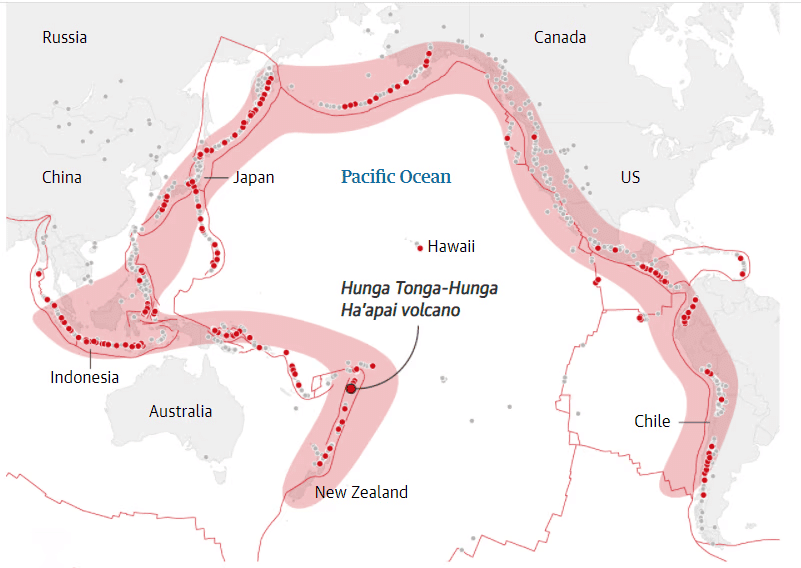
- Location: The Tonga volcano is situated in the western South Pacific Ocean, to the west of the main inhabited islands of the Kingdom of Tonga.
- Geology: It is one of 12 confirmed submarine volcanoes located along the Tofua Arc, which is part of the larger Tonga-Kermadec volcanic arc formed by the subduction of the Pacific Plate beneath the Indo-Australian Plate.
- Part of the Ring of Fire: The Tonga-Kermadec arc is a significant component of the Pacific Ring of Fire, a region known for its high volcanic and seismic activity.
- Submarine Volcano: The Tonga volcano consists of two small uninhabited islands, Hunga-Ha’apai and Hunga-Tonga.
Cyclone Dana
Why in News?
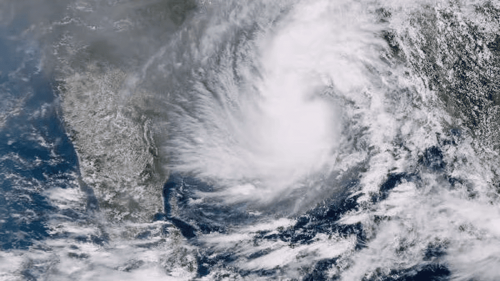
According to the India Meteorological Department (IMD), Cyclone Dana is anticipated to make landfall as a severe cyclone, with wind speeds ranging from 89 to 117 km/h, along the Odisha coast near Bhitarkanika National Park and Dhamra Port.
What are Key Facts About Cyclone Dana?
About
- Emergence: Cyclone Dana is the third cyclone to develop in the North Indian Ocean region and the second to impact the Indian coast in 2024, following Cyclone Remal. It marks the first cyclone occurrence in the post-monsoon season.
- Naming of Dana: The World Meteorological Organization (WMO) indicates that Qatar named Cyclone Dana. In Arabic, "Dana" means 'generosity' and refers to 'the most perfectly sized, valuable, and beautiful pearl.'
Reasons for Intense Rainfall
- Intense Convection: The cyclone exhibits significant convection in its western sector, extending into the upper atmosphere. This process begins when warm, moist air rises, cools, and expands, resulting in moisture condensing into water droplets, forming clouds. As the rising air cools further and condenses, it creates cumulonimbus clouds typical of thunderstorms, fostering conditions for heavy rainfall.
- Warm Moist Air: An influx of warm, moist air into the cyclone's core enhances convection, leading to more intense rainfall. This warm, moist air helps maintain and strengthen the cyclone, resulting in concentrated heavy rain over specific areas.
- Madden Julian Oscillation (MJO) Influence: Currently, the MJO is favorable for convection, contributing to heavy rainfall. It consists of two phases: an enhanced rainfall phase and a suppressed rainfall phase. During the enhanced phase, surface winds converge, causing air to rise, which results in increased rainfall. Conversely, in the suppressed phase, winds at higher altitudes cause air to descend, leading to reduced rainfall.
What Factors are Responsible for Formation of Tropical Cyclones?
- Warm Ocean Waters: A sea surface temperature of at least 27°C is vital for tropical cyclone development. Warm waters supply the necessary heat and moisture to fuel the storm's rising air and convection process.
- Coriolis Force: The Coriolis effect, due to Earth's rotation, is crucial for giving the cyclone its spin. This force is weak near the equator, which is why tropical cyclones typically form at least 5° north or south of the equator.
- Low Wind Shear: Low vertical wind shear (the difference in wind speed and direction at various altitudes) is essential. High wind shear can disrupt the storm's vertical structure, hindering its strengthening.
- Pre-existing Disturbance: A tropical disturbance, such as a low-pressure system, provides the initial organization of air circulation around which a cyclone can form.
- Convergence of Air: The convergence of warm, moist air at the surface that rises and cools is fundamental in developing the cyclone's core, creating clouds and thunderstorms.
What are the Impacts of Cyclone?
- Human Impact: Cyclones can lead to widespread casualties due to strong winds, storm surges, and flooding. Thousands may be evacuated or displaced, resulting in temporary or permanent loss of homes.
- Infrastructure Loss: Strong winds can cause power outages and structural damage, while flooding can disrupt transportation and communication systems.
- Environmental Impact: High winds and storm surges can erode coastlines, destroying natural habitats and human structures along the coast. Cyclones can inflict long-term damage on forests, wetlands, and marine ecosystems, adversely affecting biodiversity.
- Agriculture Loss: Low-lying agricultural areas are at risk of seawater intrusion and waterlogging from heavy rains, which can devastate crops and diminish agricultural productivity. Prolonged rainfall may cause water accumulation in fields, affecting soil health and damaging crops.
What Measures are Needed for Effective Cyclone Disaster Preparedness and Mitigation?
Before Cyclone
- Land Use Planning: Implement land use and building codes to restrict habitation in vulnerable zones, designating these areas for parks or flood diversion.
- Cyclone Early Warning System: Use an Impact-Based Cyclone Warning System to communicate risks and preparedness actions, emphasizing local populations and land use patterns.
- Engineered Structures: Construct buildings designed to withstand cyclone winds, including public infrastructures like hospitals and communication towers.
- Mangrove Plantation: Encourage mangrove planting initiatives to protect coastal areas from storm surges and erosion, involving community participation in these projects.
During Cyclone
- Cyclone Shelters: Establish cyclone shelters in high-risk areas, ensuring they are connected to major roads for quick evacuation and access during emergencies.
- Flood Management: Utilize sea walls, embankments, and drainage systems to control water flow and minimize flooding from storm surges and heavy rainfall.
After Cyclone
- Hazard Mapping: Develop maps indicating the frequency and intensity of cyclones based on historical data, including risks of storm surges and flooding.
- Retrofitting Non-Engineered Structures: Educate communities on retrofitting techniques, such as constructing steep-slope roofs and anchoring poles, to enhance the resilience of non-engineered homes.
Conclusion
The discussion emphasizes the significance of proactive disaster management strategies, including effective early warning systems, land use planning, and community involvement. By improving infrastructure resilience, implementing hazard mapping, and promoting mangrove conservation, we can better prepare for and mitigate the impacts of cyclones on vulnerable coastal regions.
Mains Question
Q: Discuss the factors contributing to cyclone formation and intensification, along with measures needed for effective disaster preparedness and mitigation.
Poleward Shift of Atmospheric Rivers
Why in News?
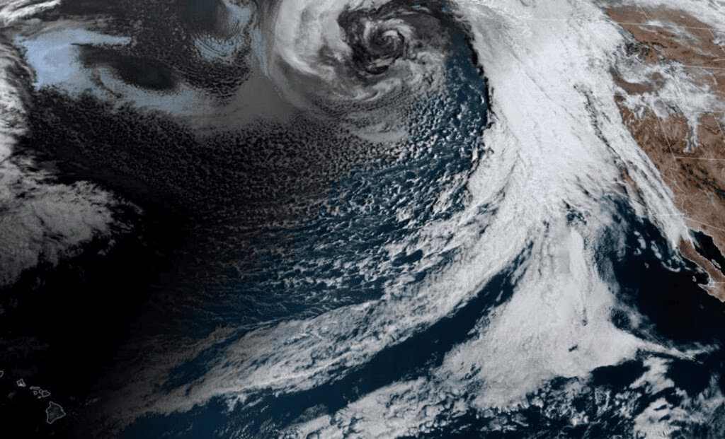
A recent study highlighted that atmospheric rivers have migrated 6 to 10 degrees poleward in the last four decades, affecting global weather conditions. This alteration is leading to heightened droughts in certain areas and intensified flooding in others, posing significant challenges for water resources and climate stability.
Why are Atmospheric Rivers Shifting Polewards?
Sea Surface Temperature Changes
- Atmospheric rivers are moving poleward due to cooling sea surface temperatures in the eastern tropical Pacific, linked to La Niña conditions since 2000.
- This change is causing prolonged droughts in subtropical regions while higher latitudes may experience more extreme rainfall and flooding.
Walker Circulation
- Strengthening Walker circulation over the western Pacific is expanding the tropical rainfall belt and altering atmospheric patterns.
- This results in high-pressure anomalies that redirect atmospheric rivers towards the poles.
Long-term Climate Trends
- The IPCC reports an approximate 1.1°C increase in global temperatures since the pre-industrial era, which has modified jet stream patterns, pushing them poleward.
- This shift affects weather patterns and increases the frequency of extreme events in higher latitudes.
What are Implications of the Poleward Shift of Atmospheric Rivers?
Water Resource Management
- Regions like California and southern Brazil, dependent on atmospheric rivers for essential rainfall, may endure prolonged droughts and water shortages.
- This situation could escalate stress on agriculture and local communities.
Increased Flooding and Landslides
- Areas at higher latitudes, including the US Pacific Northwest and parts of Europe, could face more severe rainfall, flooding, and landslides due to the poleward shift of atmospheric rivers.
Arctic Climate Impact
- The shift of atmospheric rivers into the Arctic region could speed up the melting of sea ice.
- Research indicates that atmospheric rivers are responsible for 36% of the observed increase in summer moisture in the Arctic since 1979.
Predictive Challenges
- Natural processes like the oscillation between El Niño and La Niña complicate predictions regarding atmospheric river behavior.
- Current climate models may not fully account for these variabilities, potentially leading to inaccuracies in forecasting weather patterns and water availability.
What are Atmospheric Rivers?
About
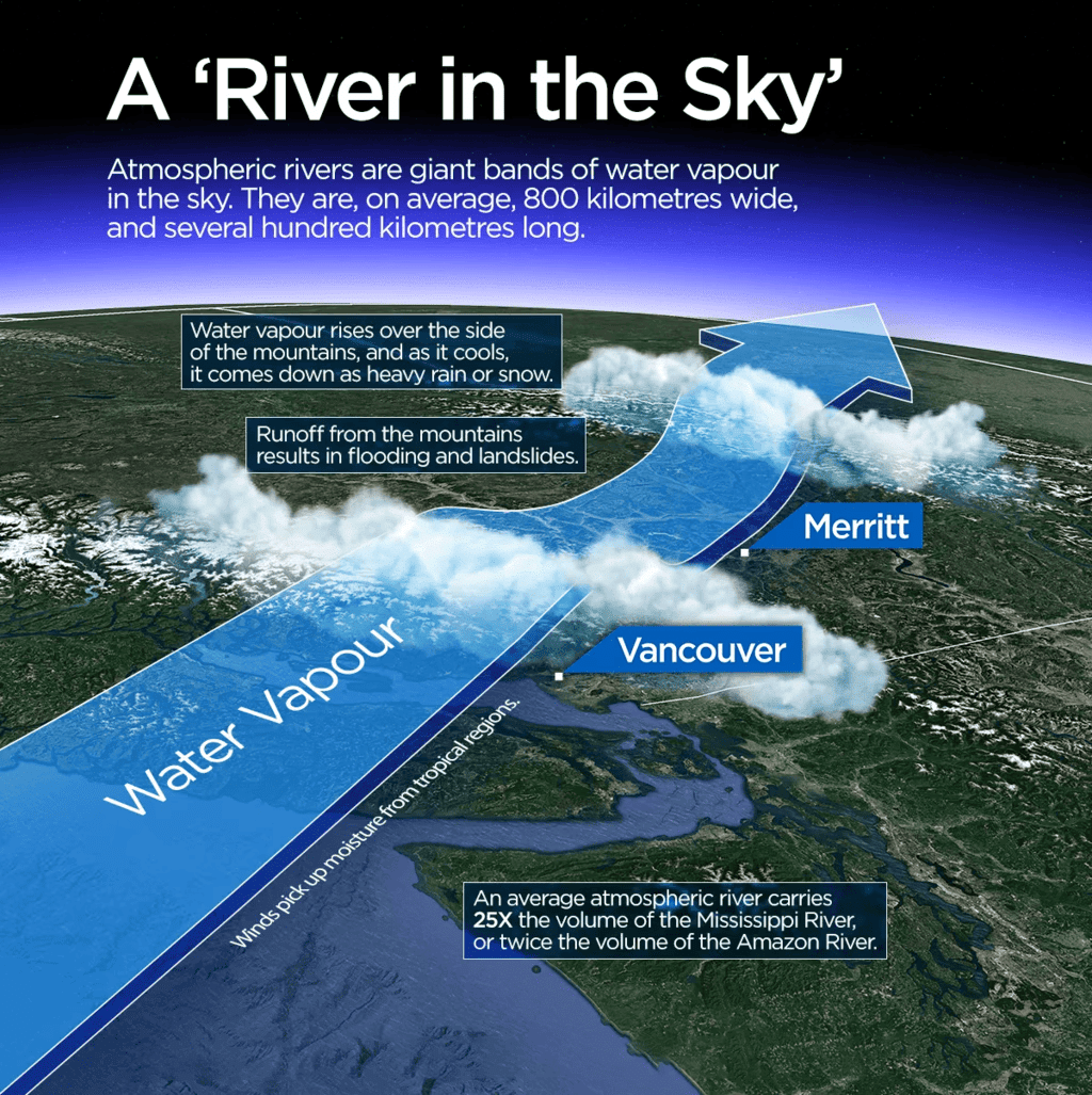
- Atmospheric rivers (ARs) are long, narrow bands of moisture in the atmosphere that carry significant amounts of water vapor from tropical regions to mid-latitude areas.
- For example, the “Pineapple Express” is an atmospheric river that transports warm, humid air from the tropical Pacific near Hawaii to the west coast of North America, especially California.
Conditions Required for Formation of AR
- Strong Low-Level Winds: These winds facilitate the transport of water vapor, with jet streams in the Northern and Southern hemispheres serving as high-speed channels, sometimes reaching speeds of up to 442 km/h (275 mph).
- High Moisture Levels: Sufficient moisture is essential to initiate precipitation processes.
- Orographic Lift: When moist air masses rise over elevated terrain like mountains, they cool as they ascend, leading to cloud formation and precipitation under favorable conditions.
Categories
- Category 1 (Weak): A minor, short-lived event with light rainfall over 24 hours.
- Category 2 (Moderate): A moderate storm that is mostly beneficial but may pose some hazards.
- Category 3 (Strong): A more intense event bringing 5-10 inches of rain over 36 hours, beneficial for reservoirs but may bring some rivers close to flood stage.
- Category 4 (Extreme): Largely hazardous with limited benefits, producing heavy rainfall over several days that can push rivers to flood levels.
- Category 5 (Exceptional): Extremely hazardous, for instance, an atmospheric river over Central California in 1996-97 caused damages exceeding USD 100 billion.
- Key Characteristics:
- Length: Often described as "rivers in the sky," atmospheric rivers can span thousands of kilometers and vary in size and strength, akin to terrestrial rivers.
- Seasonal Occurrence: In the Northern Hemisphere, they typically occur from December to February, while in the Southern Hemisphere, they are most prevalent from June to August.
- For instance, in August 2022, New Zealand experienced an atmospheric river that resulted in record rainfall and flooding. From December 2022 to March 2023, New Zealand was struck by 12 atmospheric rivers, causing intense rainfall and wind damage.
- Water Vapour Capacity: An average atmospheric river carries water vapor equivalent to the flow at the mouth of the Mississippi River, with exceptionally strong ones transporting up to 15 times that volume.
- Variability: Each atmospheric river is unique; their characteristics vary based on factors such as atmospheric instability.
- Atmospheric River on Reaching Land:
- Upon reaching land, moisture-laden air rises and cools over mountains, leading to heavy precipitation as rain or snow.
- Unlike cold winter storms, atmospheric rivers are warm, resulting in quick snowpack melting, runoff, and flooding, which can significantly affect the water supply of regions.
- The Role of Climate Change:
- Climate change is raising average global temperatures, resulting in increased water vapor in the atmosphere, thus enhancing the frequency of damaging atmospheric rivers.
- Studies show that atmospheric rivers in the Southern Hemisphere have shifted poleward by up to 0.72° per decade due to human-induced factors.
- These shifts affect ocean temperatures, atmospheric CO2 levels, and the ozone layer.
- As the planet warms, the intensity and frequency of atmospheric rivers are projected to rise, with extreme rainfall events expected to increase by up to 40% in some regions.
What are the Role of Atmospheric Rivers?
Positive Role
- Redistribution of Freshwater: Atmospheric rivers are responsible for over 50% of the mean annual runoff in many areas. For instance, California depends on ARs for up to 50% of its yearly rainfall, making them essential for both water supply and agriculture.
- Global Water Cycle: Atmospheric rivers are crucial for the global water cycle, affecting both water availability and flood risks, particularly in the western United States. They are vital for replenishing snowpacks and can greatly influence weather patterns.
- Snowpack Formation: In colder months, atmospheric rivers deposit snow, which melts later, maintaining water levels during warmer months. Snowpacks also reflect sunlight, helping to cool the Earth's surface.
Negative Role
- Flooding: Excessive precipitation can saturate soil, leading to floods, especially in areas with insufficient vegetation.
- Landslides and Mudslides: The combination of steep terrain, deforested regions, and heavy rainfall increases the risk of landslides and mudslides.
- Droughts: A scarcity of atmospheric rivers can lead to prolonged droughts, resulting in water shortages, food insecurity, and increased human conflict.
Conclusion
- The poleward shift of atmospheric rivers, driven by climate change, is leading to significant disruptions in global weather patterns.
- Higher latitudes are experiencing increased precipitation and flooding, while lower latitudes may face severe drought conditions.
- To mitigate these impacts, it is essential to enhance weather forecasting, invest in water management infrastructure, and reduce greenhouse gas emissions.
Mains Question
Q: What are atmospheric rivers? How does climate change influence their behaviour and impact?
 |
Download the notes
Geography: October 2024 Current Affairs
|
Download as PDF |
Annular Solar Eclipse
Why in News?
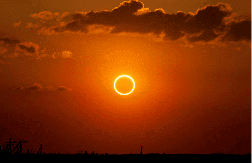
An annular solar eclipse will be seen in some parts of South America on October 2, 2023. This event will not be visible in India.
What is a Solar Eclipse?
A solar eclipse happens when the Moon comes between the Earth and the Sun, blocking the Sun's light either completely or partly, which creates a shadow on certain areas of the Earth.
There are four main types of solar eclipses:
- Total Solar Eclipse: This occurs when the Moon fully covers the Sun, making the sky go dark. People located in the path of a total solar eclipse can see the Sun's corona (the outer layer of the Sun's atmosphere), which is usually hidden by the bright light of the Sun.
- Annular Solar Eclipse: This takes place when the Moon is farthest from the Earth. In this case, the Moon does not completely cover the Sun, creating a bright ring of light around the Moon. For instance, on October 2, 2023, people in parts of South America will see this type of eclipse.
- Partial Solar Eclipse: This type occurs when the Moon only covers a portion of the Sun, making it appear as a crescent shape. During both partial and annular eclipses, areas outside the Moon’s umbra (the darkest part of its shadow) experience a partial eclipse. This is the most common type of solar eclipse.
- Hybrid Solar Eclipse: This is the rarest type of solar eclipse, where the eclipse changes between total and annular as the Moon's shadow travels across the Earth. Some regions will see a total eclipse, while others will see an annular eclipse.
Frequency of Solar Eclipses
A solar eclipse can only happen during a new moon, when the Moon and Sun are aligned on the same side of the Earth.
A new moon occurs about every 29.5 days, which is the time it takes for the Moon to complete one orbit around the Earth.
- Despite the new moon happening every month, solar eclipses do not occur every time. They take place two to five times a year, but not every new moon leads to an eclipse.
- The reason solar eclipses don’t happen every month is because the Moon's orbit is tilted by about 5 degrees compared to the Earth's orbit around the Sun.
- This tilt means that the Moon’s shadow usually misses the Earth.
- A solar eclipse can only occur when the Moon crosses specific points in its orbit, known as nodes, where the Moon's path meets the plane of Earth's orbit around the Sun.
- When a new moon takes place at one of these nodes, a solar eclipse can happen.
Aurora
 Why in News?
Auroras are bright natural displays that happen close to the North Pole (known as Aurora Borealis) and the South Pole (called Aurora Australis). They are created when charged particles from the Sun collide with the Earth’s magnetic field and atmosphere.
Aurora Borealis
- Commonly referred to as the Northern Lights, this phenomenon occurs in the northern part of the world, especially in areas near the Arctic Circle.
- Countries where you can see this include:
- Russia
- Norway
- Sweden
- Finland
- Iceland
- Canada
- Alaska
Aurora Australis
- Known as the Southern Lights, this event takes place in the southern part of the world, mainly around the Antarctic Circle.
- It can be viewed in:
- Australia
- New Zealand
- Antarctica
- Some areas in southern South America
Characteristic features of auroras
- Timing and Frequency: Auroras are best seen in the winter and around the equinoxes. Their activity increases during times of high solar activity, like during solar storms or flares.
- Shapes and Movements: Auroras can take on many forms, such as arcs, curtains, rays, and spirals. They often shift and change their shapes quickly because of their interaction with Earth's magnetic field.
Colors of Aurora
- Altitude and Atmospheric Composition: At higher elevations, oxygen atoms emit red glows, while at lower elevations, we see more common green-yellow colors.
- Oxygen and Nitrogen: In lower areas, oxygen atoms create the typical green-yellow shades. In contrast, the reddish and bluish lights near the lower edges of auroras are produced when ions hit nitrogen atoms.
- Rare Colors: When ions interact with hydrogen and helium atoms, they can generate blue and purple auroras. However, these colors are seldom seen by the human eye since they fall outside the visible spectrum.
Trigger and Formation of aurorasSignificance and importance of Auroras
- Solar Wind Generation: The solar wind is made up of fast-moving particles, mainly electrons and protons, that come from the sun's strong activity. This wind consists of hot gases that escape from the sun's surface.
- Interaction with Earth’s Magnetic Field: While most of the solar wind is redirected away, some particles get caught in Earth's magnetosphere and are pulled toward the magnetic poles.
- Trapping in the Ionosphere: The particles that are trapped move into the ionosphere, where they gather in circular regions around the geomagnetic poles.
- Collisions with Atmospheric Gases: When these trapped particles collide with gases in the atmosphere, such as oxygen and nitrogen, they transfer energy to these atoms, which results in the production of light.
- Colorful Displays: At lower altitudes, oxygen emits green and yellow colors, while at higher altitudes, it can produce red light. Additionally, collisions with nitrogen can generate blue or purple colors.
- Influence of Solar Activity: Events like geomagnetic storms, which are caused by solar activities such as coronal mass ejections (CMEs) and solar flares, increase the occurrence of auroras. During times of strong solar activity, auroras can be seen farther south than usual and tend to have more vivid colors.
Significance and importance of Auroras
- Understanding the upper atmosphere of Earth, which includes its density, composition, flow speeds, and the strength of electrical currents present.
- Study of solar activity: Auroras are directly connected to solar events such as solar flares and coronal mass ejections (CMEs). Observing auroras can aid in predicting and reducing the impact of solar activity on technologies like satellites and GPS systems.
- Cultural and historical significance: Various cultures have seen and honored auroras throughout history, often featuring them in their myths and folklore. For instance, the Inuit believed that auroras were the spirits of their ancestors.
- On May 10th, 2024, due to four strong Coronal Mass Ejections (CMEs), auroras displayed beautiful red colors that could be seen from Ladakh.
- Auroras are not just stunning natural wonders; they also contribute to our knowledge of Earth’s magnetosphere, solar activity, and the upper atmosphere, making them an important area of research.
Coastal Flooding Due to Rise in Sea Levels
Why in News?
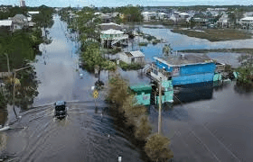
Global warming is causing sea levels to rise, which is leading to more frequent flooding in certain regions. Scientists have identified that this situation is making it harder for many tree species to grow in coastal areas.
About
- The research paper indicates that rising sea levels and coastal flooding may actually strengthen the resilience of some coastal tree species, while harming others.
- One specific species, the American holly (Ilex opaca), showed a growth increase in response to these conditions.
- In contrast, loblolly pine (Pinus taeda) and pitch pine (Pinus rigida) trees experienced negative effects due to higher water levels.
- The reason for this difference lies in the structure of tree rings, which are made up of water vessels.
- When a tree gets plenty of rain, along with the right amount of sunlight and temperature, it tends to develop more water vessels.
- However, a heavy rainfall or flooding can disrupt this process, making it difficult for the plant to grow normally.
Sea-level Rise Accelerating
- In 1993, sea levels were rising by about 2 mm per year.
- This rate has now doubled, and climate experts predict that the number of floods in coastal areas will increase three times by the year 2050.
- The main reason for this is climate change, which is caused by burning fossil fuels and releasing greenhouse gases.
- This has led to a continuous rise in global temperatures.
- Consequently, both sea surface temperatures and glacier melting have increased.
- This has resulted in higher sea levels, which pose a significant threat to coastal cities across the globe, including those in India.
Concerns with Increase in Sea Level
- Flooding: Coastal areas are experiencing more frequent and severe floods, which pose risks to infrastructure, homes, and people's livelihoods.
- Displacement: Rising sea levels are forcing communities to move, resulting in displacement and potential conflicts over limited resources.
- Saltwater Intrusion: Increased salinity is contaminating freshwater supplies, which negatively impacts drinking water availability and agricultural practices.
- Economic Impact: Coastal industries, including fishing and tourism, are heavily affected, leading to job losses and economic challenges in these regions.
- Biodiversity Loss: Important ecosystems, such as mangroves and coral reefs, are under threat, which harms biodiversity and the valuable services these ecosystems provide.
- Health Risks: Flooding increases the risk of spreading waterborne diseases, which poses health threats to affected populations.
India’s Efforts to Combat Climate Change
- Renewable Energy Expansion: India has set high goals for increasing its renewable energy production, aiming to boost its capacity significantly.
- Investment in Solar and Wind: The country has made substantial investments in solar and wind energy projects to reduce its dependence on fossil fuels and decrease greenhouse gas emissions.
- International Commitments: As a participant in the Paris Agreement, India has pledged to lower its carbon intensity and raise the proportion of energy from non-fossil fuel sources in its overall energy supply.
- Electricity Demand Goals: India plans to fulfill 50% of its electricity needs with renewable energy sources by the year 2030.
- Afforestation and Forest Conservation: Understanding the importance of forests in absorbing carbon and regulating the climate, India has launched programs aimed at increasing forest cover, restoring damaged lands, and encouraging sustainable forest management methods.
- Clean Transportation: The country is encouraging the use of electric vehicles (EVs) and has set a goal for EVs to make up 30% of the vehicle market by 2030.
- Government Support: The Indian government has introduced incentives and subsidies to promote the manufacturing and use of electric vehicles.
- Climate Resilience: India is investing in strategies to improve its ability to adapt to climate change, focusing especially on vulnerable areas like agriculture, water resources, and coastal regions.
- International Cooperation: India actively engages in global discussions and collaborations on climate change through participation in initiatives such as the International Solar Alliance and the Coalition for Disaster Resilient Infrastructure.
Northeast Monsoon (Retreating Monsoon)
Why in News?
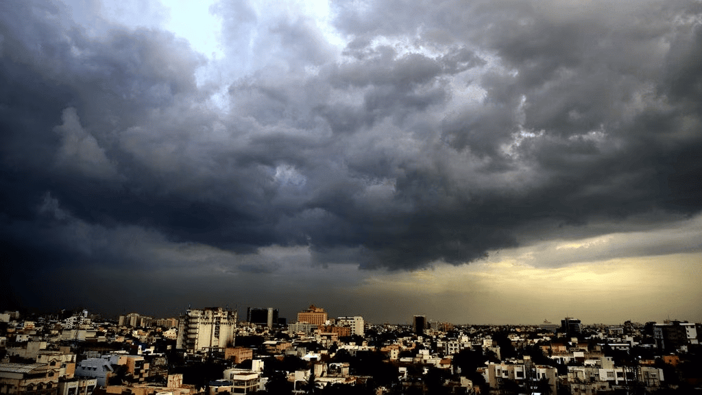
The North East Monsoon is an important weather pattern that affects southeastern India. This monsoon occurs from October to December. It is essential for bringing much-needed rainfall, particularly to Tamil Nadu and nearby regions. The North East Monsoon also helps to cool down temperatures as the area transitions from the rainy season to winter.
About Indian Monsoon
- The Indian Monsoon is an important weather event that is known for its seasonal changes in wind direction, which results in heavy rainfall across the Indian subcontinent.
- The Southwest Monsoon usually starts in June, bringing winds full of moisture from the Indian Ocean, and lasts until September.
- The Northeast Monsoon takes place from October to December, impacting the southeastern region of India.
About North East Monsoon
- Northeast Monsoon, also called the Retreating Monsoon, takes place from October to December.
- This monsoon is marked by winds that blow from the northeast.
- It mainly impacts southeastern India, particularly Tamil Nadu, and some areas along the eastern coast.
- During this time, the northeast trade winds carry moisture from the Bay of Bengal, leading to rainfall.
- The Northeast Monsoon plays an important role in refilling water sources in regions that receive less rain during the Southwest Monsoon.
Characteristics of North East Monsoon
- Timing and Duration: Occurs from October to December, marking the change from the rainy season to winter after the Southwest Monsoon.
- Wind Direction: Characterized by northeast trade winds blowing from the northeast towards the Indian subcontinent.
- Rainfall Distribution: Mainly impacts the southeastern coast of India, especially Tamil Nadu and parts of Andhra Pradesh. Rainfall during this period is usually less than that of the Southwest Monsoon but can still be significant in these areas.
- Impact on Weather: Brings cooler temperatures, helping to lower the heat from the previous summer. It also helps to refill water supplies in places that did not get much rain during the Southwest Monsoon.
- Rain Shadow Effect: The eastern coast of India, particularly Tamil Nadu, receives a lot of rain, while areas to the west may be quite dry.
- Seasonal Variability: Rainfall can vary each year, with some years having much more rain than others.
Mechanism of North East Monsoon
- During October and November, the sun moves south, causing monsoon troughs or low-pressure areas to shift southward.
- This movement leads to the weakening of troughs over the Northern Plains.
- As the Southwest Monsoon winds withdraw, a high-pressure system forms in that region.
- Cold winds then flow down from the Himalayas and the Indo-Gangetic plains towards the vast Indian Ocean.
- By early October, the monsoons have completely withdrawn from the Northern Plains.
- Following this, the Northeast Monsoon begins to impact Southeastern India.
October Heat
- The period of October to November represents a shift from a hot, rainy season to the dry winter weather.
- The retreat of the monsoon brings clear skies and an increase in temperatures.
- During the day, temperatures can be quite high, while the nights tend to be cool and comfortable.
- Despite the cooler nights, the ground remains moist, leading to hot and humid conditions during the daytime.
- This uncomfortable weather is often referred to as ‘October heat’.
Cyclones during North East Monsoon
- After October 15, temperatures start to drop quickly, especially in Northern India.
- Low-pressure areas that are usually found in north-western India begin to move toward the Bay of Bengal by early November.
- This movement is linked to cyclonic depressions, which are often called tropical cyclones.
- These storms typically form over the Andaman Sea and the Bay of Bengal.
- At times, they move across the eastern shores of India, bringing heavy and widespread rainfall.
- These cyclones can be very damaging and often lead to significant harm to both lives and property.
- The densely populated deltas of the Godavari, Krishna, and Kaveri rivers are often hit by these storms.
Impact of North East Monsoon on Tamil Nadu and Adjoining Areas
- The Northeast Monsoon brings rain to Tamil Nadu and nearby areas in Andhra Pradesh south of the Krishna Delta, as well as Kerala. This is sometimes referred to as the second rainy period in Kerala.
- As the monsoon retreats, it collects moisture while moving over the Bay of Bengal, which leads to rainfall in these regions.
- The winter rains contribute to the growth of dry evergreen forests along the coast of Tamil Nadu.
Break in Monsoon
- The monsoon season often experiences breaks in rainfall, leading to both wet and dry periods during July and August.
- This situation is referred to as a break in monsoon:
- In northern India, rainfall may be less frequent if rain-producing storms do not occur often along the monsoon trough or the Inter-Tropical Convergence Zone (ITCZ) in this area.
- On the west coast, dry spells happen when winds move parallel to the coastline.
- An increase in the strength of Tibetan high pressure is another key factor for these dry periods.
- This high pressure causes the monsoon trough to shift northward.
- During these breaks, the trough's axis settles at the base of the Himalayas, resulting in heavy rainfall in the foothills on the southern slope, while the Gangetic Plains may remain dry.
Conclusion
The Northeast Monsoon, spanning from October to December, plays a vital role in southeastern India by delivering essential rainfall and cooler temperatures. While it aids in restoring water supplies, it also brings variability and may lead to cyclonic depressions with intense rainfall. Grasping the nature of this monsoon is crucial for efficient management and preparedness, especially in areas vulnerable to its unpredictable patterns.
|
164 videos|607 docs|942 tests
|
FAQs on Geography: October 2024 Current Affairs - General Test Preparation for CUET UG - CUET Commerce
| 1. What are the key features of Little Prespa Lake and its significance in the region? |  |
| 2. How does the Chagos Archipelago contribute to global biodiversity? |  |
| 3. What are the implications of rare rain events in the Sahara Desert? |  |
| 4. How do volcanic eruptions affect the ionosphere? |  |
| 5. What are the effects of coastal flooding due to rising sea levels? |  |


