Physical Geography of India (Part- 1) - UPSC PDF Download
PHYSIOGRAPHY OF INDIA
Physiography of an area is the outcome of structure, process and the stage of development. India is characterised by great diversity in its physical features.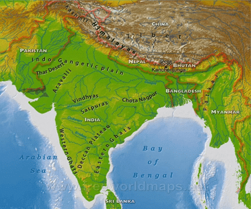
Physical map of India
India can be divided into the following physiographic divisions
- The Himalayan mountains
- The Northern plain
- The Peninsular plateau
- The Indian desert
- The Coastal plains
- The Islands
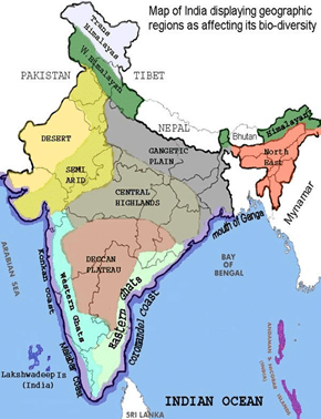
Physiographic divisions
The Himalayas: They consist of parallel mountain ranges. The great Himalayan range includes the great Himalayas, the trans Himalayas and the Shivalik. In the north west, their orientation is from north-west to south-east. In Darjeeling and Sikkim they lie in an eastwardly direction while in Arunachal they are from south-west to north-east. In Nagaland, Manipur and Mizoram they are in north-south direction.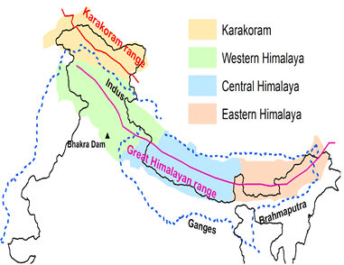
The Himalayas
The Himalayas can be further divided into
- The Kashmir or north western: It comprises ranges like Karakoram, Ladakh, Zaskar and Pir panjal. Important glaciers include Baltoro and Siachen. Important passes include the Zoji La on the great Himalayas, Banihal on the Pir panjal, Photu la on the Zaskar and Khardung La on the Ladakh range.

Kashmir Himalayas
Some important freshwater lakes such as Dal and Wular and saltwater lakes like Pangong tso and Tso moriri are in this region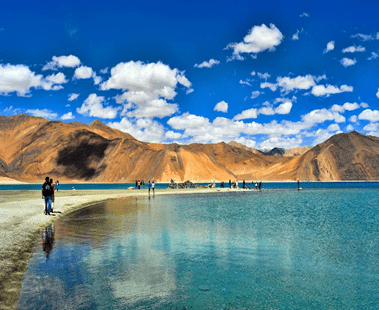
Pangong tso
- The Himachal and Uttarakhand Himalayas: It lies between the ravi in the west and the kali in the east. It is drained by the Indus and the Ganga river systems. It is distinguished by the ‘DUN’ formations like the Chandigarh-Kalka dun and Dehradun. They are inhabited by the Bhutias who migrate to the ‘Bugyals’ which are the summer grasslands. The ‘valley of flowers’ is located here.
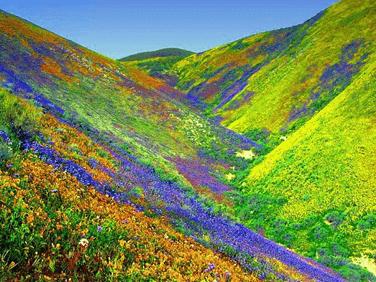
Valley of flowers in Uttarakhand
- The Darjeeling and Sikkim Himalayas: these are known for their fast flowing rivers like ‘TEESTA’ and their Tea plantations due to good rainfall all year and mild winters. They are also known for ‘DUAR’ formations. The Shiwaliks are absent here.
- The Arunachal Himalayas: They extend from east of Bhutan upto the Diphu pass in the east.Important rivers include Kameng,Dihang, Dabang and Subansiri. Tribal communities include the Monpa, Dafla, Abor, Miri and Mishmi. They practiced ‘Jhumming’ which is the slash and burn cultivation.
- The Eastern hills and mountains: In the north they are known as Patkai bum, Naga hills, Manipur hills and in the south as Mizo hills. The Barak is the most important river here. Mizoram as known as the ‘Molasses Basin’
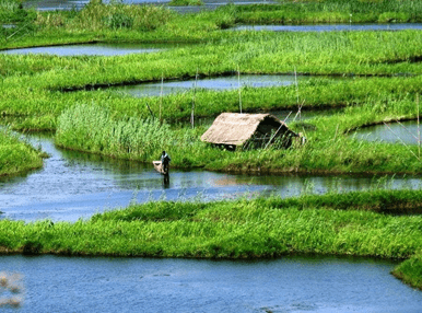
LOKTAK lake in Manipur.
The Northern plains: They are formed by the alluvial deposits brought by the Indus, Ganga and the Brahmaputra. They are also as the Indo-Gangetic plains. The average width is 150-300kms and they extend for 3200kms from east to west. Depth of alluviam deposits varies from 1000-2000kms.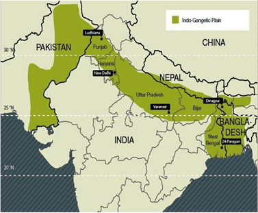
Indo-Gangetic plains
THE PLAINS ARE DIVIDED INTO
- BHABAR: It is a narrow belt ranging between 8-10km and parallel to the shiwaliks. The rivers deposit their load of rocks and boulders and sometimes disappear in this region.
- TARAI: It lies south of the bhabar with a width of 10-20kms where most of the streams and rivers re-emerge and create a swampy, marshy condition known as ‘TARAI’. It has a good growth of natural vegetation and varies wildlife.
- ALLUVIAL PLAINS: These are divided into the KHADAR and BHANGAR. Old alluviam is bhangar and the new one close to the river bank is khadar. These plains have mature stage of fluvial erosional and depositional landforms such as sand bars, meanders, ox-bow lakes and braided channels.
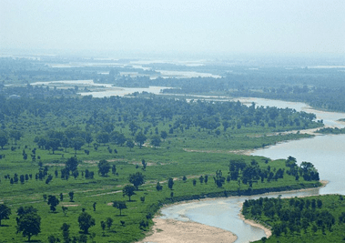
Ganga plains near Haridwar
FAQs on Physical Geography of India (Part- 1) - UPSC
| 1. What are the major physical features of India? |  |
| 2. How does the Himalayan mountain range influence India's climate? |  |
| 3. What is the significance of the Indo-Gangetic Plains in India? |  |
| 4. How does the Thar Desert impact the surrounding regions? |  |
| 5. What are the coastal regions of India known for? |  |


