Savindra Singh Summary: Continents and Oceans | Geography Optional for UPSC PDF Download

Introduction
 Geological Landscapes
This chapter delves into the origin and evolution of continents and ocean basins, emphasizing their fundamental differences. It explores the formation of these landmasses, their distribution across the planet, and the geological processes that have shaped them over time.
Characteristics of Continents and Ocean Basins
Overview
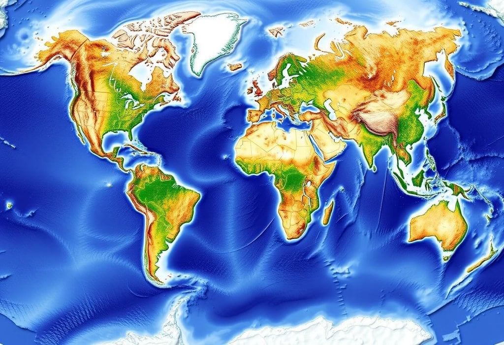
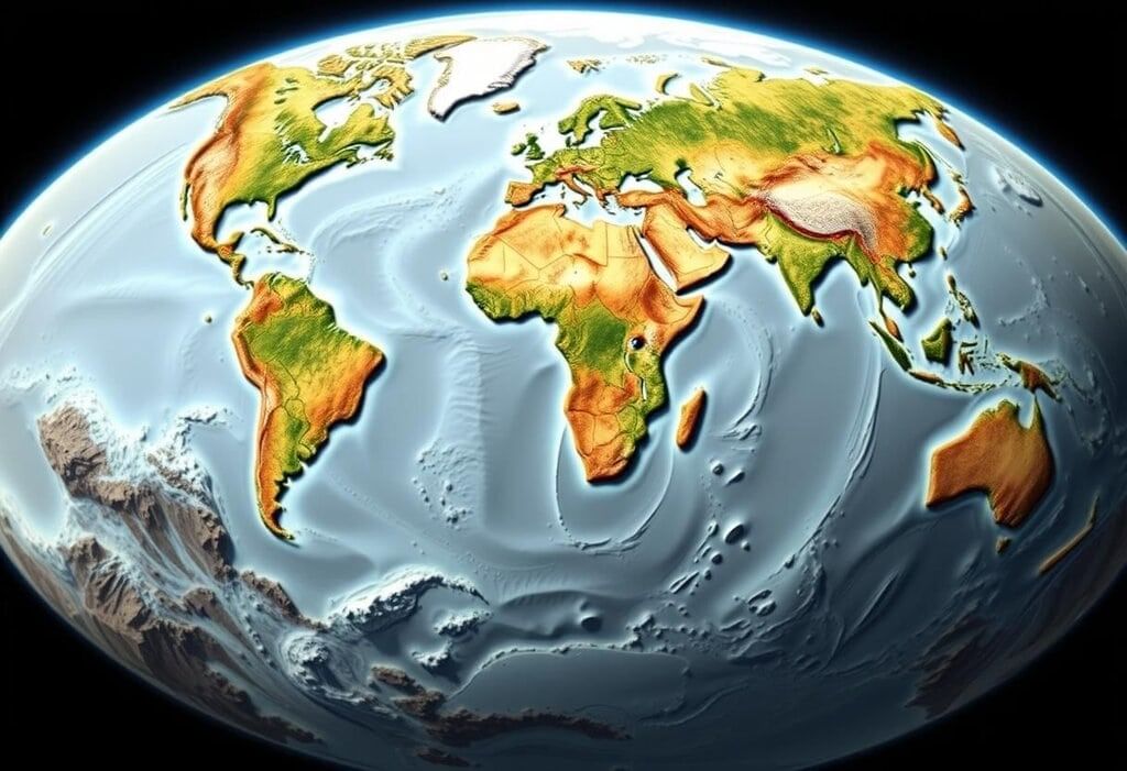
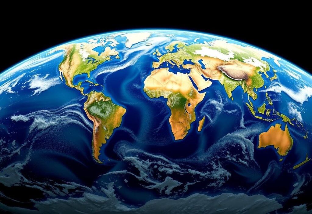
- Continents encompass 29.2% of the Earth's surface area.
- Oceans cover a substantial 70.8% of the Earth's surface.
- Both continents and oceans exhibit unique patterns that offer insights into their origins and development.
Main Features of the Earth
 Geographical Diversity
Distribution of Land and Water. The northern hemisphere is predominantly land, with land covering 75% of its area. In contrast, the southern hemisphere is primarily water, with oceans covering 90.6% of its surface.
Shape of Continents and Oceans. Most continents are shaped like triangles, with their bases in the north and points in the south. This includes continents like the Americas, Eurasia, and Africa. Australia and Antarctica are exceptions. Similarly, oceans like the Atlantic, Indian, and Pacific Oceans have their bases in the south and points in the north.
Polar Geography. The North Pole is surrounded by ocean, while the South Pole is encircled by the landmass of Antarctica.
Antipodal Geography. There are some interesting exceptions, such as Patagonia being opposite North China and New Zealand being across from the Iberian Peninsula. However, about 95% of land is located opposite water bodies.
Size of the Pacific Ocean. The Pacific Ocean is immense, covering one-third of the Earth's surface.
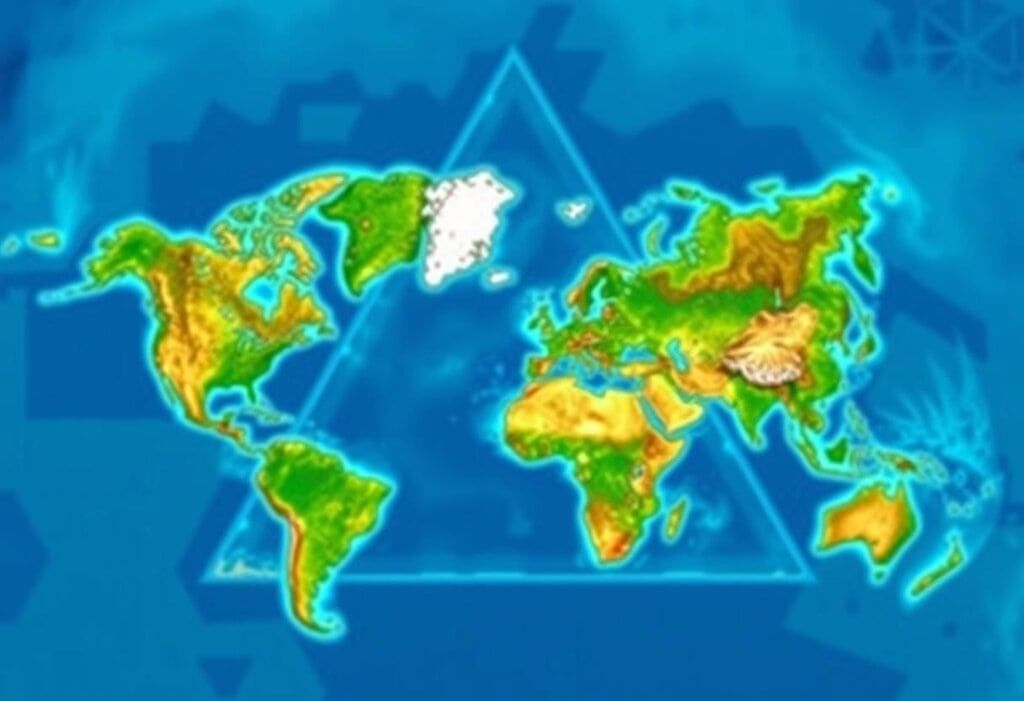
Tetrahedral Hypothesis by Lowthian Green
 Geometric Landscapes
Proposed in 1875, the Tetrahedral Hypothesis by Lowthian Green uses geometric principles to explain the distribution of continents and oceans.
Key Concepts
- Geometric Basis:. sphere under uniform pressure changes into a tetrahedron, which has the least volume for its surface area.
- Earth’s Evolution: Earth started as a sphere, cooled down, and shrank, with the crust solidifying first. As the Earth contracted, it caused the crust to collapse into a tetrahedron-like shape.
- Land and Ocean Distribution: Oceans formed on the flat faces of the tetrahedron (Pacific, Atlantic, Indian, Arctic), while continents formed at the points (e.g., Laurentian, Baltic, Siberian, Antarctic shields).
- Explanations: This hypothesis explains the presence of more land in northern areas, triangular shapes, polar arrangements, opposite positions, and the size of the Pacific Ocean.
Evaluation
- Strengths. Clearly outlines many features of distribution.
- Weaknesses. Fails to consider the Earth's balance as a tetrahedron, overlooks the impact of quick rotation on tetrahedral shapes, and assumes continents and oceans are unchanging, which contradicts plate tectonics.
Continental Drift Theory (F.B. Taylor)
 Tectonic Dynamics
Proposed in 1910 by F.B. Taylor, this theory sought to explain the formation of folded mountains during the Tertiary period by suggesting horizontal movement of continents.
- Initial State. During the Cretaceous period, there were two landmasses, Lauratia in the north and Gondwanaland in the south, both composed of sial and floating over sima.
- Driving Force. Tidal forces from the moon prompted movements towards the equator and westward.
- Outcomes. Movement towards the equator led to the formation of the Himalayas, Alps, and Caucasus, while westward movement resulted in the Rockies and Andes. This splitting also created seas like Baffin Bay, Labrador Sea, and the Indian Ocean.
- Strengths. Challenged the notion of permanent continents and introduced the idea of horizontal movement.
- Weaknesses. Proposed displacement distances may be excessive, the explanation of tidal forces is inadequate (potentially affecting Earth's rotation), and the theory relies on external forces rather than internal ones.
Continental Drift Theory by Alfred Wegener
 Continental Drift
In 1912, Alfred Wegener proposed the Continental Drift Theory to explain past climate changes through the movement of continents. He suggested that all continents were once joined together in a supercontinent called Pangaea.
Pangaea and its Surroundings
- During the Carboniferous period, the continents came together to form Pangaea, which was surrounded by the Panthalasa Ocean. This supercontinent consisted of two main parts: Lauratia in the north and Gondwanaland in the south.
Forces Behind Continental Movement
- The movement of continents towards the equator was caused by gravitational and buoyancy forces. Additionally, the westward movement of continents was influenced by tidal forces from the sun and the moon.
Process of Continental Drift
- Splitting of Pangaea. During the Mesozoic era, Pangaea began to split apart, leading to the formation of the Tethys Sea.
- Movement to Current Locations. By the Pliocene epoch, the continents had moved to their present-day locations. This period also saw the formation of the Atlantic and Indian Oceans, while the Panthalasa Ocean shrank into what is now the Pacific Ocean.
Evidence Supporting the Theory
- Geographical Evidence. The matching coastlines of the Atlantic Ocean, resembling a jigsaw puzzle.
- Geological Evidence. Similar mountain ranges, such as the Caledonian and Hercynian mountains, found on opposite sides of the Atlantic Ocean.
- Paleontological Evidence. Identical fossils, like glossopteris, discovered on different continents, indicating they were once connected.
- Climatic Evidence. Signs of Carboniferous glaciation in Gondwanaland, suggesting it was once located in a colder region.
- Geodetic Evidence. Measurements showing Greenland drifting westward at a rate of 20 cm per year.
- Behavioral Evidence. Observations of lemming populations indicating potential movements, though not strictly migratory.
Formation of Mountain Ranges and Island Arcs
- Mountain Building. The western mountain ranges, such as the Rockies and the Andes, were formed due to the westward drift of continents. Additionally, the equatorward movement of continents contributed to the creation of Alpine mountain ranges.
- Island Arcs. These were formed by continental margins that lagged behind the main landmasses. Examples include Japan and the West Indies, where the continental margins moved at a different pace compared to the rest of the continent.
Glaciation and its Explanation
- Glaciation during the Carboniferous period is explained by the location of Pangaea near the South Pole. This positioning would have allowed for the formation of large ice sheets and glaciers, contributing to the climatic conditions observed during that time.
Strengths and Weaknesses of the Theory
- Strengths. The theory was supported by comprehensive evidence and challenged the prevailing notion of the permanence of continents. It laid the groundwork for the development of plate tectonic theory, which further explained the dynamics of Earth's lithosphere.
- Weaknesses. Critics pointed out the insufficient strength of the forces proposed by Wegener, particularly the tidal forces, which were deemed too weak to cause such massive movements. Additionally, the interactions between the sial (continental crust) and sima (oceanic crust) were considered inconsistent. The fit of the Atlantic coast was also seen as incomplete, and there was a lack of detailed information about the period before the Carboniferous.
Plate Tectonic Theory
 Tectonic Dynamics
Developed in the 1960s, plate tectonic theory verifies continental drift through the movement of lithospheric plates, driven by sea-floor spreading and paleomagnetism.
Plates. The lithosphere consists of six major plates (like the Eurasian and Pacific plates) and about 20 smaller plates that move over the asthenosphere.
Plate Margins.
Constructive. New crust is formed at mid-oceanic ridges through divergent margins.
Destructive. Crust is pushed into the mantle at convergent margins.
Conservative. Shear margins slide past each other without creating or destroying crust.
Sea-Floor Spreading. Proposed by Harry Hess in 1960, this process involves the formation of new crust at mid-oceanic ridges through convection currents, while older crust is subducted at trenches. The magnetic anomalies identified by Vine and Matthews in 1963 support this concept by revealing alternating patterns of normal and reverse magnetism.
Spreading Rates. The Atlantic and Indian Oceans expand at rates of 1–1.5 cm per year, whereas the Pacific Ocean grows at 6–9 cm per year.
Paleomagnetism. Magnetic stripes on the sea floor indicate its age and movement, providing evidence for the theory of drift.
Historical Sequence
 Continental Drift
- 700 MYA: Pangaea I was formed.
- 600–500 MYA: Pangaea I began to break apart, causing the continents to drift away from each other.
- 300–200 MYA: Pangaea II formed but broke apart during the Jurassic period. This led to the separation of Africa from North America, followed by further splits in the Cretaceous period that affected South America, Africa, North America, and Europe.
- Atlantic Evolution: Opened around 200 MYA during the Jurassic period, closed between 400–300 MYA (which formed the Appalachians/Hercynian mountains), reopened 150 MYA, and continues to expand.
- Indian Ocean: Formed in the Cretaceous period as the Indian plate moved north, causing the Tethys Sea to shrink.
- Pacific Ocean: Currently contracting due to the subduction of the North American Plate.
Examples of Plate Tectonics
 Tectonic Landscapes
- Red Sea/Gulf of Aden: The Red Sea is expanding at a rate of 1–1.1 cm per year, contributing to the separation of Africa and Arabia.
- Gulf of California: This gulf is widening at 1 cm per year, leading to the separation of Baja California from North America.
Strengths and Weaknesses of Plate Tectonics Theory
- Strengths: The theory provides robust evidence for continental drift and offers explanations for geological phenomena such as earthquakes, volcanic activity, and mountain formation.
- Weaknesses: There is some debate about the exact mechanism driving plate movement, although thermal convection currents are widely accepted as the primary cause.
Conclusion
 Earth's Dynamics
- The evolution of continents and ocean basins is best explained by the theory of plate tectonics.
- This theory builds upon earlier ideas, such as Green’s tetrahedral model and the drift theories proposed by Taylor and Wegener.
- While these earlier models were useful, they had limitations due to:
- Inadequate mechanisms to explain the processes involved.
- The assumption that certain features were permanent.
- Plate tectonics, supported by evidence from sea-floor spreading and paleomagnetism, provides a comprehensive framework for:
- Understanding the present-day arrangement of continents and oceans.
- Explaining the ongoing dynamics of the Earth’s crust.
|
303 videos|635 docs|252 tests
|
FAQs on Savindra Singh Summary: Continents and Oceans - Geography Optional for UPSC
| 1. What are the main characteristics of continents and ocean basins? |  |
| 2. What is the Tetrahedral Hypothesis proposed by Lowthian Green? | |
| 3. How does F.B. Taylor's Continental Drift Theory differ from Alfred Wegener's theory? | |
| 4. What is the Plate Tectonic Theory and how does it relate to continental drift? | |
| 5. What is the significance of understanding the origin and evolution of the Earth's crust for UPSC aspirants? | |


ppt
,Viva Questions
,Extra Questions
,video lectures
,Sample Paper
,shortcuts and tricks
,Savindra Singh Summary: Continents and Oceans | Geography Optional for UPSC
,Summary
,Objective type Questions
,Savindra Singh Summary: Continents and Oceans | Geography Optional for UPSC
,Free
,past year papers
,practice quizzes
,MCQs
,Exam
,study material
,Semester Notes
,Savindra Singh Summary: Continents and Oceans | Geography Optional for UPSC
,Previous Year Questions with Solutions
,mock tests for examination
,Important questions
;


Savindra Singh Summary: Continents and Oceans Free PDF Download
Importance of Savindra Singh Summary: Continents and Oceans
Savindra Singh Summary: Continents and Oceans Notes
Savindra Singh Summary: Continents and Oceans UPSC Questions
Study Savindra Singh Summary: Continents and Oceans on the App
|
© EduRev
|
Education Revolution
|


|


