GC Leong Summary: The Oceans | Geography for UPSC CSE PDF Download

Exploring the Oceans
The oceans cover over 70% of the Earth's surface, spanning 140 million square miles, and hold vast untapped potential. They are not only a source of food like fish, mammals, reptiles, and salt, but also a place where the tides can be harnessed for power.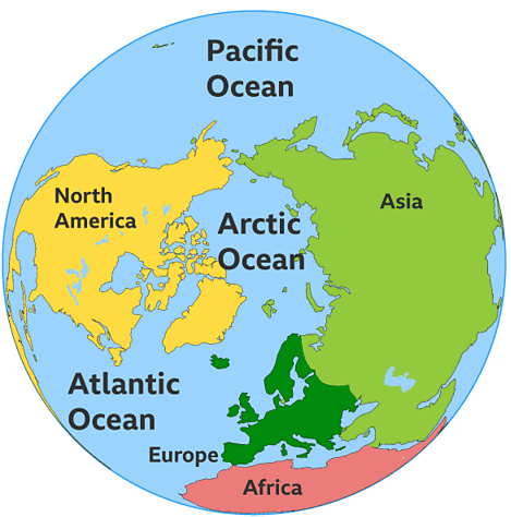
Early Exploration
- Formal investigation of the oceans began with the British Challenger expedition from 1873 to 1876, marking the first successful worldwide deep-sea exploration.
What is Oceanography?
- Oceanography, the study of oceans, has gained significant importance in recent years.
- Researches into deep seas are now conducted by various institutions, universities, government bodies, and international organizations.
Modern Techniques
- Advanced methods like rail and electrical echo devices are used to map the ocean floors and study their depths.
- Trained divers with modern breathing equipment collect valuable information from great ocean depths.
- Deep-sea core samples are taken to study different types of oceanic deposits like oozes, muds, and clays.
Monitoring and Measurement
- Automatic-recording thermometers and other sensitive instruments can be lowered to specific depths by stationary vessels equipped with laboratories for data processing.
- Various current meters have been designed to measure current flow using propellers, vanes, or pendulums.
- Sealed bottles and floating objects with instructions for reporting their exact time and place of discovery are released to track drift and current flow.
International Collaboration
- The International Council for the Exploration of the Sea, based in Copenhagen, is a prominent global oceanographic research centre.
- Large-scale oceanographic research is often best conducted by international bodies due to the high cost and complexity involved in operating and maintaining specialized vessels in open waters for extended periods.
Challenges and Future Discoveries
- Despite the availability of modern techniques, there is still much to learn about the mysteries of the oceans.
- Ongoing exploration and research continue to deepen our understanding of these vast and complex environments.
Relief of the Ocean Floor
The ocean basins share similarities with the land surface, featuring submarine ridges, plateaus, canyons, plains, and trenches. A cross-section of an ocean reveals typical submarine relief features.1. The Continental Shelf
- The continental shelf is the underwater extension of the continent, stretching from the shoreline to the continental edge, usually marked by the 100 fathom (600 feet) isobath.
- This shelf is a shallow platform with varying width, from a few miles in the North Pacific off North America to over 100 miles off north-west Europe.
- In areas with mountainous coasts, like the Rocky Mountains and the Andes, the continental shelf may be absent. Conversely, broad lowland coasts, such as Arctic Siberia, can have wide shelves, with recorded widths of up to 750 miles.
- The slope of the continental shelf is also variable, typically least where the shelf is widest, with a common gradient of 1 in 500.
- The continental shelf is often considered part of the continent, submerged due to rising sea levels, such as at the end of the Ice Age when melting ice raised sea levels significantly.
- Some smaller continental shelves may have formed through wave erosion, where land is eroded by the sea.
(a) Geographic Significance
- Rich in Marine Life: Continental shelves are teeming with life due to their shallow waters, which allow sunlight to penetrate. This encourages the growth of tiny plants and organisms, making these areas rich in plankton, a crucial food source for many fish.
- Major Fishing Grounds: These shelves are the most productive fishing areas in the world, with famous sites like the Grand Banks of Newfoundland, the North Sea, and the Sunda Shelf.
- Impact on Tides and Shipping: The limited depth and gentle slope of continental shelves help regulate tides by keeping cold underwater currents at bay and increasing tide heights. However, this can sometimes disrupt shipping activities because ships rely on tides to enter and leave ports.
- Locations of Great Seaports: Many of the world’s largest seaports, such as Southampton, London, Hamburg, Rotterdam, Hong Kong, and Singapore, are situated on continental shelves.
2. The Continental Slope
- At the edge of the continental shelf, there is a sharp change in gradient, leading to the continental slope, which has a gradient of about 1 in 20.
3. The Deep-Sea Plain
- This area lies two to three miles below sea level and covers two-thirds of the ocean floor, commonly referred to as the abyssal plain.
- Contrary to earlier beliefs that it was featureless, modern technology has revealed that the abyssal plain is uneven, with various submarine features such as plateaus, ridges, trenches, basins, and oceanic islands that rise above sea level, like the Azores and Ascension Island.
4. The Oceanic Trenches
- These are deep, narrow valleys in the ocean floor, known for their extreme depths and unique geological features.
Oceanic Deposits of the Ocean Floor
The materials eroded from the Earth that are not deposited by rivers or at the coast eventually end up on the ocean floor. The main process involved is slow sedimentation, where the eroded particles gradually filter through the ocean water and settle on top of each other in layers. The thickness of these sediment layers is still unknown, and so is the rate at which they accumulate. Generally, oceanic deposits can be classified into three categories: muds, oozes, and clays.- Muds. These are terrigenous deposits, meaning they come from land and are primarily found on continental shelves. Muds are classified as blue, green, or red, depending on their chemical content.
- Oozes. These are pelagic deposits, derived from the oceans. Oozes consist of the shells and skeletons of marine microorganisms with calcareous or siliceous parts. They have a fine, flour-like texture and can either accumulate as deposits or remain suspended in the water.
- Clays. These are mostly found as red clays in the deeper parts of ocean basins, particularly in the Pacific Ocean. Red clay is thought to be an accumulation of volcanic dust ejected during volcanic eruptions.
Overall, the ocean floor is a complex and dynamic environment where various types of deposits accumulate over time, each with its own distinct characteristics and origins.
Salinity of the Ocean
- The oceans contain almost every known chemical element in varying proportions, but their most distinctive feature is their salinity, which sets them apart from the fresh water found in lakes and streams.
- Sea water is composed of a large amount of dissolved mineral matter, with sodium chloride, or common salt, making up more than 77 percent of the total. Other significant compounds include magnesium, calcium, and potassium, while the remaining elements are present only in trace amounts.
- Due to the constant movement of ocean water, the proportions of different salts remain remarkably consistent across all oceans and even at great depths. However, the concentration of salt in ocean water, known as salinity, varies significantly in different areas. Salinity is typically expressed as a percentage or in parts per thousand.
- The average salinity of the oceans is about 35.2 percent, indicating approximately 35 parts of salt in 1,000 parts of water. However, this figure can vary widely in different regions. For example, the Baltic Sea has a much lower salinity of around 7 percent due to the influx of fresh water from rivers and melting ice. In contrast, the Red Sea has a higher average salinity of 30 percent due to high rates of evaporation and limited fresh water input.
- Enclosed seas, such as the Caspian Sea and the Dead Sea, can have extremely high salinity levels, with the Caspian Sea reaching 180 percent and the Dead Sea having a salinity comparable to that of Lake Van in Asia Minor, which is around 60 percent. These salt lakes have such high salt concentrations that it is nearly impossible to sink in them, making it much easier for beginner swimmers to float.
The variation in salinity among different seas and oceans is influenced by several factors:
- Rate of Evaporation. Areas near the High-Pressure Belts of the Trade Wind Deserts, between 20° and 30° North and South, experience high salinity due to elevated evaporation rates caused by high temperatures and low humidity. In contrast, temperate oceans have lower salinity because of cooler temperatures and reduced evaporation rates.
- Fresh Water Input. Salinity is lower than the average 35 percent in equatorial waters due to heavy rainfall and high humidity. Oceans receiving large rivers like the Amazon, Congo, Ganges, Irrawaddy, and Mekong have diluted salinity. Baltic, Arctic, and Antarctic waters have salinity levels below 32 percent due to cold climates, low evaporation, and fresh water input from melting icebergs and poleward-bound rivers such as the Ob, Lena, Yenisey, and Mackenzie.
- Water Mixing by Currents. In enclosed seas like the Caspian Sea, Mediterranean Sea, Red Sea, and Persian Gulf, where water does not mix freely with ocean water and is not penetrated by ocean currents, salinity is often high, exceeding 37 percent. In areas of inland drainage without oceanic links, continuous evaporation under clear skies leads to salt accumulation around shores. In open oceans with free-flowing currents, salinity tends to be close to the average of 35 percent or slightly lower.
The Temperature of Ocean Water
Ocean water, like land, has different temperatures in different places, both at the surface and at great depths. However, water warms up and cools down much more slowly than land does, so the annual temperature range in most of the open seas is very small, usually less than 10°F.Surface Water Temperature:
- The average annual temperature of surface ocean water decreases from about 70°F in equatorial regions to around 55°F at latitudes 45° North and South.
- At the poles, the temperature drops almost to freezing.
- However, this decrease in temperature with latitude is not constant due to the influence of warm and cold currents, winds, and air masses.
- Ocean water is mobile, like the solid Earth, so variations in temperature between different parts of the oceans can occur.
Effects of Currents:
- Cold currents, such as the Labrador Current off northeast Canada, lower surface water temperatures.
- This is why parts of eastern Canada, even at 45° North, are icebound for almost half the year.
- Conversely, warm currents like the North Atlantic Drift raise surface temperatures.
- For example, the Norwegian coast, even at latitudes 60° to 70° North, remains ice-free throughout the year due to this warm current.
Extreme Temperatures:
- The highest water temperatures are found in enclosed seas in the tropics, such as the Red Sea, where temperatures can reach between 85°F to 100°F.
- In contrast, the Arctic and Antarctic waters are so cold that their surfaces are permanently frozen, creating pack ice that extends down several feet.
- During the warmer summer months, parts of this ice break off, forming icebergs that dilute the surrounding water and lower the surface temperature of nearby ice-free seas.
Vertical Temperature Variation:
- The temperature of the oceans also changes with depth.
- < 200 fathoms. Temperature decreases rapidly, by about 1°F for every 10 fathoms.
- 200 to 500 fathoms. The rate of temperature decrease slows down.
- > 500 fathoms. The temperature drop becomes very slight, less than 1°F for every 100 fathoms.
- In the ocean depths below 2,000 fathoms (12,000 feet), the water is uniformly cold, just above freezing.
- Interestingly, even in the deepest ocean trenches, more than 6 miles below the surface, the water never freezes.
- It is estimated that over 80 percent of all ocean water is found in these deep, cold regions.
Introduction
Ocean currents refer to large masses of surface water that circulate in regular patterns around the oceans. Those that flow from equatorial regions polewards have a higher surface temperature and are known as warm currents. On the other hand, those that flow from polar regions equatorwards have a lower surface temperature and are referred to as cold currents.
Factors Influencing Ocean Currents
1. Planetary Winds- The North-East Trade Winds and the South-East Trade Winds are crucial in driving ocean currents.
- The North-East Trade Winds push the North Equatorial Current, leading to the warm Florida Current and the Gulf Stream Drift, which warm the southern and eastern coasts of the U.S.A.
- Similarly, the South-East Trade Winds drive the South Equatorial Current, warming the eastern coast of Brazil with the warm Brazilian Current.
- In temperate latitudes, the Westerlies influence ocean currents, albeit less reliably than the Trade Winds. In the northern hemisphere, the Westerlies create a north-easterly flow of water, aiding the warm Gulf Stream, which becomes the North Atlantic Drift, warming the western coast of Europe.
- In the southern hemisphere, the Westerlies drive the West Wind Drift equatorward, leading to the Peruvian Current off South America and the Benguela Current off southern Africa.
- The North Indian Ocean provides strong evidence of the influence of prevailing winds on current flows. Here, the direction of currents changes with the monsoon winds, which blow from the north-east in winter and from the south-west in summer.
2. Temperature
- There is a significant difference in the temperature of ocean waters at the equator compared to the poles. Warm water, being lighter, rises, while cold water is denser and sinks. This temperature difference causes warm equatorial waters to move slowly along the surface towards the poles, while the denser cold waters of the polar regions creep slowly along the bottom of the sea towards the equator.
3. Salinity
- The salinity of ocean water varies from place to place, affecting its density. Waters with high salinity are denser than those with low salinity. As a result, waters of low salinity flow on the surface of waters with high salinity, while waters of high salinity flow at the bottom towards waters of low salinity.
- For example, in the Mediterranean region, there is a significant difference in salinity between the waters of the open Atlantic and those of the partially enclosed Mediterranean Sea. The less saline water of the Atlantic flows on the surface into the Mediterranean, compensating for this influx with an outflow of denser bottom water from the Mediterranean.
4. Earth’s Rotation
- The Earth’s rotation affects the direction of freely moving objects, including ocean currents. In the northern hemisphere, the rotation deflects currents to the right, creating a clockwise direction of circulation, as seen with the Gulf Stream Drift and the Canaries Current.
- In the southern hemisphere, the Earth’s rotation causes an anti-clockwise deflection of currents, such as the Brazilian Current and the West Wind Drift.
5. Land Masses
- Land masses obstruct and divert ocean currents. For instance, the tip of southern Chile diverts part of the West Wind Drift northwards, creating the Peruvian Current. Similarly, the "shoulder" of Brazil at Cape Sao Roque divides west-flowing equatorial currents into the Cayenne Current, which flows north-westwards, and the Brazilian Current, which flows south-westwards.
The Circulation of the Atlantic Ocean
North Atlantic Ocean:- The North and South Equatorial Currents at the equator are driven by the steady Trade Winds, which push two streams of water from east to west.
- At the northern tip of Brazil, the South Equatorial Current is split by the landmass into the Cayenne Current, which flows along the Guiana coast, and the Brazilian Current, which flows south along the east coast of Brazil.
Cayenne Current:
- In the North Atlantic, the Cayenne Current is joined by the North Equatorial Current and heads northwest into the Caribbean Sea.
- Part of this current enters the Gulf of Mexico and emerges as the Florida Current, while the rest flows north of the Antilles to join the Gulf Stream off the southeastern U.S.
Gulf Stream:
- The Gulf Stream, one of the strongest ocean currents, is 35 to 100 miles wide, 2,000 feet deep, and flows at a velocity of three miles an hour.
- It hugs the American coast until Cape Hatteras (latitude 35°N), where it is deflected eastward by the Westerlies and the Earth's rotation, becoming the North Atlantic Drift.
North Atlantic Drift:
- The North Atlantic Drift carries warm equatorial water to Europe, fanning out into three directions: east to Britain, north to the Arctic, and south along the Iberian coast as the cold Canaries Current.
- Oceanographic research shows that two-thirds of the water brought by the Gulf Stream to the Arctic is returned to tropical latitudes by cold polar water that creeps southward in the ocean depths.
- The Canaries Current eventually merges with the North Equatorial Current, completing the clockwise circuit in the North Atlantic.
Sargasso Sea:
- Inside this ring of currents, there is an area in the middle of the Atlantic with no noticeable current. This area, known as the Sargasso Sea, gathers a large amount of floating seaweed.
Cold Currents:
- In addition to the clockwise circulation, there are also currents that enter the North Atlantic from the Arctic regions.
- The Irminger Current, or East Greenland Current, flows between Iceland and Greenland, cooling the North Atlantic Drift at the point of convergence.
- The cold Labrador Current flows southeast between West Greenland and Baffin Island, meeting the warm Gulf Stream off Newfoundland, where icebergs carried south by the Labrador Current melt.
South Atlantic Ocean:
- The South Atlantic Ocean has a similar pattern of circulation as the North Atlantic, but the circuit is anti-clockwise.
- The collection of seaweed in the still waters of the mid-South Atlantic is not as distinctive as in the North Atlantic.
- At Cape Sao Roque, the South Equatorial Current splits, with one branch turning south as the warm Brazilian Current.
- The deep blue waters of the Brazilian Current are easily distinguishable from the yellow, muddy waters carried out to sea by the Amazon River further north.
- At about 40°S, the prevailing Westerlies and the rotation of the Earth propel the current eastward to merge with the cold West Wind Drift as the South Atlantic Current.
- Upon reaching the west coast of Africa, the South Atlantic Current is diverted northward as the cold Benguela Current, bringing cold polar waters into tropical latitudes.
- The Benguela Current, driven by the South-East Trade Winds, surges equatorward in a northwesterly direction to join the South Equatorial Current, completing the circulation of currents in the South Atlantic.
Circulation of the Pacific Ocean
The circulation pattern in the Pacific Ocean is similar to that of the Atlantic but with modifications due to the Pacific's larger size and more open nature.
North Pacific:
- The North Equatorial Current flows westward, with a compensating Equatorial Counter Current flowing in the opposite direction.
- The volume of water in the Pacific equatorial current is much greater than that in the Atlantic due to the Pacific's expanse and lack of obstructing landmasses.
- The North-East Trade Winds push the North Equatorial Current off the coasts of the Philippines and Formosa into the East China Sea, where it becomes the Kuroshio or Japan Current.
- The warm waters of the Kuroshio are carried poleward by the North Pacific Drift, keeping Alaskan ports ice-free in winter.
- The Bering Current or Alaskan Current flows southward from the Bering Strait, joined by the Okhotsk Current. These currents meet the Kuroshio near Hokkaido, where it becomes the Oyashio Current.
- The cold Oyashio Current sinks beneath the warmer North Pacific Drift. Part of the cold water drifts eastward as the Californian Current along the western U.S. coast, eventually coalescing with the North Equatorial Current to complete the clockwise circulation.
South Pacific:
- The current system in the South Pacific is similar to that in the South Atlantic.
- The South Equatorial Current, driven by the South-East Trade Winds, flows southward along the coast of Queensland as the East Australian Current, bringing warm equatorial waters into temperate regions.
- This current turns eastward towards New Zealand under the influence of the Westerlies in the Tasman Sea, merging with part of the cold West Wind Drift to form the South Pacific Current.
- The current is obstructed by the tip of southern Chile, turning northward along the western coast of South America as the Humboldt or Peruvian Current.
- The cold Peruvian Current chills onshore winds, resulting in the Chilean and Peruvian coasts being practically rainless. This region is rich in microscopic marine plants and animals, attracting large shoals of fish and seabirds.
- The seabirds' droppings whiten the coastal cliffs and islands, forming thick guano deposits, a valuable fertilizer source.
- The Peruvian Current eventually links up with the South Equatorial Current, completing the cycle of currents in the South Pacific.
Ocean Currents in the Indian Ocean
1. Indian Ocean Circulation
The currents in the South Indian Ocean form a circuit, similar to other oceans. These currents include:
- Equatorial Current: This current flows westward along the equator.
- Agulhas Current: After passing Madagascar, the Equatorial Current turns southward and becomes the Agulhas Current, which merges with the West Wind Drift.
- West Wind Drift: This current flows eastward and then turns equatorward, becoming the West Australian Current.
2. North Indian Ocean Currents
In the North Indian Ocean, the direction of currents reverses between summer and winter due to the changing monsoon winds.
- Summer (June to October): During this period, the dominant wind is the South-West Monsoon, which blows currents from the south-west. This is known as the South-West Monsoon Drift.
- Winter (December onwards): In winter, the North-East Monsoon dominates, reversing the current direction to the north-east. This is called the North-East Monsoon Drift.
The currents in the North Indian Ocean clearly demonstrate the significant impact of winds on ocean circulation.
|
175 videos|624 docs|192 tests
|
FAQs on GC Leong Summary: The Oceans - Geography for UPSC CSE
| 1. What are the main features of the ocean floor? |  |
| 2. How do ocean currents affect global climate? | |
| 3. What is the importance of coral reefs in ocean ecosystems? | |
| 4. What are the primary threats to ocean health? | |
| 5. How do human activities impact marine life? | |


Viva Questions
,Objective type Questions
,shortcuts and tricks
,Semester Notes
,Exam
,Sample Paper
,Extra Questions
,practice quizzes
,ppt
,MCQs
,past year papers
,Previous Year Questions with Solutions
,video lectures
,GC Leong Summary: The Oceans | Geography for UPSC CSE
,GC Leong Summary: The Oceans | Geography for UPSC CSE
,Free
,Important questions
,GC Leong Summary: The Oceans | Geography for UPSC CSE
,Summary
,mock tests for examination
,study material
;


GC Leong Summary: The Oceans Free PDF Download
Importance of GC Leong Summary: The Oceans
GC Leong Summary: The Oceans Notes
GC Leong Summary: The Oceans UPSC Questions
Study GC Leong Summary: The Oceans on the App
|
© EduRev
|
Education Revolution
|


|


